A Rare Summer Day on Wassaw Island

North end of Wassaw Island

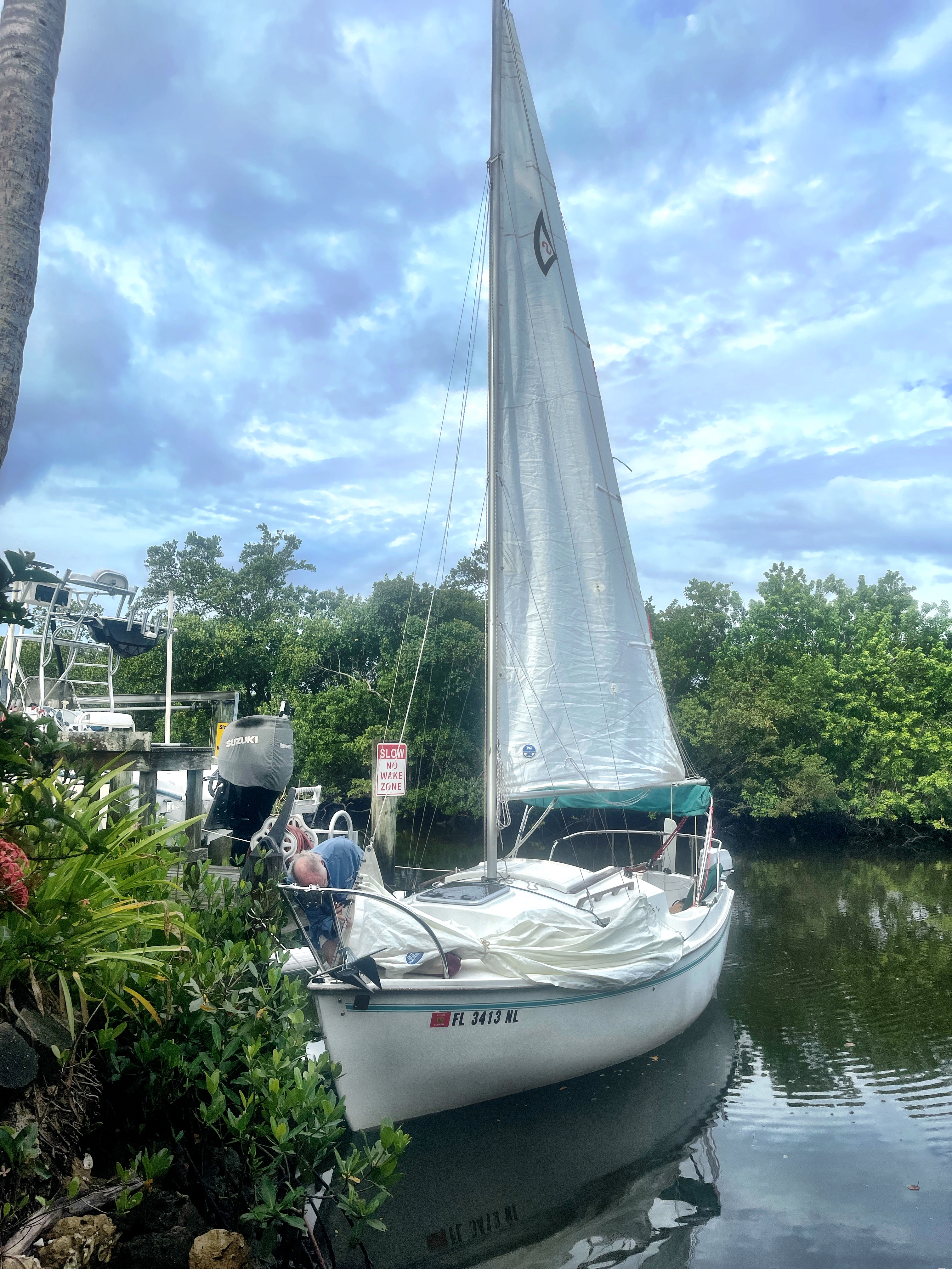
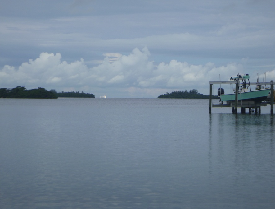
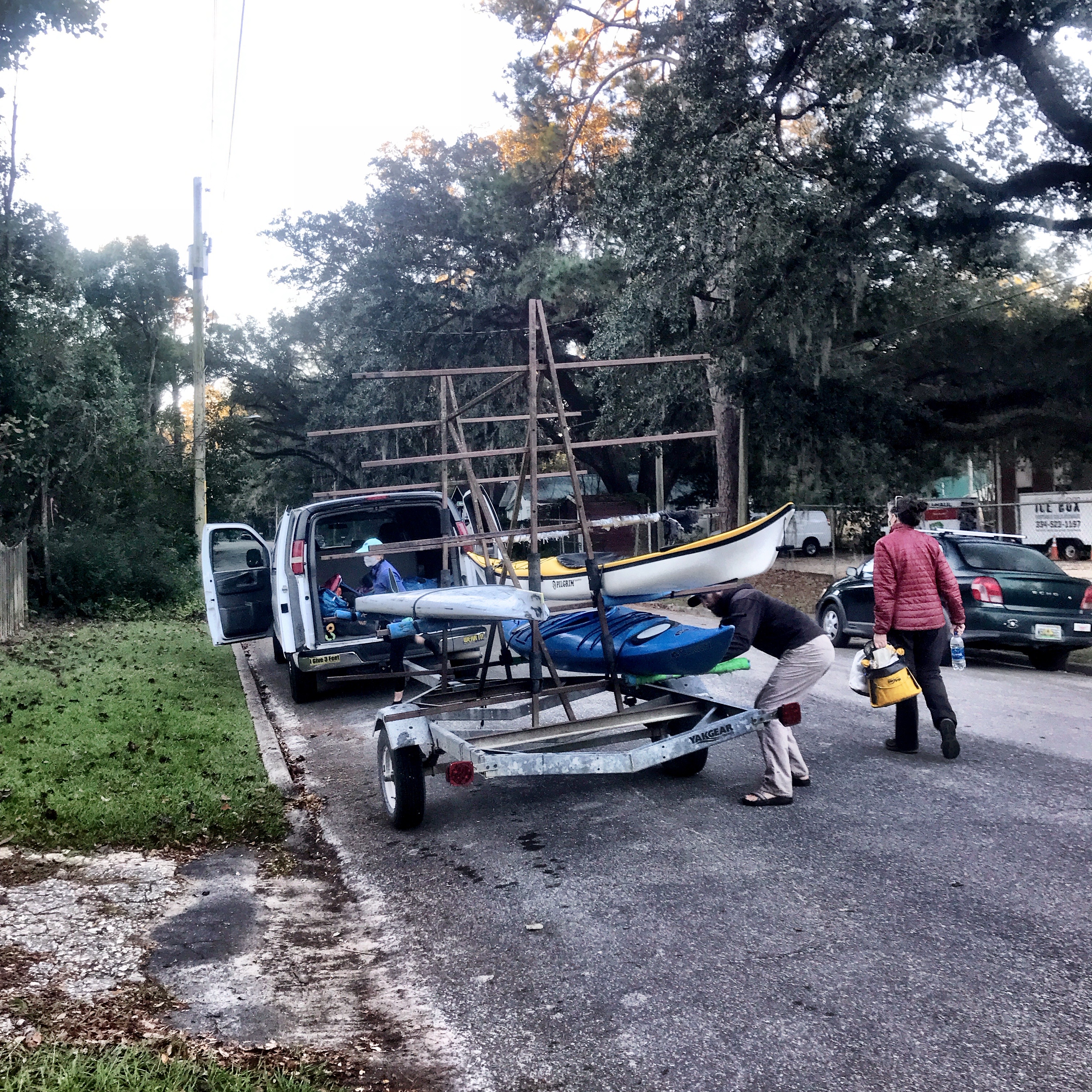
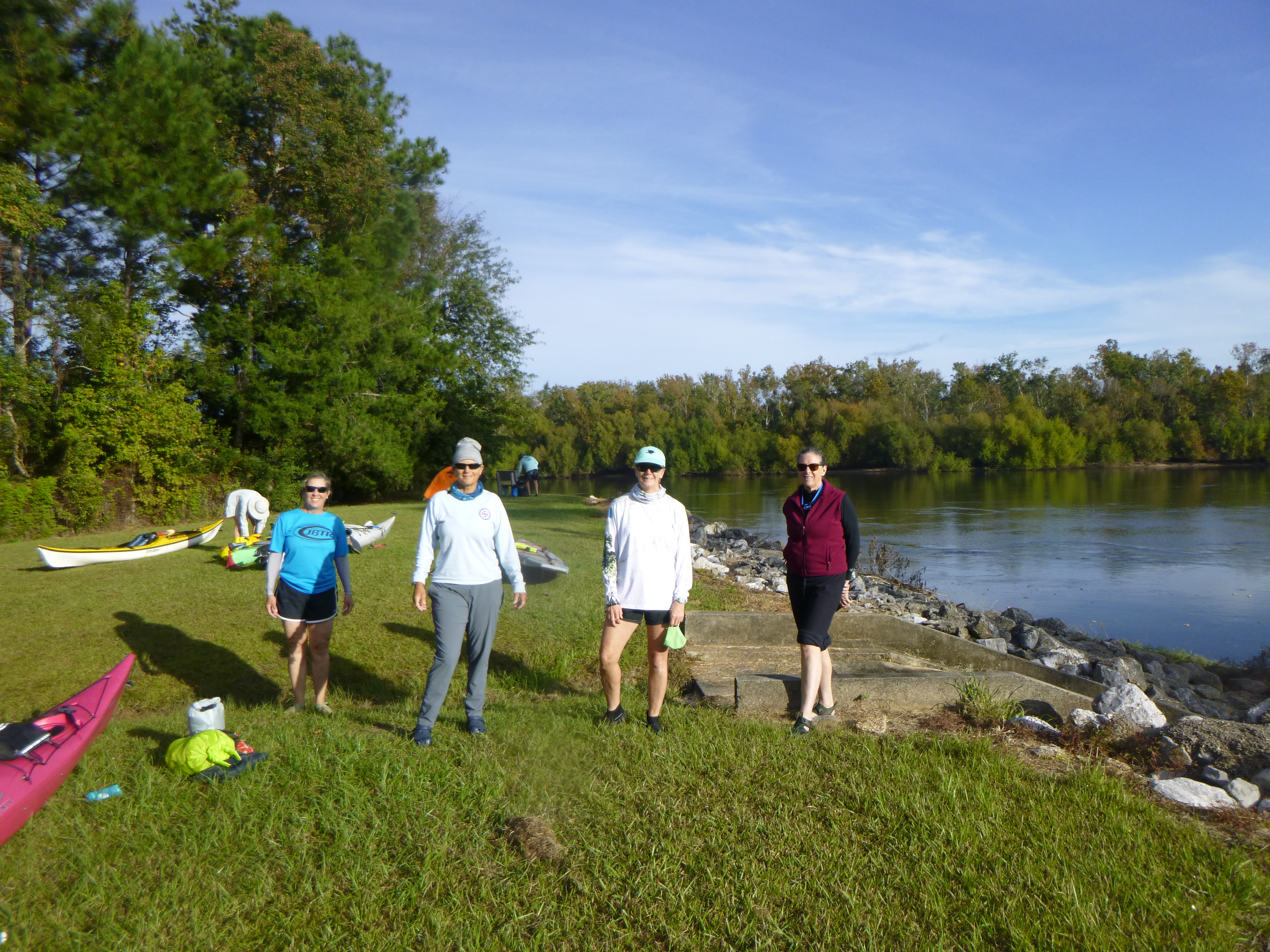
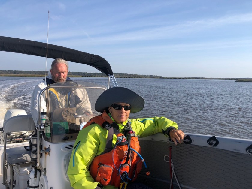
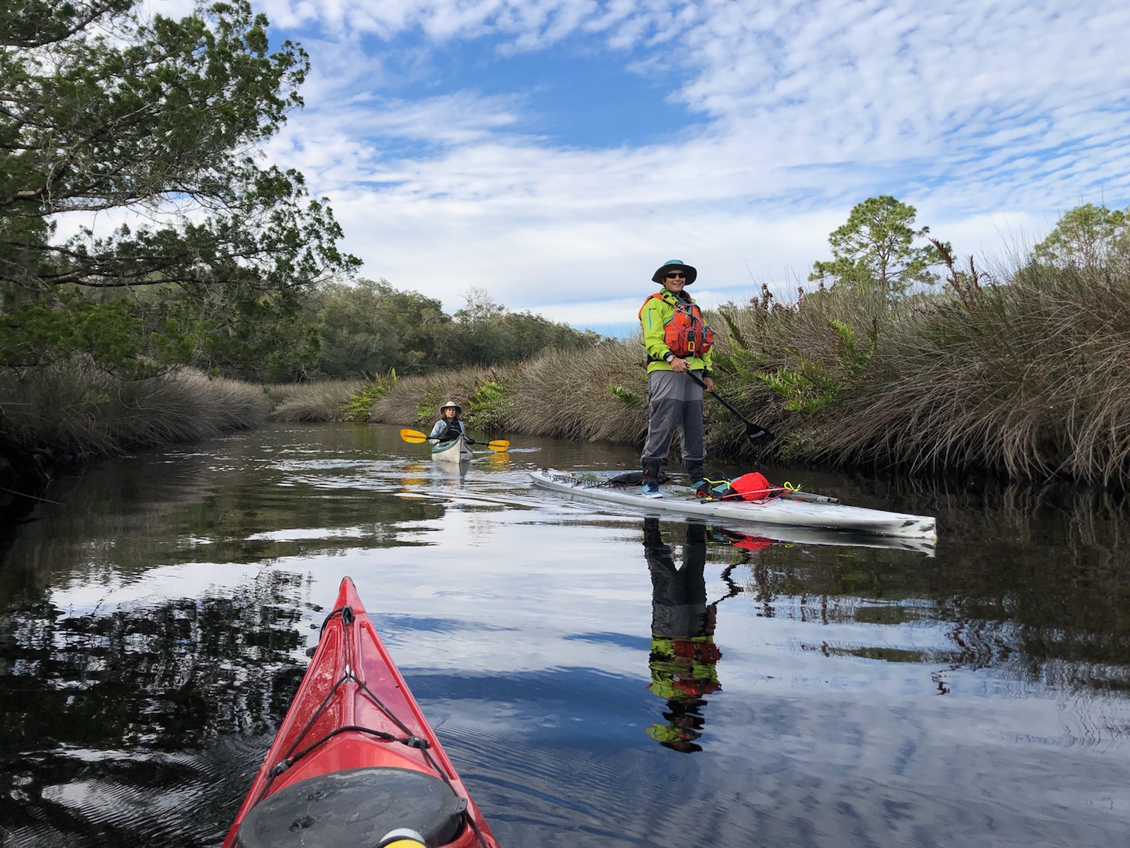
Low wind, ideal tides, and clear skies bode well for a day on Wassaw Island. Lured by the siren call of a deserted beach, we launched boat and board from the Landings Marina on Skidaway Island and rode the tide towards the north end of Wassaw Island.

Wassaw Island is one of the Sea Islands, a string of barrier islands that stretch from the Carolinas to north Florida. These islands saw waves of settlements, from indigenous peoples to enslaved African-Americans to 19th and 20th century conservationists hoping to preserve the ecological character of these islands. In particular, isolation on these islands fostered the preservation of African languages, foods, and traditions among the Gullah-Geechee people who had once comprised the bulk of the Sea Island residents.

George and Sarah Eddy Parsons in 1866 (Courtesy of FWS)

Wassaw Island is one of several largely undeveloped islands along the Georgia coast, and we can thank wealthy industrialists and financiers for their semi-wild condition. Shortly after the Civil War, the Parson family from Maine bought the Wassaw and later transferred ownership to the US government to prevent development, forming the Wassaw National Wildlife Refuge. Today, Wassaw and nearby Little Tybee, Ossabaw and St. Catherine’s provide critical habitat for this marine ecosystem, and the isolated beaches foster an almost unimaginable sense of solitude and wilderness.

Blooming yucca
Leopard crab shell
Wilson’s Plover nesting area

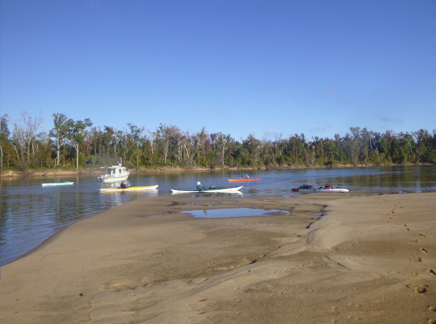
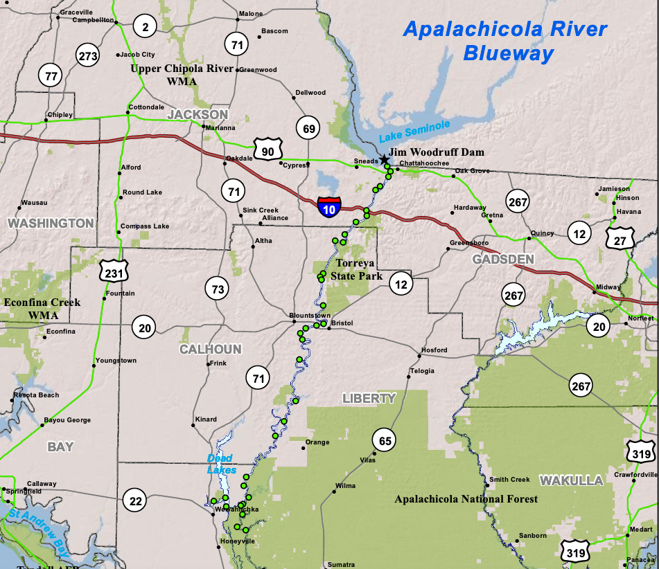
These islands are accessible only by boat, a perfect day trip for paddlers. However, this is coastal paddling, so it is important to wait for the right wind and tide conditions. Coastal Georgia boasts tides of up to 8-10′ feet, so that is alot of water moving in and out of these rivers and sounds.

Courtesy of Google Maps.
Again, thank you Google Maps

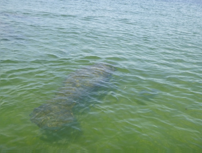
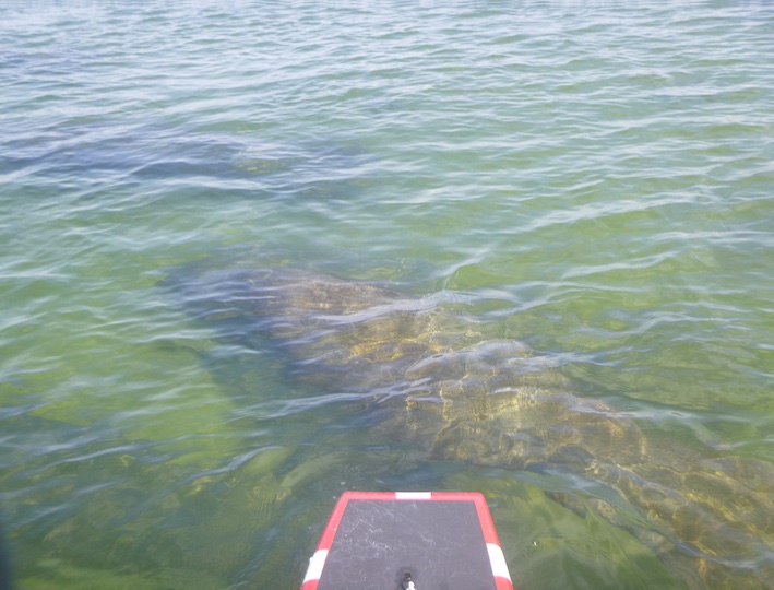
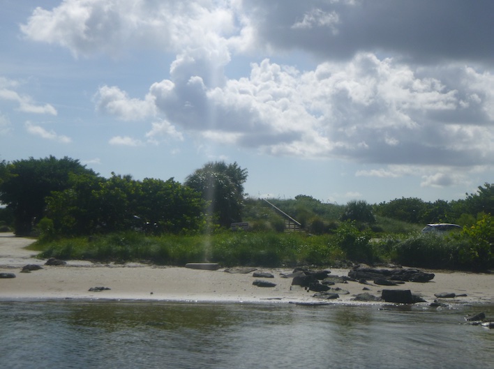
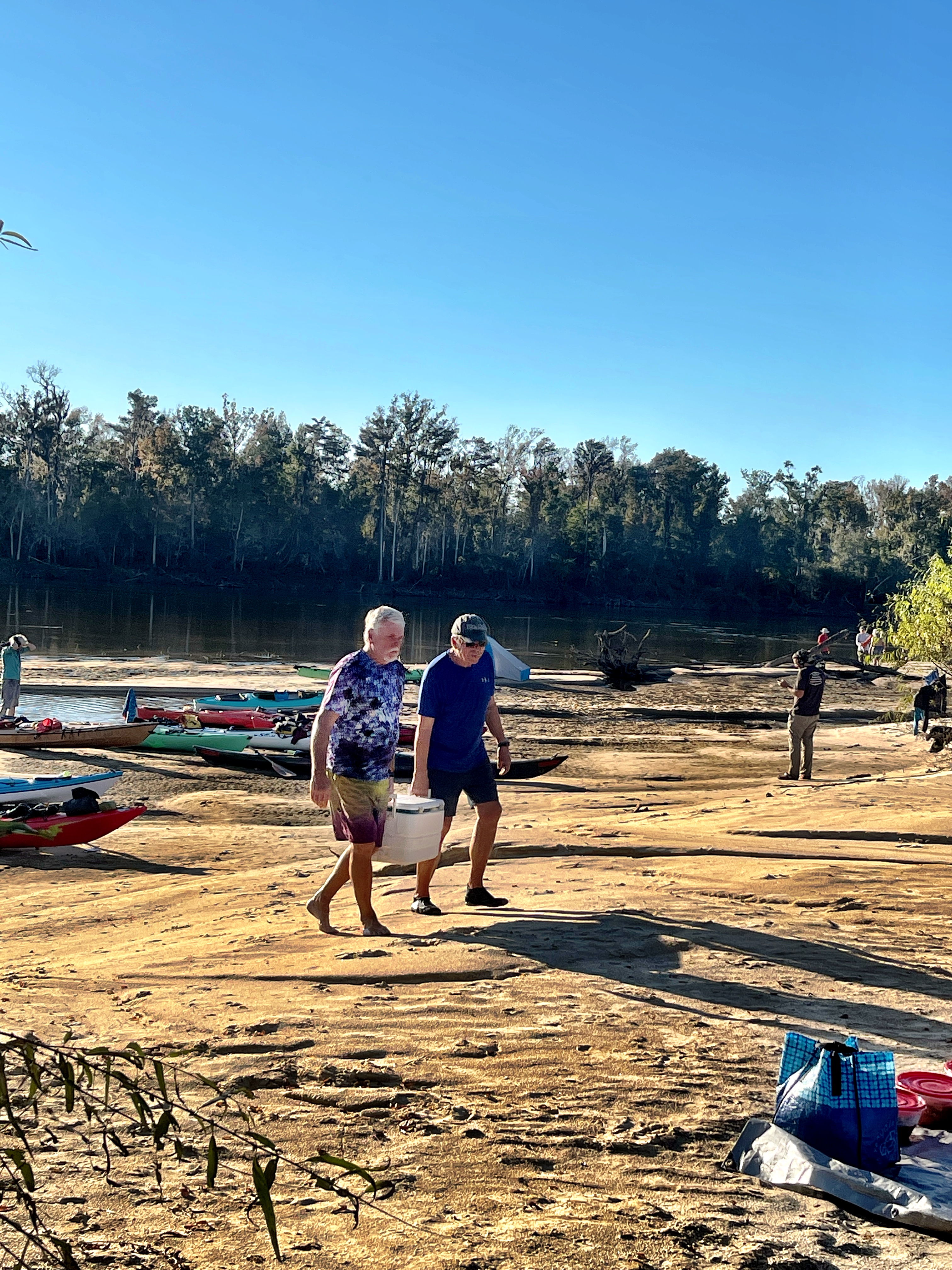
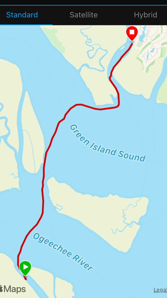
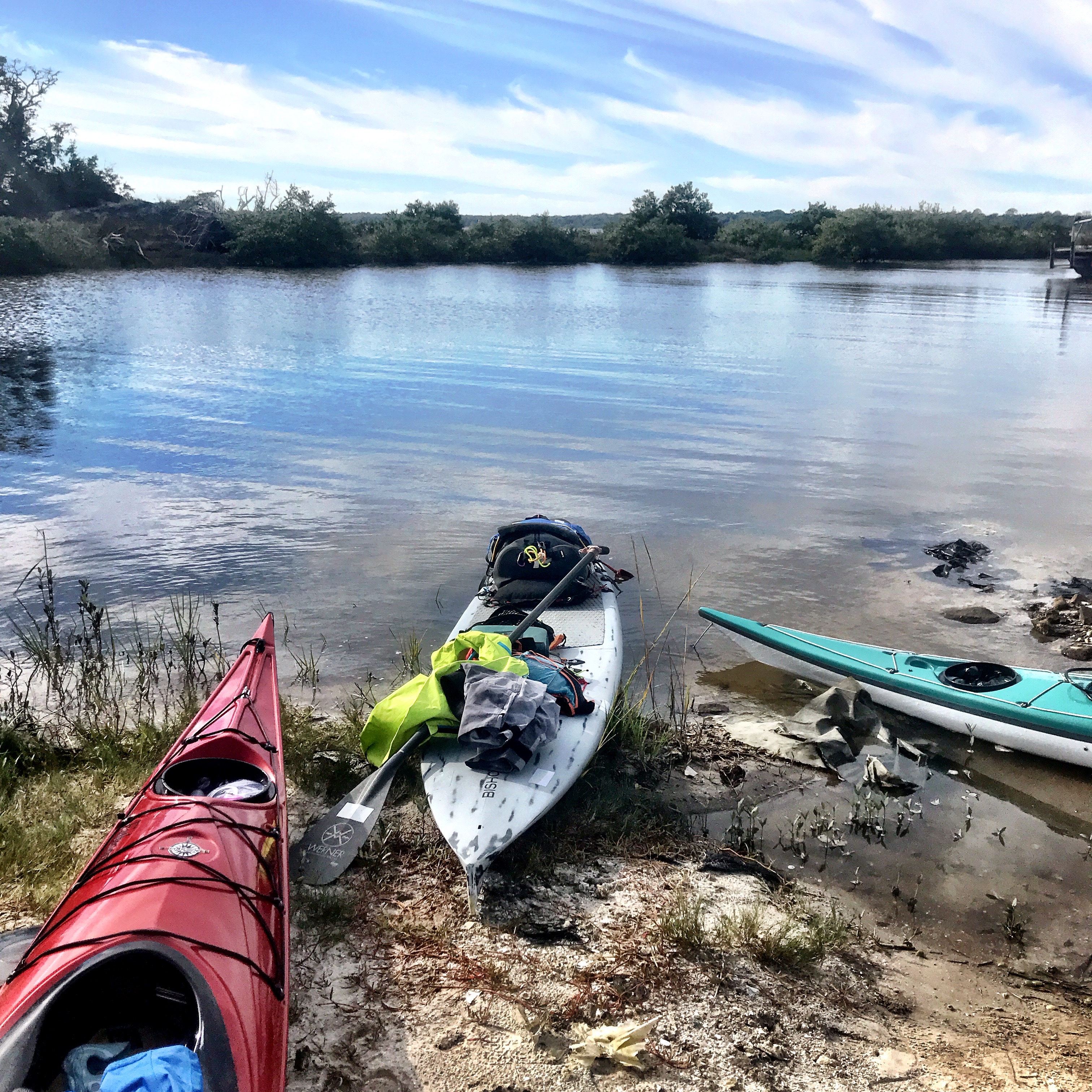
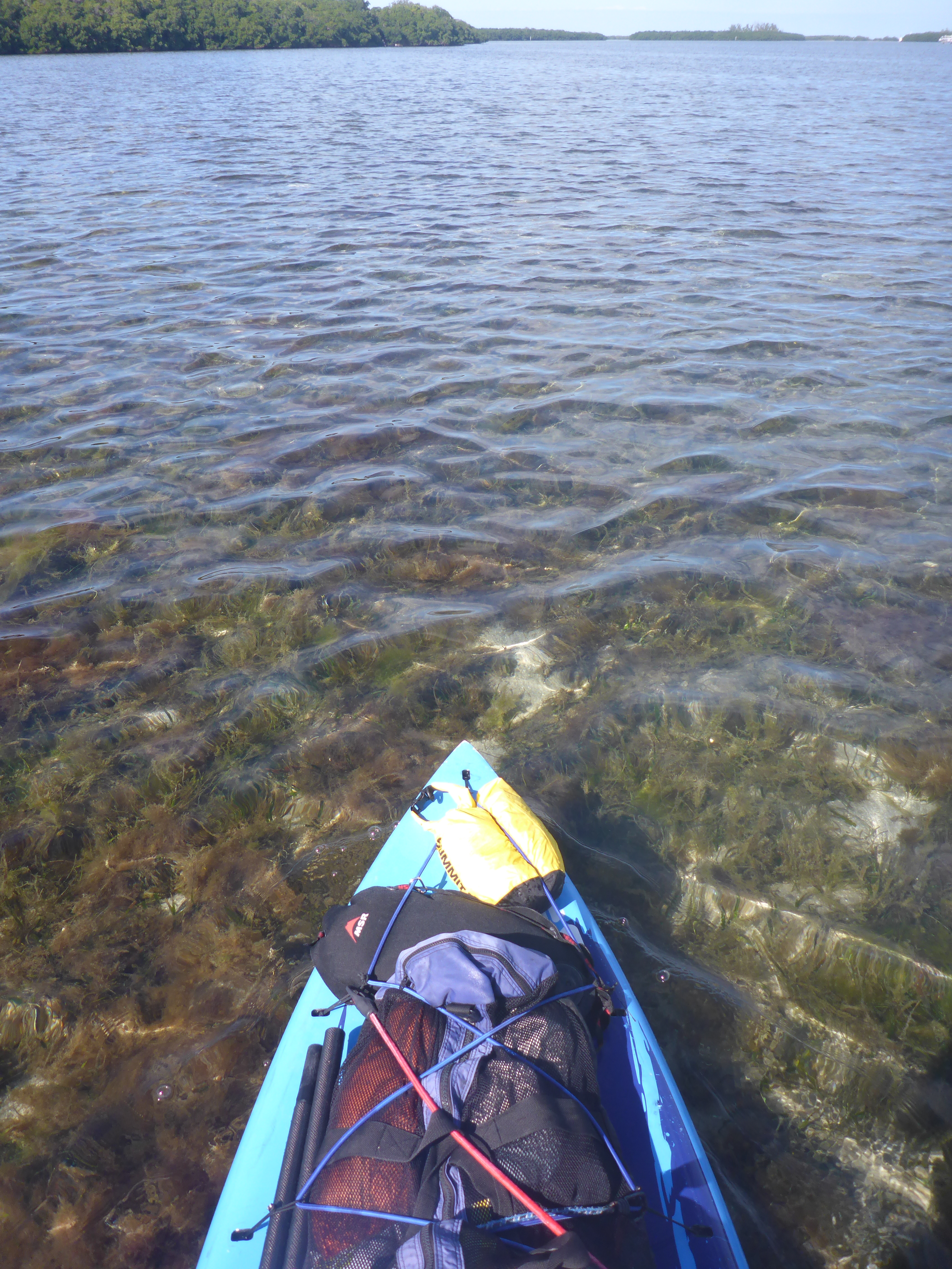
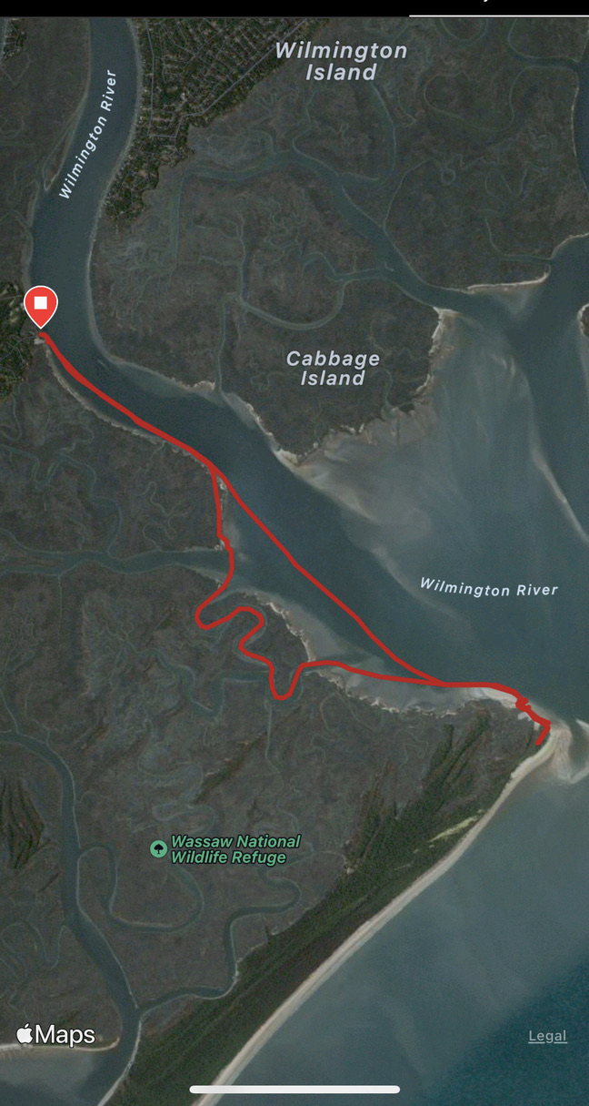
From the Landings Marina, we paddled approximately 6 miles down the Wilmington River, across Romerly Marsh Creek, and landed on the north end. We carried our gear above the high tide line, hoping the trees might offer even the tiniest bit of shade. Then, a long refreshing float and our first wildlife encounter. A large stingray reminded us do the stingray shuffle.

Seeking shade
Failed attempt at shade
No attempt at shade

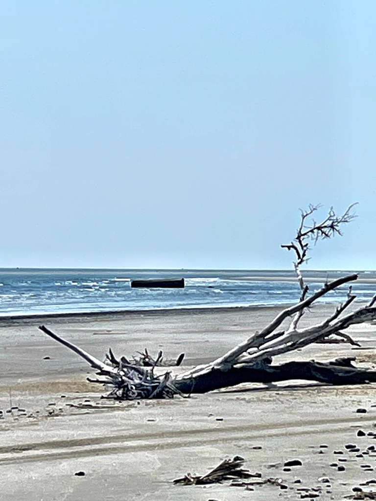
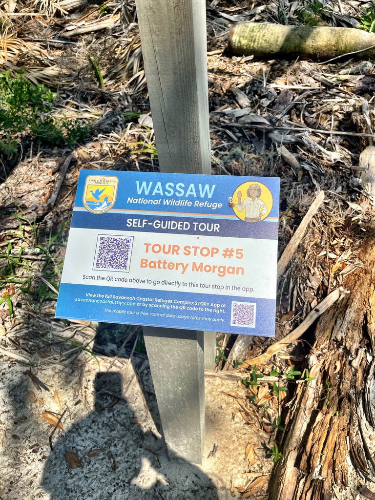
Cooled off by our float and Kathryn’s watermelon, we walked toward a laerge stone block just offshore. This, Kathryn said, is what remains of Battery Morgan, a gun battery constructed during the Spanish-American War. That this block was once well onshore reveals just how much the sand and islands change over the years.

What’s left of Battery Morgan

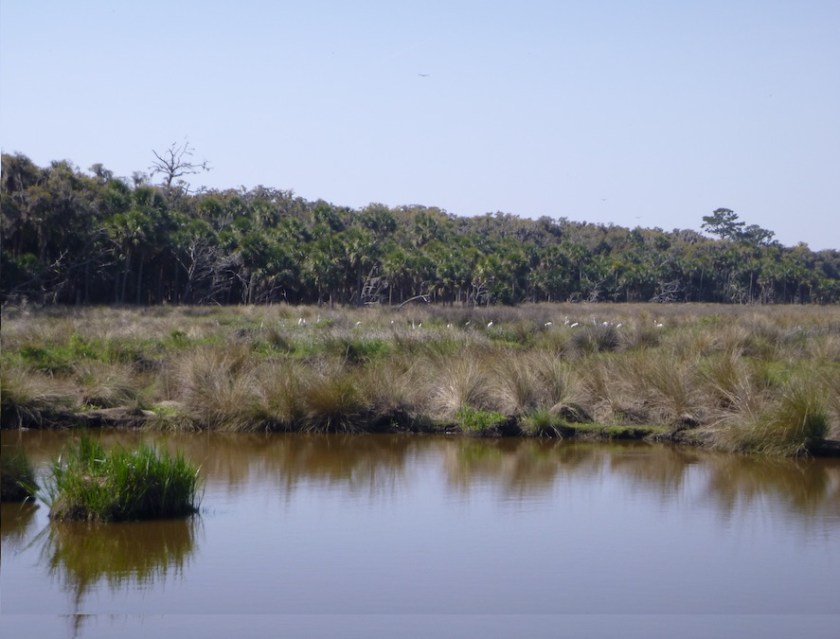
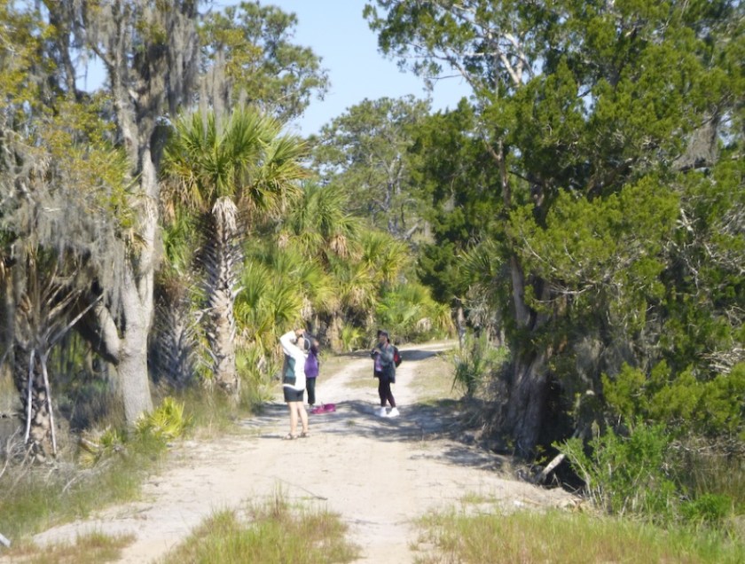
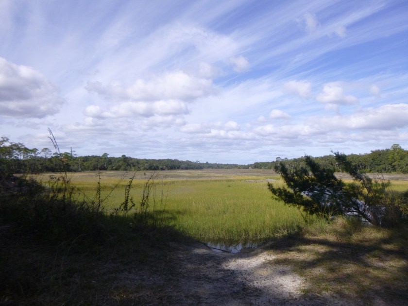
The block marked the entrance to the island’s dirt roads and a self-guided cell phone tour. We ambled slowly up the road, then quickly marched back out when the mosquito brigade emerged in force. The pond and the birds could wait until the colder months.

Road entrance
This will wait until January.
A creepy crawly?

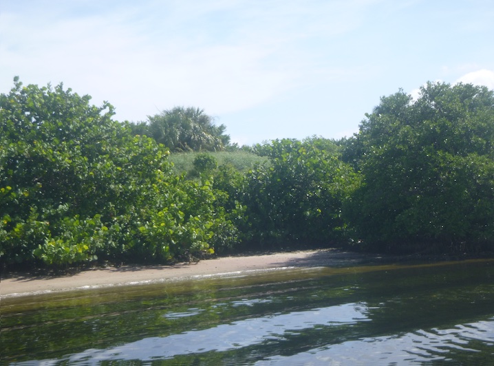
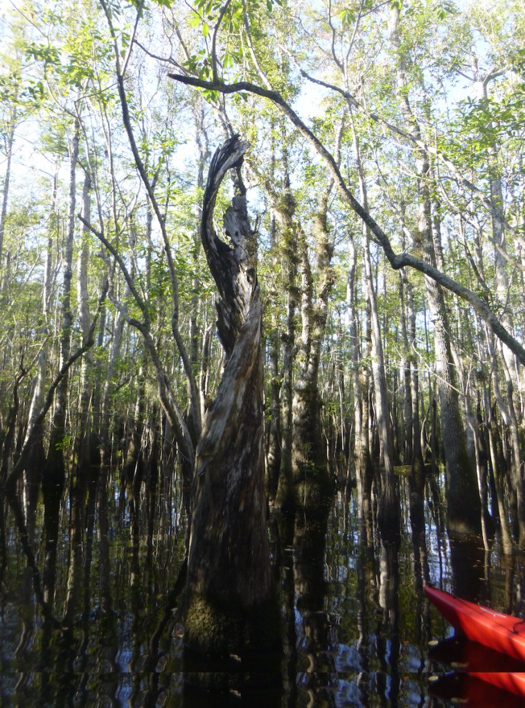
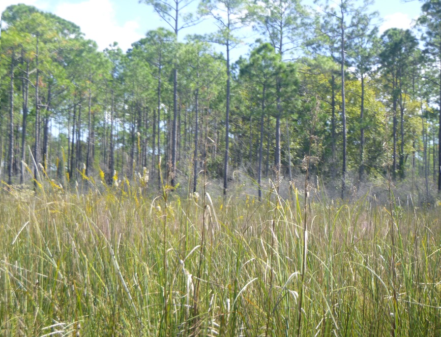
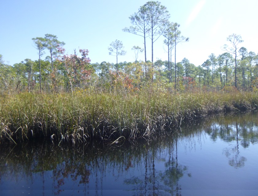
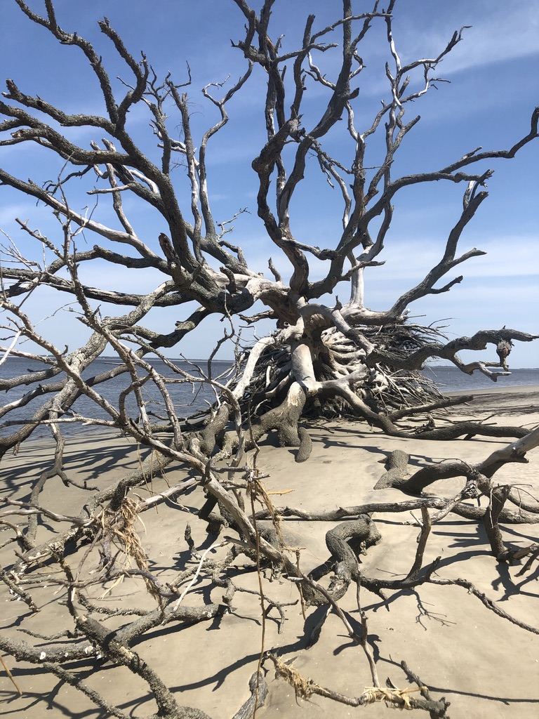
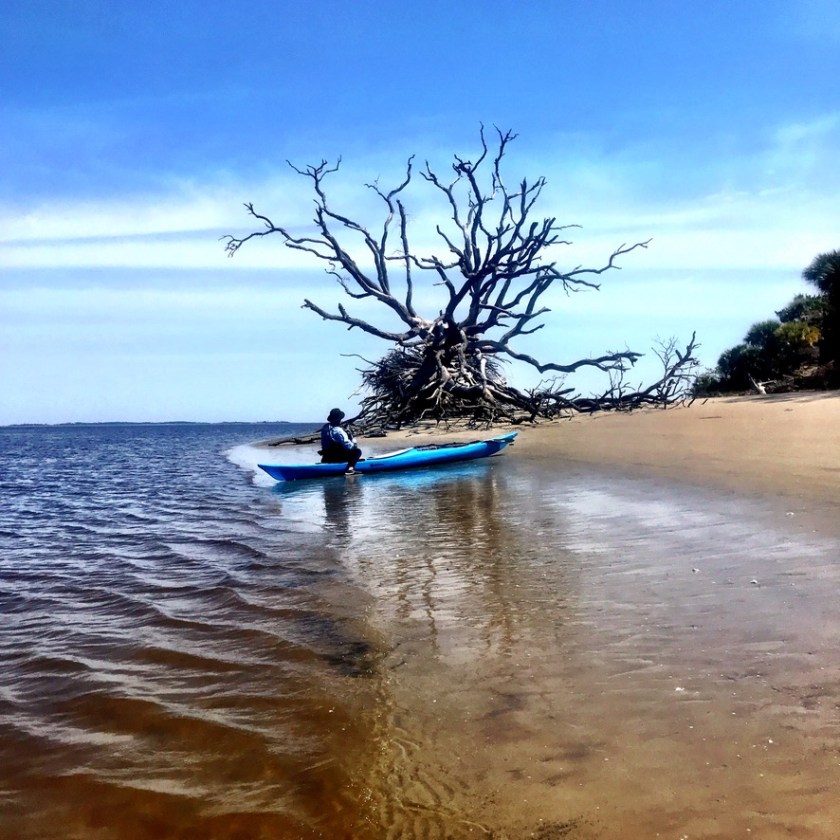
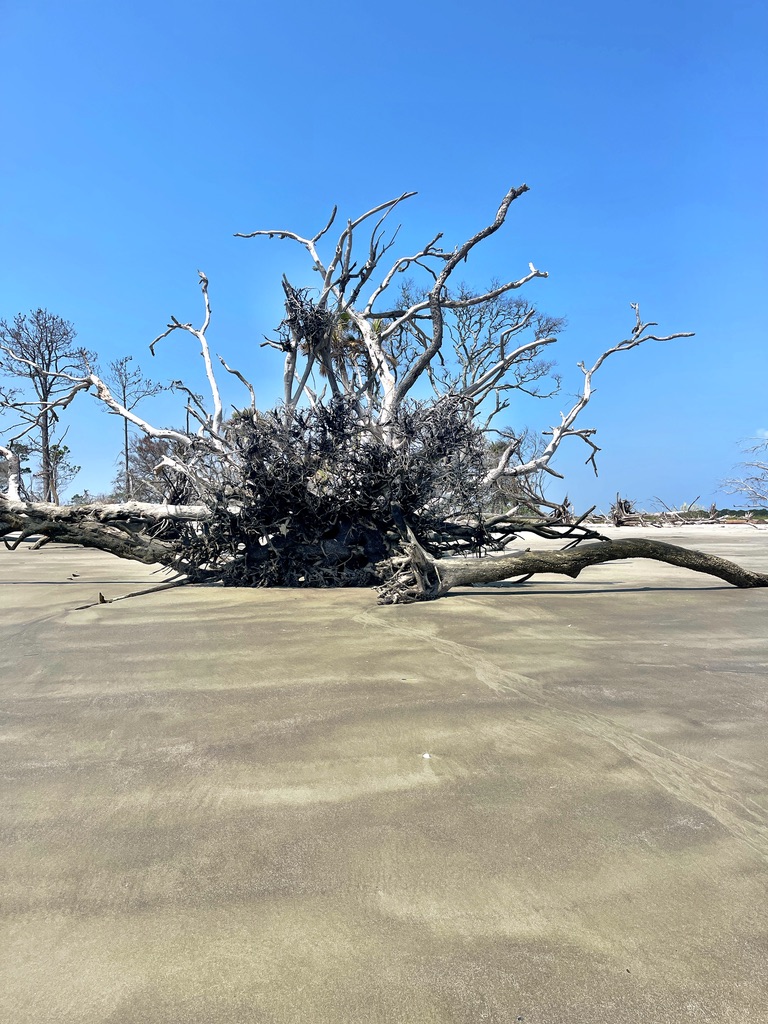
After fleeing the mosquitos and any other critters inhabiting the interior, we wandered through the dead trees on the point. Storms and shifting tides create haunting boneyards of dead trees that appear on all of these barrier islands. These trees also function as a reef of sorts, providing shelter for fish and incubating oysters.

Oysters Rockefeller anyone?
Why I wear shoes

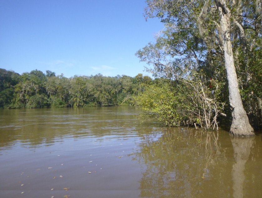
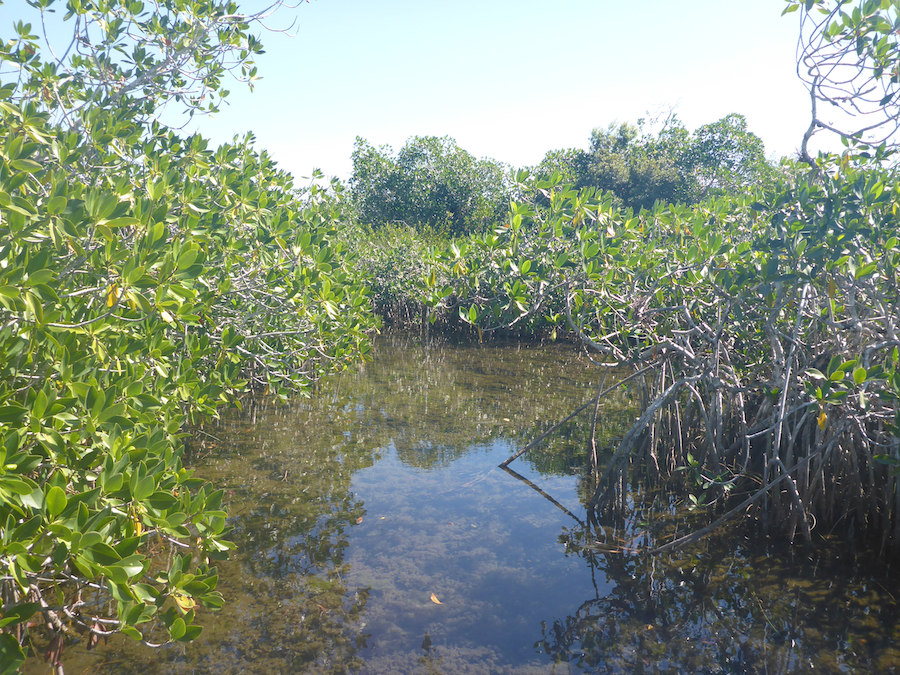
These barrier islands and the marshes surrounding them host great biodiversity, both on land and sea. The dark waters of estuaries—where the waters of rivers and the sea mingle—reveal life, or organic matter, and it is a mistake to dismiss this water as simply “dirty”, as some do. The biologically rich waters of marshes and estuaries support juvenile fish, that often need a mix of fresh and salt water, and the microorganisms that feed them.

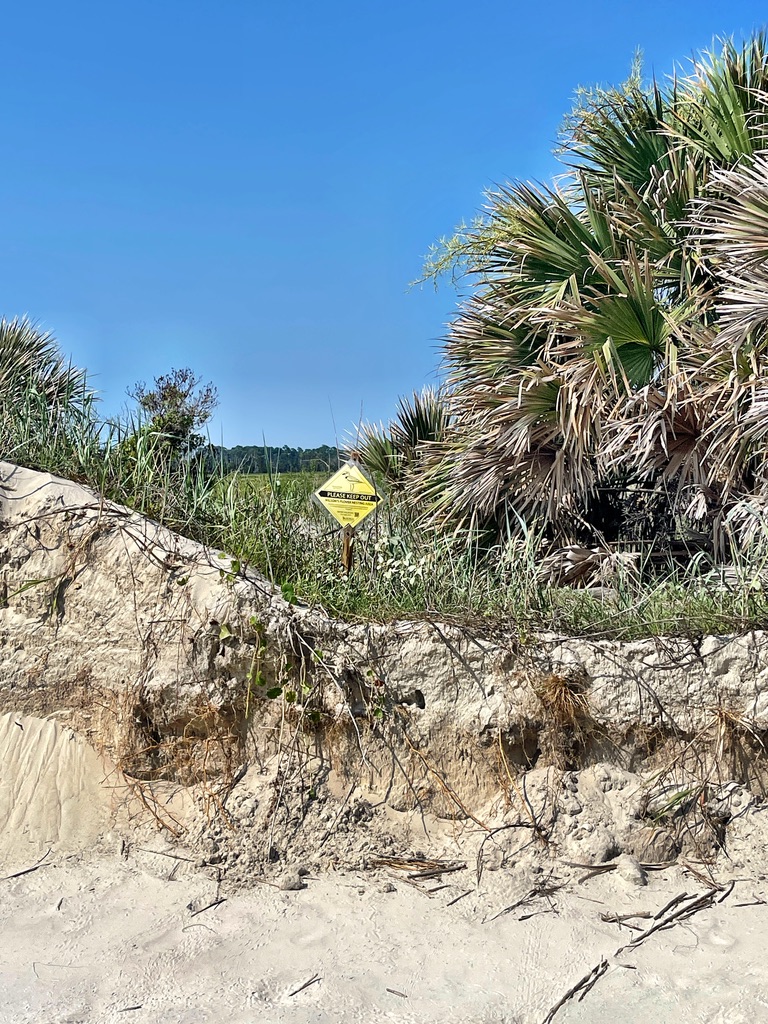
As we paddled, I saw several turtle heads popping up and back down as soon as they saw us. The turtle population along the Georgia coast has risen, thanks to the efforts of volunteers on the different islands. Over the season, volunteers mark nests, protect the nests, and protect hatchlings as they make their way to the sea. The Caretta Project allows volunteers to stay on Wassaw Island for a week to identify nests and/or protect hatchlings, depending on the time. We saw several of signs which, we assume, mark regions for the turtle volunteers. An amazing week, for sure.

How did I get here? Hold my beer.
Free Willy!

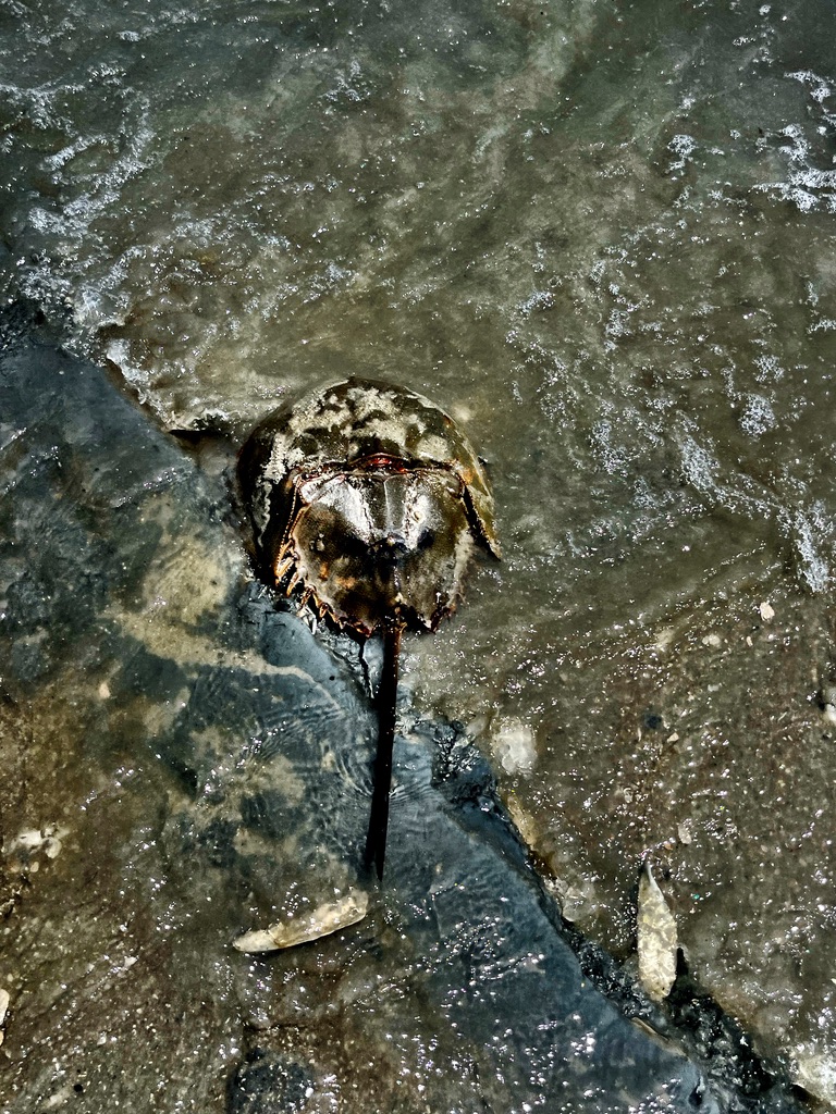
Walking back to our gear, we noticed a horseshoe crab trapped in the sand. As we removed sand to free it, its tail twitched, and finally it swam away. Although horseshoe crabs might seem ubiquitous on the Gulf and Atlantic coast, their numbered have dwindled, due to both environmental factors and their blood being used for biomedical reasons.

Deadman’s Hammock Photo credit: Kathryn Lapolla
Photo credit: Kathryn Lapolla

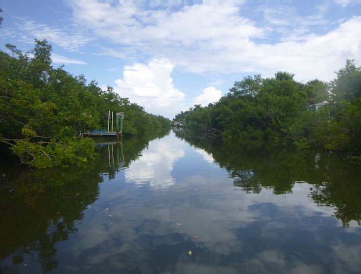
And time for us to leave as well—an incoming tide, and the wind at our backs. Instead of retracing our steps, we detoured past the oyster mound at Dead Man’s Hammock, wound our way through Old Romerly Marsh Channel, and then back across Romerly Marsh Creek to the Wilmington River. Kathryn warned, me not to take that tempting left up Romerly Marsh Creek. It’s a mistake you do not repeat.


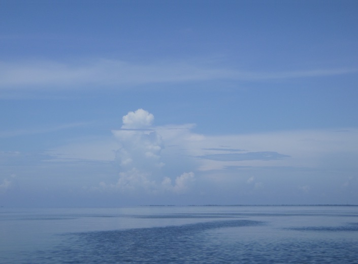
We could have detoured more, but thoughts of of Leopold’s ice cream, a Savannah delicacy that my grandmother remembered from her childhood, fueled a speedy return. We slowed briefly to watch several baby sharks playing and feeding, then went to feed ourselves. Sitting on the marina deck, we reflected on such an unusual summer day—no signs of the afternoon storms. Typically signs of building storms chase us off the water by early afternoon. So while we lucked out on the day’s conditions, in reality we are even luckier to have such a biologically and culturally significant area to explore.

SUP and Sail Under the Sunshine Skyway

Emerson Point, Palmetto, FL

SUP and Sail in Tampa Bay in August? But why? The weather swings between dead calm and squalls, making both sailors and paddlers cranky. But we needed to test our Sanibel 18 sailboat—KneeDeep 1, newly rebuilt after two years languishing in the yard. So off we went, boat and board, to Terra Ceia, Florida at the south end of the Sunshine Skyway Bridge.

Our mission: prepare KneeDeep l to be our floating home for upcoming sailing and paddling trips. On our SUP and Sail trips, Kevin sails, I paddle my SUP, and we meet at a designated anchorage at the end of the day. A good test of our navigation skills as well as our relationship. With an 14″ draft, KneeDeep l is ideal for navigating the shoals of southwest Florida and the Everglades. But if our larger sailboat, an O’Day 222, is a floating tent with a vestibule, KneeDeep l is a floating bivy. A floating bivy that will shelter us for West Coast Trail Sailing Squadron trips and, more important, house Kevin during the Everglades Challenge in March while I’m paddling.

With help from Andy Bartley and Mary Mangiapia, we launched the boat just past high tide on Sunday afternoon.

Terra Ceia and the south end of Tampa Bay was new to me, so I consulted Florida Paddling Trail Association‘s (FPTA) website which suggested several routes. Additionally, the Manatee County Paddling Guide offered routes as well as information about local history and the ecosystem. Brooke Longeval also shared a route around Rattlesnake Key and Emerson Point. In the end, I created my own routes, but these resources gave me a start.

Courtesy of FPTA
Thanks Brooke!

Over the four days, I paddled to Emerson Point and around Rattlesnake Key, under the Sunshine Skyway Bridge, and partly across Tampa Bay towards the large American flag on Mullet Key, the start of the Everglades Challenge. The afternoon storms limited my range—I never wanted to be too far offshore when the inevitable storms blew up. And after a 52-mile training paddle the previous weekend, I needed to ease my way back into my Paddle Monster workouts. But I feel like I barely scratched the surface of the paddling this area offers.

A speck on the horizon

In past years, Kevin and I have done multiday SUP and sail trips to southwest Florida, the Ten Thousand Islands, and the Everglades. Each trip has been a learning experience, both for Kevin on the boat and me on my board, and we debrief after each trip. What have we learned? What went wrong, or could have but fortunately didn’t? Our expedition sea kayak training has given us skills in open water, navigation, and marine communication as well as lessons in self-reliance. The latter is especially important because we are alone on our individual crafts, often miles apart. In particular, during the Everglades Challenge when I will be paddling and camping from my board, and Kevin will single-hand the sailboat.

A pod of manatees
And more manatees
Grassy Flats Make Happy Fish Until…
Baby Shark Do Do Do
Fins to the Left, Fins to the Right

Terra Ceia is a small community in Manatee County surrounded by nature preserves, including the Terra Ceia Preserve State Park and the Terra Ceia Aquatic Preserve. Many of the areas I paddled were shallow grassy flats that provided habitat for juvenile fish, baby sharks, rays, and manatees. One day I ate lunch surrounded by a pod of manatees, and another morning I watched baby sharks stalk their breakfast, tiny fins thrashing left and right.

Canal to our rented house in Terra Ceia
Miguel Bay to Tampa Bay
Heron at Emerson Point
Spoil Island

I hadn’t realized how significant this area was to Native American history. Terra Ceia and Emerson both house ceremonial mounds in which archaeologists have discovered multiple periods of Native American culture. The Madira Bickel Mound State Archaeological Site is accessible by both road and water, the backside anyway.

After paddling and sailing under the August sun, Kevin and I met most afternoons for a float.

Sailors and paddlers are never happy—either too much wind or too little. One afternoon, we floated and commented on the beautiful cloudscapes. But in the beauty lurks danger. I wondered if we weren’t tempting fate. Of course, we were.

Where’s my wind?
Building Clouds
Something Wicked This Way Comes

The inevitable happened—a storm blew up over Bradenton, and Kevin rode it out on the boat while I, safe at the house, followed the storm’s progress on my phone. A stark reminder of how fast Florida’s weather can change.

Sunshine Skyway Bridge

Over adult beverages that evening, we pronounced our shake-out cruise a success. Kevin determined what KneeDeep l needed, and I explored the south end of Tampa Bay. Our next step: preparing KneeDeep l for multiday trips into the remote and shallow waters of the Everglades. We’ve done these trips on our larger boat, but how will this smaller boat fare in rough conditions? Let the training begin. March and the Everglades Challenge will be here before we know it!

Clouds over Rattlesnake Key

Apalachicola Rivertrek 2021: Dam to Bay by SUP

Team Rivertrek 2021. 16 paddlers, 106 miles, and an abundance of love for the Apalachicola River. Over 5 days, from the Woodruff Dam in Chattahoochee to Apalachicola Bay, our team bonded with the river and with each other. When I dismounted my paddleboard in Apalachicola, I did so with a much deeper appreciation for the river and the ecosystems it crosses.

Loaded board

I joined Apalachicola Rivertrek to learn about the river and to raise funds for the Apalachicola Riverkeeper. The Apalachicola Riverkeeper monitors water quality, coordinates volunteers, and mounts legal challenges to preserve the river and its environs. In addition to its beauty, the Apalachicola River and Bay is considered one of five biological hotspots in North America. In 2021, I paddled the first two days of Rivertrek, and I knew then that I wanted to join the team in 2021. Paddling the length of the river over 5 days was—literally—an immersive experience in the river’s moods from dam to bay.

Ready to launch
Jim Woodruff Dam
Test packing

Our journey began in the town of Chattahoochee, just south of the Florida-Georgia line, where Georgia’s Chattahoochee River becomes Florida’s Apalachicola River. The Chattahoochee River starts in north Georgia, flows through metro Atlanta, and continues south as the Georgia-Alabama border until it reaches Lake Seminole and the Jim Woodruff Dam. Once in Florida, the Apalachicola River streams into Apalachicola Bay and then the Gulf of Mexico. Each day we paddled approximately 21 miles miles, about 4-5 hours on the swift-moving Apalachicola River.

Day 1: Chattahoochee to Sandbar just above Alum Bluff

Day 2: Sandbar to Estiffanulga

Day 3: Estiffanulga to Sandbar just above Gaskin Park

Day 4: Sandbar to Hickory Landing Campground

Day 5: Hickory Campground to Apalachicola

Like glass

Florida has hills! The first two days revealed things not typically associated with Florida: hills and fall colors. After 6 miles, we passed Torreya State Park, a Florida backpacking destination, and looked up at Gregory House, an 1849 mansion, later moved to the park. We camped on a sandbar that night just upstream from Alum Bluff, a 135 foot geological anomaly in Florida. Erosion over millenia exposed a section of the earth’s crust, including fossils. We continued past more bluffs and a waterfall until we reached Bristol Landing, a small park with a much-anticipated flush toilet.

Gregory House in Torreya State Park
Approaching Alum Bluff
Alum Bluff
A waterfall!
More bluffs
Bristol Landing

Just downstream, we passed under the Highway 20 bridge, the last bridge over the Apalachicola River until the bay. Soon after, we made a quick detour into Sutton Lake and Bayou to see the tupelo and cypress trees. Unfortunately, deadfall prevented us from paddling too far up into the bayou, but even our short visit let us peek into this swamp ecosystem.

Houseboats on Sutton Lake
Sutton Lake and Bayou

Later that afternoon, we reached Estiffanulga County Park where we camped in a small park. That night Riverkeeper volunteers treated us to a paella dinner, and we realized that noone would lose weight on this trip between these dinners and an endless supply of cookies. Later FWC gave a hands-on talk about reptiles, and we all got to handle snakes.

Our view from Estiffanulga
Building clouds
Floating dog kennel

Although wind and clouds threatened us one afternoon, our weather was mostly sunny, perfect for swimming and bathing during our breaks. Most days we had one lunch break and two cookie breaks on the plentiful sandbars. These sandbars make the Apalachicola an ideal river for multiday trips—plenty of campsites.

Time for a swim
Drying gear
Board at rest
Anyone got a signal?
Time for a break

On our third night, we camped just upstream of Gaskin Park. Again our intrepid volunteers treated us to dinner: the Apalachicola Riverkeeper support boat, source of an endless supply of food, produced a pot of gumbo!

Home sweet home
Dinner arrives
Setting up

On our fourth day, we ascended Sand Mountain, which gave us beautiful views of the river and a chance to stretch our legs.

Sand Mountain
Climbing our mountain
After the climb

Unlike the natural bluffs upstream, Sand Mountain is the product of dredging by the US Army Corps of Engineers. The dredging process cut off a slough, thus interfering with natural water flows. According to the Riverkeeper, sloughs help circulate water and nutrients through riverine systems in a process similar to veins and arteries in our bodies.

The Apalachicola Riverkeeper is part of a team working to restore three sloughs. Ken Jones, project manager and our support boat driver, explained the process to us in Douglas Slough.

Ken Jones
Finding the slough
Douglas Slough
East River Slough
East River Slough
A happy camper

On our fourth day of paddling, the river transitioned to a coastal environment. We had fewer sandbars and fewer breaks. On our final night, we camped at Hickory Landing Campground, a 1 1/2 mile paddle up Owl Creek. In October 2021, I explored this area when the Rivertrek was rescheduled due to high water. We paddled nearby Devon, Owl and Black Creeks and learned from Riverkeeper Doug Alderson about distributaries: channels that distribute water away from the main channel, out into the watershed.

Just 22.2 miles to go
Entrance to Owl Creek
Ever-growing load
Low country boil

That night Riverkeeper volunteers set a high bar: a low country boil! The promised cold front indeed rolled through but our feast and warm clothes kept us going on the final leg to Apalachicola Bay.

Railroad Bridge
Our promised fanfare
Perfection
The end is in sight

Doug promised us fanfare when we reached Apalachicola, and he delivered: a band and plenty of beer. I know that my next visit to Apalachicola will include a visit to the Oyster City Brewery. After goodbyes to new and old friends, Harry of Harry Smith Outdoors, shuttled bodies, boats, and board back to Tallahassee. Like most good trips, it went way too fast. Even though we paddled the entire Apalachicola River, I felt like I only had a glimpse into what this region offers. I’m already planning my next trip.

Everything But the Apalachicola

Cash Creek

Boards, boat, and gear loaded for Apalachicola Rivertrek 2021, a 106-mile paddle down the Apalachicola River to benefit the Apalachicola Riverkeeper. Mother Nature had other plans and dumped inches of rain on the southeast, flooding the river and our campsites. Our trip was postponed until November 10, but Janice and I were ready for an adventure and headed west to Florida’s Panhandle. The delay allowed us to explore multiple ecosystems around Apalachicola Bay that we might never have discovered otherwise. Yay Plan B!

Ride the bore tide.
Miss anything?

As the storms raged, we brainstormed, poring over paddling options described on the Apalachicola Riverkeeper, Florida Paddling Trails Association, and Florida Circumnavigation Saltwater Paddling Trail websites. So many choices.

After two days hiding out at the Carrabelle Beach RV Resort, which I highly recommend, we joined our group at the Hickory Landing Campground near Sumatra, Florida. This Apalachicola National Forest campground provided easy access to Owl Creek and other creeks near the Apalachicola River.

The following morning, Doug Alderson led us a short distance down Owl Creek to Devon Creek, accessible only during high water. Owl and Devon Creeks, like other nearby creeks, are black water, filled with the tannins of decayed vegetation. We meandered through the trees until we reached a swamp and could go no further.

Less than a mile downstream from Devon Creek, the Apalachicola River flowed on. I poked my nose out into the current—it was swift.

Later, Janice and I paddled upstream on the slow-moving Owl Creek and further upstream on Black Creek. Georgia Ackerman and Doug Alderson of the Apalachicola Riverkeeper were terrific resources on local paddling. Additionally, the Riverkeeper website, as well as the FWC and Forest Service‘s websites also provide maps and paddling guides to the forest and the bay.

On our final day, we drove south towards the bay to the tidal Cash Creek and High Bluff Creeks. The open marsh landscape contrasted well with the forested landscape around Owl Creek and the Hickory Landing Campground.

Cash Creek Courtesy of FWC

From the Cash Creek launch, we paddled about a mile to a Y-intersection where High Bluff Creek split off from Cash Creek. We followed the twists and turns of High Bluff until it split into fingers in the marsh. As it narrowed the flow picked up, testing our boat and board control skills as we avoided logs and deadfall.

At the Y, we paddled up Cash Creek which took my breath away. My height on the SUP put me at eye-level with the flowers.

I felt like we were paddling through a painting, our own version of the Immersive Van Gogh exhibit, surrounded by fields of yellow flowers. And we had a touch of fall, fall for Florida, that is.

Although we were initially disappointed that Rivertrek was postponed, this trip gave us a chance to paddle different rivers and to meet members of the Rivertrek team. At a moment’s notice, Doug and Georgia assembled Rivertrekkers and volunteers for a fun weekend, complete with banjo music! I’m more excited than ever about Rivertrek and the Apalachicola River and Bay. And next time, I’m finding oysters.

And, one more month.

If you would like to contribute to the Apalachicola Riverkeeper, you can do so on the Rivertrek team page (just scroll down to my name): http://apalachicolariverkeeper.org/rivertrek/. Or please mail a check to the riverkeeper, noting my name: Apalachicola Riverkeeper, P. O. Box 8, Apalachicola, Florida 32329

Rivertrek 2021: Let’s Save the Apalachicola River

Apalachicola Riverbank

On October 6, I will join the 2021 Rivertrek team to paddle the 106 miles of the Apalachicola River, from the Georgia-Florida border to the Gulf of Mexico. This five-day trek raises funds for the Apalachicola Riverkeeper to help them protect the river and bay. Last fall, I spent two days on the Apalachicola River and was immediately hooked (https://floridawaterscapes.com/2020/11/29/apalachicola-sup-2020-style/). I knew then that I wanted to join this team. 

 Every fall, a team of paddlers embarks on this journey.  The Apalachicola Riverkeeper advocates for the health of the Apalachicola River and Bay through a variety of efforts, including water quality monitoring, fighting oil and gas drilling in the region, and public outreach, among other things. Everyone benefits from a healthy riverine system, and who doesn’t love Apalachicola Bay oysters? Contributions support the outreach, education, and advocacy efforts of Apalachicola Riverkeeper.

 If you would like to contribute to the Apalachicola Riverkeeper, you can do so on the Rivertrek team page (just scroll down to my name): http://apalachicolariverkeeper.org/rivertrek/. Or please mail a check to the Riverkeeper, noting my name:

Apalachicola Riverkeeper, P. O. Box 8, Apalachicola, Florida 32329

 Thank you for your support.

Reposted from November 2020:

Apalachicola SUP: 2020 Style

Morning on the sandbar

What can alleviate the insanity of 2020 better than sandbar camping, good friends, and no wifi? By 9am, November 4—the day after the election, Jill, Liz, Jennifer, and I paddled away from the noise and into the solitude of the Apalachicola River. Over the next two days, our team of four—three kayaks and one paddleboard—would cover the 45-ish miles from Jim Woodruff Dam to the Estiffanulga Boat Ramp.

Maps and points on the Apalachicola Blueway (courtesy of Apalachicola Riverkeeper)
Door to door service from om Harry Smith, Harry Smith Outdoors

Our journey began in the town of Chattahoochee, just south of the Florida-Georgia line, where Georgia’s Chattahoochee River becomes Florida’s Apalachicola River. The Chattahoochee River starts in north Georgia, flows through metro Atlanta, and continues south as the Georgia-Alabama border until it reaches Lake Seminole and the Jim Woodruff Dam. Once in Florida, the Apalachicola River streams into Apalachicola Bay and the Gulf of Mexico.

Load and launch at Clyde Hopkins Park, Chattahoochee, FL
Jennifer prepares to launch

Why the Apalachicola River? Jill needed to complete the first two days of the Apalachicola Rivertrek, and the rest of us stepped in as good friends to “help”. Every October, the Apalachicola Riverkeeper organizes Rivertrek, a 5-day, 106-mile paddle from Chattahoochee to Apalachicola Bay. The Apalachicola Riverkeeper, headed by Executive Director Georgia Ackerman, monitors the health of the river and bay, and Rivertrek raises funds support this mission.

However, in keeping with the spirit of 2020, Hurricane Sally broke the trip in half and pushed the second half of the trip into November. So, Liz and I were happy to “help” Jill and Jennifer paddle from Clyde Hopkins Park to Estiffanulga Boat Ramp where they would join the rest of their team. And Liz and I would return home.

One of many anchored houseboats along our route

Shortly after we launched, we passed under the I-10 bridge and left “civilization” behind. The Apalachicola River is wide and flows swiftly. At times, we saw evidence of the barge traffic that once plied the river, but mostly, and surprisingly, we had the river to ourselves.

For most of its length, the Apalachicola River forms the boundary between Eastern and Central time zones, and my watch alerted me to the change when I veered towards one side or another. However, just before the river joins the bay, the boundary between zones veers sharply—and inexplicably—westward away from the river. Why? Florida lore (and historical research) credits developer and financier Ed Ball (1888-1981) for this anomaly. Ball wanted his Wakulla Springs hunting lodge and his Port St. Joe paper mill (30+miles west) in the same time zone, and, in true Florida style, Ed Ball got what Ed Ball wanted.

Who drew that line? (Courtesy of ESRI.com.)

The high water propelled us downstream, averaging 4-6 MPH with little effort. Some sections featured scraggly trees still recovering from Category 5 Hurricane Michael that shredded the panhandle in 2018. In other sections, willows highlighted the coordinated efforts of Apalachicola Riverkeeper, EPA, and the University of Florida, among others, to reduce sandbar erosion.

Recovering trees

By 3pm, we found home for the night, a sandbar with ample space for socially-distanced tents. Plenty of time to swim, relax, and set up camp.

Time to chill
Liz vs the Sawyer squeeze
Home for the night

We paddled about 20 miles our first day, leaving about 20 more for the second day. Given the river’s flow, we relished a relaxed morning, drinking coffee and drying dew-soaked gear. That’s how it started anyway.

A slow morning
Manatee pajama envy
Run!

I was barely into my first cup of coffee when Jennifer pointed to her Pocket Rocket stove, now engulfed in flames. “Run,” Liz yelled, and we sprinted to the far side of the sandbar. Seconds later, a large boom echoed across the river valley, perhaps causing some to wonder if hunting season had started early. A gas leak? A bad O-ring? We’ll never know. And we never found the piece that blew off.

Alum Bluff
Topography in Florida!

Just downstream from our campsite, we passed Alum Bluff, a 135′ high sandbar that towers over the river. The heights of Alum Bluff and Torreya State Park were the biggest surprises of the trip for me–actual topography in our flat state.

We stopped for a quick break at the boat ramp in the town of Bristol. Shortly after, we reached Sutton Creek and Bayou on the river’s west side and took a side trip up this sleepy creek. Stands of tupelo trees arched over still water, providing a feeling of stillness and gravity.

Sutton Creek
Sutton Bayou

Despite our leisurely morning, the day had passed quickly. Time to find a campsite. Our goal—a sandbar two miles upstream of our take-out at Estiffanulga Boat Ramp. Estiffanulga Boat Ramp was mile 63, and the sandbar 65. We pulled over around mile 70 and coordinated charts, watches, and mileage.

Checking charts and a little break

The miles ticked by. Around mile 65, what looked suspiciously like our sandbar barely peeped out from under the water. That wasn’t going to work. We paddled on, looking for possibilities.

Where’s my sandbar?

It was not to be, and Estiffanulga County Park would be our home for the night. We rounded the final bend and saw the boat ramp—and two tents being set up. Two other members of Rivertrek had arrived for the next morning’s rendezvous.

Our evening view
The four Musketeers
Apalachicola Riverkeeper boat

The rest of the Rivertrek crew arrived the next morning, along with Georgia Ackerman and the Riverkeeper boat. Liz and I waved goodbye as they resumed their journey towards Apalachicola Bay. 2020 was not yet done with Rivertrek though. As Tropical Storm/Hurricane Eta pinballed around the Gulf of Mexico, the Rivertrekkers changed their plans once again. But, as all paddlers know—all plans are contingent, and nature bats last. Nonetheless, I envied them as they headed south, and maybe 2021 is my year for Rivertrek.

And they’re off

Donkeys, SUP, and Basket Weaving on Ossabaw Island

Photo credit: Kathryn Lapolla

Just a short paddle from Skidaway Island in Savannah, Georgia, lies Ossabaw Island, offering a glimpse into Georgia’s cultural and ecological history. I had kayaked and camped on Ossabaw Island several years ago with Ronnie and Marsha of Sea Kayak Georgia, but I hadn’t seen the buildings or explored the island’s interior. When Kathryn Lapolla of Savannah Coastal Ecotours invited me to join her and a group of basket weavers from Tennessee on Ossabaw Island, I leapt at the chance to return.

Ossabaw Island is one of the Sea Islands, a chain of barrier islands stretching from the Carolinas to north Florida. Unlike many of these islands, Ossabaw, St. Catherines and Wassau have remained largely undeveloped. But the structures that remain on Ossabaw reveal both a unique history that parallels that of the Low Country. The island’s beauty obscures a rich and difficult history, including centuries of slavery and later Reconstruction wherein African Americans gained and soon lost access to land. Paddling across the Ogeechee River, I bore in mind that a place of joy to me might yield pain to others.

From the Landings to Ossabaw

Kathryn and I prepared our respective crafts, an NDK Sportive kayak and a 14′ Bishop A’u paddleboard, for a 10 am departure. Although the trip was only 6 miles, Georgia’s strong tidal flows make tidal planning essential. Kathryn’s husband Fran had already shuttled the weavers to the island, along with gear and food for the week.

Courtesy of the Ossabaw Foundation

We arrived at Torrey Landing, just a short walk from the Clubhouse where we were all staying. On my last visit, I camped at the South End Beach Camp, a primitive site almost 8 miles away. The Clubhouse with its community kitchen and expansive porch felt luxurious.

Ossabaw Island’s history is similar to that of the Low Country, with waves of indigenous settlements, followed by European settlers. One notable exception was visionary Sandy West (1913-2021) who cultivated the artistic oasis that Ossabaw later became. According to the Ossabaw Island website, archaeologists and historians documented numerous indigenous communities prior to the arrival of Spanish and English settlers. In 1763, John Morel, Sr. purchased the island and brought 30 enslaved people to produce indigo and later sea cotton. After the Civil War, parcels of land were distributed to the newly freed people to farm as part of Reconstruction. Unfortunately, this was a short-lived promise. Soon thereafter, Andrew Jackson rescinded this distribution and returned much of the land to ante-bellum landowners.

Eleanor Torrey West, known as Sandy, inherited Ossabaw from her parents and founded the Ossabaw Foundation to preserve the island. She later deeded Ossabaw Island to the State of Georgia with the provision that it would remain undeveloped. She lived on the island full-time and welcomed groups of artists, writers, and educators to stay for short periods. And that is how I came to be weaving a basket on Ossabaw Island.

I came to Ossabaw to paddle, but I became strangely entranced by the process of making a basket. Kathryn had warned me that the weavers weren’t going to let me go without making one. I was game, but wary, as the least artistic person ever. But with Barbara’s excellent instruction (and mistake fixing), I actually made a basket. I loved visiting with the weavers. They come every year and told island stories of years past.

Donated to the Ossabaw Foundation

But it wasn’t all about basket weaving. Kathryn and I explored the island by boat and board. One day,we surfed the tiny waves rolling in around Bradley Point on the south end.

Another day Fran hauled boat and board up the Bradley River. We rode the tide downstream and back to the landing, looking out for gators and dolphins along the way.

The tidal currents of the Ossabaw River created an endless pool for my SUP practice. As part of my technique training through Paddle Monster, Coach Larry Cain had assigned both land and on-water drills to improve my stroke. I paddled upstream, practicing my catch and exit, floated back down and repeated, again and again. An alligator surveyed my first few passes, until the sun and repetition lulled it to sleep.

Photo credit: Pam Bullock

We also toured the island by land, piling into the back of the Foundation truck. We saw Middle Place, site of the Genesis Project, another Sandy West creation. From 1970-1983, artists and others spent from a week to a year on the Genesis Project, “a cooperative, semi-sustainable community” where they lived “close to the land.” I wish I had learned about the Genesis Project when I was writing Living Sustainably. I found these communities fascinating, but found few in the deep south.

We saw the once-elegant Main House and looked for bird life towards the south end of the island.

Ossabaw had no shortage of wildlife, some wanted and some not. Sandy had introduced donkeys to the island, and they loved their apples and carrots. A less welcome raccoon slipped into the house early one morning and helped himself to granola bars and snacks.

And suddenly, it was time to paddle back to the mainland. Ossabaw is a magical place, revealing so much cultural and ecological history. The fate of Ossabaw Island is in the hands of the State of Georgia. I hope they live up to Sandy West’s expectations.

Meanderings on Moses Creek

Paddling on (Photo credit: Alicia Windham-Reid)

Just a short paddle from St. Augustine to Moses Creek, an oasis of calm along the Matanzas River. I’ve driven across the wide Matanzas River many times on my way to the beach and wondered about its many tributaries. In early December, my chance to explore. Four people, three kayaks, one paddleboard, and one dog launched from the Butler Park West boat ramp, paddled down and across the Matanzas River (aka the ICW), and up Moses Creek to a primitive campsite.

Time to go

Months before, in the heat of the summer, we had scouted the campsite and floated for hours in the calm water below. Roseate spoonbills filled the trees along the creek, leading us to dub the site the ‘Roseate Riviera.’ The December cold, however, had driven them to warmer climes, and the trees were empty. Moses Creek runs through the St. Johns Water Management District’s Moses Creek Conservation Area, a tidal marsh with a mix of local ecosystems. The area has a mix of biking, hiking, and paddling trails and is one of the few places that allow primitive camping.

After setting up camp, we paddled up Moses Creek, passing a picnic area and another campsite. My previous paddling trips to the area mostly revolved around Dale William’s Rough Water Training Sessions in which we practiced surf and rescue skills in Matanzas Inlet. I had been wanting to explore the inshore waters, in part because of their rich history.

Fort Mose Historic State Park in St. Augustine (Courtesy of Florida State Parks)

I knew that Fort Mose Historic State Park lay upstream on the Matanzas River. Fort Mose (pronounced Mo-say) commemorates the first free black town in the “what now is the United States.” As described by the Florida Museum, “in 1738 the Spanish governor established the runaways in their own fortified town, Gracia Real de Santa Teresa de Mose, about two miles north of St. Augustine, Florida.” African-Americans gained their freedom by reaching Spanish-held territory, a lesser known part of the Underground Railroad. The Bitter Southerner‘s “The First Floridians” places the site in historical context and asks what might have been if the Spanish had retained control of Florida. I look forward to learning more about this rich history.

We paddled upstream until the creek narrowed, and the tide turned. Even though Moses Creek’s tides were not that strong, the tidal flows are the Matanzas River are significant, so we timed our paddling accordingly.

The following day, we explored some of its extensive trails on foot. We walked from our campsite on Moses Point to the picnic area directly across, about 4 miles each way. Closer to Highway 206, we saw off-road bike trails which looked fun.

We returned home the next morning, again timing our paddle with the tides. Even though we were mere miles from St. Augustine, Moses Creek felt remote. Before this trip, I hadn’t given much thought to these water management district conservation areas, but, in retrospect, I realize that I had hiked in the Rice Creek area in doing research on the Bartram Trail. I recently paddled up the nearby Rice and Etoniah Creeks which were beautiful. These conservation areas, dotted around the state, are a hidden gems for primitive camping, hiking, and paddling. More to explore in our amazing state.

Efficient loading technique?
It only looks remote
Janice and Millie (Photo credit: Alicia Windham-Reid)

Apalachicola SUP: 2020 Style

Morning on the sandbar

What can alleviate the insanity of 2020 better than sandbar camping, good friends, and no wifi? By 9am, November 4—the day after the election, Jill, Liz, Jennifer, and I paddled away from the noise and into the solitude of the Apalachicola River. Over the next two days, our team of four—three kayaks and one paddleboard—would cover the 45-ish miles from Jim Woodruff Dam to the Estiffanulga Boat Ramp.

Maps and points on the Apalachicola Blueway (courtesy of Apalachicola Riverkeeper)
Door to door service from om Harry Smith, Harry Smith Outdoors

Our journey began in the town of Chattahoochee, just south of the Florida-Georgia line, where Georgia’s Chattahoochee River becomes Florida’s Apalachicola River. The Chattahoochee River starts in north Georgia, flows through metro Atlanta, and continues south as the Georgia-Alabama border until it reaches Lake Seminole and the Jim Woodruff Dam. Once in Florida, the Apalachicola River streams into Apalachicola Bay and the Gulf of Mexico.

Load and launch at Clyde Hopkins Park, Chattahoochee, FL
Jennifer prepares to launch

Why the Apalachicola River? Jill needed to complete the first two days of the Apalachicola Rivertrek, and the rest of us stepped in as good friends to “help”. Every October, the Apalachicola Riverkeeper organizes Rivertrek, a 5-day, 106-mile paddle from Chattahoochee to Apalachicola Bay. The Apalachicola Riverkeeper, headed by Executive Director Georgia Ackerman, monitors the health of the river and bay, and Rivertrek raises funds support this mission.

However, in keeping with the spirit of 2020, Hurricane Sally broke the trip in half and pushed the second half of the trip into November. So, Liz and I were happy to “help” Jill and Jennifer paddle from Clyde Hopkins Park to Estiffanulga Boat Ramp where they would join the rest of their team. And Liz and I would return home.

One of many anchored houseboats along our route

Shortly after we launched, we passed under the I-10 bridge and left “civilization” behind. The Apalachicola River is wide and flows swiftly. At times, we saw evidence of the barge traffic that once plied the river, but mostly, and surprisingly, we had the river to ourselves.

For most of its length, the Apalachicola River forms the boundary between Eastern and Central time zones, and my watch alerted me to the change when I veered towards one side or another. However, just before the river joins the bay, the boundary between zones veers sharply—and inexplicably—westward away from the river. Why? Florida lore (and historical research) credits developer and financier Ed Ball (1888-1981) for this anomaly. Ball wanted his Wakulla Springs hunting lodge and his Port St. Joe paper mill (30+miles west) in the same time zone, and, in true Florida style, Ed Ball got what Ed Ball wanted.

Who drew that line? (Courtesy of ESRI.com.)

The high water propelled us downstream, averaging 4-6 MPH with little effort. Some sections featured scraggly trees still recovering from Category 5 Hurricane Michael that shredded the panhandle in 2018. In other sections, willows highlighted the coordinated efforts of Apalachicola Riverkeeper, EPA, and the University of Florida, among others, to reduce sandbar erosion.

Recovering trees

By 3pm, we found home for the night, a sandbar with ample space for socially-distanced tents. Plenty of time to swim, relax, and set up camp.

Time to chill
Liz vs the Sawyer squeeze
Home for the night

We paddled about 20 miles our first day, leaving about 20 more for the second day. Given the river’s flow, we relished a relaxed morning, drinking coffee and drying dew-soaked gear. That’s how it started anyway.

A slow morning
Manatee pajama envy
Run!

I was barely into my first cup of coffee when Jennifer pointed to her Pocket Rocket stove, now engulfed in flames. “Run,” Liz yelled, and we sprinted to the far side of the sandbar. Seconds later, a large boom echoed across the river valley, perhaps causing some to wonder if hunting season had started early. A gas leak? A bad O-ring? We’ll never know. And we never found the piece that blew off.

Alum Bluff
Topography in Florida!

Just downstream from our campsite, we passed Alum Bluff, a 135′ high sandbar that towers over the river. The heights of Alum Bluff and Torreya State Park were the biggest surprises of the trip for me–actual topography in our flat state.

We stopped for a quick break at the boat ramp in the town of Bristol. Shortly after, we reached Sutton Creek and Bayou on the river’s west side and took a side trip up this sleepy creek. Stands of tupelo trees arched over still water, providing a feeling of stillness and gravity.

Sutton Creek
Sutton Bayou

Despite our leisurely morning, the day had passed quickly. Time to find a campsite. Our goal—a sandbar two miles upstream of our take-out at Estiffanulga Boat Ramp. Estiffanulga Boat Ramp was mile 63, and the sandbar 65. We pulled over around mile 70 and coordinated charts, watches, and mileage.

Checking charts and a little break

The miles ticked by. Around mile 65, what looked suspiciously like our sandbar barely peeped out from under the water. That wasn’t going to work. We paddled on, looking for possibilities.

Where’s my sandbar?

It was not to be, and Estiffanulga County Park would be our home for the night. We rounded the final bend and saw the boat ramp—and two tents being set up. Two other members of Rivertrek had arrived for the next morning’s rendezvous.

Our evening view
The four Musketeers
Apalachicola Riverkeeper boat

The rest of the Rivertrek crew arrived the next morning, along with Georgia Ackerman and the Riverkeeper boat. Liz and I waved goodbye as they resumed their journey towards Apalachicola Bay. 2020 was not yet done with Rivertrek though. As Tropical Storm/Hurricane Eta pinballed around the Gulf of Mexico, the Rivertrekkers changed their plans once again. But, as all paddlers know—all plans are contingent, and nature bats last. Nonetheless, I envied them as they headed south, and maybe 2021 is my year for Rivertrek.

And they’re off

SUP Training Camp in the Keys

RZ5ONz%7Sx2dDdxdFi7BUQ_thumb_37d0
Glassy seas in Key Largo

Paddleboard training in the Keys…sign me up! Scott Baste, owner of Tavernier-based Paddle! the Florida Keys,  posted a Winter SUP Camp focused on strokes, speed, and efficiency. The timing was perfect. I had been training for the Watertribe Ultramarathon, a 62-mile race from Fort De Soto to Camp Haze Marina. But I knew I had gaps in my skills, and I really really wanted to get faster.

New boards
Trying out new boards!

Part of the fun: trying out new gear! Testing shorter paddles and narrow boards made for a wobbly, but surprisingly dry, start.

Jill getting feedback

Practicing strokes
Practicing strokes

Coach Scott
Coach Scott

Once we got our board, or sea, legs, the real fun began. Scott began with land drills to improve our strokes. Then we practiced, paddling up and down the canal behind his shop incorporating what we had learned. Later, we reviewed our progress, analyzing form and strokes through video footage. The camera doesn’t lie.

Key Largo mangroves
Key Largo mangroves


Shallow waters
Shallow waters

That afternoon and the following day, we practiced our skills on Tavernier Creek and nearby waters. The wind was gusting from the west around 20 mph, so we kept to the sheltered Atlantic side.

Eddy
Any eddy will do. Photo credit: Scott Baste

As we talked technique, Scott pointed out the rich biodiversity of the mangrove shallows. Eagle rays, barracudas, and bonnet head sharks, among others, swam around and under our boards. Paddleboards provide a perfect vantage point for viewing wildlife.

The following day, Paddle! the Florida Keys sponsored a SUP race and a post-race mini-clinic taught by Zach Rounsaville of Orange Beach, AL. Watching the race and joining the clinic revealed a new side of paddleboarding to me: racing and stroke finesse. In the clinic, Zach worked on body mechanics to make the forward stroke more efficient, and I am still working to incorporate what I learned.

Mangroves
Nine Mile Pond canoe trail

On our final afternoon, we paddled on the Nine Mile Pond kayak trail near Flamingo in Everglades National Park. High winds still challenged us, but I saw an ecosystem entirely new to me: Marjorie Stoneman Douglas’ ‘River of Grass.’

Everglades
River of Grass


Where's the trail?
Where’s the trail?

Getting low in mangrove tunnels

As we ducked under branches, I picked Scott’s brain about Watertribe. So far,  Conquistador (his Watertribe moniker) is one of two people to complete the 270-mile Everglades Challenge on a paddleboard. Completing the Everglades Challenge requires a broad range of skills, including navigation, backcountry camping, paddling in wind and waves, and endurance. I’ve been paddling in Everglades and 10,000 Islands to enhance my skills, but gaps remain. Nonetheless I (Flamingo) will be on the beach in Fort De Soto next March for the 2021 Everglades Challenge.

uaQZsFzbRkiza4BgIOxZYg_thumb_37c4
Friendly Everglades gator

This is why I was so happy when Scott announced his Winter SUP Training, and I hope there will be more of them. SUP is still a relatively new sport, and training opportunities seems focused on racing and SUP surf. Paddleboarders are venturing into conditions, including coastal, whitewater, and multiday expeditions, typically paddled in kayaks or canoes. Some skills such as navigation are transferable from kayak to SUP, but others might require a SUP-specific focus (paddling in wind, for example). I need to work on paddling a loaded SUP through swells, a skill I have in a kayak. As the SUP world grows, ideally SUP-specific training opportunities will follow. Right now I’ve got my eye on a SUP trip down the Salmon River, an entirely different form of the sport. These are exciting times for paddleboarders!

world
The world from a SUP


Testing the Waters: WaterTribe Boot Camp 2019

2019-01-12 11.41.28.jpg
Ready to go at Fort De Soto Boat Ramp

Can I paddle 300 miles in 7 days on a paddleboard? Do I want to attempt this feat? The WaterTribe Everglades Challenge is “an unsupported, expedition style adventure race for kayaks, canoes, and small boats” from Tampa to Key Largo, approximately 300 miles. The shorter Ultramarathan—the sprint version—extends the 67 miles from Tampa to Placida. The Watertribe blend of endurance, navigation, and expedition has tempted me ever since I first learned of this event. In January 2019, I attended the WaterTribe Boot Camp in Fort De Soto Park to see if I had the right stuff to enter the race in 2020.

2019-01-12 11.41.34
Boards Loaded and Ready to Go

The Boot Camp format consisted of a talk by Chief followed by a paddle and camping trip on Shell Island. Chief’s talk covered a range of topics critical for both starting and completing the challenge safely. A paddle or sail down Florida’s coast through the Everglades and Florida Bay is a serious undertaking. I already own and carry much of the safety gear based on my kayak training, but he reinforced the idea that critical gear should be carried on our bodies or PFDs. In my 5* BCU class, Gordon Brown emphasized the same point as we practiced on-water boat repairs. Chief’s mantra regarding GPS devices stuck with me: Two is one, and one is none, an accurate reflection of my experience with marine devices. Salt water and GPS’ do not play well together.

screen shot 2019-01-16 at 4.45.51 pm
Courtesy of WaterTribe.com

Chief also posed a question that each of us can only answer for ourselves. What are your goals in this challenge—to win your division or to finish? To me, finishing would be a victory. As Chief spoke, I did the math in my head. The event is almost 300 miles, and you have 8—really 7—days to get to Key Largo. The final party is in Key Largo on the 7th day, and I am not one to miss a party. That means approximately 45-50 miles per day. Can I handle the mileage and pace for 7 days straight? I have a year to figure that out.

My first challenge was finding a trail name. All long distance paddlers and hikers need a trail name. Through hikers on the AT and PCT have creative names, and I wanted a name that would also work for my upcoming AT hike. So I became Flamingo, and Janice chose HighTea in homage to her British heritage.

screen shot 2019-01-16 at 4.50.18 pm
Courtesy of WaterTribe.com

After Chief’s talk, the group headed to the beach where an array of boats and boards lined the shore. I was relieved to see another paddleboard there, but I was surprised to see so many sailing Hobies. I had assumed there would be more kayakers or canoers. One kayakers was incredulous when I revealed that I had a kayak at home. Why a paddleboard, he asked? I don’t think I can answer that, other than that I love the freedom of standing on a SUP.

2019-01-12 12.11.54
Crossing the bay

2019-01-12 12.11.43
Clear waters around Shell Key

We launched from the boat ramp for the short paddle to Shell Key. Chief had sent us coordinates and waypoints for the campsite on Shell Key and for several paddling options. The Challenge itself leaves from a beach facing the Tampa Bay shipping channel, and crossing a shipping channel is always nerve-wracking. For the Boot Camp, the weather was sunny and warm, and the water glassy, but conditions are rarely that benign for the Challenge.

2019-01-12 12.24.46
A tight squeeze

2019-01-12 12.33.20
Wrong way

Plan A involved paddling through a mangrove tunnel, then through Bunce’s Pass to the outside of Shell Key. We paddled around a small island searching for the promised mangrove channel. We made it about 50 feet then realized it was a dead end. Since it was too narrow to turn around, we paddled backwards—fin first which might turn out to be a useful skill. On to Plan B, we crossed the shallow flats, passed the motorboats lining Bunce’s Pass, then headed north to find out campsite.

2019-01-12 17.06.17
Drying gear

2019-01-12 14.42.43
Beach camping

Our group camped midway up the beach. It’s hard to believe this level of wilderness camping exists so close to St. Pete and Tampa. I set up my 1-person tent that I bought for the Appalachian Trail. Packing like a backpacker is crucial to SUP expeditions. The weight must be balanced and centered. The Hobie Mirages might carry 80 pounds of gear, but I can only carry approximately 30 pounds, including water, on my board. One new tip: pool noodles. From now on, I’ll stow them in my gear bags to increase flotation in case of capsize. One of the best parts of the Boot Camp was picking up tips about gear and packing. The other part: the people.

img_2163
Sunset

2019-01-13 07.38.36
Early morning coffee klatsch

The WaterTribe draws kindred spirits. After all, only so many people want to paddle from Tampa to Key Largo in any vessel, much less a paddleboard. After the sun set, we gathered around the campfire and traded stories. Though people came from all walks of life, it was a congenial and helpful group. I now understand why people come back year after year.

2019-01-13 09.55.06
Abandoned boat near Bunce’s Pass

2019-01-13 11.36.14
Skyway Bridge

2019-01-13 11.36.09
Cargo Boat in the shipping channel

The next morning, I drank coffee as the sun rose, a luxury I might not have during the Challenge. To make miles, I assume that I’ll be on the water before dawn. Most people savored the slow morning and moved on to their own adventures by 10 am. Janice and I paddled around Mullet Key to see the launch site. As we headed back, the wind came up, a premonition of future conditions.

I have no doubt the Everglades Challenge will be difficult, probably one of the hardest things I will ever do. Between now and Challenge 2020, I’ll hike the Maine section of the AT and kayak Alaska’s Inside Passage which will prepare me. I’ll also train on the paddleboard and consider what size and length board will work best for me. I already know that my 12′ Fanatic is too slow. But I look forward to the next year of training, planning routes, and figuring out gear. Do I have the right stuff? I’ll never know unless I try.

bird