

On October 6, I will join the 2021 Rivertrek team to paddle the 106 miles of the Apalachicola River, from the Georgia-Florida border to the Gulf of Mexico. This five-day trek raises funds for the Apalachicola Riverkeeper to help them protect the river and bay. Last fall, I spent two days on the Apalachicola River and was immediately hooked (https://floridawaterscapes.com/2020/11/29/apalachicola-sup-2020-style/). I knew then that I wanted to join this team.
Every fall, a team of paddlers embarks on this journey. The Apalachicola Riverkeeper advocates for the health of the Apalachicola River and Bay through a variety of efforts, including water quality monitoring, fighting oil and gas drilling in the region, and public outreach, among other things. Everyone benefits from a healthy riverine system, and who doesn’t love Apalachicola Bay oysters? Contributions support the outreach, education, and advocacy efforts of Apalachicola Riverkeeper.
If you would like to contribute to the Apalachicola Riverkeeper, you can do so on the Rivertrek team page (just scroll down to my name): http://apalachicolariverkeeper.org/rivertrek/. Or please mail a check to the Riverkeeper, noting my name:
Apalachicola Riverkeeper, P. O. Box 8, Apalachicola, Florida 32329
Thank you for your support.

Reposted from November 2020:
Apalachicola SUP: 2020 Style

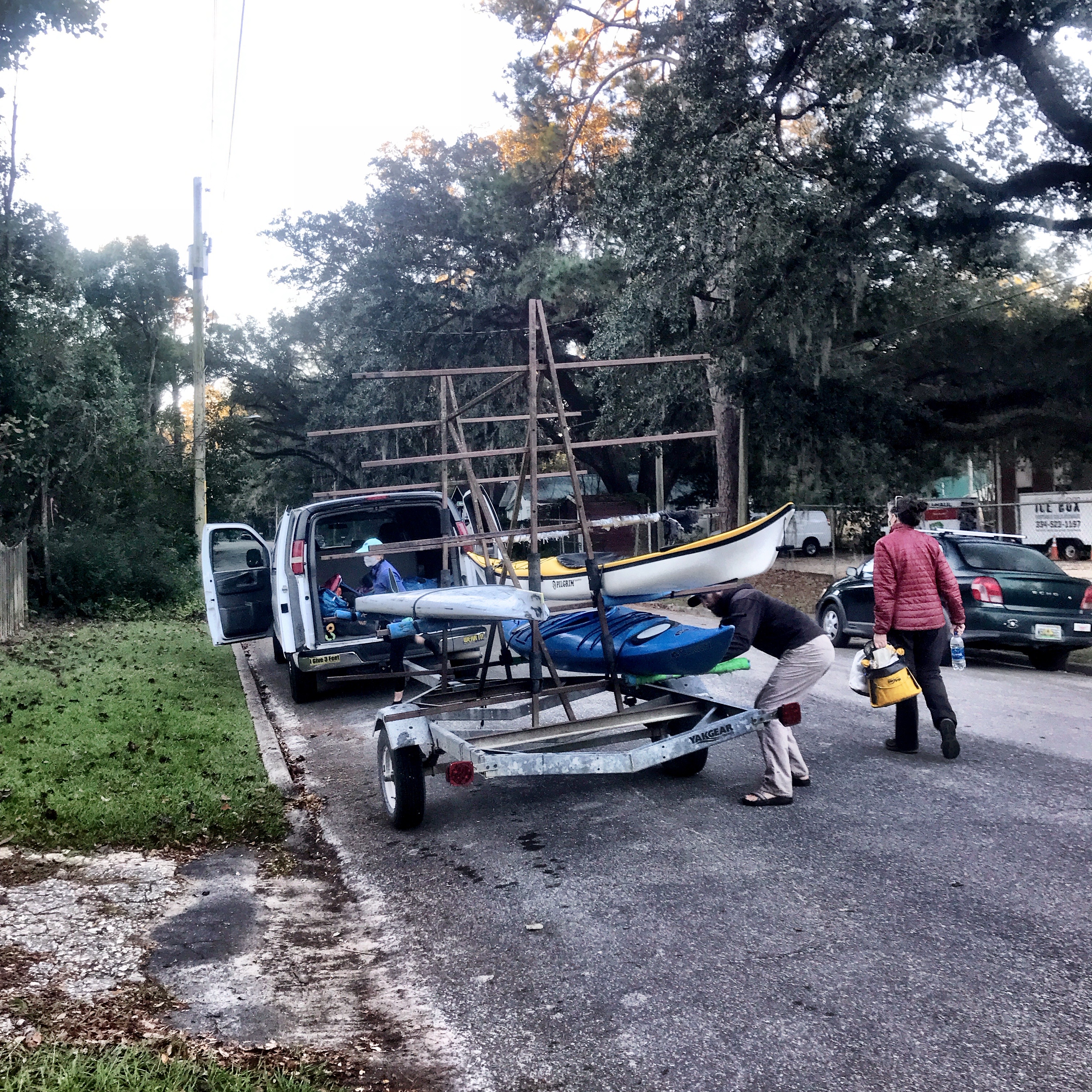
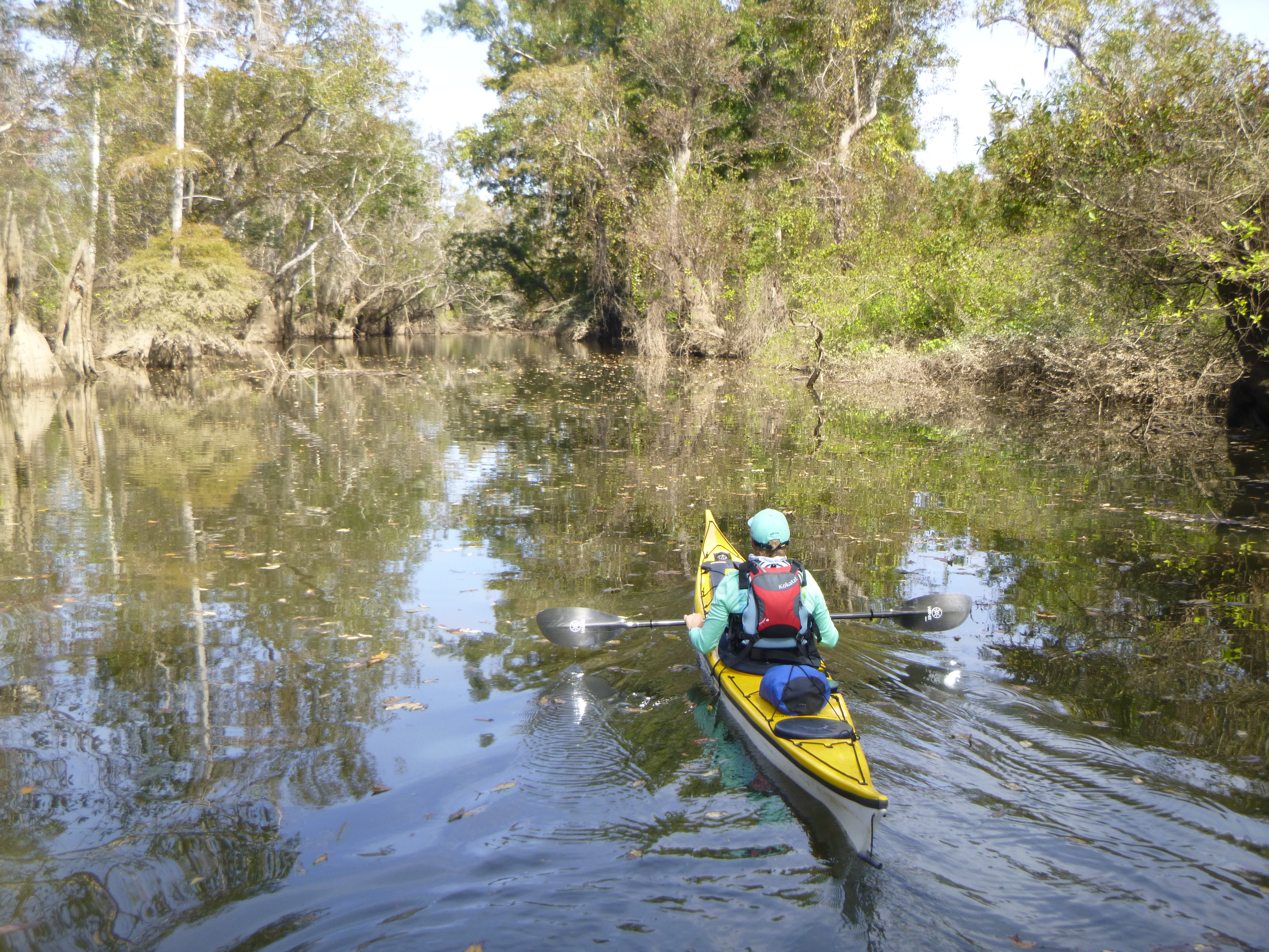
What can alleviate the insanity of 2020 better than sandbar camping, good friends, and no wifi? By 9am, November 4—the day after the election, Jill, Liz, Jennifer, and I paddled away from the noise and into the solitude of the Apalachicola River. Over the next two days, our team of four—three kayaks and one paddleboard—would cover the 45-ish miles from Jim Woodruff Dam to the Estiffanulga Boat Ramp.
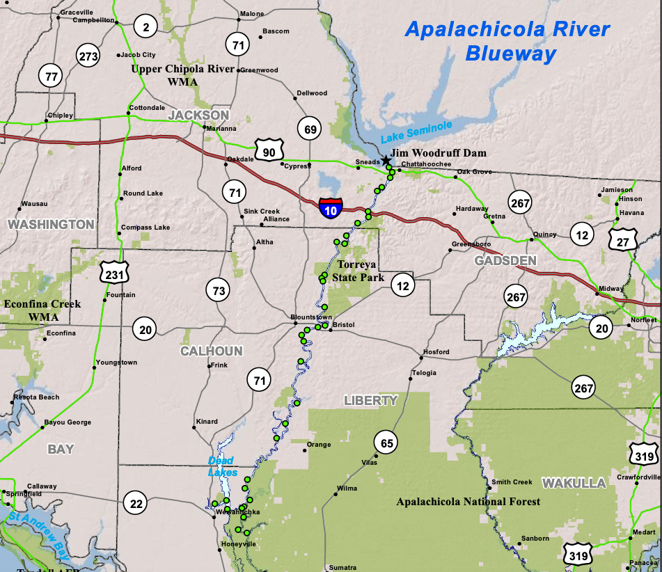
Our journey began in the town of Chattahoochee, just south of the Florida-Georgia line, where Georgia’s Chattahoochee River becomes Florida’s Apalachicola River. The Chattahoochee River starts in north Georgia, flows through metro Atlanta, and continues south as the Georgia-Alabama border until it reaches Lake Seminole and the Jim Woodruff Dam. Once in Florida, the Apalachicola River streams into Apalachicola Bay and the Gulf of Mexico.


Why the Apalachicola River? Jill needed to complete the first two days of the Apalachicola Rivertrek, and the rest of us stepped in as good friends to “help”. Every October, the Apalachicola Riverkeeper organizes Rivertrek, a 5-day, 106-mile paddle from Chattahoochee to Apalachicola Bay. The Apalachicola Riverkeeper, headed by Executive Director Georgia Ackerman, monitors the health of the river and bay, and Rivertrek raises funds support this mission.
However, in keeping with the spirit of 2020, Hurricane Sally broke the trip in half and pushed the second half of the trip into November. So, Liz and I were happy to “help” Jill and Jennifer paddle from Clyde Hopkins Park to Estiffanulga Boat Ramp where they would join the rest of their team. And Liz and I would return home.

Shortly after we launched, we passed under the I-10 bridge and left “civilization” behind. The Apalachicola River is wide and flows swiftly. At times, we saw evidence of the barge traffic that once plied the river, but mostly, and surprisingly, we had the river to ourselves.
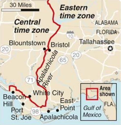
For most of its length, the Apalachicola River forms the boundary between Eastern and Central time zones, and my watch alerted me to the change when I veered towards one side or another. However, just before the river joins the bay, the boundary between zones veers sharply—and inexplicably—westward away from the river. Why? Florida lore (and historical research) credits developer and financier Ed Ball (1888-1981) for this anomaly. Ball wanted his Wakulla Springs hunting lodge and his Port St. Joe paper mill (30+miles west) in the same time zone, and, in true Florida style, Ed Ball got what Ed Ball wanted.
The high water propelled us downstream, averaging 4-6 MPH with little effort. Some sections featured scraggly trees still recovering from Category 5 Hurricane Michael that shredded the panhandle in 2018. In other sections, willows highlighted the coordinated efforts of Apalachicola Riverkeeper, EPA, and the University of Florida, among others, to reduce sandbar erosion.

By 3pm, we found home for the night, a sandbar with ample space for socially-distanced tents. Plenty of time to swim, relax, and set up camp.
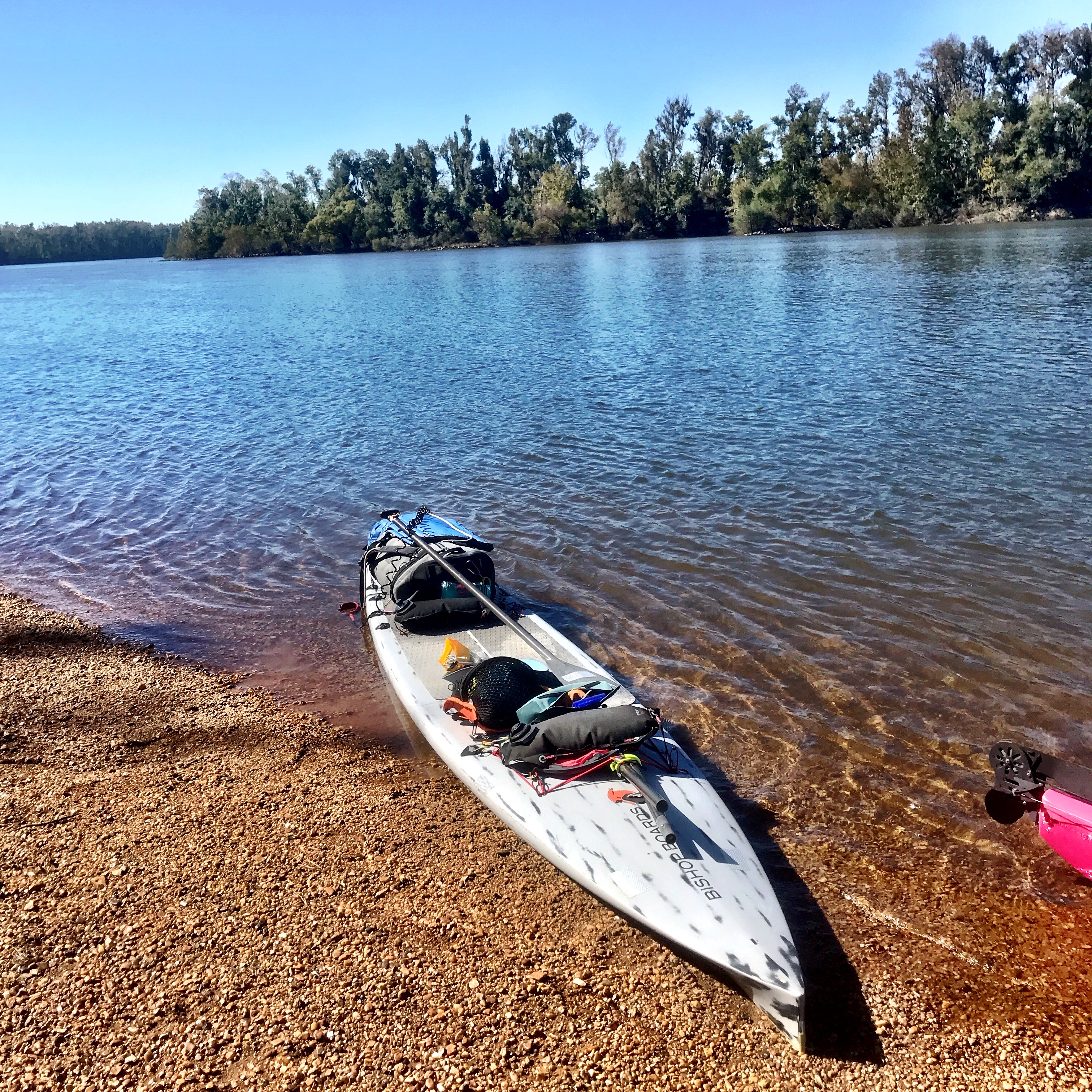


We paddled about 20 miles our first day, leaving about 20 more for the second day. Given the river’s flow, we relished a relaxed morning, drinking coffee and drying dew-soaked gear. That’s how it started anyway.

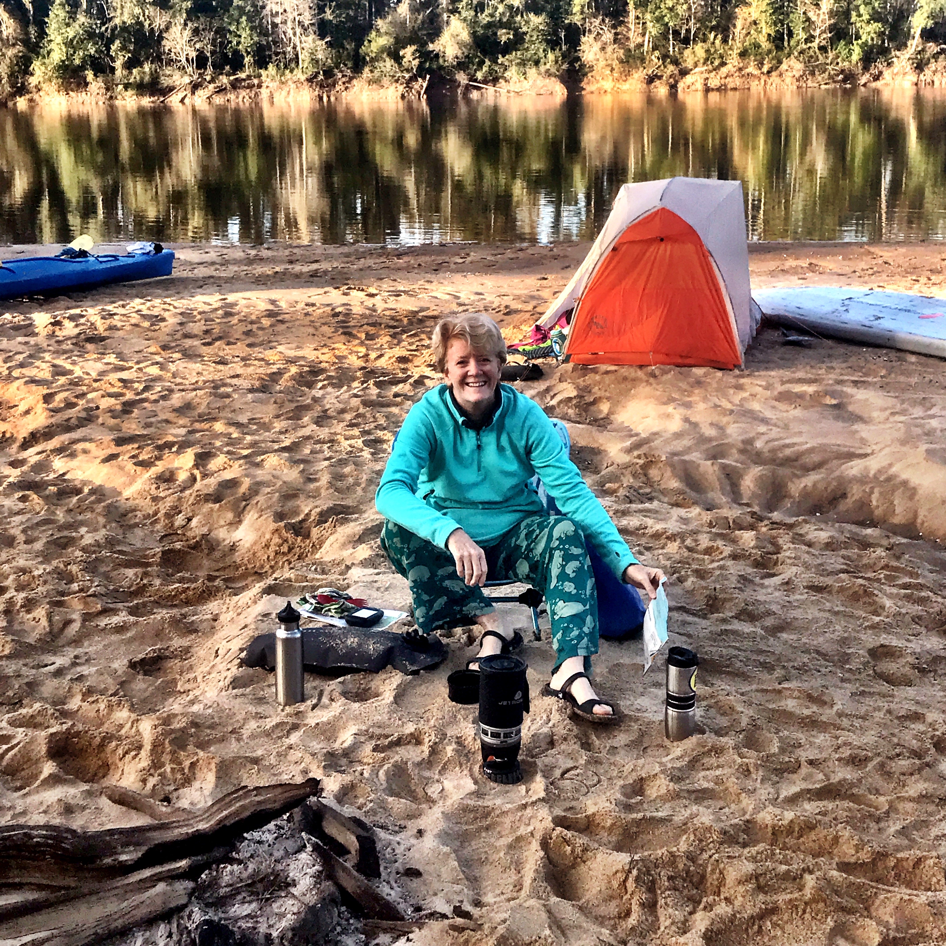

I was barely into my first cup of coffee when Jennifer pointed to her Pocket Rocket stove, now engulfed in flames. “Run,” Liz yelled, and we sprinted to the far side of the sandbar. Seconds later, a large boom echoed across the river valley, perhaps causing some to wonder if hunting season had started early. A gas leak? A bad O-ring? We’ll never know. And we never found the piece that blew off.


Just downstream from our campsite, we passed Alum Bluff, a 135′ high sandbar that towers over the river. The heights of Alum Bluff and Torreya State Park were the biggest surprises of the trip for me–actual topography in our flat state.
We stopped for a quick break at the boat ramp in the town of Bristol. Shortly after, we reached Sutton Creek and Bayou on the river’s west side and took a side trip up this sleepy creek. Stands of tupelo trees arched over still water, providing a feeling of stillness and gravity.

Despite our leisurely morning, the day had passed quickly. Time to find a campsite. Our goal—a sandbar two miles upstream of our take-out at Estiffanulga Boat Ramp. Estiffanulga Boat Ramp was mile 63, and the sandbar 65. We pulled over around mile 70 and coordinated charts, watches, and mileage.

The miles ticked by. Around mile 65, what looked suspiciously like our sandbar barely peeped out from under the water. That wasn’t going to work. We paddled on, looking for possibilities.

It was not to be, and Estiffanulga County Park would be our home for the night. We rounded the final bend and saw the boat ramp—and two tents being set up. Two other members of Rivertrek had arrived for the next morning’s rendezvous.

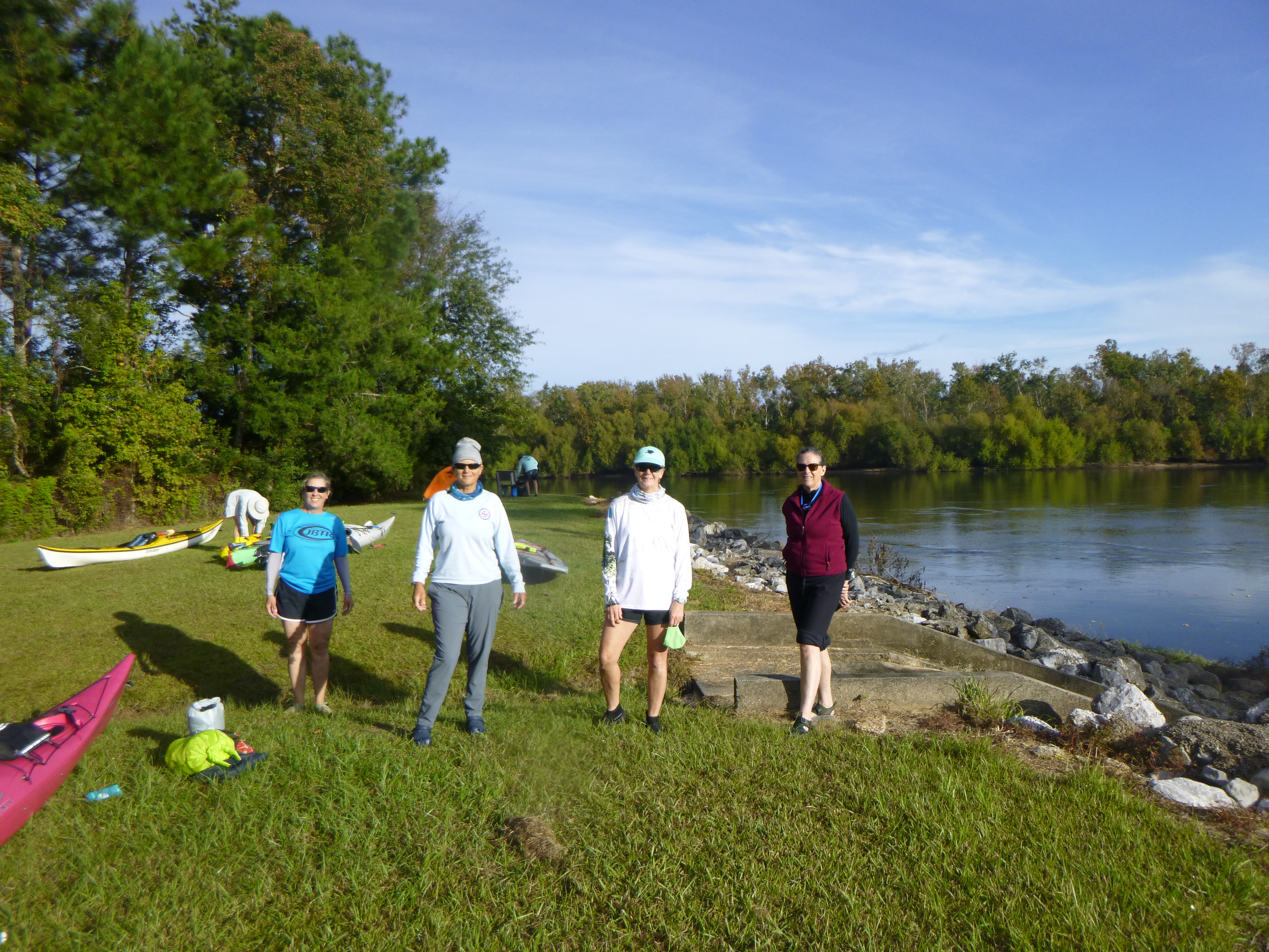

The rest of the Rivertrek crew arrived the next morning, along with Georgia Ackerman and the Riverkeeper boat. Liz and I waved goodbye as they resumed their journey towards Apalachicola Bay. 2020 was not yet done with Rivertrek though. As Tropical Storm/Hurricane Eta pinballed around the Gulf of Mexico, the Rivertrekkers changed their plans once again. But, as all paddlers know—all plans are contingent, and nature bats last. Nonetheless, I envied them as they headed south, and maybe 2021 is my year for Rivertrek.

