Shoals, Slow Flow, and a SUP on the Suwannee 230

Ready to go at Griffis Fish Camp Photo credit: Ryan Gillikin

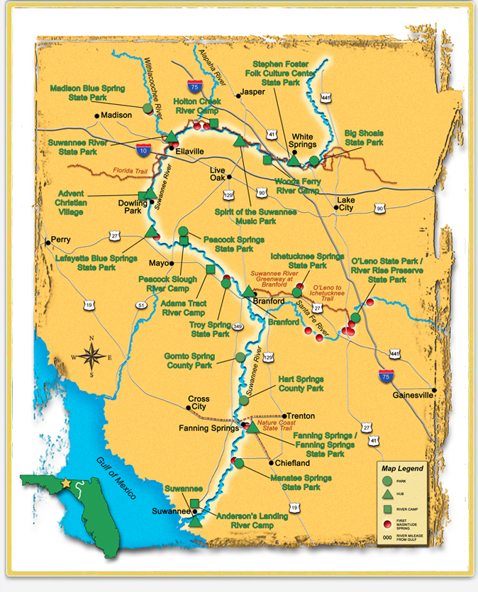
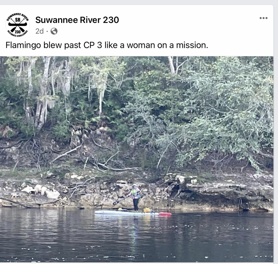
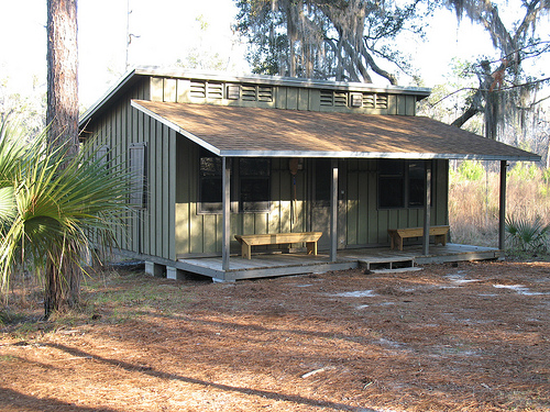
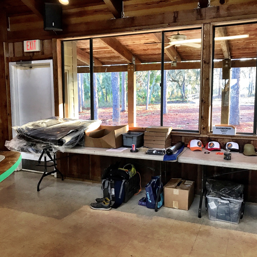
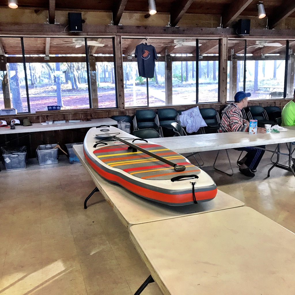
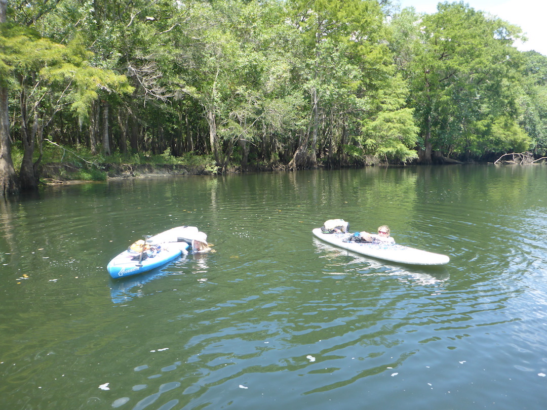
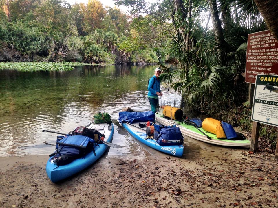
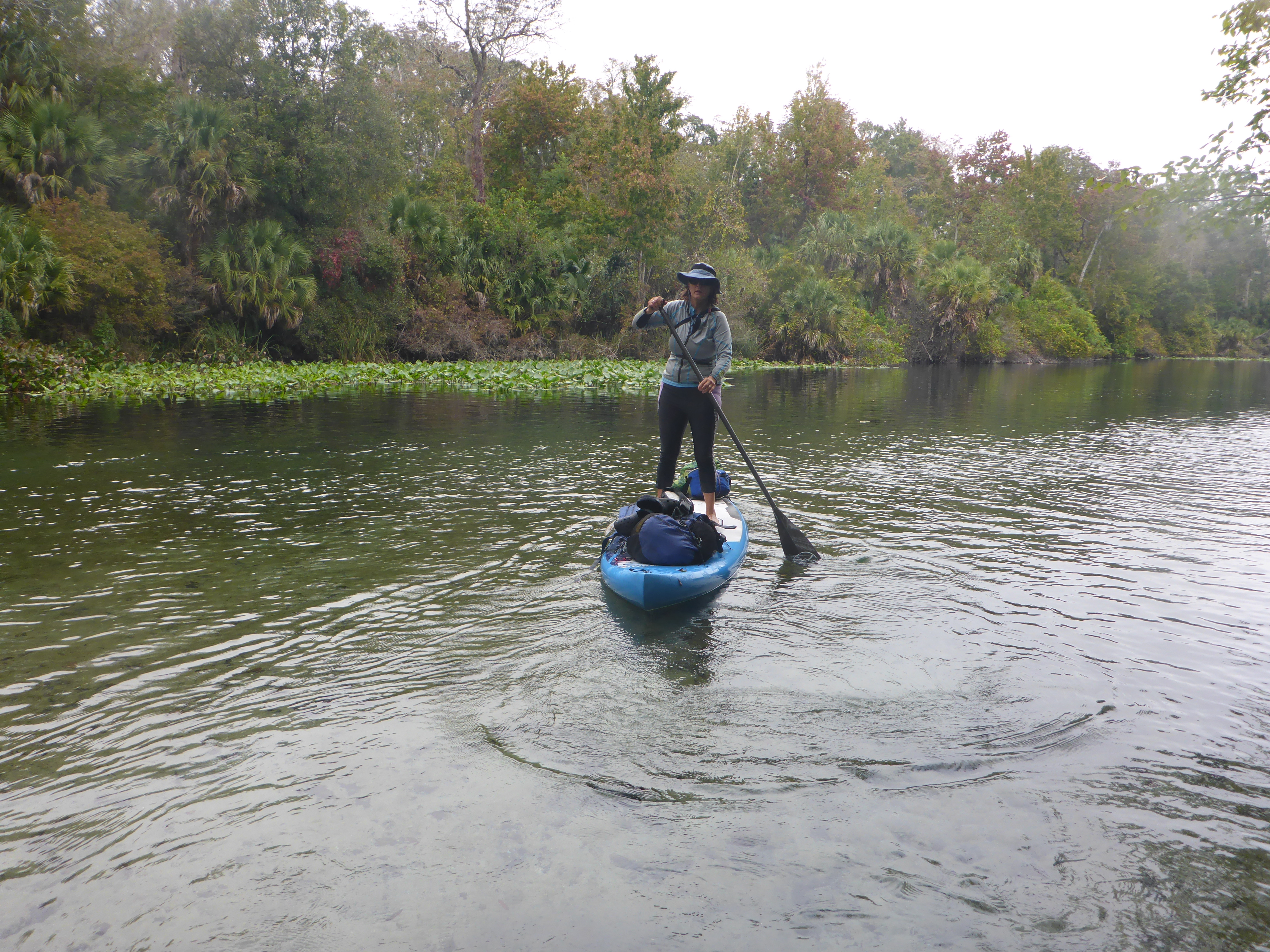
7:30 am, Griffis Fish Camp, Fargo, Georgia. Paddlers in 18 watercraft—canoes, kayaks, and paddleboards—eager to start the Suwannee230. The Suwannee230 is a 230 miles race, from Griffis Fish Camp, just downstream of the Okefenokee Swamp, to Suwannee, Florida, where the Suwannee River meets the Gulf of Mexico.

Suwannee River Visitors Center, Fargo, Georgia, October 2021
Suwannee230 course

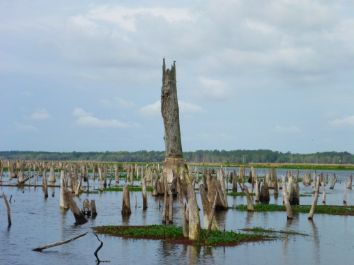
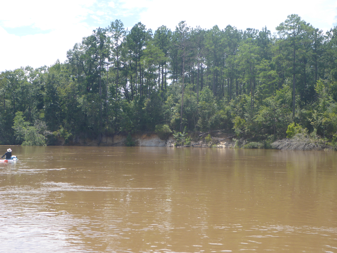
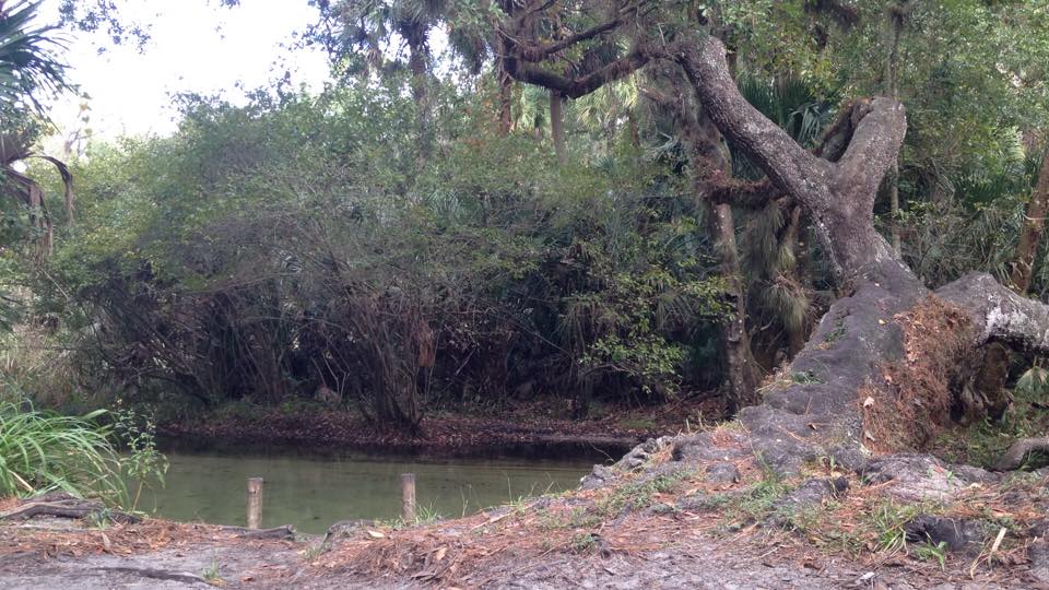
The exposed sandy banks—flooded during last year’s race—hinted at the obstacles that we would paddle over, under, and around. In last year’s race, higher water obscured the river’s path, and several paddlers detoured into the maze of trees. This year, the lower water made the course clear but exposed obstacles we paddled over last year.

Checkpoints along the way

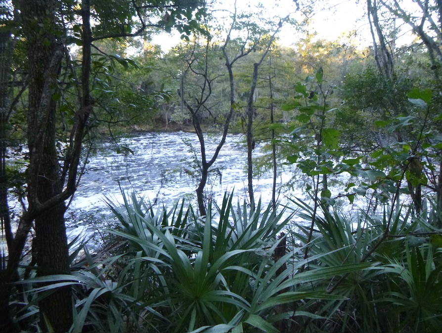
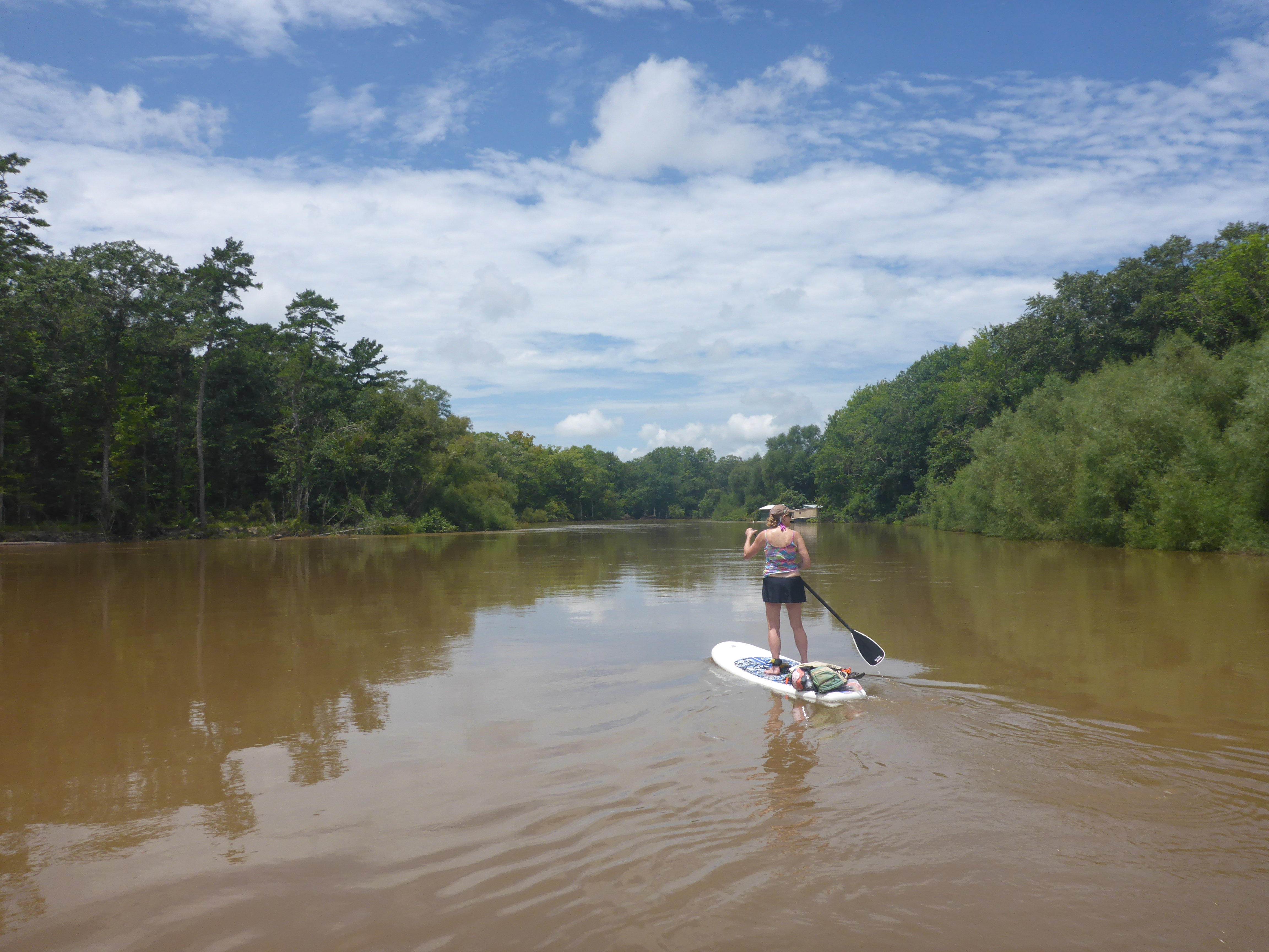
In the morning’s low light, we navigated the twists and turns of the Upper Suwannee, its character vastly different from the broad Lower Suwannee. I missed the boost I had enjoyed in earlier paddles. But no rain—even from Hurricane Ian—meant slow flows and a sporty collection of obstacles, shoals, rocks, and trees.

Exposed bluffs in previous years

Soon, the entire group portaged portaged over a log that blocked the entire river, entertaining the campers drinking their morning coffee. On that first day, I paddled around blockages, slithered under trees, and tried to avoid catching my 3″ gummy fin on submerged branches.

Tannins of the Suwannee River
Sandy banks for a break

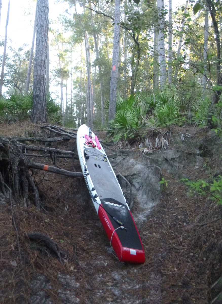
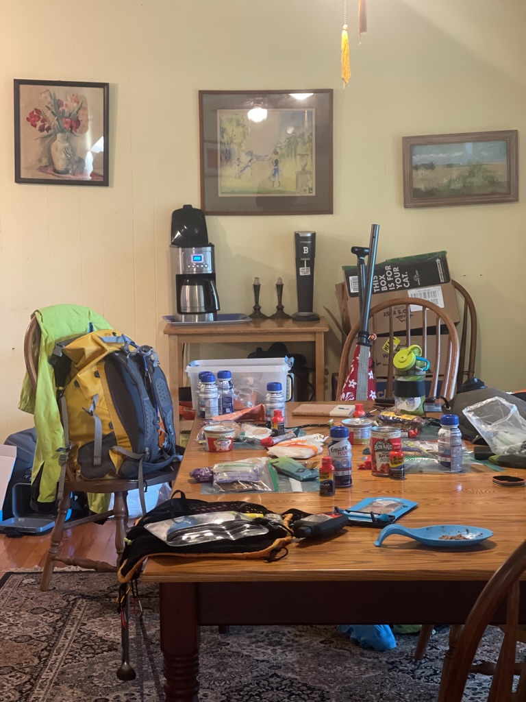
Day 1 goal: to reach Big Shoals rapid, a mandatory portage, before dark. Yet, despite my obsessing over this portage the previous night, it was surprisingly easy in the dark. The sign, somewhat obscure in the daylight, reflected brightly under my headlamp’s glare. I hauled my board and gear, stuffed in a backpack, up the bank, along the short trail, and back down the rooty slope to the area beyond the rapid. I had packed minimally to reduce my time on the portage and was on my way by about midnight.

I portaged early the next morning in 2021.
Big Shoals, 2021
After Big Shoals, 2021

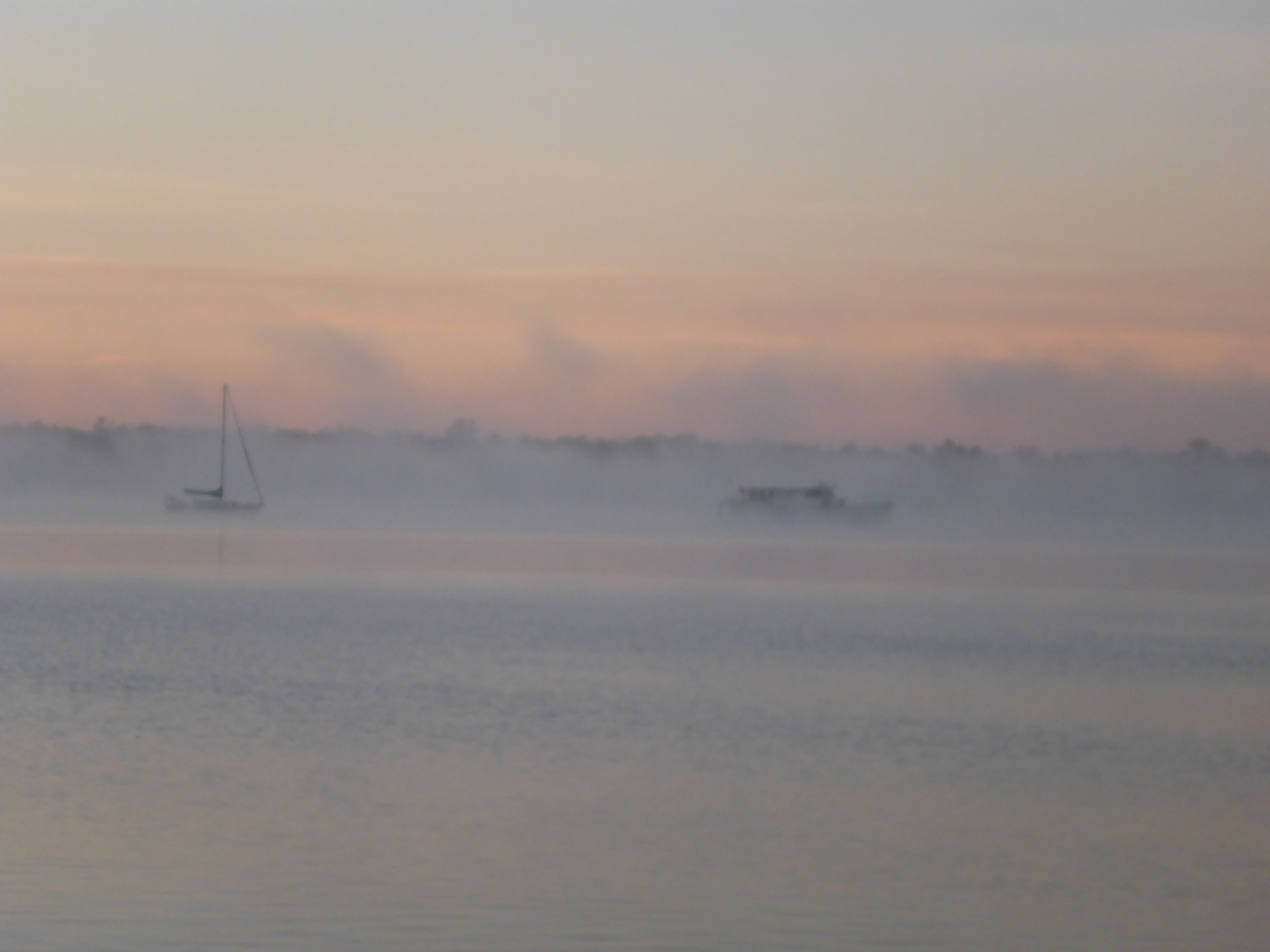
By this time, any ambient light had faded, and darkness shrouded the river. Columns of fog swirled around me, like dust devils, as if the river wasn’t already creepy enough. I paddled gingerly, knowing Little Shoals was less than a mile ahead. And, although I prefer letting my eyes adjust to the darkness, I turned on my headlamp and shined my bright dive flashlight around, even though I would hear the shoals before I saw them. Red eyes and yellow eyes all around—nothing creepy there. For the rest of the trip, the song “The Night Has a Thousand Eyes” ran through my head.

My night view LOL

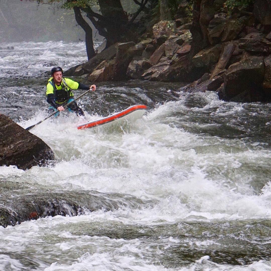
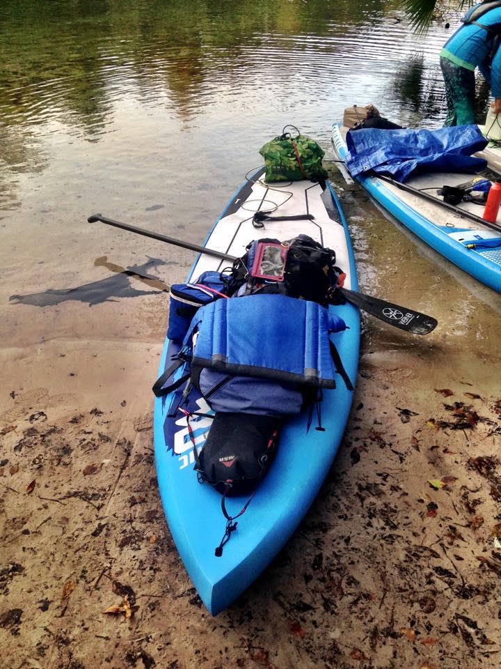
I thought I was prepared, headlamps, a dive flashlight, and my gummy, flexible fin. All of my rough water training stresses preparation, to avoid the “and there I was” situations. And yet there I was—running shoals in the dark on my 14′ SIC RS paddleboard which turned out to be remarkably sturdy. I lined my board over the first set as a tandem canoe with far superior lights flew by. Back on the board, I alternated paddling and shining my light as I navigated the remaining shoals.

Little Shoals area, 2021. Flooded during my previous paddles.
Wayside Park, White Springs, August 2021

Just before White Springs, a final shoal sheared off my fin, and I called it a night. I shone my light to find a campsite—the reason I carry that light, and found a sandbar to call home. I woke at 4:30 am to a pair of canoes—again, with better lights—navigating that shoal and went back to sleep for another hour.

Remains of White Sulphur Springs House

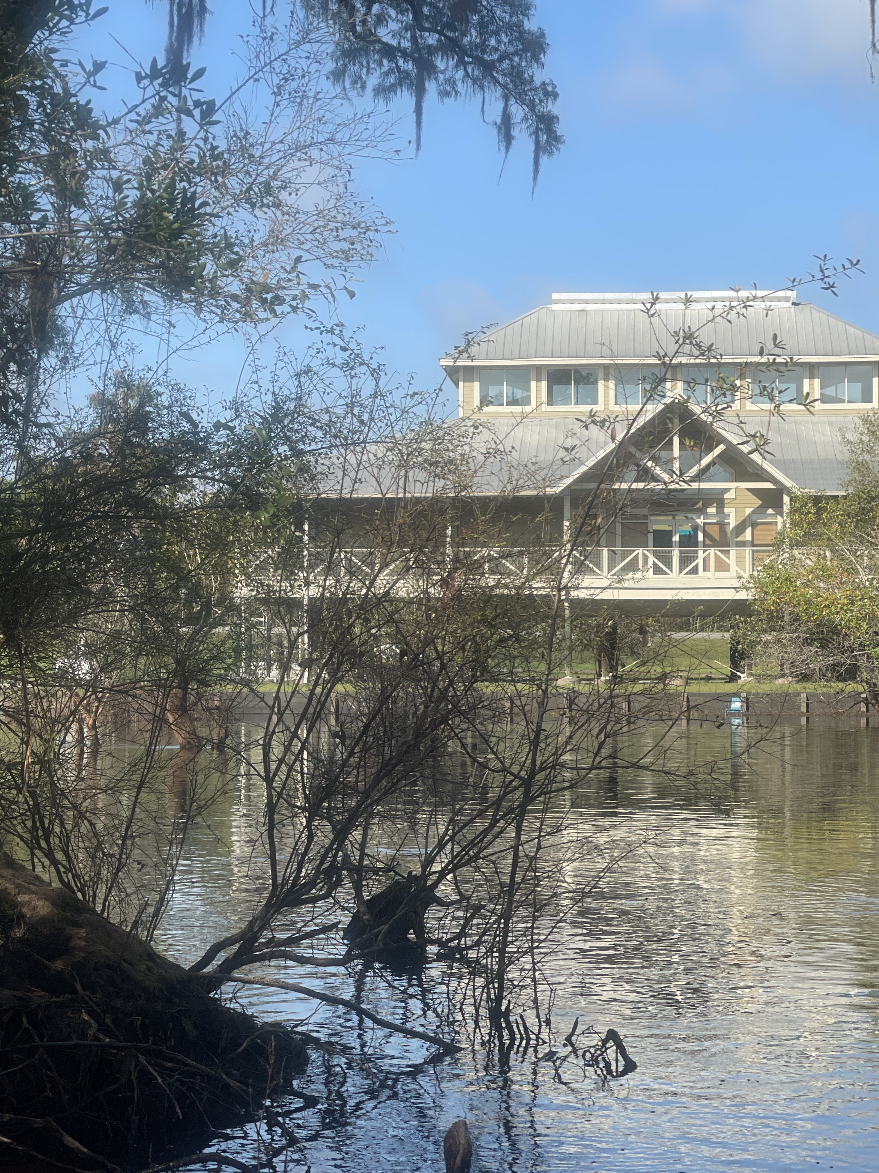
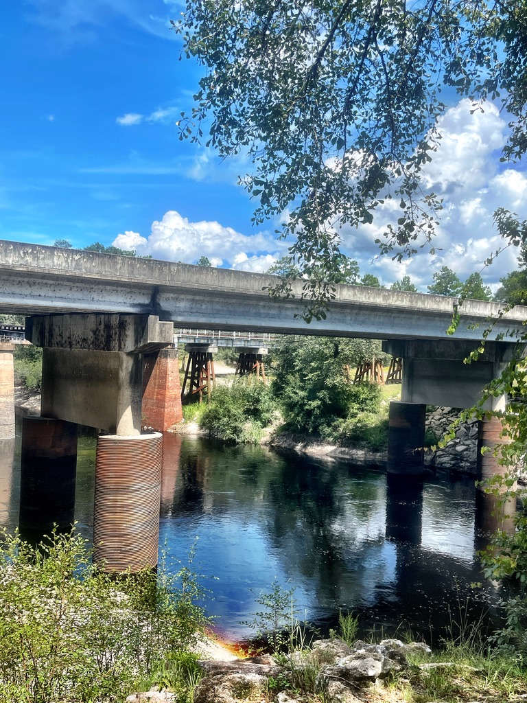
Day 2. At the springhouse I retrieved the food and water I stashed. I had little sleep that night, and ambitious plans of a big mileage day faded throughout the day. I craved sleep, and I fantasized about sleep throughout the day. Spirit of the Suwannee Music Park, Suwannee River State Park, and finally the jarring lights of Advent Christian Village before I reached Dowling Park River Camp. And then I slept.

I looked better than I felt Photo credit: Ryan Gillikin

The next morning, Janice, director of Paddle Florida or perhaps an angel, brought me coffee and lasagna. To reduce gear, I didn’t bring a stove so hot coffee was heavenly.

Before
During

Day 3—I needed big miles, at least 70. A cold front was coming, and I was about over the Suwannee—this year’s race was more demanding. But fortified by a good night’s sleep, coffee, and lasagna, I was ready to tackle the miles. Past Branford and Gornto Springs park, then darkness. As in the previous nights, I let my eyes adjust to the swath of light that revealed the river’s curves. And I read the water in this light for disturbances, branches for example, that could snag my fin. More than anything, I didn’t want to fall at night.

I briefly “rested” at the Hart Springs boat ramp, where camping is prohibited. My Spidey-sense woke me at 4:18, 12 minutes before my alarm. And 12 minutes before the police cruised by, where I stood, holding my paddle and not camping.

Photo credit: Janice Hindson

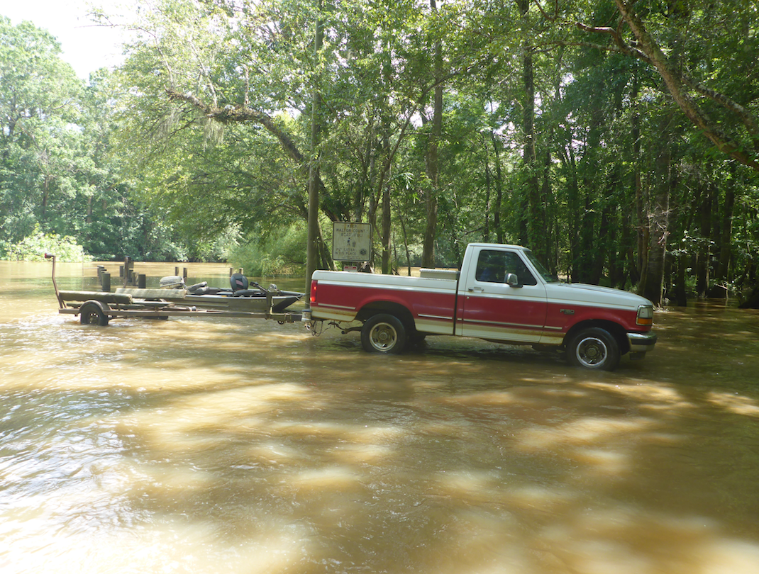
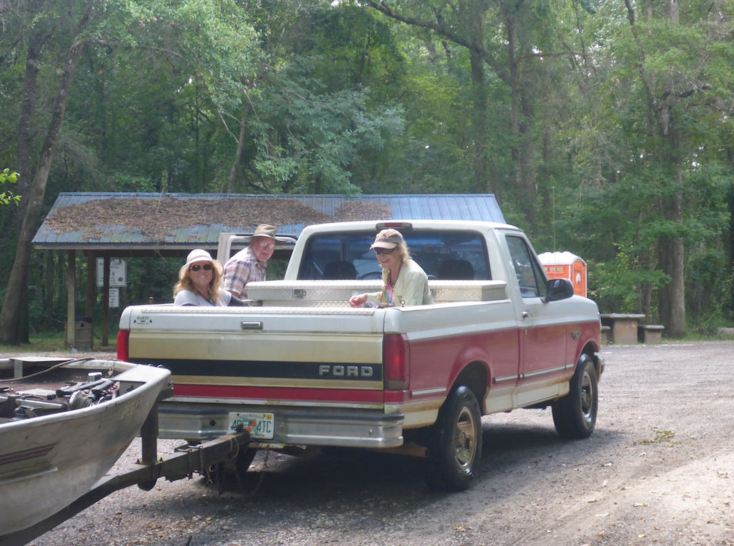
Day 4—a mere 35 miles to Bills Fish Camp. I launched into the darkness. My watch read only 2.1 mph. Stupid GPS watch. I stopped and restarted my course. Still slow. D’oh! I turned around and magically my speed doubled. All the other boat ramps had been on the left. Not that one.

Jumping Sturgeon

At Fanning Springs, I stepped off the board and experienced a few seconds of “sea-legs.” Balancing in the dark—without visual markers—is harder than I thought! Several hours later, I surfed a downwind course as the cold front rolled in. So much fun, but I knew I would pay. I was so close to the finish when headwinds flipped my fun into a slog. Head down, I tucked into the vegetation and pushed through the final four miles.

I’m done! Photo credit:: Ryan Gillikin

Done! Despite the low water and obstacles, I beat my previous time by over two hours. My training with Coach Larry Cain and Paddle Monster paid off! Still plenty of room for improvement, but the training and a reduced gear load really helped. Next up: Florida Circumnavigational Saltwater Paddling Trail (CT) and the Everglades Challenges. See you on the beach.

The reason why

Paddle 2 the People—A Feast for SUP

96OlAyq0SaiLiGHJd1pQkw_thumb_34dd
Wekiva Spring

SUP surf. Paddling up a spring run. S’mores and campfires—what’s not to love? All that and more at Todd Bishop’s inaugural Paddle 2 the People in Wekiva Springs State Park.

iybhIqe9RmwKEXw2-CVSzBokgnVVmvi7PAPcKtUKGk2DrB9AKl1_WEQb5XFwVl6rHXx8Pg4-UXq6bQGNmfCQh939JScD7J2tP9qtEwwmyGNW=s0-d
Wekiva Springs State Park Cabin (Courtesy of Rangervision.blogspot.com)

I loaded my board and drove to the Youth Camp at Wekiva Springs State Park. It felt like a reunion—Ronnie Kemp of Sea Kayak Georgia, Ashley Brown and Jeff Atkins of Wave Paddler, and Christa Foisy of Paddle NC and more. My kayak buddies had switched from boats to boards.

IRI16gt1QqiKNqfSiuYBDQ_thumb_34e7
Fishing SUP

Y1u7SIO7TX6LrFlkLaLbNQ_thumb_34e9
Fishing SUPs are wide and stable

We learned stuff on the water, and we learned stuff on land. David Hernandez and Will Niemann from St. Augustine Paddle Sports spoke about fishing SUPs, a quickly growiong market segment. These SUPS are large and stable, with hatches, attachment points for coolers, and even a bar to stand up. Not a bad way to spend a day on the water.

CrYtZJLDRc24ulcLtePpZg_thumb_34e3
Chillaxing in the dining hall

%fnA+gFxSamqkuLaL+Xxvg_thumb_34e2
Board options

NtUVRQu2T%CQJoqsFH+OMA_thumb_34e6
Swag

Plenty of options each day, ranging from an L1-2 IDW/ICE to coastal paddling to ‘Meet and Greet’ paddles on the Wekiva River and Rock Springs Run.

Screen Shot 2019-03-02 at 8.43.09 AM
Menu of activities

so0zvGqCRU+KqngImch2qQ_thumb_34e5
Inflatable boards bounce off of rocks

Chaz Corallo of, ironically, Flatwater Paddle Co. of New Jersey showed us the gear necessary to do battle with rocks, including body armor, helmet and breakaway leash. Not just anyone can style Nantahala Falls on a SUP.

Chaz bracing
Rocking the Cross Tail Heel side Low Brace (Photo credit: Steve Faives of H20 Stoked)

Chaz at nanty
Chaz Styling Nantahala Falls (Photo credit: Steve Faives of H20 Stoked)

Inflatable boards bounce, not break, on rocks. I can’t say the same about bodies. Body armor seems like a good idea.

qjr6QQssQaSC%%cTSdUEiA_thumb_34e0
Ronnie Kemp of Sea Kayak Georgia

vR5SnUMzQce7Hqe8JRZkhQ_thumb_34d8
What lurks below Rock Springs Run

One day, we paddled down Wekiva River and up Rock Springs Run which has 3 primitive campsites, perfect for a SUP camping trip. Despite the proximity to Disney and Orlando, this landscape feels primeval and wild.

q8tAHjJ7TW2KHdVSQVGM6w_thumb_34d6
The best fish tacos ever

mRbfa5PhTmKaaXyxXgkIEg_thumb_34d7
Wekiva Island-just down the road

Road trip to Wekiva Island for fish tacos and beer! Noone left hungry.

New friends, new skills, and a new board for Watertribe. I’m looking forward to Paddle 2 the People, part deux.

xsPJQmLmQ0uArO6hjdR+1w_thumb_34dc
The primeval beauty of Rock Springs Run

Can William Bartram Help Us Save the St. Johns River?

fog rising over Palatka
Misty morning on the St. Johns River

Can William Bartram—Quaker, adventurer, and naturalist—help us save the St. Johns River? In the late 1700s, William Bartram (1739-1832) sailed the north-flowing St. Johns River and recorded north Florida’s cultural and natural history in his Travels of William Bartram. Bartram’s words have drawn adventurers, naturalists, and historians to the river and cultivated in them a deep appreciation for local history, flora, and fauna. I  came to love the St. Johns River after paddling in William Bartram’s Wake on a Paddle Florida trip on the Bartram Trail in Putnam County. Most recently, Bartram Inn owner Linda Crider created the Bartram Adventure Tour so that Bartram enthusiasts and others can trace Bartram’s route on foot, bike, and boat. On this trip, I realized that William Bartram also forged paths to conservation.

The Bartram Inn, Palatka, FL

I was excited when Linda invited me to join the inaugural Bartram Adventure Tour. I knew that several days with fellow Bartram enthusiasts would help me better understand why William Bartram’s words remain powerful. In 2016, I met Sam Carr and Dean Campbell on a Bartram-inspired Paddle Florida trip on the St. Johns River. While paddling downstream in a blustery December wind, I learned that Sam, Dean and others designed Bartram Trail in Putnam County  so that people could visit sites that Bartram described. The printed guide, trailside QR codes, and website provide locations, journal entries and commentaries so that visitors can follow Bartram’s footsteps and see (or imagine seeing) what he saw. The Bartram Adventure Tour combines guided cycling, paddling, and hiking tours on the Bartram Trail in Putnam County with a stay in the Bartram Inn.

Palatka
St. Johns River map

Sunrise over the St. Johns

The pre-dawn light woke me early on my first morning of the trip.  I could see the St Johns from my room on the second floor of the Inn, so I grabbed a cup of coffee and walked outside to watch the sunrise. Mist shrouded the anchored boats and blurred my view of Memorial Bridge that divides east and west Palatka. It struck me that I had never spent the night in Palatka. I had driven over the bridge innumerable times on my way to Crescent Beach, but rarely stopped in Palatka except for gas or snacks. I recalled Linda’s observation from the previous evening, that only when people stop, get out of their cars, and get on the water do they begin to care for the river. Perhaps here was a clue to Bartram’s power, the power of place—his words guide us to magical places on the St. Johns where we can see, touch, and sometimes feel the river’s beauty.

2018-12-12 13.37.54
View from Orange Point in Welaka Forest

2018-12-12 11.31.16
Bartram Trail kiosk

afLMHch4Q1+v%DUVeWcS7w_thumb_3449
Hike to Orange Point through Welaka Forest

We had two short hikes that day. First, we walked along the Puc Puggy Trail at the Palataka Waterworks Environmental Education Center. Then, we hiked down a newly cut trail in the Welaka State Forest that brought us to Orange Point and John’s Landing. The trail between these points followed the river and provided the best views of the river. Our trip included a number of ‘Bartram moments.’ Sam read from Bartram’s Travels and explained the significance of a particular place. Hearing Bartram’s  description helped me imagine the landscape he encountered so many years ago.

2018-12-12 14.36.37
Sam reads the Bartram Prayer

On our final stop before lunch, we climbed Mount Royal, a site now confined within the gated Mount Royal Airpark Community. From atop this (excavated) Indian mound, Sam read aloud the ‘Bartram Prayer’ which offers insight into Bartram’s—and his own—feeling of stewardship towards the river and the surrounding land. The prayer resonates with him because it shows that preserving creation reflects the will of God and adds purpose to living on the St. Johns.

Bartram Prayer
Bartram Prayer

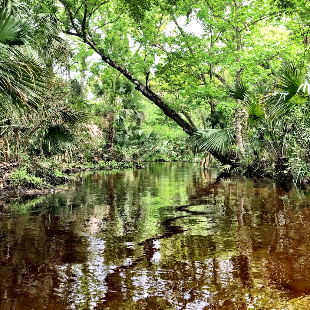
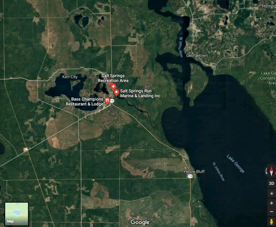
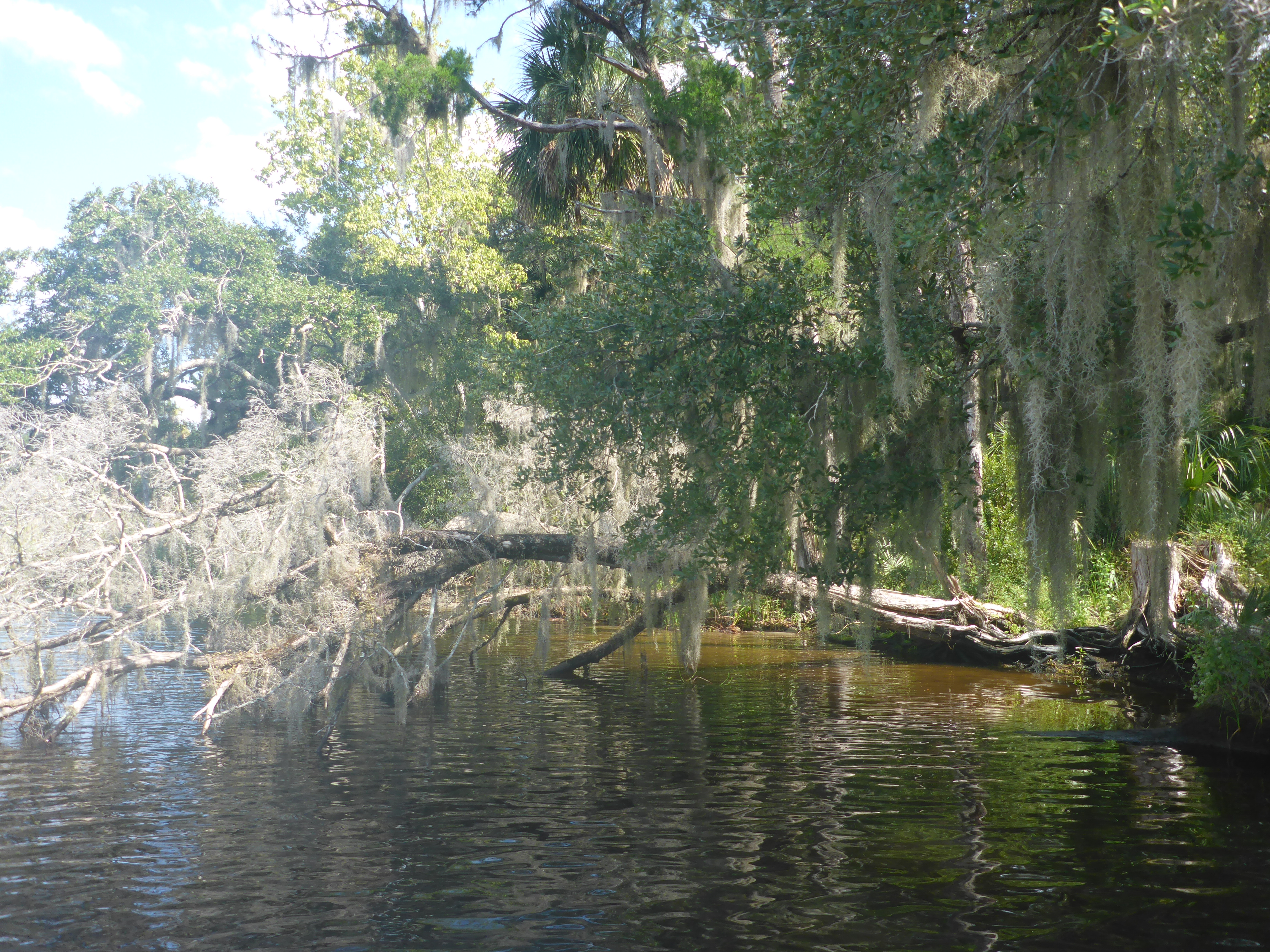
Sam claims that Bartram was the “original hippie”—embracing peace, love, and care for all beings, including other people. In Bartram’s description of nearby Six Mile Run (a.k.a. Salt Springs Run), he writes

At the same instant innumerable fish are seen, some clothed in the most brilliant colors . . . all in intercourse performing their evolutions: there are no signs of enmity, no attempt to devour each other; the different bands seem peaceably and complaisantly to move a little aside, as it were to make room for the others to pass by.

Shouldn’t humans emulate the peaceable bands of fish, Bartram seems to say, where all coexist peacefully? Bartram’s care extended to the many Native Americans he met whom, unlike his contemporaries, he viewed as equals. His egalitarian approach to people and nature reflected a Quaker sensibility that would motivate others centuries later.

2018-12-12 10.17.25
Puc Puggy (‘Flower gatherer’) Nature Trail (Site 6)

9pl30Fr8TLCCt+semzMTLg_thumb_3442
The team at Puc Puggy Nature Trail

On our final day, we met another Putnam County resident who has taken William Bartram to heart. Biologist Mike Adams has been restoring the region’s native plants, including longleaf pine, for over 20 years. He and his family bought and preserved a tract of land on the St. Johns River.

IMG_2126
Saturiwa, named for a Timucuan chief

IMG_2125
Downstream from Palatka on the St. Johns River

A passing cold front thwarted our plans to pedal the 13 miles from Palatka to Saturiwa, so we grabbed our raincoats and piled into our cars. Under the eaves of his broad porch, Mike explained how he had come to love Florida’s diverse landscape and William Bartram.

2018-12-14 11.05.32
Mike Adams dressed as William Bartram

2018-12-14 11.35.18
The Carniverous Pitcher plant (Sarricenia)

2018-12-14 11.43.46
Native fern

2018-12-14 12.14.22
A slippery walk down the boardwalk

In his William Bartram persona, Adams outlined his conservation program and described the design and construction of his house and surrounding buildings. As he pointed out the details of the house, including this inlaid compass, I thought of yet another Bartram lesson: the mix of science and beauty. The sciences, arts, and humanities were not always considered as separate endeavors.

2018-12-14 12.48.58
Compass showing the orientation of the house

I recalled a discussion with University of Florida historian Steve Noll during the Center for Humanities in the Public Sphere summer program for high school students. William Bartram, Noll pointed out, embraced both the humanities and the sciences, and he communicated his scientific findings in artful, if not flowery, language. The blend of science and story, along with ethics, history, and beauty, can help us save our Florida waters. Artist Margaret Tolbert’s Aquiferious is one example, using a holistic approach to showcase and, hopefully, save our springs.

William Bartram’s writings have motivated these Putnam County residents to conserve land, create the Bartram Trail, and follow Bartram’s path on land and sea. We only protect what we know and love. Getting people on the water and into Putnam County helps the river and the people who live there. William Bartram has become an environmental ambassador for the St. Johns River in Putnam County. He still has much to teach us.

Bartram Adventure Tour postcard
To learn about the Bartram Adventure Tour, watch the video.


EjAucRB+kOAEaMswkeA_thumb_3422


Imagining William Bartram’s Salt Springs

Salt Springs Run cloudscape

Salt Springs Run hints of old Florida, before Disney and development transformed the land. The scrub landscape bordering the run offers a glimpse of the Florida William Bartram encountered centuries ago. Paddling this river lets me escape the twenty-first century for a little while.

I launch at Salt Springs Marina and slide my paddleboard onto the calm water just below the head-spring. The water is cloudier than the last time I visited a year ago, which saddens me.  Heavy rains and over-pumping from the aquifer have degraded many area springs. But even so, Salt Springs rarely disappoints.

The Salt Springs Marina sits at one end of a large pool. To the left lies the headspring itself and just downstream a pack of motor boats have anchored for an afternoon of swimming and sun. I turn my right, downstream, away from boats and people. It only takes one river bend to step back in time and imagine how William Bartram felt when he floated down what he called Six Mile Springs. On my first trip to Salt Springs, I paddled In William Bartram’s Wake on Paddle Florida’s 2015 Bartram History Paddle.  Dean Campbell and Sam Carr, designers of the Bartram Trail in Putnam County, regaled us with Bartram lore as we paddle down Salt Springs Run and up the St. Johns River to Palatka.

In 1766, Quaker naturalist and explorer William Bartram and his father John Bartram encountered Salt Spring Run while exploring the shore of Lake George, a wide spot in the St. Johns River. They rowed upstream against the slow-moving current until they reached the head-spring which they called Johnson Spring. Their journal entry, dated January 24, 1766, describes the oak hammocks, cypress knees, and pines that still characterize this run. Today, adventurers can paddle, hike, and bike sections of the Bartram Trail in Putnam County using maps and QR code that identify sites mentioned in Bartram’s travel journals. Site 28 marks the entrance to Salt Springs Run on the western shore of Lake George. Both University of North Florida’s Florida History Online and Bartram Trail in Putnam County provide ecological, historical, and literary commentary on the specific sites Bartram visited.

Rocky point
Site 28-Rocky Point

Screenshot 2015-12-15 16.13.05
Paddle Florida’s Bartram History Paddle 2015

Today, Salt Springs Run is part of the Salt Springs Recreation Area in the Ocala National Forest, easily reached by Highway 19. In the time of Bartram’s Travels and even well into the early twentieth century, most people travelled by boat. The dense and swampy Florida landscape made overland journeys difficult and dangerous. To reach Salt Springs, the Bartrams rowed up the north-flowing St. Johns River and up what we call Salt Springs Run.

Ocala National Forest Sign
Sign at Salt Springs Marina

Salt Springs Area Map
Courtesy of Google Maps

William Bartram returned to Salt Springs in 1774 and again floated the spring run. But his observations and “romantic imagery” after this second descent reveal so much more about Bartram and his enchantment by the spring.

“But there are yet remaining scenes inexpressibly admirable and pleasing. Behold, for instance, a vast circular expanse before you, the waters of which are so extremely clear as to be absolutely diaphanous or transparent as the ether; the margin of the bason ornamented with a grat variety of fruitful and floriferous trees, shrubs, and plants, the pendant golden Orange dancing on the surface of the plellucid waters, the balmy air vibrating with the melody of the merry birds, tenants of the encircling aromatic grove.” (Travels)

William Bartram’s ornate language captures the magic of Florida’s springs. I see the magic on my friends’ faces when they plunge into a spring’s clear waters.  Bartram’s flowery descriptions likely influenced writers and poets far beyond Florida. Scholars have traced Samuel Taylor Coleridge’s poem Kubla Khan to Bartram’s description of Salt Springs.

In Xanadu did Kubla Khan
A stately pleasure-dome decree:
Where Alph, the sacred river, ran
Through caverns measureless to man
   Down to a sunless sea.
So twice five miles of fertile ground
With walls and towers were girdled round;
And there were gardens bright with sinuous rills,
Where blossomed many an incense-bearing tree;
And here were forests ancient as the hills,
Enfolding sunny spots of greenery.

Salt Springs, like all Florida springs, flows from an ancient sea, deep under the Floridan Aquifer, passing through limestone and karst caverns. Coleridge’s sacred Alph could very well be our own Salt Springs Run. Who isn’t captivated by our springs?

Salt Run grass2018-10-06 11.09.162018-10-06 11.13.10

Even though the water was more tannic than my last visit to Salt Springs, in my mind’s eye, I envision the crystal blue flow that William Bartram must have seen–the water that is “absolutely diaphanous or transparent as the ether.” I’ve seen this clarity on the Ichetucknee, Naked Springs at Gilchrist Blue, and Cannon springs during the Ocklawaha drawdown, so I know what is possible.

fishface2
Cannon Springs

img_3058
Naked Springs

P1000916
Gilchrist Blue springs

My father recently passed away at Oak Hammock in Gainesville, FL, after struggling with dementia for several years. After he died, so many residents and staff at Oak Hammock spoke fondly of my father, whose Charlie Brown smile lit up the room. My mother and I worried that nobody knew my father as we knew him, in the past. But they loved him as they knew him, as he was in the last years of his life.

I’ve only known and loved the springs in their current state. My husband Kevin tells me how much cleaner they were when he first came to Florida over twenty years ago. Still others reminisce about their clarity before air conditioning made Florida newly habitable and brought millions of new residents, including myself. I love them as they are.

Salt Springs Run is an out and back paddle, and fortunately paddling back upstream to the marina is not difficult. I paddled past the marina towards the headspring where motor boats congregated just beyond the ropes marking the Salt Springs swimming area. After the solitude of the spring run, the competing stereos emanating from the boats was jarring, but we all have our ways of loving Salt Springs.

2018-10-06 12.54.10
Boats anchored outside Salt Springs Marina

William Bartram’s words illustrate how some visitors responded to a landscape alien to them. I’m interested in landscapes and the people who inhabit them, past and present. Paddling on the waters that Bartram described helps me imagine the springs in a former, more glorious state. Even though I love the springs as they are, I know we can do better. Perhaps if we can expand our ecological imagination, we can find the will to restore and repair our springs.


Paddleboards in the Panhandle

2017-08-09 12.30.36
The Choctawhatchee River

Springs, a midnight swim, rope swings, and a water slide — Florida’s Panhandle catapulted me back to my childhood. Who knew that I could laugh so much in three days?

Four paddleboards, one Pilgrim Expedition, snorkeling gear, and loads of food. We pointed the Paddle Florida van west towards Lake Lucas in Chipley, Florida, our base while we explored this area between Panama Beach and the Alabama border. This inland region is dotted with rivers, lakes, and springs, ideal for paddleboarding and swimming, and the Gulf of Mexico is nearby for those wanting a saltwater fix.

Lake Lucas
View from our porch

We settled into our A-frame cabin, perched on the shore of Lake Lucas. Later that night, we paddled across the placid lake and lay on our boards, gazing up at the almost full moon. And that set the tone for the rest of the trip.

I woke up early the next morning–we had crossed into Central time. The moon lingered in the western sky while the dawn’s light was barely visible in the east. Coffee in hand, I sat on the dock and watched the celestial performance until the sun was high.

We planned a full day on Holmes Creek, a tributary of the Choctawhatchee River, and Cypress Springs and drove to the Holmes Canoe Livery and Water Park for a shuttle. While we waited for our shuttle, we enjoyed their water slide and rope swing. I’m not sure any of us have laughed so much in years, as we climbed up the tower and slid down into the water again and again. I could have happily spent the day there.

Rope swing and slide on Holmes Creek

We launched at Culpepper Landing and paddled about a mile upstream to Cypress Springs, a local swimming hole. Many other swimmers and paddlers clearly had the same idea. We were not alone, but it never seemed overcrowded–amazing for a sunny summer day. We tied up our boards, donned mask, fins, and snorkel, and swam around the blue hole, diving deep against the rising current and watching the sky through the water’s distortion.


2017-08-08 13.00.10
Cypress Springs

The tannin line
The tannin line

Fins
Fins up in Cypress Springs

After swimming and eating lunch, we headed downstream to our takeout at Fanning Branch Boat Ramp. The spring was cold and I was ready to warm up.

As we paddled downstream, the river changed moods several times. Shallow and twisty-turny, like a creek, then wide and straight. Clear, like a spring run, and, in other places, opaque. Never predictable.

Katie on Holmes Creek
Holmes Creek

Holmes Creek
Reflections


Placid waters on Holmes Creek
A hidden spring?

2017-08-08 13.48.57
Cooling off in Holmes Creek

After several miles, we passed the Holmes Creek Canoe Livery and Waterpark, where many people completed their trip. After a short break, we continued downstream for the last four miles of our trip. Once again the river changed moods, and our paddling became more challenging. The Livery warned us that we would be ducking under trees, and they were right. Once we lay flat on our boards, using our arms to weave through a tangle of branches. Several times, we crawled to the front of our board to free the fins  caught on submerged branches, a hazard unique to paddleboards. Several times, I heard the splash of someone going in. Through it all, we laughed and laughed, mostly because it felt good to be in the water. We endured a long paddle that day, about 9 miles, and I was both sad and relieved when we reached Fanning Branch.

On our third and final day, we planned  a five-mile paddle on the Choctawhatchee River, from the New Cedar Log Landing boat ramp to Morrison Springs.  The river was high, possibly at flood stage, and moving fast. Rain had recently soaked the Panhandle, and the high river flow had drowned out Morrison Springs. Nonetheless, Morrison Springs was our take-out, and we hoped that we would find the entrance to the spring, not obvious even under ideal circumstances.


We pushed our boards into the swiftly moving current and sped downstream. The Choctawhatchee is wide with few obstacles, unlike Holmes Creek. A fisherman told us the spring entrance was marked by a giant leaning cypress, and hence the quest for the cypress began.

Flooded Choctawhatchee River

Sand bluffs on the Choctawhatchee

Floating camp on the Choctawhatchee
One of many river camps

Choctwhatchee bench
Park bench on the river bank

We scoured the river banks for the elusive leaning cypress. Instead we saw floating river camps, a park bench with a view, and sandy bluffs eroded by years of floods. “Is that it?” we asked again and again, each time we floated by anything remotely resembling a leaning cypress. We paddled on, recalculating how far we had paddled.

Finally we came to a boat launch and discovered that Morrison Springs was three miles upstream. No way were we paddling against that current, and a storm was rolling in. A  fisherman, kind enough not to laugh at our predicament, us to our cars. It would have been a long walk to the road.

Coming in for a landing

Boat ramp

Hitching a ride
Hitching a ride

On our way home, we stopped at Ponce de Leon State Park for a final swim. As we dove and snorkeled in this fountain of youth, it seemed fitting to end our adventure here as we had spent the last three days laughing and playing like kids. Being on a paddleboard, so close to the water, jumping off and climbing back on, brought out the kid in all of us.

This short trip offered a taste of paddling in the Panhandle, and it was also a preview of Paddle Florida’s new Choctawhatchee Challenge scheduled for March 2018. I can’t wait to paddle more of this wonderful part of Florida.

Ponce de leon Springs
Revived by Ponce de Leon State Park


Pancakes and Water-skiing Elephants: Hidden Histories of DeLeon State Park (St. Johns, Part 3)

In 1831-2, James John Audubon visited Spring Garden Plantation in search of the Common Gallinule. Unlike most visitors from the north, Audubon did not appreciate the scrub landscape that had enchanted William Bartram and Marjorie Kinnan Rawlings.

floating on a paddleboard under cloudy skies in DeLeon Springs State Park, Florida
Liz Sparks on DeLeon Spring Run

How was I supposed to focus on history with the deafening shrieks of children ringing in my ears? I had come to learn about the park’s history and perhaps even swim, but I quickly realized that every child from every camp from miles had also come to cool off in the spring. Oh well. I was preparing to teach a class on the culture, history, and ecology of Florida State Parks and was visiting the parks that exemplified kitschy pre-Disney Old Florida. With a water-skiing elephant and a sugar mill do-it-yourself pancake restaurant, DeLeon Springs made the cut. And despite my focus on tourist kitsch, I learned a great deal about the park’s rich history.

To escape the bedlam, I entered the one place guaranteed to be child-free: the park’s small museum. The room had posters, pictures, and artifacts that traced the area’s history, starting with the Mayaca people who inhabited the area for at least 6,000 years. Unfortunately, many burial mounds and artifacts were lost or destroyed when European settlers came to the region.

sign with history of mayaca indigenous people
DeLeon Springs’ First People

DeLeon Springs State Park sits between Deland and Astor, on the east side of the St. Johns River. Water coming from this second magnitude spring flows into Spring Garden Lake, then through Lake Woodruff and Lake Dexter en route to the St. Johns. Fish and game were plentiful for early Florida residents.

Easy access to the St. Johns River drew subsequent populations, starting with the Spanish in the 1500s. In the 1800s, settlers established Spring Garden Plantation to grow cotton and sugar cane. Florida’s history as a slave state is often over-looked, but slavery and plantations sadly thrived along the St. Johns River in the antebellum years.

List of slavesand ages
Spring Garden Slave List, 1829 (The Broadus R. Littlejohn, Jr. Manuscript Collection. Book 304.)

In 1831-2, James John Audubon visited Spring Garden Plantation in search of the Common Gallinule. Unlike most visitors from the north, Audubon did not appreciate the scrub landscape that had enchanted William Bartram and Marjorie Kinnan Rawlings.

‘Here I am in Florida . . . which from my childhood I have consecrated in my imagination as the garden of the United States,’ Audubon wrote. But he found a place ‘where all that is not mud, mud, mud is sand, sand, sand, inhabited by alligators, snakes and scorpions.’

Drawing of Common Gallinule, James John Audubon
Common Gallinule (http://www.audubon.org/birds-of-america/common-gallinule)

Spring Garden Plantation did not fare well in the mid-1800s. The Seminoles burnt it down during the Second Seminole War (1835-42),  then Union troops burnt it again during the Civil War. Later the site was renamed DeLeon Springs, yet another Florida site claiming to  be Ponce De Leon’s fountain of youth.

sign on name change to promote business and tourism in Florida.
Fountain of Youth Placard

tour boat with children swimming
Fountain of Youth Eco/History Tour boat

DeLeon Springs is the epitome of Old Florida tourism, and Queenie, the water skiing elephant, was DeLeon’s Springs crown jewel. In “The Waterskiing Elephants of DeLeon Springs“, Rick Kilby writes about Liz Dane who water-skiied with her pet elephant Queenie in 1958-9. In 2015, Liz Dane returned to DeLeon Springs to speak about Queenie and her experiences at the park.

Queenie the water-skiining elephant
Mural on DeLeon Museum Wall

Finally, enough history — it was time to get on the water. My paddling buddies and I see how far we could go on the spring run. Not far, as it turned out. The fin of my paddleboard caught in the mud on this shallow run. Even more ominous, dark clouds loomed over us. We raced back, not a moment too soon, and the skies broke. The silver lining: the typically long lines for the Old Spanish Sugar Mill Restaurant had disbursed. This restaurant is a tourist favorite for good reason. Each table has its own griddle, so guests make their own pancakes at the table.

We came for the kitsch and stayed for the history. Where ever I go in Florida, I am reminded of the deep and rich history of our rivers, springs, and parks. Deleon Springs State Park , though, has one of the most interesting blends of history, ecology, and recreation and is well worth a visit.

ruins of old sugar mill for crushing cane
Sugar Mill Ruins

view across DeLeon Springs of sungar Mill restaurant
Old Spanish Sugar Mill Restaurant

bubbling pancake with blueberries
Cooking pancakes on the griddle

matheson

Visit the River of Dreams at the Matheson History Museum, 513 E University Avenue, Gainesville, FL 32601   Phone: (352) 378-2280

Hours:  11:00 a.m. – 4:00 p.m., Tuesday – Saturday

The Matheson will offer related programming from now through June, ranging from talks at the museum to paddling tours guided by Lars Anderson at Adventure Outpost. Visit the Matheson’s events page for details.

This exhibition emerged from the research of Dr. Whitney Sanford, Florence Turcotte, and students in the UF Religion Department, and was made possible by the generous support of Visit Gainesville; the State of Florida, Division of Cultural Affairs; and the Center for the Humanities and the Public Sphere at the University of Florida.

Thank you to our partners the Special & Area Studies Collections of the George A. Smathers Libraries at UF, UF Religion Department, and the UF Museum Studies Program, as well as the UF Florida Puerto Rico Digital Newspaper Project, the Laboratory of Southeastern Archeology, Department of Anthropology at UF and the National Park Service, Timucuan Ecological and Historic Preserve.

Curator: Briley Rasmussen

Associate Curators: Alexis Schuman and Lauren O’Neill

Guest curators: A. Whitney Sanford, Florence Turcotte

Assisted by:  Peggy Macdonald, Sarah ‘Moxy’ Mocyzgemba, Amanda M. Nichols, Brian K. Szymborski 

Exhibition Photographer: Anne Ledbetter

Mural Artists: Gillian Fazio and Laura North

Graphic Designer: Brianna Ostrowski

Paddleboard Camping on Rock Springs Run

2016-11-12-11-15-36
Rock Springs Run

Paddling upstream in the dark on Rock Springs Run with loaded paddleboards—an auspicious start to our SUP camping trip? Jill, Janice, and I had set out for three nights of camping in the Wekiwa River Basin, just north of Orlando. Our destination, Otter Primitive Campsite, was several miles upstream. The calm, clear waters of the Wekiwa River and Rock Springs Run seemed like an ideal site to try out a multi-day SUP trip, and fortunately Jill and Janice quickly agree to almost any adventure.


Wekiwa-Springs-State-Park-Map.mediumthumb.pdf.png
Wekiwa Springs State Park Map

We arrived at Wekiwa Spring State Park around 4:30, later than we’d intended. Within an hour, we had ferried our boards, firewood, and gear down the hill to the boat launch. Although the three of us are experienced kayak campers, loading paddleboards with gear presents a different challenge than loading kayaks. We packed efficiently like backpackers and were pleasantly surprised at how well the gear fit on the boards. I bought my 12′ Fanatic Ray because its thick rails and quasi-displacement hull make it suitable for touring with gear. I loaded a mesh bag full of camping gear and smaller dry bags under the bungee cords on the bow and placed the food on the stern, behind my feet. Janice and Jill both packed their gear into larger drybags. We each carried a 10 liter MRS dromedary water bag on our boards—much more than we actually needed.

boards-loaded-and-ready-to-go
12′ loaded Fanatic Ray

jill-and-our-loaded-boards
Packing up at the Wekiwa River launch

To reach Otter Camp, the first of the three campsites on Rock Springs Run (heading upstream) meant paddling a short distance down the Wekiwa River until we reached Rock Springs Run, then 2-3 miles upstream. None of us had paddled loaded boards before, and we were all surprised at their stability. Finally we launched, trying to make the most of our final hour of sunlight.

The downstream section of the Wekiwa River went fast as the current moved us along. The sun’s light illuminated submerged logs that could snag a fin—a paddleboard hazard that kayakers do not face. We reached the confluence of the rivers quickly, but once we turned upstream we realized that our journey would take much longer than we anticipated. Low water conditions made the current swift, and we eddy-hopped back and forth across the river to avoid the swiftest parts.  Rock Springs Run was shallower and twistier than the Wekiwa, and the clear water made it difficult to determine depth. At a slower pace, we continued upstream, appreciating the river’s beauty in the fading light.


2016-11-11-16-36-01
Reflections on the Rock springs Run

Eventually the last of the sunlight disappeared, and we could see the moon’s rays through the trees. We put on our headlamps. [Note to self: either leave earlier or pack the headlamps on top.] Paddling upstream in the dark added an entirely new dimension to our trip, but it was strangely calming, especially after weeks of election-related noise. The only thing breaking the calm were occasional peals of hysterical laughter when one of us got snagged. We all knew that alligators lurked in the area, but none of us dared to actually mention this fact. We aimed our lights at the shore, hoping for signs of our campsite. After two  hours of paddling, we arrived at Otter Camp.

2016-11-12-11-11-35
Entrance to Otter Camp

view-from-otter-camp
Riverside view

Our home for the next three nights, Otter Camp has room for up to 10 tents, two benches, a large locking bear box to store food in, and a campfire ring. The site overlooks the river, and it is hard to believe that we were in the outskirts of Orlando. Over the next two days, we paddled up and down the Rock Springs Run, and friends came to join us. Exploring it during daylight, the stream seemed like three different rivers. Slow and wide towards the top, twisty and fast in the middle, and wide and open towards the bottom. We saw egrets, limpkins, herons, kingfishers, and ibis—and one hawk. Lots of turtles and no gator sightings until we paddled Juniper Spring Run on Sunday.

heading-downstream
A narrow stretch of the Rock Springs Run

2016-11-11-15-20-50
Ducking under trees and branches

great-blue-heron
Great Blue Heron

2016-11-11-14-46-24
Ibis on a branch

On Sunday morning, we packed up and reversed our route. With lighter loads and downstream current, the trip took one hour. Overall, I was happy with my gear selections and my paddleboard. I cover less distance on my paddleboard than I do in my kayak (NDK Pilgrim Expedition), so I’ll need to account for that on future trips. Using a basecamp worked for our shake-down trip, but the Wekiva/Rock Springs Run/St Johns area several options for moving camps daily. Sections of the Florida Circumnavigation Trail are also appropriate for a paddleboard. Even though our trip did not have the most auspicious start, our ability to adapt to—and laugh at— our circumstances set the tone for the trip. I think we got as much of a workout from laughter as from paddling. The only question is where to next?


2016-11-13-09-30-51
Coming home

Becoming Enchanted by the Springs

img_0095
Ichetucknee paddling gang

I find it difficult to explain the magic of our springs. You just have to see them or, better yet, swim in their crystal clear waters. Sometimes I tell people that it feels like flying, floating with nothing supporting me from above or below. And I tell them about spring-hopping down the Santa Fe and the Suwannee rivers and paddling down spring runs like the Ichetucknee.  They nod politely and ask if Gainesville is close to the beach. (No, it isn’t.)

Finally, someone bit. I just spent five glorious days introducing two friends to our own spring-shed in north central Florida and witnessed the springs work their enchantment on my friends, as they have on so many visitors before them. And this is important as those of who care about the springs know–people won’t protect what they don’t know about and love.

After a long winter in Michigan, Carol and Kiran arrived, ready to paddle and ready for spring. We had been emailing back and forth about options—I sent pictures and links about the Rainbow, the Ichetucknee, and the Ocklawaha, among others. An embarrassment of riches. “Everything”, they said, “we want to do it all.”CE2A224B-FFE9-44CF-B9B7-3A23A1AFE43C

We started with the Santa Fe. With two kayaks, one paddle board, and a car full of gear and snacks, we arrived at Rum 138 in Fort White, just 45 minutes or so north of Gainesville. While I pumped up my board, Carol and Kiran learned about the springs and features that we would see on our trip. We launched boats and board at Rum Springs and immediately paddled upstream to circumnavigate the appropriately named Rum Island. Rum Island lies between two county jurisdictions and, according to rumor, was home to moonshine and boot-leg operations.P1000916

P1000917
Paddling over Blue springs

Soon after, on the left side, we spotted the clear outflow that marked the entrance to Gilchrist Blue Springs. Leaving the tannic waters of the Santa Fe behind, we paddled upstream to the headwaters where we donned our masks and swam over the vent that releases the spring flow. The flow is strong so you need to hold on to get a good look.

img_3073
Blue spring vent

img_3068
Swimming in Blue

Diving down and looking back up toward the water’s surface gives a funhouse mirror-like distortion of the trees and clouds above.

img_3062
Springs impressions

We had some company — others were jumping off the platform into the spring below, probably students blowing off tension from final exam preparations.

Next we swam our boats to the entrance of Naked Springs and walked up to the headspring.

img_3080
Naked spring run

If Blue Spring had not enchanted my friends, Naked Spring worked its magic. The spring run was empty of people, and woods in-between silenced the noise, yelps, and music of Blue Springs . We swam around the two vents of Naked Springs, watching fish who also seemed curious about us. Swimming through the clear water transports me to another world — the quiet disorients me, and when I pop my head up out of the water, it takes a moment to resituate myself in time and place.

We floated down to Devil’s Ear, Ginnie, and Dogwood Springs, but after such a long time in Blue and Naked Springs, we were too cold to swim. Our perpetually cool springs even chilled my visitors from the cold north, and we made a note to pack neoprene for the next day. As we floated towards the Highway 47 bridge, the sky grew darker, and we quickened our pace, partly to keep warm and partly to avoid the rain that was sure to come. We heard one rumble of thunder just as the bridge came into sight—perfect timing.

Just one day in the springs, and my friends were hooked and ready for more. The next day Mary Jane and Janice joined us on the Ichetucknee, one of our premiere spring runs. We launched at the south entrance, which had been closed for renovation, and headed upstream, against the spring’s flow. The lower portion of the river gives a swampy feel — the river twists and turns under a tree canopy. Although the road is nearby, the trees and vegetation make the river feel far more remote than it is. We waved to the tubers and paddlers floating downstream, with the flow, and some wondered why we bothered paddling upstream.


Lone manatee

When we passed the mid-point entrance, we looked for the lone manatee that I had seen several days before. The river opens up at this point, and I have often seen manatees chomping away at the vegetation. No manatees, but the turtles and egrets put on their own show as we made our way towards the headspring.

img_3065
Row of sunning turtles

Heading downstream, we immersed ourselves in an underwater theater. Donning mask, snorkel, and fins, we swam, pulling boats and board behind us. We met mullet, gar, and turtles face to face. For the hour or so of the swim to the take-out, each of us was immersed in our own thoughts and our own world, completely unplugged. A rare opportunity to just be and let my thoughts drift.Nonetheless, while I love this freedom, by the end of this swim, my thoughts have usually drifted towards the possibility of alligators as I reach the warmer waters where the Ichetucknee feeds into the Santa Fe. The take-out is a welcome site.

img_3072
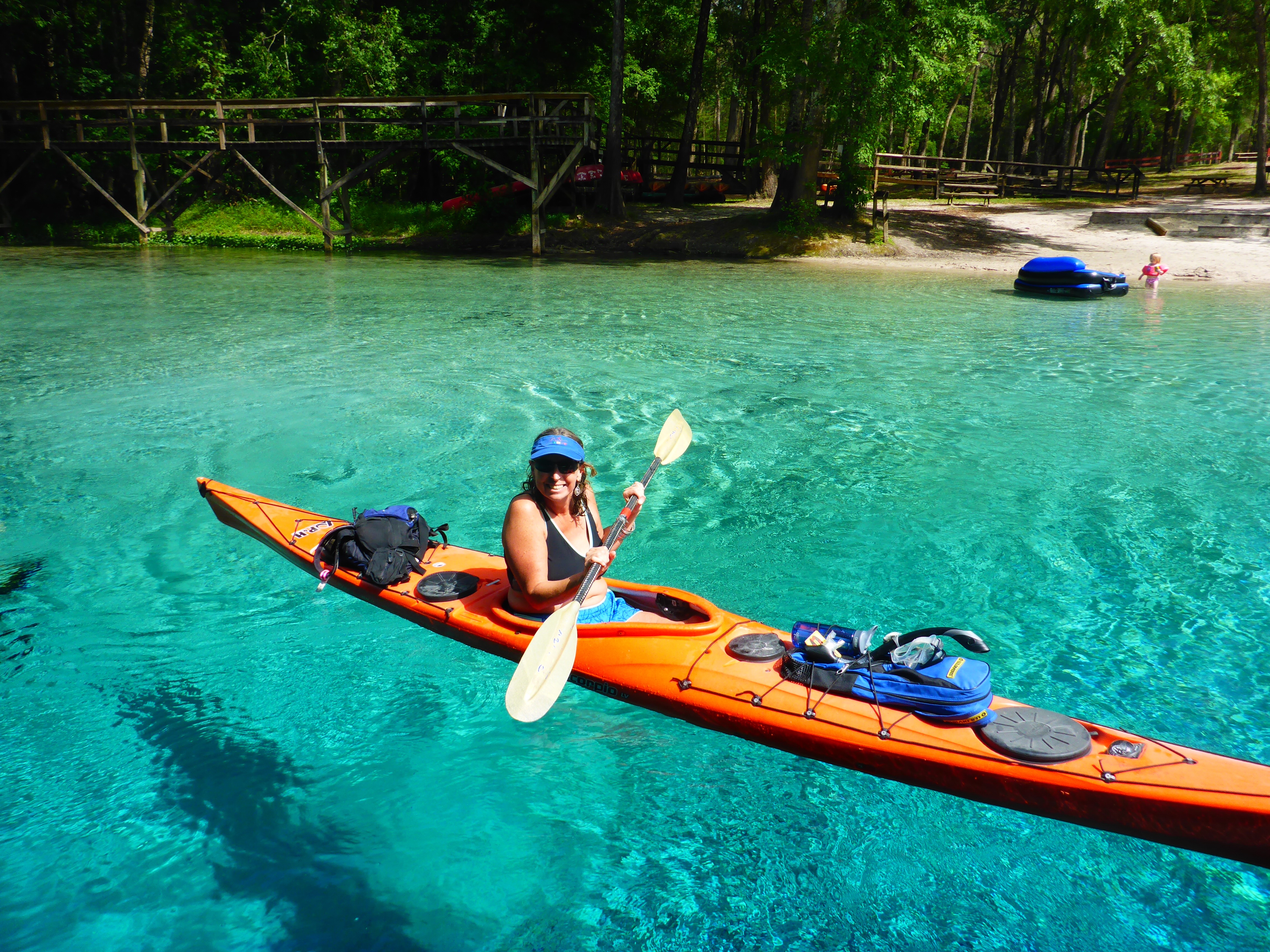
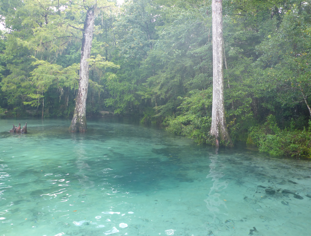
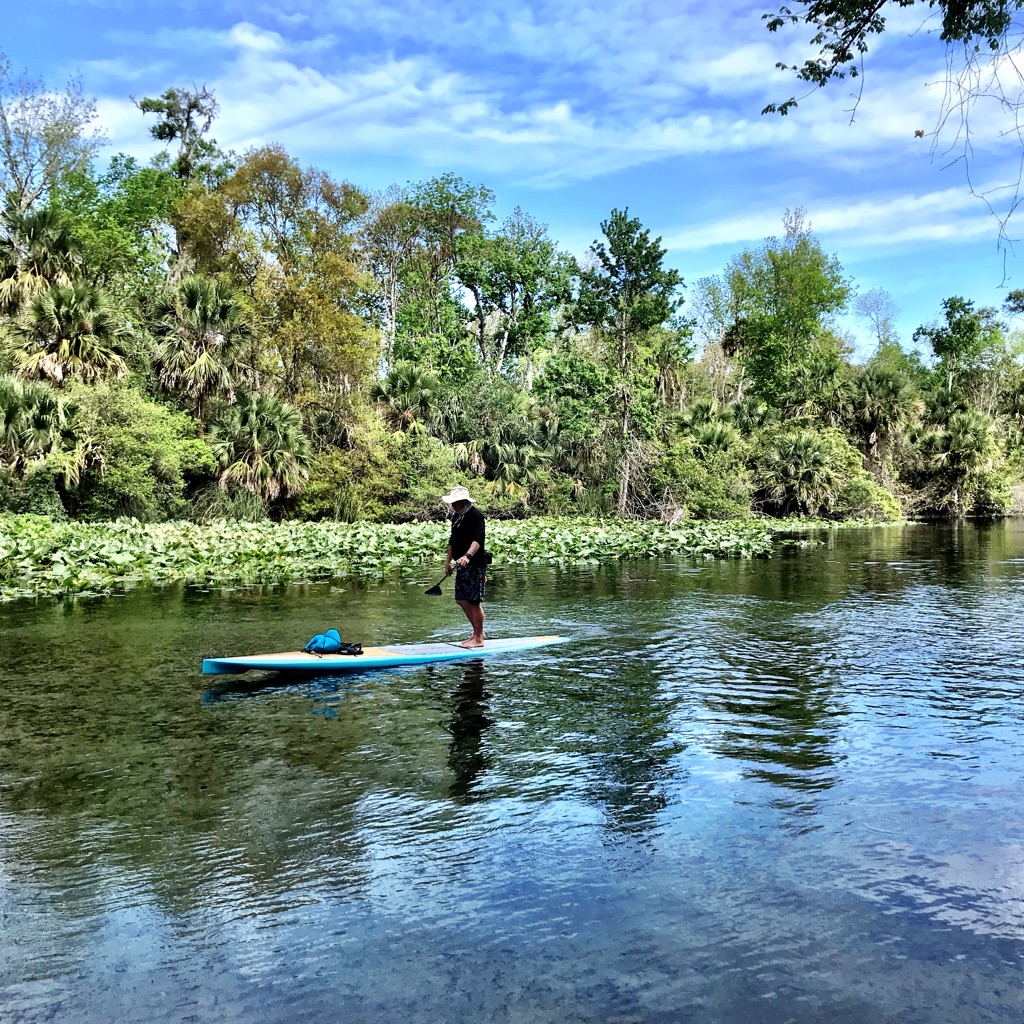
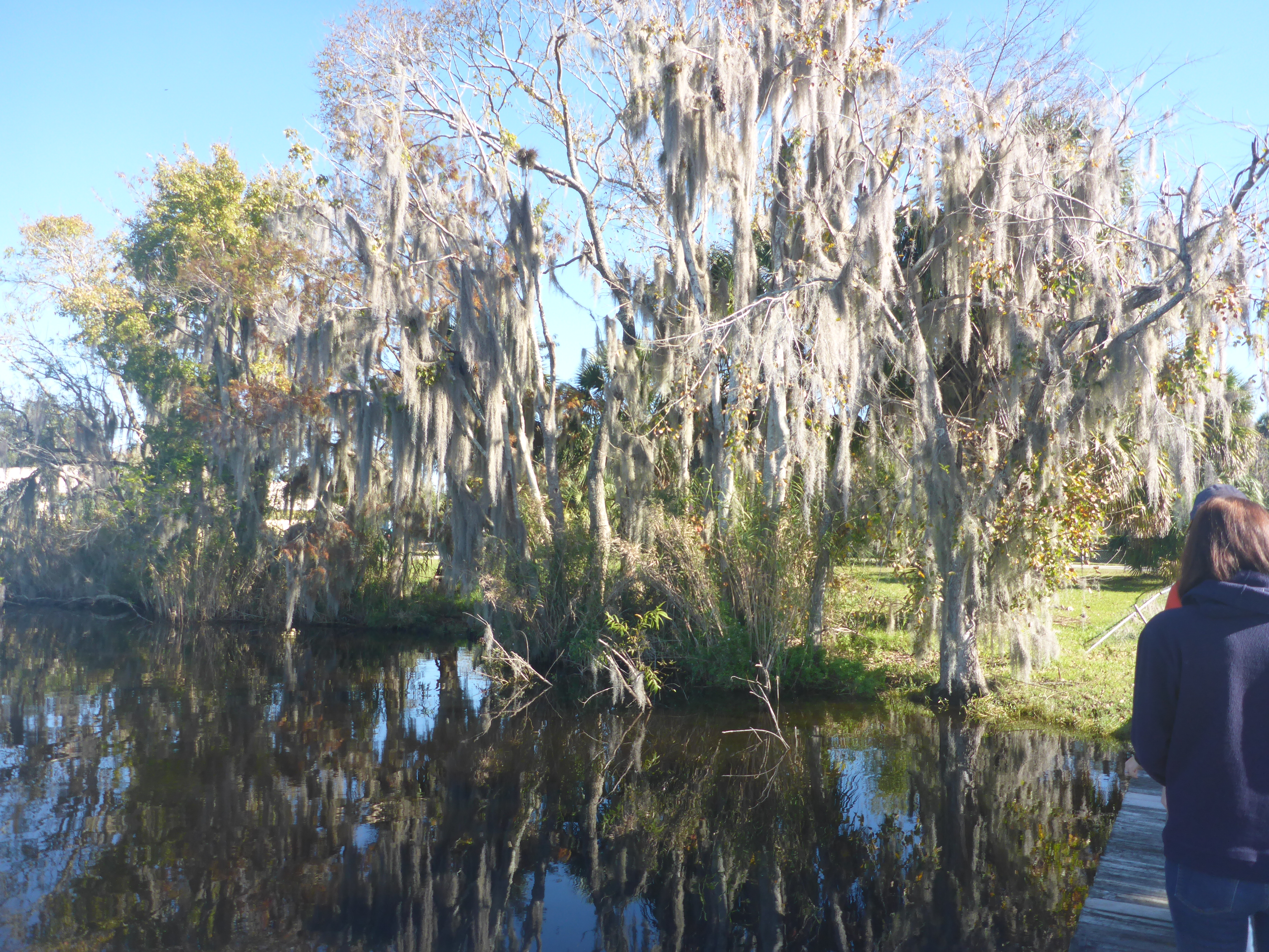
Swimming and paddling in our springs feels like a gift, but seeing them through the eyes of new visitors makes me fall in love all over again. My friend Flo Turcotte, UF archivist for Marjorie Kinnan Rawlings’ papers, detailed how Rawlings became enchanted by north central Florida’s primeval landscape in her article “For This is an Enchanted Land“. I saw the process of enchantment begin anew, and I know that my friends will come back for more.

img_3058
Devil’s Eye

When Vacation Becomes an Adventure

Blue skies on the Suwannee River.jpg
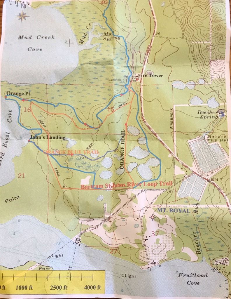
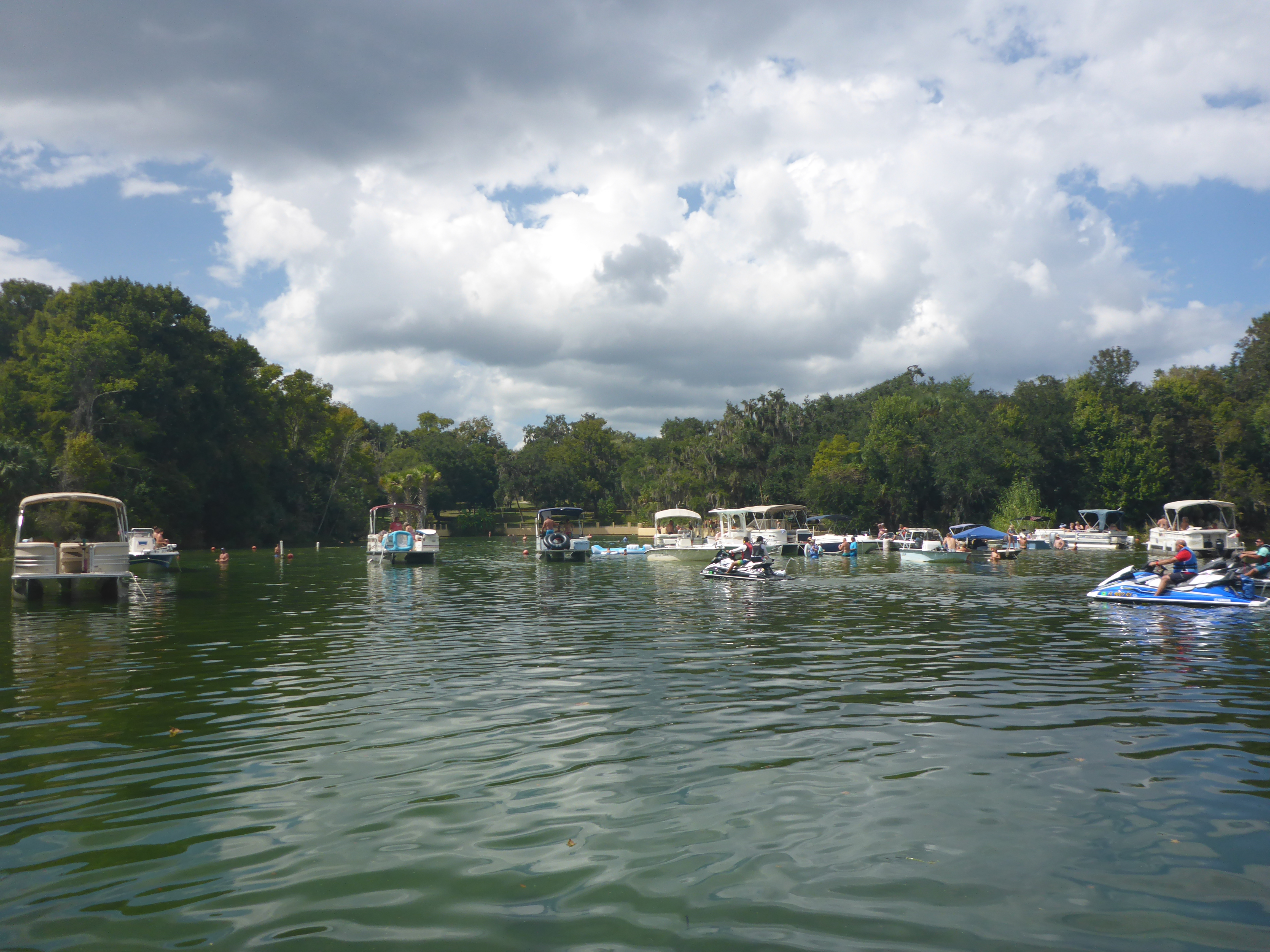
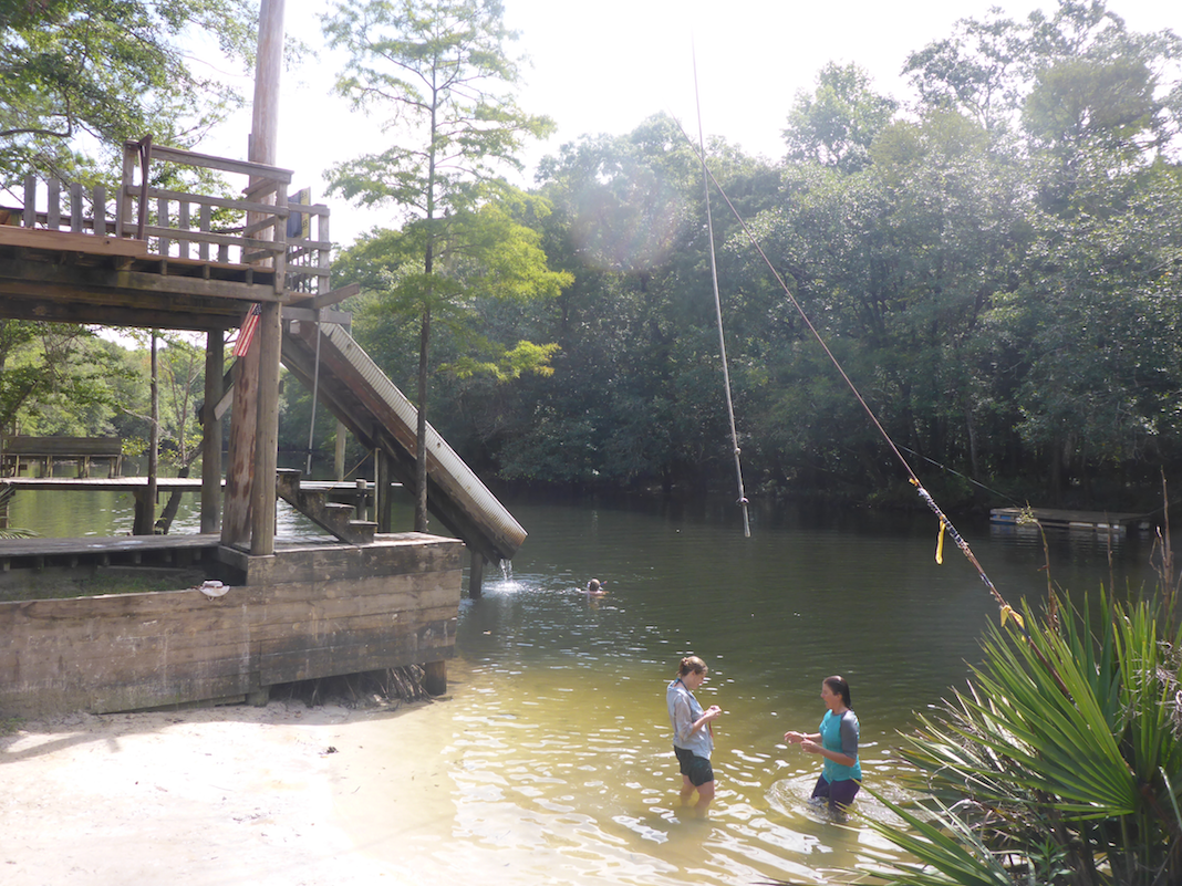
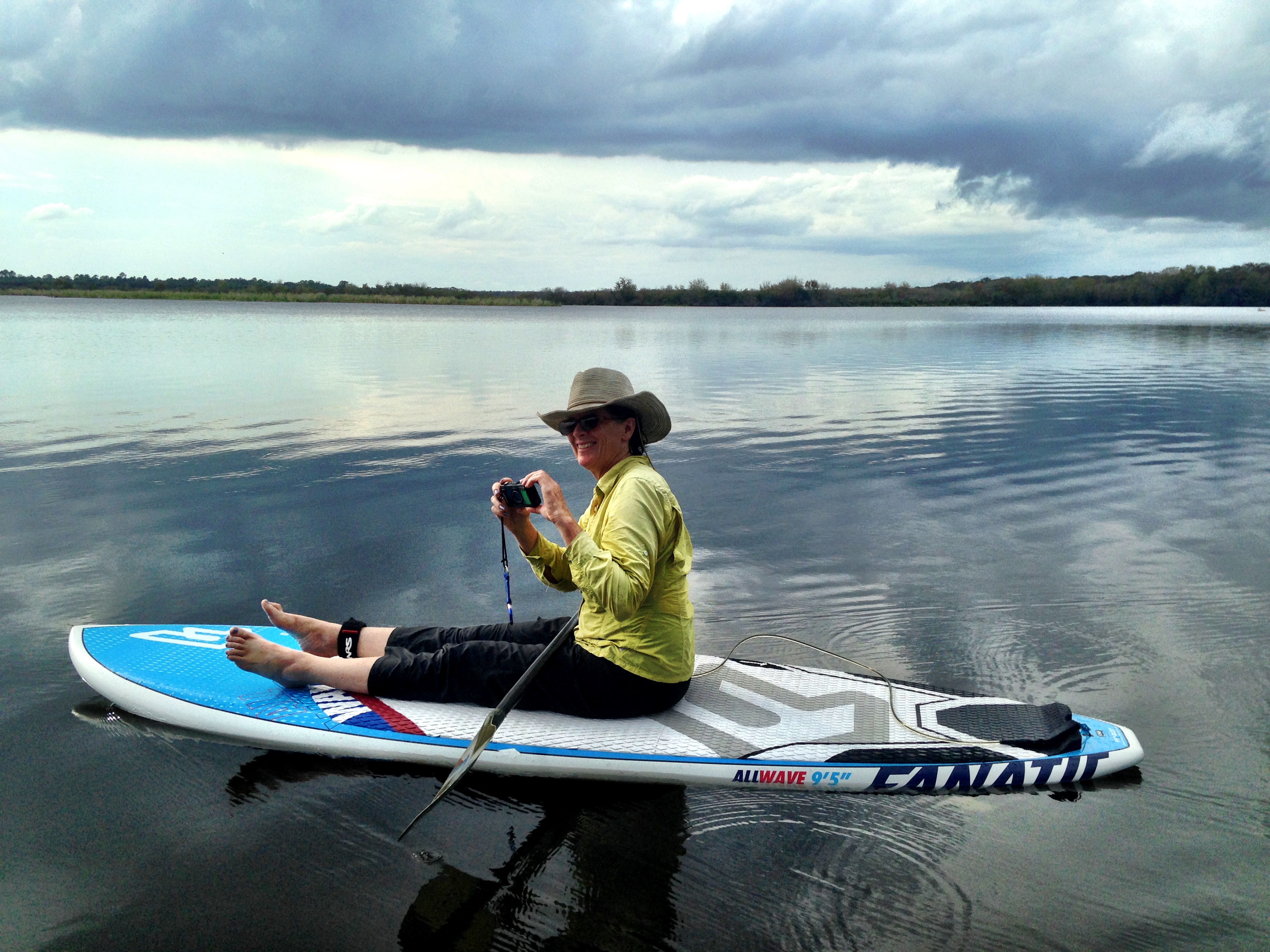
On Saturday morning, April 2, 90+ kayakers and one paddle boarder (me) launched from Spirit of the Suwannee to paddle 20 miles downstream back to our campsite at the Suwannee River State Park. We were all part of Paddle Florida’s annual Suwannee River Paddling Festival, scheduled each year for the first weekend in April. Paddle Florida‘s motto is “Inspiring. Meaningful. Adventure.”And while our performers and the river itself fulfilled the first two promises, Mother Nature served us a full plate of adventure with Friday night’s storms and flooded rivers.

Participants arrived Friday afternoon, under foreboding skies, and we all knew that storms would roll through Live Oak at some point that night. We set up our tents on the bluff overlooking the river, staking out lines with care to make them as rain-proof as possible.


The rain held off for our evening entertainment– Thomas Hawkins from Florida Defenders of the Environment, told about work to restore the Ocklawaha River, and Matt Keene’s River Be Damned documentary narrated the Ocklawaha’s contested history and portrayed river’s beauty in its free-flowing state. Many in the group had paddled on the Ocklawaha River during the recent drawdown and seen springs like Cannon that are visible only when the Rodman Reservoir is lowered. Currently, there is much dialogue and debate among those who wish to restore the Ocklawaha River to its natural flow and those who have grown attached to the lake-like ecosystem of the Rodman Reservoir. I recently wrote “Requiem for a River” about those of us grieving the loss of these springs. Thomas Hawkins brought up the point that many supporters of the Rodman Reservoir have already mourned the loss of the free-flowing Ocklawaha and cannot bear the loss of this new ecosystem they have come to love. Most everyone agrees that we never should have damned the river in the first place, but now, whatever we do will make someone unhappy.

We stayed dry for another hour while Scott Jantz led his ghost tour around the ruins of Drew Mansion and Ellaville across the river. By the time the group returned from their ghostly walk, around 10 pm, the raindrops started, and thunder grew louder. Time to hunker down in our tents. Over the next eight hours, storms rolled through the Panhandle, along the I-10 corridor, pelting us with rain and lighting up the sky. When we emerged from our tents for breakfast, the rain had slowed to a drizzle. Some tents had fared better than others, and few campers had slept well. My tent and tarp combo–described as looking like a child’s sheet fort–kept me dry, but others spent a very wet night. Everyone, it seemed, was grateful for coffee that morning.

2015-16 is an El Niño year, and Paddle Florida trips has felt the impact of that this season, from the Nor’easter on the Bartram trip in December to another overnight soaker on the Great Calusa Blueway trip in February. Someone commented that “extreme weather conditions transform a vacation into an adventure,” and rising to meet these challenges is satisfying and also gives us much better stories. I wonder how our weather apps change our experience? I camped for years without access to weather warnings, but now my iPhone alerts me when I am in the red tornado watch zone. Do I really want that information when there is little I can do about it?

The skies were gray but clear when we launched at the Spirit of the Suwannee beach Saturday morning. We floated past the limestone bluffs that line the river until we reached our lunch spot at 12 miles, Gibson Park boat ramp. The paddling was difficult- we paddled against a headwind, and while we assumed that the rains would make the flow faster, we were wrong. Many people were grateful for Paddle Florida’s signature PBJ lunch spread and perhaps even more grateful for the opportunity to take the shuttle back to the campsite. The paddle both before and after lunch was beautiful and serene, especially as the skies cleared just as most of us arrived in camp. The sunny afternoon skies allowed tired paddlers to nap, dry their tents, and, for the slightly more energetic, place bids at the silent auction. The auction which raised money for the Florida Defenders of the Environment was followed by a sunset serenade by singers Frank Lindamood and Lon and Lis Williamson.

Saturday night’s clear skies and cool temperatures let us all get a good night’s sleep for Sunday’s paddle down the Withlacoochee River. The rains in western Florida had been filling the Withlacoochee over the past week, and we heard that the river would be fast. Madison Blue Spring, our launch point, was totally flooded out, and the river moved swiftly past the spring. One by one, we walked our boats down the flooded wooden ramp, launched, and quickly entered the river’s flow. Unlike last year, we did not stop and swim in springs in either the Suwannee or the Withlacoochee. As predicted, the day’s 12 mile paddle was fast as we floated down the river, steering through the swirls and boils caused by the high water levels. In only a couple hours, we reached the confluence with the Suwannee, just downstream of our campsite. After a short paddle upstream, we were home again.Spanish moss and trees lining the Withlacoochee.jpg

The scent of our BBQ lunch wafted over the campsite as we took down our tents and packed up. It was time to say goodbye to new and old friends. Laughing around the campfire. Scott’s ghost tour. Desperately waiting for early morning coffee. Floating down two beautiful rivers. And not to forget the crazy weather. These things bring us together and make us eager to get back on the water.

Requiem for a River

herontrees.jpg

I went to the Kenwood boat ramp last week to see it for myself — how much had the Ocklawaha River risen since the end of the drawdown, and would I still be able to see the tree stumps that reveal the drowned forest below?  I paddled the river during the drawdown, when the Ocklawaha was briefly restored to its natural flow, revealing bubbling springs and sandy banks. Now I felt compelled to witness the reverse, to see how the rising waters covered the treasures below. I was surprised to see that the river level had not yet risen significantly, so I inflated my paddle board and began to paddle upstream. Dark, low clouds filled the sky—which seemed fitting, and I estimated I had about 1 1/2 hours to wind my way through this apocalyptic riverscape.

The Rodman Reservoir had been lowered for the past several months, and, like many others, I took the opportunity to see rarely uncovered springs like Cannon Springs and Tobacco Road. I joined the Florida Defenders of the Environment at Kenwood where Lars Anderson pointed out springs and historical features, and later Captain Karen Chadwick, North Star Charters, gave me a tour on her skiff. I paddled from Eureka West to the boat ramp across from near Payne’s Landing and saw fishers lining the newly uncovered banks.

2016-03-17 10.26.26.jpg

On this day, though, I came by myself, to  be in silence on the water. The overcast day was still, the quiet only broken by the occasional motorboat. The fishermen waved as they went by, and the silence was restored. Several friends told me that they did not want to see the rising water, that it would be too sad. I understood their feelings, especially those of friends who have loved the Ocklawaha for a long time. I am a relative newcomer to Florida and have become enchanted by its springs and rivers and Old Florida, but people who grew up on the Ocklawaha have entirely different stories to tell.

In “How do we Grieve the Death of a River’,  activist Winona LaDuke asks “How do you express condolences for a river, for a life, to a man to whom the river is the center of the life of his people? That is a question we must ask ourselves.” Mining tailings have destroyed the Waatuh River, or “Grandfather”, in southeast Brazil, a river central to the lives of  indigenous people .

Okhlawaha dusk.jpg
Ocklawaha at dusk

Okhlawaha.jpg
Ocklawaha near Eureka West

Many years ago longtime residents grieved as they lost access to their land and homes when the Ocklawaha was first flooded, and they grieve again as the waters rise again, drowning the the sandy banks that provided sanctuary for alligators and birds. The “Restore the Ocklawaha River” Facebook page shows sadness—some  discovered the Ocklawaha’s springs for the first time this year and now mourn the loss. Others wonder why some voices count more than others—why do the voices of the bass fisherman count more than the poor fisherman who cannot afford a boat and have lost access to much of the river? But there is hope as well. The Save the St. Johns Tour brought scores of newcomers to the Ocklawaha River and made many of us realize that we can regain what was lost.

As I paddled among the stumps, I recalled the river bends upstream near Eureka West and the times I swam in Cannon springs. The sky was darkening, and the wind was becoming stronger, so I quickened my pace. I didn’t want to be on the water during a thunderstorm. I paddled through the dead trees — the water was slightly higher than when I paddled this area previously. I had to take care that hidden roots would not catch the fin on my board and pitch me forward. I wished I had seen the forests before 1968, when the Ocklawaha was first flooded.

I paddled hard against the wind and reached the boat ramp. As I deflated the board and packed up, I watched the fishermen pull up to the ramp, also trying to beat the storm. Just as I reached the main road, the storm broke, and lightning filled the sky. I was surprised that I had become so attached to the river in such a short time. I am sorry that the state of Florida insists on drowning the Ocklawaha River, but I am glad that I came to bear witness.

2016-03-17 10.56.36.jpg


%d bloggers like this: