Can William Bartram Help Us Save the St. Johns River?

fog rising over Palatka
Misty morning on the St. Johns River

Can William Bartram—Quaker, adventurer, and naturalist—help us save the St. Johns River? In the late 1700s, William Bartram (1739-1832) sailed the north-flowing St. Johns River and recorded north Florida’s cultural and natural history in his Travels of William Bartram. Bartram’s words have drawn adventurers, naturalists, and historians to the river and cultivated in them a deep appreciation for local history, flora, and fauna. I  came to love the St. Johns River after paddling in William Bartram’s Wake on a Paddle Florida trip on the Bartram Trail in Putnam County. Most recently, Bartram Inn owner Linda Crider created the Bartram Adventure Tour so that Bartram enthusiasts and others can trace Bartram’s route on foot, bike, and boat. On this trip, I realized that William Bartram also forged paths to conservation.

The Bartram Inn, Palatka, FL

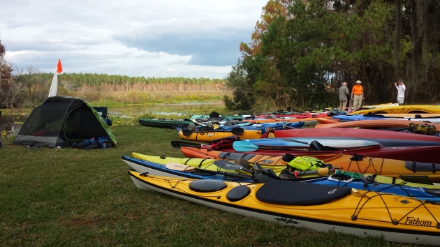
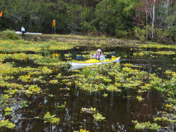
I was excited when Linda invited me to join the inaugural Bartram Adventure Tour. I knew that several days with fellow Bartram enthusiasts would help me better understand why William Bartram’s words remain powerful. In 2016, I met Sam Carr and Dean Campbell on a Bartram-inspired Paddle Florida trip on the St. Johns River. While paddling downstream in a blustery December wind, I learned that Sam, Dean and others designed Bartram Trail in Putnam County  so that people could visit sites that Bartram described. The printed guide, trailside QR codes, and website provide locations, journal entries and commentaries so that visitors can follow Bartram’s footsteps and see (or imagine seeing) what he saw. The Bartram Adventure Tour combines guided cycling, paddling, and hiking tours on the Bartram Trail in Putnam County with a stay in the Bartram Inn.

Palatka
St. Johns River map
Sunrise over the St. Johns

The pre-dawn light woke me early on my first morning of the trip.  I could see the St Johns from my room on the second floor of the Inn, so I grabbed a cup of coffee and walked outside to watch the sunrise. Mist shrouded the anchored boats and blurred my view of Memorial Bridge that divides east and west Palatka. It struck me that I had never spent the night in Palatka. I had driven over the bridge innumerable times on my way to Crescent Beach, but rarely stopped in Palatka except for gas or snacks. I recalled Linda’s observation from the previous evening, that only when people stop, get out of their cars, and get on the water do they begin to care for the river. Perhaps here was a clue to Bartram’s power, the power of place—his words guide us to magical places on the St. Johns where we can see, touch, and sometimes feel the river’s beauty.

2018-12-12 13.37.54
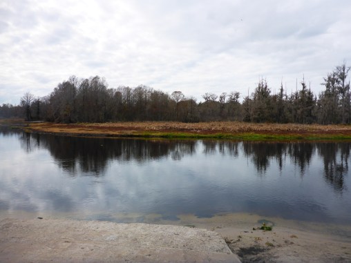
View from Orange Point in Welaka Forest
2018-12-12 11.31.16
Bartram Trail kiosk
afLMHch4Q1+v%DUVeWcS7w_thumb_3449
Hike to Orange Point through Welaka Forest

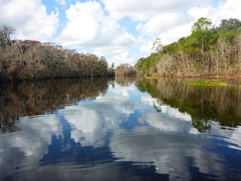
We had two short hikes that day. First, we walked along the Puc Puggy Trail at the Palataka Waterworks Environmental Education Center. Then, we hiked down a newly cut trail in the Welaka State Forest that brought us to Orange Point and John’s Landing. The trail between these points followed the river and provided the best views of the river. Our trip included a number of ‘Bartram moments.’ Sam read from Bartram’s Travels and explained the significance of a particular place. Hearing Bartram’s  description helped me imagine the landscape he encountered so many years ago.

2018-12-12 14.36.37
Sam reads the Bartram Prayer

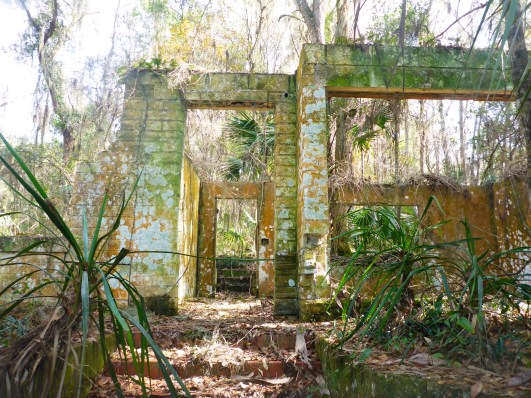
On our final stop before lunch, we climbed Mount Royal, a site now confined within the gated Mount Royal Airpark Community. From atop this (excavated) Indian mound, Sam read aloud the ‘Bartram Prayer’ which offers insight into Bartram’s—and his own—feeling of stewardship towards the river and the surrounding land. The prayer resonates with him because it shows that preserving creation reflects the will of God and adds purpose to living on the St. Johns.

Bartram Prayer
Bartram Prayer

Sam claims that Bartram was the “original hippie”—embracing peace, love, and care for all beings, including other people. In Bartram’s description of nearby Six Mile Run (a.k.a. Salt Springs Run), he writes

At the same instant innumerable fish are seen, some clothed in the most brilliant colors . . . all in intercourse performing their evolutions: there are no signs of enmity, no attempt to devour each other; the different bands seem peaceably and complaisantly to move a little aside, as it were to make room for the others to pass by.

Shouldn’t humans emulate the peaceable bands of fish, Bartram seems to say, where all coexist peacefully? Bartram’s care extended to the many Native Americans he met whom, unlike his contemporaries, he viewed as equals. His egalitarian approach to people and nature reflected a Quaker sensibility that would motivate others centuries later.

2018-12-12 10.17.25
Puc Puggy (‘Flower gatherer’) Nature Trail (Site 6)
9pl30Fr8TLCCt+semzMTLg_thumb_3442
The team at Puc Puggy Nature Trail

On our final day, we met another Putnam County resident who has taken William Bartram to heart. Biologist Mike Adams has been restoring the region’s native plants, including longleaf pine, for over 20 years. He and his family bought and preserved a tract of land on the St. Johns River.

IMG_2126
Saturiwa, named for a Timucuan chief
IMG_2125
Downstream from Palatka on the St. Johns River

A passing cold front thwarted our plans to pedal the 13 miles from Palatka to Saturiwa, so we grabbed our raincoats and piled into our cars. Under the eaves of his broad porch, Mike explained how he had come to love Florida’s diverse landscape and William Bartram.

2018-12-14 11.05.32
Mike Adams dressed as William Bartram
2018-12-14 11.35.18
The Carniverous Pitcher plant (Sarricenia)
2018-12-14 11.43.46
Native fern
2018-12-14 12.14.22
A slippery walk down the boardwalk

In his William Bartram persona, Adams outlined his conservation program and described the design and construction of his house and surrounding buildings. As he pointed out the details of the house, including this inlaid compass, I thought of yet another Bartram lesson: the mix of science and beauty. The sciences, arts, and humanities were not always considered as separate endeavors.

2018-12-14 12.48.58
Compass showing the orientation of the house

I recalled a discussion with University of Florida historian Steve Noll during the Center for Humanities in the Public Sphere summer program for high school students. William Bartram, Noll pointed out, embraced both the humanities and the sciences, and he communicated his scientific findings in artful, if not flowery, language. The blend of science and story, along with ethics, history, and beauty, can help us save our Florida waters. Artist Margaret Tolbert’s Aquiferious is one example, using a holistic approach to showcase and, hopefully, save our springs.

William Bartram’s writings have motivated these Putnam County residents to conserve land, create the Bartram Trail, and follow Bartram’s path on land and sea. We only protect what we know and love. Getting people on the water and into Putnam County helps the river and the people who live there. William Bartram has become an environmental ambassador for the St. Johns River in Putnam County. He still has much to teach us.

Bartram Adventure Tour postcard
To learn about the Bartram Adventure Tour, watch the video.


EjAucRB+kOAEaMswkeA_thumb_3422


Traveling through Time on the St. Johns River

2018-12-13 13.29.26
The glassy St. Johns hold its secrets

Rivers were once America’s highways, carrying people from place to place. But rivers also let us journey through time, revealing the stories and histories of those who have gone before. Looking out over a glassy St. Johns River, I wonder what stories the river holds. People have lived and worked on the St. Johns River for millennia, including Paleo-Indians, European colonists, and Cracker homesteaders. The St. Johns reveals their stories to archaeologists and historians through artifacts and written records. What can we learn about these layers of history, from the recent past to pre-historic times, by being on the river?

EjAucRB+kOAEaMswkeA_thumb_3422
Bartram Inn Postcard

I came to Palatka to join the inaugural Bartram Adventure Tour. In the late 1700s, William Bartram, Quaker, naturalist, and adventuer, sailed the north-flowing St. Johns River and described the people, flora, and fauna he encountered. Bartram Inn owner Linda Crider created this tour so that Bartram enthusiasts and adventurers could visit sites that naturalist William Bartram (1739-1823) described in his Travels of William Bartram. The Bartram Trail in Putnam County guides adventurers to these sites on foot, bike, and boat. Reading Bartram’s words is one thing, but seeing these sites from the seat of a kayak brings these stories to life.

2018-12-13 12.09.39
A kayaker’s view

On the water, I can almost imagine a time when the river was Florida’s main highway. Today, the Memorial Bridge in Palatka spans the St. Johns, and Highways 17 and 19 parallel the eastern and western banks. But this network of roads and bridges did not exist for Harriet Beecher Stowe, William Bartram, or the Native American populations who preceded them.

rc09286
1873 Steamer Routes (Florida Memory)
screenshot-2017-01-26-10-22-52
Palatka News timetables (Chronicling America)
palmetto-leaves
Palmetto Leaves

In her 1872 work Palmetto Leaves, Harriet Beecher Stowe writes

St. John’s is the grand water-highway through some of the most beautiful portions of Florida; and tourists, safely seated at ease on the decks of steamers, can penetrate into the mysteries and wonders of unbroken tropical forests.

The key phrase is “the mysteries and wonders of unbroken tropical forests.”  Florida’s dense scrub landscape made land travel difficult and dangerous. Imagine the snakes, gators, and spiders under foot. Until industrialist Henry Flagler (1830-1913) developed the Florida East Coast Railway in the early years of the twentieth century, the St. Johns River remained Florida’s “grand water-highway” for good reason.

2018-12-13 10.33.01
A Bartram moment on the St. Johns

On an overcast day, Bartram enthusiast Dean Campbell met us in Welaka for a six-mile paddle. We visited several springs, including Welaka Springs and Satsuma Springs. Today we cool off in these springs, but once they were sources of life.

2018-12-13 12.56.20
Welaka Spring with QR code
2018-12-13 11.19.50
Satsuma Spring Run
2018-12-13 11.27.58
Satsuma Spring vent

Just beyond Welaka, we paddled past the remains of the Shell Harbor Restaurant which figured in Dean’s own family history. After church, his family used to eat Sunday dinner there followed by an afternoon cruising the river on their boat. The restaurant is now in disrepair, like many fish camps along the St. Johns.

2018-12-13 10.11.42
Remembering times from the recent past
2018-12-13 10.13.03
Remains of the Shell Harbor Restaurant

Boats, docks, and homes in varying stages of disrepair hint at the recent past, but the river itself holds evidence of the distant past. The day prior, diver and archaeologist Mike Stallings displayed some of his finds, including a mastodon tooth. Mike and others have found pottery from the St. Johns culture, a native American culture along the river dating from 500 BCE until the arrival of Europeans. The St. Johns River near Palatka is fossil-rich because the river level has varied over thousands of years, from 400 feet above sea level to 40 feet below.

2018-12-12 13.47.04
Treasures from the St. Johns

This was not a wilderness paddle—homes, fish camps, and marinas lined the shores, illustrating that even today, many people rely on the St. Johns River for their sustenance and livelihood. The day before, Sam Carr had commented that Bartram didn’t forge any new trails. In fact, William Bartram traveled along a river that was home to multiple populations, including settlers, plantation owners, and Native Americans.  Bartram wrote extensively of his encounters with the different native populations he met. The west side of the St. Johns River, known as the “Indian shore,” was less populated than the east side, where British colonists and plantation owners had settled. Bartram, however, rarely wrote about the plantations lining the shore, and he certainly encountered European settlers. He mentions Stokes Landing (Spaulding Lower Store) and Rollestown (Site 7), but his Travels portray a landscape unsettled by Europeans.

qrM5W3doQuSsCcwC7Ak9oQ_thumb_3407
Bartram mural in Palatka

In Palmetto Leaves, Harriet Beecher Stowe offers advice for northerners heading south for the winter, but her words betray a concern about the sheer numbers of snowbirds  arriving in Florida. Dean thought that William Bartram held similar concerns. Painting the landscape as harsh and unforgiving slowed the migration of newcomers. Remember that only the relatively recent development of air conditioning made Florida’s climate bearable to all but the toughest. As Florida’s population surpasses 21 million, the sea level continues to rise, and development runs unchecked, Stowe and Bartram’s concerns are prescient.

A1xV8HnBSjyNyFXl95A_thumb_341c
Tourists on a steamer

Paddling the St. Johns River is an opportunity to be immersed in history—literally, if you capsize, which I do not recommend. The St. Johns River holds the stories of generations of people who have lived before us. Following Bartram’s trail helps us imagine their lives in Florida’s many pasts.

s8p2QLl0RvmThQZE0JAzWw_thumb_3420
Palatka is the city of murals


Bartram Adventure Tour postcard
To learn about the Bartram Adventure Tour, watch the video.

Imagining William Bartram’s Salt Springs

Salt Springs Run cloudscape

Salt Springs Run hints of old Florida, before Disney and development transformed the land. The scrub landscape bordering the run offers a glimpse of the Florida William Bartram encountered centuries ago. Paddling this river lets me escape the twenty-first century for a little while.

I launch at Salt Springs Marina and slide my paddleboard onto the calm water just below the head-spring. The water is cloudier than the last time I visited a year ago, which saddens me.  Heavy rains and over-pumping from the aquifer have degraded many area springs. But even so, Salt Springs rarely disappoints.

The Salt Springs Marina sits at one end of a large pool. To the left lies the headspring itself and just downstream a pack of motor boats have anchored for an afternoon of swimming and sun. I turn my right, downstream, away from boats and people. It only takes one river bend to step back in time and imagine how William Bartram felt when he floated down what he called Six Mile Springs. On my first trip to Salt Springs, I paddled In William Bartram’s Wake on Paddle Florida’s 2015 Bartram History Paddle.  Dean Campbell and Sam Carr, designers of the Bartram Trail in Putnam County, regaled us with Bartram lore as we paddle down Salt Springs Run and up the St. Johns River to Palatka.

In 1766, Quaker naturalist and explorer William Bartram and his father John Bartram encountered Salt Spring Run while exploring the shore of Lake George, a wide spot in the St. Johns River. They rowed upstream against the slow-moving current until they reached the head-spring which they called Johnson Spring. Their journal entry, dated January 24, 1766, describes the oak hammocks, cypress knees, and pines that still characterize this run. Today, adventurers can paddle, hike, and bike sections of the Bartram Trail in Putnam County using maps and QR code that identify sites mentioned in Bartram’s travel journals. Site 28 marks the entrance to Salt Springs Run on the western shore of Lake George. Both University of North Florida’s Florida History Online and Bartram Trail in Putnam County provide ecological, historical, and literary commentary on the specific sites Bartram visited.

Rocky point
Site 28-Rocky Point
Screenshot 2015-12-15 16.13.05
Paddle Florida’s Bartram History Paddle 2015

Today, Salt Springs Run is part of the Salt Springs Recreation Area in the Ocala National Forest, easily reached by Highway 19. In the time of Bartram’s Travels and even well into the early twentieth century, most people travelled by boat. The dense and swampy Florida landscape made overland journeys difficult and dangerous. To reach Salt Springs, the Bartrams rowed up the north-flowing St. Johns River and up what we call Salt Springs Run.

Ocala National Forest Sign
Sign at Salt Springs Marina
Salt Springs Area Map
Courtesy of Google Maps

William Bartram returned to Salt Springs in 1774 and again floated the spring run. But his observations and “romantic imagery” after this second descent reveal so much more about Bartram and his enchantment by the spring.

“But there are yet remaining scenes inexpressibly admirable and pleasing. Behold, for instance, a vast circular expanse before you, the waters of which are so extremely clear as to be absolutely diaphanous or transparent as the ether; the margin of the bason ornamented with a grat variety of fruitful and floriferous trees, shrubs, and plants, the pendant golden Orange dancing on the surface of the plellucid waters, the balmy air vibrating with the melody of the merry birds, tenants of the encircling aromatic grove.” (Travels)

William Bartram’s ornate language captures the magic of Florida’s springs. I see the magic on my friends’ faces when they plunge into a spring’s clear waters.  Bartram’s flowery descriptions likely influenced writers and poets far beyond Florida. Scholars have traced Samuel Taylor Coleridge’s poem Kubla Khan to Bartram’s description of Salt Springs.

In Xanadu did Kubla Khan
A stately pleasure-dome decree:
Where Alph, the sacred river, ran
Through caverns measureless to man
   Down to a sunless sea.
So twice five miles of fertile ground
With walls and towers were girdled round;
And there were gardens bright with sinuous rills,
Where blossomed many an incense-bearing tree;
And here were forests ancient as the hills,
Enfolding sunny spots of greenery.

Salt Springs, like all Florida springs, flows from an ancient sea, deep under the Floridan Aquifer, passing through limestone and karst caverns. Coleridge’s sacred Alph could very well be our own Salt Springs Run. Who isn’t captivated by our springs?

Salt Run grass2018-10-06 11.09.162018-10-06 11.13.10

Even though the water was more tannic than my last visit to Salt Springs, in my mind’s eye, I envision the crystal blue flow that William Bartram must have seen–the water that is “absolutely diaphanous or transparent as the ether.” I’ve seen this clarity on the Ichetucknee, Naked Springs at Gilchrist Blue, and Cannon springs during the Ocklawaha drawdown, so I know what is possible.

fishface2
Cannon Springs
img_3058
Naked Springs
P1000916
Gilchrist Blue springs

My father recently passed away at Oak Hammock in Gainesville, FL, after struggling with dementia for several years. After he died, so many residents and staff at Oak Hammock spoke fondly of my father, whose Charlie Brown smile lit up the room. My mother and I worried that nobody knew my father as we knew him, in the past. But they loved him as they knew him, as he was in the last years of his life.

I’ve only known and loved the springs in their current state. My husband Kevin tells me how much cleaner they were when he first came to Florida over twenty years ago. Still others reminisce about their clarity before air conditioning made Florida newly habitable and brought millions of new residents, including myself. I love them as they are.

Salt Springs Run is an out and back paddle, and fortunately paddling back upstream to the marina is not difficult. I paddled past the marina towards the headspring where motor boats congregated just beyond the ropes marking the Salt Springs swimming area. After the solitude of the spring run, the competing stereos emanating from the boats was jarring, but we all have our ways of loving Salt Springs.

2018-10-06 12.54.10
Boats anchored outside Salt Springs Marina

William Bartram’s words illustrate how some visitors responded to a landscape alien to them. I’m interested in landscapes and the people who inhabit them, past and present. Paddling on the waters that Bartram described helps me imagine the springs in a former, more glorious state. Even though I love the springs as they are, I know we can do better. Perhaps if we can expand our ecological imagination, we can find the will to restore and repair our springs.


Pancakes and Water-skiing Elephants: Hidden Histories of DeLeon State Park (St. Johns, Part 3)

In 1831-2, James John Audubon visited Spring Garden Plantation in search of the Common Gallinule. Unlike most visitors from the north, Audubon did not appreciate the scrub landscape that had enchanted William Bartram and Marjorie Kinnan Rawlings.

floating on a paddleboard under cloudy skies in DeLeon Springs State Park, Florida
Liz Sparks on DeLeon Spring Run

How was I supposed to focus on history with the deafening shrieks of children ringing in my ears? I had come to learn about the park’s history and perhaps even swim, but I quickly realized that every child from every camp from miles had also come to cool off in the spring. Oh well. I was preparing to teach a class on the culture, history, and ecology of Florida State Parks and was visiting the parks that exemplified kitschy pre-Disney Old Florida. With a water-skiing elephant and a sugar mill do-it-yourself pancake restaurant, DeLeon Springs made the cut. And despite my focus on tourist kitsch, I learned a great deal about the park’s rich history.

To escape the bedlam, I entered the one place guaranteed to be child-free: the park’s small museum. The room had posters, pictures, and artifacts that traced the area’s history, starting with the Mayaca people who inhabited the area for at least 6,000 years. Unfortunately, many burial mounds and artifacts were lost or destroyed when European settlers came to the region.

sign with history of mayaca indigenous people
DeLeon Springs’ First People

DeLeon Springs State Park sits between Deland and Astor, on the east side of the St. Johns River. Water coming from this second magnitude spring flows into Spring Garden Lake, then through Lake Woodruff and Lake Dexter en route to the St. Johns. Fish and game were plentiful for early Florida residents.

Easy access to the St. Johns River drew subsequent populations, starting with the Spanish in the 1500s. In the 1800s, settlers established Spring Garden Plantation to grow cotton and sugar cane. Florida’s history as a slave state is often over-looked, but slavery and plantations sadly thrived along the St. Johns River in the antebellum years.

List of slavesand ages
Spring Garden Slave List, 1829 (The Broadus R. Littlejohn, Jr. Manuscript Collection. Book 304.)

In 1831-2, James John Audubon visited Spring Garden Plantation in search of the Common Gallinule. Unlike most visitors from the north, Audubon did not appreciate the scrub landscape that had enchanted William Bartram and Marjorie Kinnan Rawlings.

‘Here I am in Florida . . . which from my childhood I have consecrated in my imagination as the garden of the United States,’ Audubon wrote. But he found a place ‘where all that is not mud, mud, mud is sand, sand, sand, inhabited by alligators, snakes and scorpions.’

Drawing of Common Gallinule, James John Audubon
Common Gallinule (http://www.audubon.org/birds-of-america/common-gallinule)

Spring Garden Plantation did not fare well in the mid-1800s. The Seminoles burnt it down during the Second Seminole War (1835-42),  then Union troops burnt it again during the Civil War. Later the site was renamed DeLeon Springs, yet another Florida site claiming to  be Ponce De Leon’s fountain of youth.

sign on name change to promote business and tourism in Florida.
Fountain of Youth Placard
tour boat with children swimming
Fountain of Youth Eco/History Tour boat

DeLeon Springs is the epitome of Old Florida tourism, and Queenie, the water skiing elephant, was DeLeon’s Springs crown jewel. In “The Waterskiing Elephants of DeLeon Springs“, Rick Kilby writes about Liz Dane who water-skiied with her pet elephant Queenie in 1958-9. In 2015, Liz Dane returned to DeLeon Springs to speak about Queenie and her experiences at the park.

Queenie the water-skiining elephant
Mural on DeLeon Museum Wall

Finally, enough history — it was time to get on the water. My paddling buddies and I see how far we could go on the spring run. Not far, as it turned out. The fin of my paddleboard caught in the mud on this shallow run. Even more ominous, dark clouds loomed over us. We raced back, not a moment too soon, and the skies broke. The silver lining: the typically long lines for the Old Spanish Sugar Mill Restaurant had disbursed. This restaurant is a tourist favorite for good reason. Each table has its own griddle, so guests make their own pancakes at the table.

We came for the kitsch and stayed for the history. Where ever I go in Florida, I am reminded of the deep and rich history of our rivers, springs, and parks. Deleon Springs State Park , though, has one of the most interesting blends of history, ecology, and recreation and is well worth a visit.

ruins of old sugar mill for crushing cane
Sugar Mill Ruins
view across DeLeon Springs of sungar Mill restaurant
Old Spanish Sugar Mill Restaurant
bubbling pancake with blueberries
Cooking pancakes on the griddle

matheson

Visit the River of Dreams at the Matheson History Museum, 513 E University Avenue, Gainesville, FL 32601   Phone: (352) 378-2280

Hours:  11:00 a.m. – 4:00 p.m., Tuesday – Saturday

The Matheson will offer related programming from now through June, ranging from talks at the museum to paddling tours guided by Lars Anderson at Adventure Outpost. Visit the Matheson’s events page for details.

This exhibition emerged from the research of Dr. Whitney Sanford, Florence Turcotte, and students in the UF Religion Department, and was made possible by the generous support of Visit Gainesville; the State of Florida, Division of Cultural Affairs; and the Center for the Humanities and the Public Sphere at the University of Florida.

Thank you to our partners the Special & Area Studies Collections of the George A. Smathers Libraries at UF, UF Religion Department, and the UF Museum Studies Program, as well as the UF Florida Puerto Rico Digital Newspaper Project, the Laboratory of Southeastern Archeology, Department of Anthropology at UF and the National Park Service, Timucuan Ecological and Historic Preserve.

Curator: Briley Rasmussen

Associate Curators: Alexis Schuman and Lauren O’Neill

Guest curators: A. Whitney Sanford, Florence Turcotte

Assisted by:  Peggy Macdonald, Sarah ‘Moxy’ Mocyzgemba, Amanda M. Nichols, Brian K. Szymborski 

Exhibition Photographer: Anne Ledbetter

Mural Artists: Gillian Fazio and Laura North

Graphic Designer: Brianna Ostrowski

Cruisin’ Down Florida’s Grand Highway (St. Johns, Part 2)

View On the St. Johns River_Mandarin Fla._Home of the Late Harriett Beecher Stowe_Near Jacksonville.jpg
Courtesy of Matheson History Museum

In the late 1800s, Harriet Beecher Stowe (1811-1896) followed a seasonal migration pattern now familiar to all Floridians—snowbirds landing in Florida to bask in our balmy winters. Today people cruise down I-95 and I-75 in RVs. In Stowe’s time, they cruised down the St. Johns in steamships.

Stowe wintered in Mandarin, Florida in a house overlooking the St. Johns River, a river she came to love. Her book Palmetto Leaves describes her life and community in Florida and offers advice for other northerners heading south. In particular, she reminisces about sailing and boating on the St. Johns River. In the St. Johns lower basin, near Mandarin, the river is slow and wide, almost a mile wide at some points. Preparing for a day of boating, she describes her view as

…five good miles of molten silver in the shape of the St. Johns River, outspread this morning in all its quivering sheen, glancing, dimpling and sparkling, dotted with sailboats, and occasionally ploughed by steamboats gliding like white swans back and forth across the distance.

black-knight
View from Black Knight Boat ramp

Palmetto Leaves.jpg

The St. Johns River was Florida’s “grand river highway,” and travel by steamship was more comfortable and safer than travel overland. Florida’s dense scrub landscape made land-based travel extremely difficult, so boats and rivers were a lifeline to Florida settlers, traders, and tourists.

Steamships helped open the market for Florida tourism. In Palmetto Leaves, Stowe wrote that the

St. John’s is the grand water-highway through some of the most beautiful portions of Florida; and tourists, safely seated at ease on the decks of steamers, can penetrate into the mysteries and wonders of unbroken tropical forests.

Passengers from the north could enjoy Florida’s warm winters and reach locations such as Sanford, Silver Springs, and Palatka by ship.

rc09286
1873 Steamer Routes (Florida Memory)
screenshot-2017-01-26-10-22-52
Palatka News timetables (Chronicling America)

By the mid-1800s, steamships plied the route between Jacksonville and Sanford, carrying goods, people, and agricultural products.  Boats that took passengers on the Ocklawaha and the Silver River required the smaller, more maneuverable sternwheeler, as in the Okahumkee below. Passengers heading northward transferred to larger ocean-going side-wheel paddleboats in Jacksonville.

th.jpg
City of Jacksonville Sidewheeler (Photo credit: St. Johns River Ship Co.)

Stowe describes her overnight cruise upriver—south—to Enterprise. This grand round, or tour, up the St. Johns River to Enterprise, across to St. Augustine, and back, she wrote, marks the “accomplished Floridian sight-seer.

Turning our boat homeward, we sailed in clear morning light back through the charming scenery which we had slept through the night before. It is the most wild, dream-like, enchanting sail conceivable. The river sometimes narrows so that the boat brushes under overhanging branches, and then widens into beautiful lakes dotted with wooded islands. [Palmetto Leaves]

Only the “constant and pertinacious firing kept up by that class of men who think that the chief end of man is to shoot something” detracted from her trip.

shooting_from_boat_on_ocklawaha
Log of the Okahumkee

The city of Enterprise on Lake Monroe was the southern terminus of the navigable section of the St. Johns River. Even today, most navigational charts stop at Sanford. In Stowe’s day, visitors to Sanford could stay in the elegant Hotel Sanford, built in 1886.

rc03808.jpg
Hotel Sanford (Florida Memory)

Henry Shelton Sanford (1823-1891) established the city of Sanford in the 1870s. He imported thousands of citrus trees to develop the citrus industry and established Sanford as a commercial and tourism hub of central Florida.

Today, most visitors arrive in Florida by car, plane, and occasionally, train, and the big rat dominates the tourism scene. Beecher’s slow trip up and down the St. Johns might not offer the excitement of Disney’s Splash Mountain, but traveling Florida’s waterways gives us a glimpse into the past, when rivers were our highways. Today, the Barbara-Lee, a stern wheel paddleboat, takes visitors for a slow cruise along the river, revealing birds and other wildlife. Others enjoy the St. Johns on pontoon boats, kayaks, and sailboats, seeing aspects of Florida only visible from water. These trips remind us that we have—and still do—rely on our rivers for commerce, transportation, and recreation. The St. Johns River is still the River of Life.

matheson

Visit the River of Dreams at the Matheson History Museum, 513 E University Avenue, Gainesville, FL 32601   Phone: (352) 378-2280

Hours:  11:00 a.m. – 4:00 p.m., Tuesday – Saturday

The Matheson will offer related programming from now through June, ranging from talks at the museum to paddling tours guided by Lars Anderson at Adventure Outpost. Visit the Matheson’s events page for details.

This exhibition emerged from the research of Dr. Whitney Sanford, Florence Turcotte, and students in the UF Religion Department, and was made possible by the generous support of Visit Gainesville; the State of Florida, Division of Cultural Affairs; and the Center for the Humanities and the Public Sphere at the University of Florida.

Thank you to our partners the Special & Area Studies Collections of the George A. Smathers Libraries at UF, UF Religion Department, and the UF Museum Studies Program, as well as the UF Florida Puerto Rico Digital Newspaper Project, the Laboratory of Southeastern Archeology, Department of Anthropology at UF and the National Park Service, Timucuan Ecological and Historic Preserve.

Curator: Briley Rasmussen

Associate Curators: Alexis Schuman and Lauren O’Neill

Guest curators: A. Whitney Sanford, Florence Turcotte

Assisted by:  Peggy Macdonald, Sarah ‘Moxy’ Mocyzgemba, Amanda M. Nichols, Brian K. Szymborski 

Exhibition Photographer: Anne Ledbetter

Mural Artists: Gillian Fazio and Laura North

Graphic Designer: Brianna Ostrowski

Save

Save

Save

Under Darkening Skies: Meeting the Challenge, Ocklawaha Odyssey, Part 2

Ock2016-57.jpg
The skies darken Photo credit: Jill Lingard

Our final challenge: Orange Springs to the Rodman Dam campsite. Although we only had six miles to paddle, dark skies loomed overhead and paddlers hunched over cell phones assessing the possibility of rain. The Paddle Florida truck was loaded with gear, wet from the night’s rain, and we waited, some more patiently than others, for permission to launch.

Today’s paddle would take us across Lake Ocklawaha, or the Rodman Reservoir, over the barely submerged stumps of drowned trees. Karen Chadwick warned us to follow the channel markers and avoid taking the shortcuts that looked so tempting. Hitting a submerged log could lead to a dangerous capsize. I paddled through this tree graveyard last spring after the drawdown and was struck by its eerie beauty (Requiem for a River).

herontrees
Floodscape
2016-03-17 10.56.36
“Hold my beer”
submerged-logs
Danger lurks below
OLYMPUS DIGITAL CAMERA
Photo credit: Henry Dorfman

At 8:45, Bill cleared us to launch and we retraced our path from Orange Springs to the main channel of the Ocklawaha River. During our paddle from Eureka to Orange Springs, the character of the river changed: it widened and became choked by vegetation. Without a little push from the river current, this final paddle across Lake Ocklawaha was destined to be a slog under any circumstances. We embarked, all hoping to cross the lake before the impending storm.

The route was obvious in the beginning—a clear line of channel markers led the way. After we passed the Kenwood boat ramp on the left, our goal—Rodman Dam campground—lay exactly due east across the lake. Easier said than done, however. As most of the group entered the widest part of the lake, the skies darkened and a squall passed overhead. The winds picked up and it was difficult to see more than several boats lengths ahead. I followed my compass heading to the east, trusting my heading was correct.

OLYMPUS DIGITAL CAMERA
Clouds gather Photo credit: Henry Dorfman
OLYMPUS DIGITAL CAMERA
The deluge begins Photo credit: Henry Dorfman
OLYMPUS DIGITAL CAMERA
Rescue at sea Photo credit: Henry Dorfman

The wind, waves, and rain challenged everyone. As I waited by a channel marker trying to guide paddlers in, I struggled to hold position against gusts that threatened to capsize my boat. The storm passed, everyone arrived safely to the campground, and skies brightened for a final group meal, catered by Backwoods Smokehouse and Grill. The sunshine and abundant food left everyone in good cheer as we returned to our cars and said our final goodbyes to new and old friends.

ock2016-58
After the storm Photo credit: Fred Haaser

The storm challenged everyone, including rescue boaters, and several people asked how they might improve their skills. How can strokes and edging help you control your boat in the wind? Where can you learn rough water skills to prepare for the open waters of large lakes or coastal waters? There are many pathways to improve paddling and safety skills. Learning self-rescue techniques, including the roll, provides the capability and confidence to tackle bigger challenges.

Classes and certifications:

ACA (American Canoe Association) and Paddlesports North America (the American version of BCU, British Canoe Union) offer certifications and sequential instruction in kayaking and other paddle sports. Their webpages show the skills required for the different certifications and list instructors and programs that teach these skills. The sites mentioned below offer ACA and PNA/BCU programs in the southeast.

Symposia and instruction in the southeast:

The East Coast Paddlesports Symposium, held annually each April in Charleston, SC, offers a range of on and off-water classes and the opportunity to demo equipment. Many retailers bring boats, paddles, and other gear, and this is one of the best places to see a wide range of equipment. Classes are held on the lake and on the more challenging waters near Folly Beach.

Sea Kayak Georgia located on Tybee Island, and Savannah Canoe and Kayak offer private kayak and paddle board instruction and expeditions. The waters around Tybee Island provide a good instruction to rough water. Dale Williams of Sea Kayaking USA , also on Tybee, offers more advanced instruction.

Each October, Ronnie Kemp and Marsha Henson of Sea Kayak Georgia bring in world-class instructors such as Dale Williams, Nigel Dennis (Sea Kayaking UK) and Eila Wilkinson (Tidal Waters) for their symposium. Sea Kayak Georgia’s symposium offers instruction and assessment for PNA/BCU three and four star levels.

Russell Farrow of Sweetwater Kayaks in St. Petersburg, FL provides instruction in and around Weedon Island. Their annual symposium in March brings in world-class instructors, offering classes from rolling to Greenland-style paddling.

For those who have caught the kayak surf bug, Cross Currents Sea Kayaking offers the Kiptopeke Symposium in the rougher waters in coastal Virginia.

This list is not exhaustive. Opportunities for instruction abound in the southeast and beyond. Playing and surfing in rough coastal waters is safe and fun once you have mastered some basic skills. So get out there and have fun!

small-whit-waves
Fun in the surf

Save

An Ocklawaha Odyssey with Paddle Florida

riverand clouds3 copy
Ocklawaha River

On December 3, over sixty intrepid kayakers gathered in Silver Springs State Park for a four-day adventure down the Silver and Ocklawaha Rivers. Our journey began in the crystal clear headwaters of the Silver River and ended in the murky waters of manmade Lake Ocklawaha near the Rodman Dam. Our float down these rivers helped us better understand the lives of those who once made the Ocklawaha home and contemporary controversies over the fate of the Ocklawaha River.

On our first morning, we paddled six miles down the Silver River. Some paddlers saw monkeys and a couple rare manatees that make it past the dam. Herons, ibis, and anhingas sunned themselves on this warm December day. After lunch at Ray Wayside Park, we continued down, or up geographically, the north-flowing Ocklawaha. The river was surprisingly clear—perhaps an effect of the drought.

OLYMPUS DIGITAL CAMERA
Herding cats for a photo Photo credit: Henry Dorfman
OLYMPUS DIGITAL CAMERA
Manatee on the Silver River Photo credit: Henry Dorfman
OLYMPUS DIGITAL CAMERA
Monkey on the Silver River Photo credit: Henry Dorfman
OLYMPUS DIGITAL CAMERA
Sunning bird Photo credit: Henry Dorfman


Sixteen and one-half miles down river from our start, we set up camp at Gore’s Landing. That night, Peggy MacDonald, Executive Director of the Matheson History Museum in Gainesville, Florida, and I spoke about the Ocklawaha River and its springs, in anticipation of our forthcoming exhibit at the Matheson: “The St. Johns River and Its Springs.” In her book Marjorie Harris Carr: Defender of Florida’s Environment, Peggy describes Carr’s efforts to stop the Cross Florida Barge canal. The canal was never completed, but the Rodman Dam on the once free-flowing Ocklawaha River remains, creating an artificial reservoir called Lake Ocklawaha. The high waters have dramatically altered the river’s ecosystem, drowning trees and disturbing habitat of fish and fowl. Captain Karen Chadwick and filmmaker Matt Keene (River Be Dammed) were also present to discuss contemporary efforts to free the Ocklawaha.

Sunday’s paddle from Gore’s Landing to Eureka was a quick 9 miles, and we reached camp by lunchtime. The Ocklawaha was still remarkably clear, but we all knew that would change as we reached Lake Ocklawaha.

That night, University of Florida archivist Flo Turcotte spoke about acclaimed author Marjorie Kinnan Rawlings, moonshine, and life on the Ocklawaha River. Rawling’s novel South Moon Under depicts the lives of the Jacklin family who lived in the scrub along the Ocklawaha and relied on their moonshine income as farming and trapping became less economically viable. Paddling through the dense scrub made me realize how tough their lives must have been. After the talk, Flo passed out samples of moonshine, which would help power us up for Monday’s 13-mile paddle to Orange Springs.

On Monday, most people made the short detour to see the Cannon Spring, one of the lost springs drowned by the flooded Ocklawaha. Karen said that this spring captured the imagination of the public and was one of the most valuable tools in the initial efforts to restore the Ocklawaha. Later, during the 2015-6 drawdown, images of Cannon spring on social media introduced many to this once-hidden gem, and scores of people visited Cannon during its short window of visibility (Searching for—and Finally Finding—Cannon Springs. After the drawdown when the waters rose, many would mourn the re-drowning of this treasure (Losing Cannon Springs).

OLYMPUS DIGITAL CAMERA
Entrance to Cannon springs Photo Credit: Henry Dorfman
cspring4 copy
Cannon springs freed

fishface2

Lizfloodedcannon2
Flooded Cannon Spring–2016

After our side trip to Cannon Springs, we searched for our lunch stop, just past the sign for Payne’s Landing. The Treaty of Payne’s Landing in 1832 commemorates some of the worst episodes of our nation’s history. The treaty forced Seminoles to relocate to Oklahoma along the Trail of Tears. Further, escaped slaves would lose the protection they had gained by joining with the Seminoles.

After this point, the river became slower, wider, and clogged with vegetation. The Ocklawaha River is lowered every three to four years to eliminate the vegetation that makes the river impassable. Although the drawdown ended less than a year prior, the main channel was already blocked. Fortunately, Paddle Florida Executive Director Bill Richards had arranged for help from Mickey Thomason with the Office of Greenways and Trails.  Possibly for the first time in history, kayakers cheered the sound of an airboat.Florida’s version of a snowplow, an airboat with a rake attached to the front, cleared a route through the thick vegetation, and we paddled single file through the narrow path that remained open only briefly.

OLYMPUS DIGITAL CAMERA
Photo credit: Henry Dorfman
OLYMPUS DIGITAL CAMERA
Airboat to the rescue Photo credit: Henry Dorfman
OLYMPUS DIGITAL CAMERA
Photo credit: Henry Dorfman
OLYMPUS DIGITAL CAMERA
Photo credit: Henry Dorfman

Paddling through the weeds was difficult, but a tailwind pushed us towards our camp at Orange Springs. The day was sunny, but winds signaled that the weather would be changing. Fortunately, the rain held off long enough for us to enjoy a concert under the stars by Whitey Markle and the Swamprooters. Hearing him sing “The Poor Old Ocklawaha” reminded us that this still beautiful river—and all the wildlife that lives in and around it—will suffer as long as the dam remains.

Before going to bed that night, everyone checked their tents and tightened stakes and lines. We had all heard reports of rain and storms, and we wondered about the next day’s paddling conditions. To be continued in Ocklawaha Odyssey, Part 2.


Requiem for a River

herontrees.jpg

I went to the Kenwood boat ramp last week to see it for myself — how much had the Ocklawaha River risen since the end of the drawdown, and would I still be able to see the tree stumps that reveal the drowned forest below?  I paddled the river during the drawdown, when the Ocklawaha was briefly restored to its natural flow, revealing bubbling springs and sandy banks. Now I felt compelled to witness the reverse, to see how the rising waters covered the treasures below. I was surprised to see that the river level had not yet risen significantly, so I inflated my paddle board and began to paddle upstream. Dark, low clouds filled the sky—which seemed fitting, and I estimated I had about 1 1/2 hours to wind my way through this apocalyptic riverscape.

The Rodman Reservoir had been lowered for the past several months, and, like many others, I took the opportunity to see rarely uncovered springs like Cannon Springs and Tobacco Road. I joined the Florida Defenders of the Environment at Kenwood where Lars Anderson pointed out springs and historical features, and later Captain Karen Chadwick, North Star Charters, gave me a tour on her skiff. I paddled from Eureka West to the boat ramp across from near Payne’s Landing and saw fishers lining the newly uncovered banks.

2016-03-17 10.26.26.jpg

On this day, though, I came by myself, to  be in silence on the water. The overcast day was still, the quiet only broken by the occasional motorboat. The fishermen waved as they went by, and the silence was restored. Several friends told me that they did not want to see the rising water, that it would be too sad. I understood their feelings, especially those of friends who have loved the Ocklawaha for a long time. I am a relative newcomer to Florida and have become enchanted by its springs and rivers and Old Florida, but people who grew up on the Ocklawaha have entirely different stories to tell.

In “How do we Grieve the Death of a River’,  activist Winona LaDuke asks “How do you express condolences for a river, for a life, to a man to whom the river is the center of the life of his people? That is a question we must ask ourselves.” Mining tailings have destroyed the Waatuh River, or “Grandfather”, in southeast Brazil, a river central to the lives of  indigenous people .

Okhlawaha dusk.jpg
Ocklawaha at dusk
Okhlawaha.jpg
Ocklawaha near Eureka West

Many years ago longtime residents grieved as they lost access to their land and homes when the Ocklawaha was first flooded, and they grieve again as the waters rise again, drowning the the sandy banks that provided sanctuary for alligators and birds. The “Restore the Ocklawaha River” Facebook page shows sadness—some  discovered the Ocklawaha’s springs for the first time this year and now mourn the loss. Others wonder why some voices count more than others—why do the voices of the bass fisherman count more than the poor fisherman who cannot afford a boat and have lost access to much of the river? But there is hope as well. The Save the St. Johns Tour brought scores of newcomers to the Ocklawaha River and made many of us realize that we can regain what was lost.

As I paddled among the stumps, I recalled the river bends upstream near Eureka West and the times I swam in Cannon springs. The sky was darkening, and the wind was becoming stronger, so I quickened my pace. I didn’t want to be on the water during a thunderstorm. I paddled through the dead trees — the water was slightly higher than when I paddled this area previously. I had to take care that hidden roots would not catch the fin on my board and pitch me forward. I wished I had seen the forests before 1968, when the Ocklawaha was first flooded.

I paddled hard against the wind and reached the boat ramp. As I deflated the board and packed up, I watched the fishermen pull up to the ramp, also trying to beat the storm. Just as I reached the main road, the storm broke, and lightning filled the sky. I was surprised that I had become so attached to the river in such a short time. I am sorry that the state of Florida insists on drowning the Ocklawaha River, but I am glad that I came to bear witness.

2016-03-17 10.56.36.jpg


Losing Cannon Springs

River withclopuds2.jpg
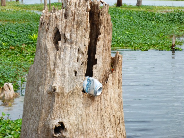
Twice last week, I swam in the blue waters of Cannon Springs. I brought my mask and snorkel so I could see the vent and the fish that swam in the hole. Even from the shore, I could see fish in the spring—the water was that clear. The entire Okhlawaha River is beautiful, but its hidden springs are gems that are worth working for. I had paddled south from the Payne’s Landing entrance and north from Eureka West to see the different moods of the river – the twisty s-turns closer to Eureka straighten out as the river widens on its northward course.

verticaltrees.jpg

I wanted Liz, my fellow adventurer, to see the Okhlawaha River in its lowered—or natural—state, and especially I wanted to show her Cannon and Tobacco Springs while we had the opportunity. I had told her about swimming in Cannon and tromping up to see Tobacco Springs and knew she would want to do the same. After our shuttle, we pulled her kayak and my paddleboard to our launch—which had significantly more water than it did several days ago. I had heard that the water was up, that they were releasing was from the Moss Bluff dam, and from the shore, the flow did seem faster. We shrugged and pointed downstream, loaded with masks, snorkels, and snacks.

As we floated, I tried to point out the features that Karen Chadwick, boat captain for North Star Charters, had mentioned on my previous trip. We had seen wooden remnants of a steamboat launch, one of the 96 landings on the 135 miles along the trip from Palatka to Silver Springs.Okhlawaha.png

When steamboats traveled the river, there were launches almost every mile, dropping off and picking up lumber and other supplies. The St. Johns and the Okhlawaha were once Florida’s highways, making travel possible before roads penetrated the swamps and forests.

Screenshot 2016-02-07 20.03.46.png
File photo, Ocala Star Banner

I love looking at maps and charts, and considering rivers as highways ‘flips’ my perspective on maps. When I want to get from one place to another, I search for roads or maybe trails if I am hiking or biking. Before roads penetrated the swamps, though, land travel was difficult, if not impossible. Most people traveled by boat, so the waterlines on the map—not so much land features—are critical. So, the borders, the intersections where land meets water, those draw my eye because those spaces allowed the interaction of people and place.Screenshot 2016-02-07 20.02.27.png

As we floated downstream towards Cannon, I kept wondering if we had missed the spring. The river seemed slightly different, more swollen, and disorienting. Even the gators seemed larger, and we saw several who did not seem afraid of us. In fact, one swam along with us which was not reassuring on an inflatable paddleboard.


When we reached the entrance to Cannon Springs, I realized how much the water had risen. Only three days before, the spring run was clear, but now it was tannin-colored, and water flooded over areas that had been dry land. We paddled upstream towards the spring and met Karen, Margaret Tolbert and Javed coming back down, their kayaks loaded on Karen’s skiff. Margaret and Javed had been drawing and painting along the river that day. They shook their heads as we passed by. Cannon springs was now brown, its brilliant blue drowned out by the incoming water. I was sorry that Liz did not get a chance to see Cannon in its blue state.

On March 1, the river will start to rise again to flood stage as the Rodman drawdown comes to an end. The Rodman/Kirkpatrick dam will again create the Rodman Reservoir or Lake, and the banks along the Okhlawaha where I saw fisherman, birds, and gators will be submerged for another three to four years.lotsofegrets.jpg

The Rodman Dam was initially built as part of the larger Cross Florida Barge Canal project. The Cross Florida Barge project was stopped in 1971, in large part by efforts of Marjorie Harris Carr, and Cross Barge area has become the Marjorie Harris Carr Cross Florida Greenway. The Rodman Dam, though, has remained in place, a point of controversy between groups who want to restore the river’s natural flow and those that want to maintain the reservoir.

desolation.jpg

Even if the Okhlawaha River were restored to its natural flow, the land needs time to heal. In constructing the aborted Cross Florida Barge Canal, giant crushers rolled along the banks, uprooting trees and shredding the landscape. Landowners along the river lost their property and never regained access to their land, even after the project ended. Today you can see the ruins of the Strange house, now on Greenway land, and imagine the wonderful view of the river they must have had.Lizinhouse.jpg

Slightly downstream of the Strange House lies Payne’s Landing, yet another reminder of loss and heartbreak. In 1832, the representatives of the Seminole and the US Government signed the Treaty of Payne’s Landing in which the Seminole would leave their cattle, relocate to Oklahoma, and received compensation after resettlement. By all accounts, many of the chiefs were bullied or tricked into signing the treaty and refused to leave Florida, a chain of events that led to the Second Seminole War.

We took out at Payne’s Landing and reversed our shuttle. Despite the flooding of Cannon Springs, the day was spectacular, a sunny winter day in Florida, and we were happy to be on the water. Most people are happy at the take-out, and they should be. Whether fishing  or paddling, a day on the water is usually a good day. Nonetheless, there are somber undertones — Payne’s Landing, the crushers, and the incipient re-drowning of this landscape makes me think about the river’s history and the people who have called this home.

Searching for—and Finally Finding—Cannon Springs

riverand clouds3 copy.jpg
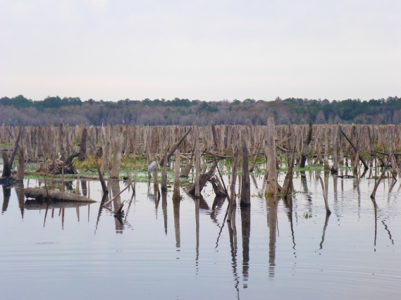
I had started to wonder if Cannon Springs and the Okhlawaha River was going to be my holy grail. Starting in September and lasting until March 2016, the Rodman reservoir on the Okhlawaha River is drawn down, the river-lake levels lowered substantially. This draw down occurs every few years—to prevent fish kills and reduce the vegetation that obstructs the water—and exposes the natural flow of the river.  The lowered levels on the Okhlawaha River offer us a glimpse of the past and a future that could be—without the Rodman Dam. I was especially interested in seeing those springs like Cannon that reveal themselves only during these periodic drawdowns.cspring4 copy

My first attempts to get on the river resulted in a series of major errors—locking the keys in the car at the remote Kenwood boat ramp, battery-less GPS and camera, and less than complete information about boat ramps. (I am now my own case study in fieldwork errors for my Religion and Fieldwork class.) As more and more spectacular pictures adorned my facebook feed, I was even more determined to see—and swim in—Cannon springs.

Finally, I made it—twice in one week. Armed with the GPS coordinates, my husband Kevin and I found the elusive put-in across from Payne’s Landing. We turned down a sandy road, lined with ‘NO ATV’ signs, and bumped our way through the small Hog Valley community towards the river. We launched and pointed our boats upstream. The entrance to the Cannon Springs Run was approximately one mile south of Payne’s Landing, and the entrance had been described as ‘unmistakable’, a tree-lined clear passage. I was also hoping to find Tobacco Springs situated between Payne’s Landing and Cannon Springs.

The river at Payne’s Landing is broad with an expansive vista. Several fisherman sat on the east side of the river, where the draw down has exposed the beach. The day was overcast, but warm, a seemingly auspicious start to our journey.  Some parts of the shore had healthy trees that have survived the flooding, while other patches revealed the desolation of a dying landscape.

2016-01-26 12.20.26.jpg

Heading south, we heard shots which continued for about 15 minutes—target practice, we assumed, so we paddled on, but a bit unnerved. Soon after, the batteries in both the GPS and the camera failed. Three inauspicious signs, but we kept going. We settled into a rhythm against the slight downstream flow and saw woodstorks, ibis, egrets, and a variety of herons—and of, course, gators.

We paddled mostly in the center of the river, avoiding the vegetation near the banks where gators like to hide. Kevin paddled into the vegetation once and heard the unmistakable splash of a startled gator. After about half a mile, the wide river narrowed into a series of s-curves, and dark lines on the trees along the bank told us what has become the new normal for water levels— the flood stage caused by Rodman/Kirpatrick dam. lines copy.jpgFinally, we spotted what had to be the entrance to Cannon Springs. Everyone said that the entrance to the Cannon Spring Run is unmistakable—a tree-lined corridor, and they were right.

cannontunnel3.jpg

The water cleared quickly as we paddled up the short spring run. First we saw several vents that are part of the larger Cannon Spring system, then the blue spring itself.  The spring is relatively shallow so the vent is visible. I pulled out my mask and snorkel and dove into the clear water to see the vent. (Swimming in January is a major benefit of living in Florida.)


Seeing Cannon Springs once was not enough, so when I saw the Aquaholics trip down the Okhlawaha River scheduled for the following Saturday, I immediately signed up. I met the group at 9 am at Eureka West boat ramp, and after shuttling cars to Payne’s Landing, we floated downstream. Karen Chadwick, boat captain for North Star Charters, joined us in her kayak for the float and offered both historical and environmental perspectives on the river and its ecoheritage. She is also Vice President of the Putnam County Environmental Council and member of Florida Defenders of the Environment has been working to restore the Okhlawaha River to its free-flowing state, carrying on Marjorie Harris Carr’s environmental legacy. As we floated downstream, Karen pointed out historical features that I would have otherwise missed and also led us to the elusive Tobacco Springs.

We saw a number of milled logs, remnants of the days of logging the surrounding forests. She also pointed out the wooden remnants of a steamboat launch area. When steamboats travelled the river, there were launches almost every mile, dropping off and picking up lumber and other supplies. The St. Johns and the Okhlawaha were once Florida’s highways, making travel possible before roads penetrated the swamps and forests. Just a few wooden remnants are visible now. steamboatlaunch2.jpg

Then, finally, Tobacco Springs! Kevin and I had looked for it, but never found it. Not surprising – the spring run was clogged with water lettuce. Our group of intrepid kayakers (and my paddle-board) pushed our way through the vegetation until fallen trees blocked our path. We dragged our boats onto the bank and walked a several hundred feet through fairly dry muck. The spring was worth it – deep and not as clear as Cannon Springs, but full of fish. We peered down into the spring from the ruins of an old dock. None of us dared swim here, given the possibility of alligators in the cave below.


Just beyond Tobacco spring, we explored the ruins of the Strange house on land that is now part of the Florida Greenway. Dr. Strange built a house on the Okhlawaha River, complete with pool, patio, and river-front view. The family lost access to the land during construction of the never-completed Cross-Florida Barge canal. Tragically, Dr. Strange and his grandson were killed when their truck rolled into the river.strangedoor copy.jpg


I found my grail – Cannon Springs and Tobacco Springs, gifts from the current drawdown. I hope to get back out again soon. Karen said that the river has already risen, and starting on March 1, 2016, the reservoir will continue to fill, rendering these springs almost imperceptible. The exposed beaches will be submerged again, drowning nesting areas for birds and turtles. I’d like to paddle this section of the Okhlawaha River again, just to see what it is like when the water floods again, but I have a feeling that I will be disappointed. River withclopuds2.jpg

%d bloggers like this: