Spiders, Scrub, and Sweat: Hiking the Rice Creek Headwaters

Grasses in Rice Creek Conservation Areas
Rice Creek Conservation Area

After a summer on the water, I was ready to brave Florida’s August heat for a hike through the Rice Creek Conservation Area. Just west of Palatka, this conservation area’s trails wander through cypress swamps and the headwaters of Rice Creek. Rice Creek flows into the St. Johns River and is listed on Putnam County’s Bartram Trail map. William Bartram, an 18th century Quaker explorer and botanist, traveled through Florida and wrote of his visit in his Travels. 

The Bartram map includes biking, hiking, and paddling trails that incorporate these historic sites, perfect for a mix of history and outdoor adventure and most sites are marked with a QR code, linking viewers to relevant information. Last fall, I joined Paddle Florida‘s St. Johns History Paddle where we explored Bartram sites by water, and I wrote about this trip in In William Bartram’s Wake. Over the past year, I have been scouting sites around the St. Johns River for a Spring 2017 exhibit at the Matheson History Museum, “River of Dreams: The St. Johns River and Its Springs.”

Rice Creek Conservation Area sign.jpg

Rice Creek Conservation Area.jpg
Credit: St. Johns Water Management District

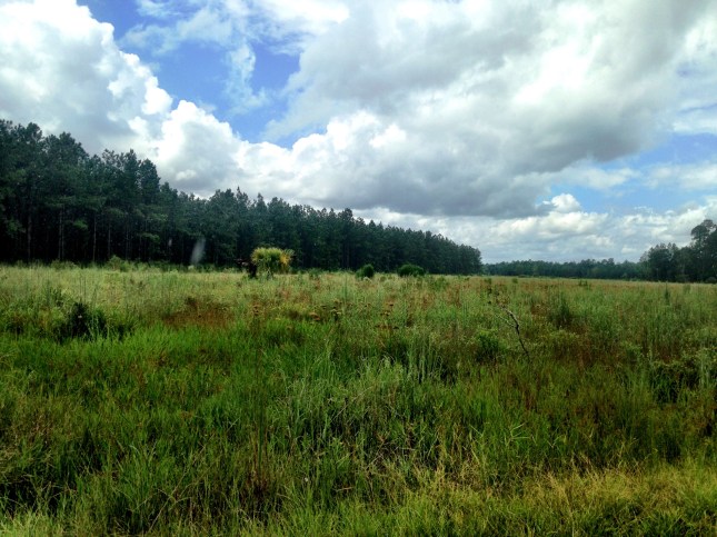
The QR code at the parking lot marked this site as the terminus of Bartram’s trip up Rice Creek. The kiosk explained that this area was established as a rice and indigo plantation in the 1780s, hence the name Rice Creek. After a short walk along an exposed gravel road, we entered the shaded woods. The trail is narrow and crowded with palmettos, cypress trees, and other greenery, typical of the Florida scrub. Spiders had woven massive webs across the trail, and I ducked under these webs.

Walking through this landscape reminds how difficult land travel once was, especially Florida’s swampy landscape. Rivers like the St. Johns and smaller creeks were America’s roads and highways, and people and goods moved by river and sea.

Scrub landscape
Scrub landscape
Spider across the trail
Spider webs across the trail
Bridge to cypress tree
Bridge to view the large cypress tree
Big Cypress Tree
{Enormous cypress tree

We followed the white blazes which soon merged with the Florida Trail.This section of the Florida Trail is raised on a dike and reveals the remnants of the file and drainage system of the rice and indigo plantation. Here, we walked alongside small creeks and swampy areas that comprised the headwaters of Rice Creek. The water was low, but the muddy terrain and cypress knees hint at much higher water levels.

Rice Creek headwaters
Rice Creek Headwaters
Rice Creek Hilton
Rice Creek Hilton
Rice Creek
Rice Creek
Cypress knees
Cypress knees

We walked just over a two-mile section of the area north of SR100, mostly around the headwaters. Rice Creek crosses under SR 100 and flows for approximately 7 miles to the St. Johns River. On January 30, 1766, William and John Bartram landed at the mouth of Rice Creek, then called Gray’s Creek, and rowed upstream.

Bartram on Rice Creek.png
Credit: Putnam county Bartram Trail

“According to John Bartram’s journal, they found the creek to be about 60 feet across and 15 feet deep and meandering in a west by south direction.  After progressing about seven miles, though the water was still 7 feet deep and more than sufficient for their shallow draft vessel, and more than 30 feet wide, they found the creek blocked with trees and snags and turned about to retrace their route back to the St. Johns. ” (http://bartram.putnam-fl.com/index.php/trail-history/sites-1-thru-10/site-3-nbsp-grays-creek-final)

The Bartram Trail Map depicts a route for paddlers, and I have yet to visit this section of river. Apparently, the paddle is wild and beautiful, but this chilling description in the Florida Times-Union gives me pause:

“As we entered the creek, the 50 people on board immediately became silent. There was no sound anywhere, no wildlife except for vultures in the trees along the banks. A deathly pall hung over the area. Even the trees looked sickly and stressed.

The poisons being released into the creek had turned it to a place of death. We learned the tragedy went deep below us to many organisms which, if they survived, would be unable to reproduce.” (http://jacksonville.com/opinion/letters-readers/2011-07-01/story/georgia-pacific-pollution-easily-observed-rice-creek#)

Rice Creek lies downstream of the Georgia-Pacific paper mill in Palatka, and the mill has been discharging waste into Rice Creek since 1947.Fortunately groups such as the St. Johns Riverkeeper have been working to mitigate damage to Rice Creek and the St Johns.

William Bartram encountered relatively clean, although inhabited, landscapes and waterscapes and wrote of their beauty. Following in his wake and imagining what he saw helps me see these places with fresh eyes and reminds me these land and waterscapes are my home and worth protecting.

Vista.jpg

SUPPing for Scallops

IMG_2206
Launch site at Rocky Creek Road


Hagens Cove cloudscape

On July 4, fueled by a hearty stack of blueberry pancakes, Jill, Scott, Kevin, and I launched three kayaks and one paddleboard from Rocky Creek Road, just south of Steinhatchee.  I had always thought that a paddleboard would work well for scalloping because it is so easy to jump on and off the board. I brought my 10 1/2 foot inflatable board which could keep up with the longer kayaks for this short distance. So boards and boats loaded with snorkeling gear, mesh bags, and water, we headed out down the creek and  out into the Gulf. Most of the area is too shallow for large motorized boats, so ideal for kayaks and paddleboards.

Loaded Paddleboard
Loaded paddleboard

We saw a line of motorboats anchored a mile or two offshore, and we paddled to an area about halfway between the boats and the shore. After twenty minutes, we reached the longer sea grasses that scallops like and donned masks, fins, and snorkels. Jill and Scott had made floating scallop nets with pool noodles and mesh bags, and we each tied one to our boats and board.

Pulling our boats and board with bow lines, we swam around the grasses looking for the tell-tale lines of glowing blue “eyes.” It was close to high tide, and the water was about 3-4 feet deep, ideal for scalloping. Shallower than that, and seeing the scallops becomes difficult because you stir up silt as you step on or swim close to the bottom. At first, I didn’t see any, and I worried I would be THAT person who came up empty-handed. As my eyes attuned, I began to catch more and more scallops. I expected them to hide in the grasses, but instead they lay out in the open, in beds of brownish muck. Catching scallops is mostly a matter of reaching and grabbing. But, when motivated, they will zip away.

We swam and swam, loading our mesh bags. I wasn’t wearing a watch and was surprised when Jill said it was almost 5 pm. We all had plenty of scallops, although nowhere near our limit. Paddleboarding out was a breeze, but paddling back with a mesh bag full of scallops was like dragging a sea anchor, so we loaded the bags into the kayaks.


IMG_2208
A cooler of scallops

Scallops in cooler and boats/boards loaded, we drove back to Steinhatchee in search of beer and scallop shuckers. Signs advertising shucking services lined the road, but the shuckers had been shucking all day and they were done—how did we not foresee this on the Fourth of July? We drove home, resigned ourselves to watching educational YouTube videos on shucking scallops, and took solace in pizzas at Blue Highway Pizza. The next day, we honed our shucking skills and feasted on garlic scallop pasta.

Scalloping at Hagens Cove
Wading out at Hagens Cove
Searching for scallops
ready for scallops
Ready for scallops
Hagens Cove Park
Hagens Cove Park

Two weeks later, emboldened by our success, Kevin and I returned to Steinhatchee with my mother, a novice scalloper. We chose Hagens Cove, north of Steinhatchee, because it offered beach access scalloping, just a quarter mile from shore. I brought my paddleboard as a platform for gear, food, and water and a floating pool chair for my mother. This area was shallow, and we waded and snorkeled out until it was deep enough to find scallops. As we got further out, the scallops grew larger and more plentiful. A darkening sky and lightning eventually drove us back to shore, and we returned to Steinhatchee. We enjoyed a terrific meal at Kathi’s Krabs while our scallops were being shucked.

Kathis Krab Shack
Kathi’s Krab Shack in Steinhatchee
Horseshoe crab
Horseshoe crab

The scallop season (from June 25-September 24) is almost half over, and the Gulf waters have warmed to bathtub temperatures. Whether I go scalloping again this season or not, I’m sure I will get out again on my board. The calmer Gulf waters are perfect for paddleboarding, and when clear, I have seen a variety of marine life standing on the board.

Save

%d bloggers like this: