Tomoka-Paddling a Hidden Gem

2019-01-07 16.36.55

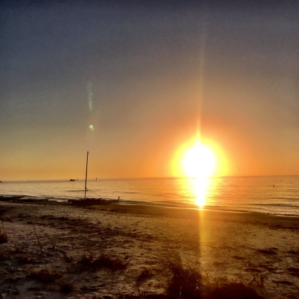
Tomoka, Bulow, and North Peninsula—it would be easy to fly over these gems cruising down I-95. But you shouldn’t. Nestled in the coastal waters between Ormond Beach and Flagler Beach, these parks showcase all that Florida’s coastal areas have been and can be.

the-loop
Old KIngs Road (Courtesy of Tripadvisor)

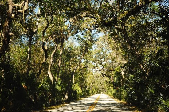
Your approach to the parks begins on the Old Kings Road. Driving through this canopy of trees made me realize that this might not be the Florida I thought I knew. Old Kings Road was one of Florida’s first major roads, designed over 200 years ago for north-south transit. As any Floridian knows, overland travel through Florida’s dense scrub landscape was—and is—dangerous and difficult. Creating a road was no easy feat. According to history buff Jim Massfeller, after Florida moved from Spanish to British rule in 1763, the road was commissioned to reach from Pellicer Creek to the Indian River. Today the road forms part of what some call the Daytona Loop and is used by bicyclists, motorcyclists, and paddlers eager to paddle through history.

I had been eager to paddle Tomoka and Bulow State Parks for a while now. Both combined coastal estuary paddling with an area rich in history. Jill wanted to visit these parks for FPTA‘s annual reunion for those who have completed Florida’s Saltwater Circumnavigational Trail which will be held in Tomoka State Park. Those paddlers might have rushed through these parks on their expeditions, but now they will have the luxury of touring the area slowly.

2019-01-07 14.00.51
Tomoka State Park Campsite

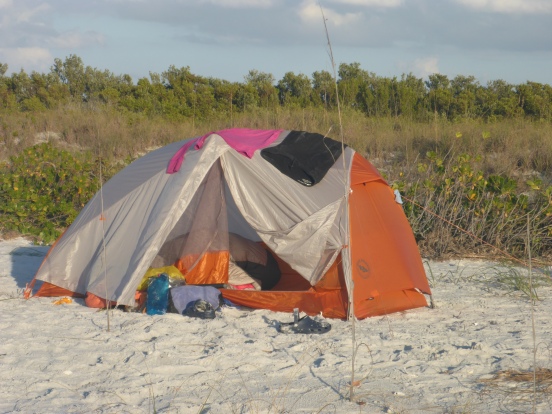
Jill and I found a shady campsite at Tomoka State Park. Mid-week on a January, the park’s campground  was relatively available and quiet. We camped on of the loops in the main campground. The group campsite is larger and has water access from a small dock.

2019-01-08 09.56.05
Tomoka State Park group campsite

After we set up our tents, we set out to learn about the park’s paddling opportunities. The park ranger directed us to the Tomoka Outpost, the camp store that also rents boats and other gear. They are also the local source for Tomoka IPA and Cajun boiled peanuts, perfect post-paddle snacks.

2019-01-08 09.57.21
A very calm Tomoka River
IMG_2149
Side creek on the Tomoka River
IMG_2147
Perfect for paddleoards

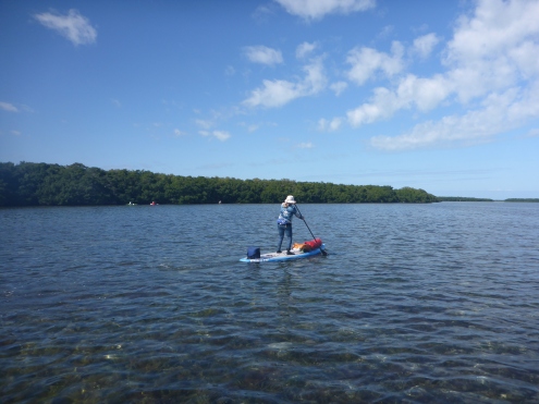
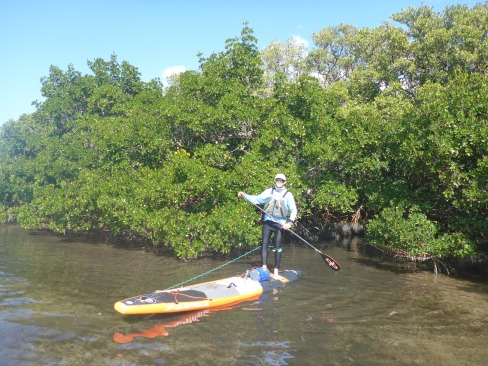
The Outpost sits directly on the Tomoka River and offers access for kayaks, boards, and motorboats. We had time that afternoon for a short paddle up and down the Tomoka River. That short paddle gave us an idea of the area and lets us explore some side creeks as well. On that day, the river was glassy, but a windy day might make things a bit more exciting.

IMG_2153
Boat launch and deck
2019-01-08 10.14.45
Critical information

After our paddle, we returned to the store to explore options for longer paddles. The store manager was extremely helpful about places to paddle as well as tides. The kiosk outside the store has a map of paddling trails inside the park. She also had a map of a longer-more tidal influenced paddle that extends beyond the park. The Tomoka River Paddling Guide has mileage and locations as well.

2019-01-08 10.36.08
Kiosk with paddling information
IMG_2154
Satellite photo of paddling options in Tomoka Outpost

These trail maps give multiple options for paddling, ranging from 1-2 hour out and back to a day  long loop trail. Make sure to check the tides—especially for the longer paddles. The manager told us to look at the Halifax River spot on Tides4fishing.com and to add 45 minutes. The paddling here is coastal estuary paddling at its best. The nutrient-rich marshland supports a a host of birds, fish, and marine mammals.

In addition to paddling, Tomoka State Park also has walking and hiking trails. One trail leads to a statue of Chief Tomokie. The Timucuan Native Americans lived on this site prior to Spanish and British colonization. Native Americans had lived in the St. Johns River region for over 10,000 years, and archaeologists are still studying their remains, including pottery and villages.

Screen Shot 2019-02-17 at 1.28.47 PM
Chief Tomokie (Courtesy of Florida Memory)

Several miles from Tomoka State Park, Bulow State Park showcases a later piece of Florida history—the Bulow family’s sugar plantation. In the late 1700s and early 1800s, British and Spanish immigrants established rice, indigo, and sugar plantations in what was then called East Florida. The extended Seminole Wars destroyed the Bulow Plantation and others like it, but the ruins tell an important part of Florida’s early history.

2019-01-08 12.12.03
Entrance road to Bulow State Park
Screen Shot 2019-02-14 at 1.23.04 PM
(Courtesy of Florida State Parks)

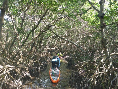
The long skinny Bulow State Park has multiple entrances, and it would be easy to end up at the wrong one. (And how do I know this?) The northernmost entrance holds the ruins as well as the kayak launch, and this paddling trail takes you from the historic plantation to an estuary paddle. From this launch, you can paddle upstream about 3.5 miles before the Bulow Creek become impassible. Others enjoy a downriver paddle to either the Waller Boardman Bridge or the High Bridge. Note that parking at the Waller Boardman Bridge is extremely limited. The park also has extensive hiking trails for those who need some walking time.

Screen Shot 2019-02-14 at 1.34.38 PM
(Courtesy of Florida State Parks)
Screen Shot 2019-02-14 at 1.33.27 PM
(Courtesy of Road Trippers.com)

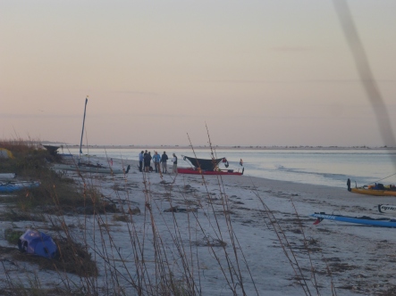
If you are ready for some surf or maybe some beach time, North Peninsula State Park is just up the road, one of Florida’s many beach front state parks. Paddling, hiking, or just chillaxing, you can’t go wrong with any of these parks.

Screen Shot 2019-02-14 at 1.26.35 PM
(Courtesy of Authentic Florida.com)

Testing the Waters: WaterTribe Boot Camp 2019

2019-01-12 11.41.28.jpg
Ready to go at Fort De Soto Boat Ramp

Can I paddle 300 miles in 7 days on a paddleboard? Do I want to attempt this feat? The WaterTribe Everglades Challenge is “an unsupported, expedition style adventure race for kayaks, canoes, and small boats” from Tampa to Key Largo, approximately 300 miles. The shorter Ultramarathan—the sprint version—extends the 67 miles from Tampa to Placida. The Watertribe blend of endurance, navigation, and expedition has tempted me ever since I first learned of this event. In January 2019, I attended the WaterTribe Boot Camp in Fort De Soto Park to see if I had the right stuff to enter the race in 2020.

2019-01-12 11.41.34
Boards Loaded and Ready to Go

The Boot Camp format consisted of a talk by Chief followed by a paddle and camping trip on Shell Island. Chief’s talk covered a range of topics critical for both starting and completing the challenge safely. A paddle or sail down Florida’s coast through the Everglades and Florida Bay is a serious undertaking. I already own and carry much of the safety gear based on my kayak training, but he reinforced the idea that critical gear should be carried on our bodies or PFDs. In my 5* BCU class, Gordon Brown emphasized the same point as we practiced on-water boat repairs. Chief’s mantra regarding GPS devices stuck with me: Two is one, and one is none, an accurate reflection of my experience with marine devices. Salt water and GPS’ do not play well together.

screen shot 2019-01-16 at 4.45.51 pm
Courtesy of WaterTribe.com

Chief also posed a question that each of us can only answer for ourselves. What are your goals in this challenge—to win your division or to finish? To me, finishing would be a victory. As Chief spoke, I did the math in my head. The event is almost 300 miles, and you have 8—really 7—days to get to Key Largo. The final party is in Key Largo on the 7th day, and I am not one to miss a party. That means approximately 45-50 miles per day. Can I handle the mileage and pace for 7 days straight? I have a year to figure that out.

My first challenge was finding a trail name. All long distance paddlers and hikers need a trail name. Through hikers on the AT and PCT have creative names, and I wanted a name that would also work for my upcoming AT hike. So I became Flamingo, and Janice chose HighTea in homage to her British heritage.

screen shot 2019-01-16 at 4.50.18 pm
Courtesy of WaterTribe.com

After Chief’s talk, the group headed to the beach where an array of boats and boards lined the shore. I was relieved to see another paddleboard there, but I was surprised to see so many sailing Hobies. I had assumed there would be more kayakers or canoers. One kayakers was incredulous when I revealed that I had a kayak at home. Why a paddleboard, he asked? I don’t think I can answer that, other than that I love the freedom of standing on a SUP.

2019-01-12 12.11.54
Crossing the bay
2019-01-12 12.11.43
Clear waters around Shell Key

We launched from the boat ramp for the short paddle to Shell Key. Chief had sent us coordinates and waypoints for the campsite on Shell Key and for several paddling options. The Challenge itself leaves from a beach facing the Tampa Bay shipping channel, and crossing a shipping channel is always nerve-wracking. For the Boot Camp, the weather was sunny and warm, and the water glassy, but conditions are rarely that benign for the Challenge.

2019-01-12 12.24.46
A tight squeeze
2019-01-12 12.33.20
Wrong way

Plan A involved paddling through a mangrove tunnel, then through Bunce’s Pass to the outside of Shell Key. We paddled around a small island searching for the promised mangrove channel. We made it about 50 feet then realized it was a dead end. Since it was too narrow to turn around, we paddled backwards—fin first which might turn out to be a useful skill. On to Plan B, we crossed the shallow flats, passed the motorboats lining Bunce’s Pass, then headed north to find out campsite.

2019-01-12 17.06.17
Drying gear
2019-01-12 14.42.43
Beach camping

Our group camped midway up the beach. It’s hard to believe this level of wilderness camping exists so close to St. Pete and Tampa. I set up my 1-person tent that I bought for the Appalachian Trail. Packing like a backpacker is crucial to SUP expeditions. The weight must be balanced and centered. The Hobie Mirages might carry 80 pounds of gear, but I can only carry approximately 30 pounds, including water, on my board. One new tip: pool noodles. From now on, I’ll stow them in my gear bags to increase flotation in case of capsize. One of the best parts of the Boot Camp was picking up tips about gear and packing. The other part: the people.

img_2163
Sunset
2019-01-13 07.38.36
Early morning coffee klatsch

The WaterTribe draws kindred spirits. After all, only so many people want to paddle from Tampa to Key Largo in any vessel, much less a paddleboard. After the sun set, we gathered around the campfire and traded stories. Though people came from all walks of life, it was a congenial and helpful group. I now understand why people come back year after year.

2019-01-13 09.55.06
Abandoned boat near Bunce’s Pass
2019-01-13 11.36.14
Skyway Bridge
2019-01-13 11.36.09
Cargo Boat in the shipping channel

The next morning, I drank coffee as the sun rose, a luxury I might not have during the Challenge. To make miles, I assume that I’ll be on the water before dawn. Most people savored the slow morning and moved on to their own adventures by 10 am. Janice and I paddled around Mullet Key to see the launch site. As we headed back, the wind came up, a premonition of future conditions.

I have no doubt the Everglades Challenge will be difficult, probably one of the hardest things I will ever do. Between now and Challenge 2020, I’ll hike the Maine section of the AT and kayak Alaska’s Inside Passage which will prepare me. I’ll also train on the paddleboard and consider what size and length board will work best for me. I already know that my 12′ Fanatic is too slow. But I look forward to the next year of training, planning routes, and figuring out gear. Do I have the right stuff? I’ll never know unless I try.

bird


Paddling and Plunder in Matanzas Inlet

It’s that time of year. The best time of year–Matanzas! Only four more days.

Heading out

Every February Dale Williams of Sea Kayaking USA gathers his band of paddlers for a week of rough water training in Matanzas Inlet. Shaped like a ‘C’, the Matanzas River flows from St. Augustine Inlet southward to Matanzas Inlet so tidal flows and currents affect both north and south inlets. St. Augustine was the first permanent European settlement in what would later become the United States, and this historically-rich region reveals much about our past, missions, battles, pirates and plunder. But who can focus on history in the surf? As I bounce around in the chop, surf, and shoot through standing waves, enjoying the coastal chaos that river mouths offer, my world shrinks to body, boat, and blade.

Matanzas Inlet
Matanzas Inlet in north Florida (Courtesy of Google Maps)

We’re paddling sea kayaks, many of us in 16′ NDK Pilgrims and Romanys, designed by Nigel Dennis from Anglesey Island in Wales. Nigel designed these boats to handle the lumpy waters, or ‘jobbledy bits’, off the coastal UK. We’ve discovered that these kayaks make terrific surf boats, and we have plenty of surf in the southeast.

With the right conditions—swell, wind, and current, Matanzas Inlet offers near perfect waves for surfing our 16′ kayaks. Long boat surfing occupies a tiny niche in the kayak world, but the few of us who surf are addicted. Dale chose Matanzas Inlet because its shifting sandbars provide both excellent surf and a range of conditions to accommodate different skills levels. Not surprisingly, these conditions result in numerous opportunities for self- and assisted rescues.

Matanzas Inlet
(Courtesy of http://www.skypic.com)


We gather from many points in the US. The Texans, Louisianians, and Floridians among us don drysuits against Florida’s February chill, while some of the braver folks from Michigan and New England wear shorts. For them, Florida’s February might as well be summer.

On the beach

Some of us are training for the American Canoe Association’s (ACA) Advanced Coastal Kayaking Instructor Award, which requires a combinations of factors including 3-5 foot seas, 15-25 knots wind, 3-4 surf break, and 5 knots current. This means not only surviving these conditions but teaching, playing and rescuing in them. Each morning and evening, we meet on the porch of our shared house for Dale’s “academics”, where we discuss surf and rescue techniques and topics such as navigation and marine weather. By the time we reach our launch site, the day has warmed to a temperature even I can tolerate.]

Matanzas Launch
Preparing to launch
Massacre of the French Marker, Matanzas Inlet
Photo credit: George Lansing Taylor, Jr. UNF (https://digitalcommons.unf.edu/historical_architecture_main/3343/) Sponsors: in cooperation with St. Johns County Historical Commission

An historical marker describing the 1565 ‘Massacre of the French’ marks our path through the dunes. We refer to ‘Matanzas’ so casually—”Are you coming to Matanzas this year?” Even though Fort Matanzas National Monument sits just upstream, it’s difficult to imagine that this tranquil inlet hosted such bloodshed and cruelty. The Spanish massacred over 300 stranded French mariners in this place. I’d reflected on this before, the incongruity that places of great beauty and tranquility mask bloody histories. Just north, for example, Fort George Inlet near Jacksonville was the southernmost point of the Low country slave trade.

Our schools teach a myth of origin that revolves around New England, pilgrims, and religious rebellion, but Spanish rule of Florida began in 1513, prior to any British settlements. The First Coast endured waves of French, Spanish, and British newcomers who eradicated indigenous populations, and, often, each other. In 1742, the Spanish built Fort Matanzas to guard against British incursions, and they ruled Florida until 1763. The British gained control from 1763-1783, ceded Florida back to the Spanish in 1783, and regained the territory in 1821.

The sandbars that guard the entrance to the river mouth shaped Florida history. The shallow waters of Matanzas Inlet protected Fort Matanzas and St. Augustine from British invaders, but they also led to plunder and piracy. Pirates chased ships aground onto sandbars along the Florida Coast and plundered the cargo. Wreckers, as described in Tim Robinson’s Tales from Old Florida later replaced pirates and salvaged materials from ruined boats, establishing settlements in the process. River mouths were treacherous to anything other than small, nimble boats.

Map of Matanzas 1742
Map of Matanzas 1742 (Courtesy of Florida Center for Instructional Technology)

This 1742 map shows how the Matanzas Inlet shoreline has changed, which is what happens with sandy coasts. Unlike the rocky coasts of the northeast and Britain, our river mouth hydrology changes with every hurricane and every major storm. NOAA charts illustrate permanent land masses and static navigational features, but sandbars come and go, so that we re-learn our coasts after every storm.

Matanzas WavesMatanzas NDKs

And this is why we train here. To learn how to navigate through the changing hydrology of sandbars and river mouths. Some paddlers were exploring these features for the first time, learning to brace and roll in the waves. Others, like myself, were learning to lead other paddlers, to bring groups safely through a surf zone with breaking waves up to four feet. This means not only leading groups out through waves, but bringing them back through the waves. Like climbing, it’s easier to go up or out than down or in.

The strong tidal currents of the Matanzas River, combined with strong winds, made rescues and group cohesion difficult. An out-going tide could sweep boat, victim, and rescuers out to sea. We had some unusual challenges, one afternoon, a bank of fog descended on us, rare for Florida. This is why we practice in this venue, to be prepared when the rescues, capsizes, and out-of-boats experience are real.

Surfing at Jax 3
Surfing at Jax Beach Photo credit: Joe Crespi

On our first morning, the conditions were big, maybe too big, but the waves were clean. Dale gave us free time to play and surf as a warm up for our subsequent training. At one point, I realized that we had company—two dolphins were also playing and surfing in the waves. As they leapt over the waves, they exposed their full bodies—nose to tail, something I rarely see. It’s a gift and a privilege to play with dolphins. So, forgetting the pressures of training and the ravages of history, I surfed under the bright February sun.

Paddling

%d bloggers like this: