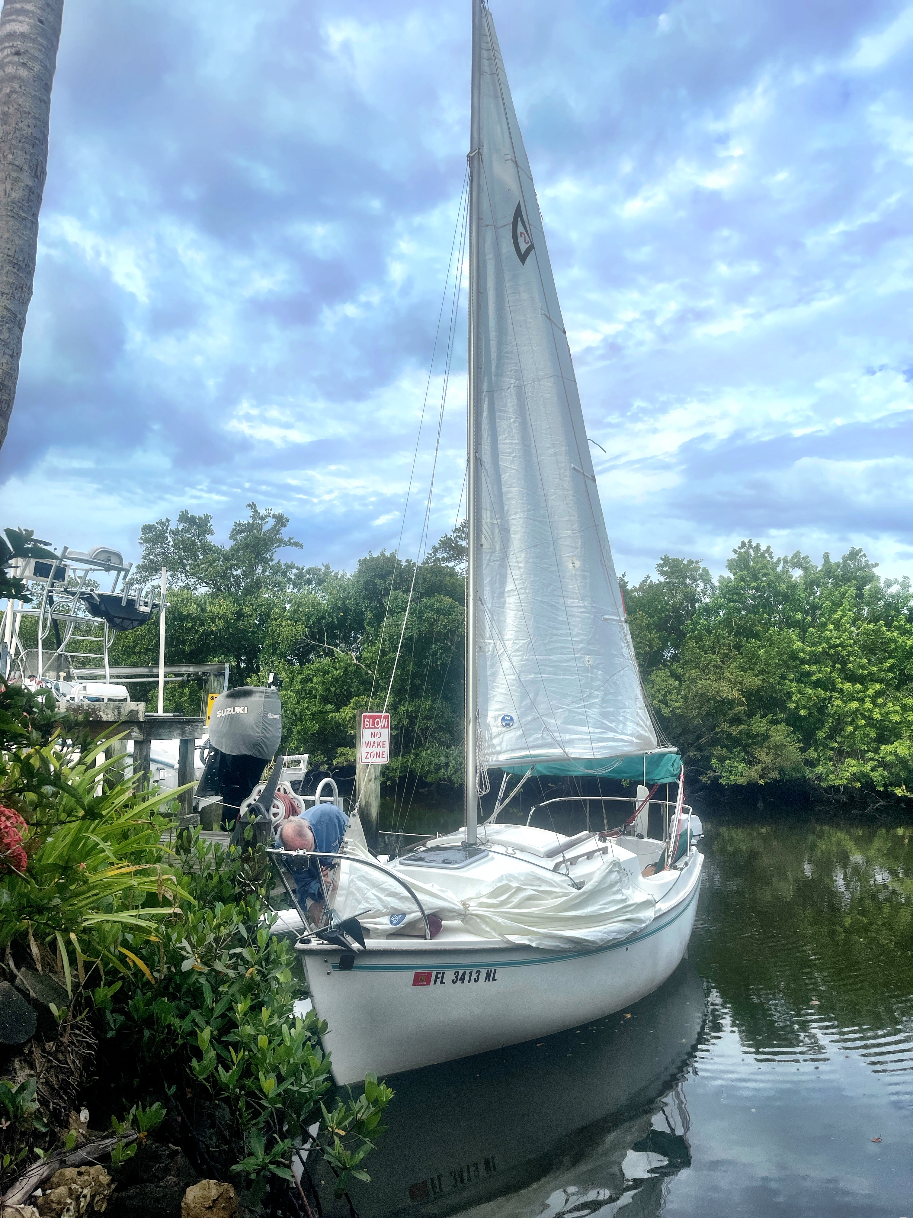
A break in the wearther between storms — we’re off! With board, board, and gear, Kevin and I fought wind and rain to reach Goodland, Florida. Our plan: 5 days exploring land and water in Rookery Bay and the Ten Thousand Islands to test new gear. My new board — a Sic Maui RS Atlantis 14′ x 24″ — and new rigging for our floating tent, a Sanibel 18 sailboat. New gear almost always creates an adventure..
There’s a boat ramp in here somewhere
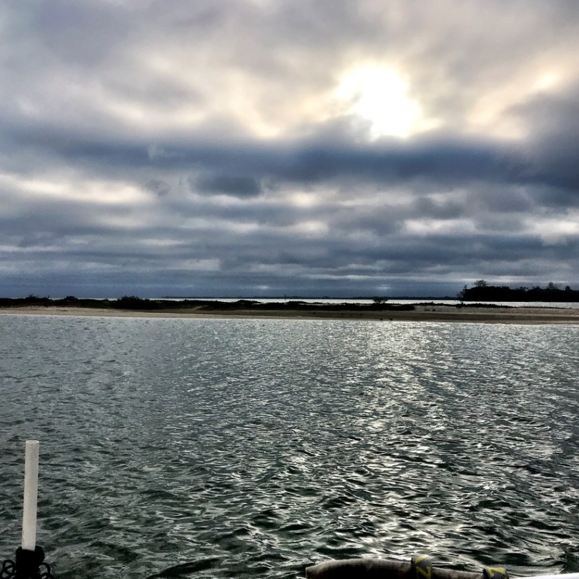
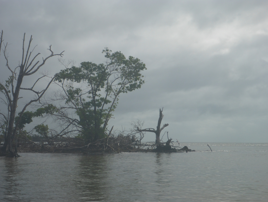
Threading the needle
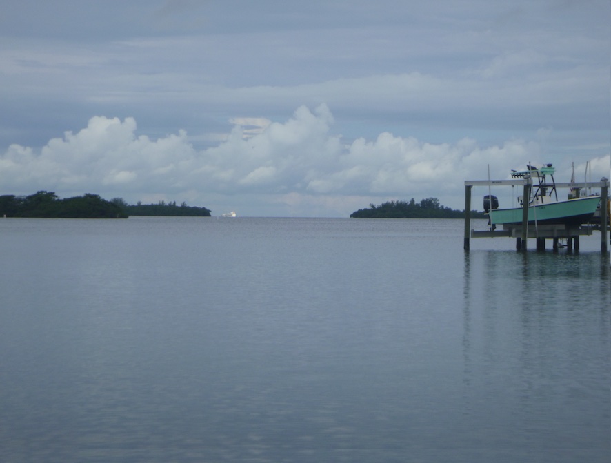
First up: launching in the midst of a marina make-over. Jackhammers pounded our ears as we set up the boat. By late Thursday afternoon, we were anchored near the marina and ready to north towards the Isle of Capri the next morning.
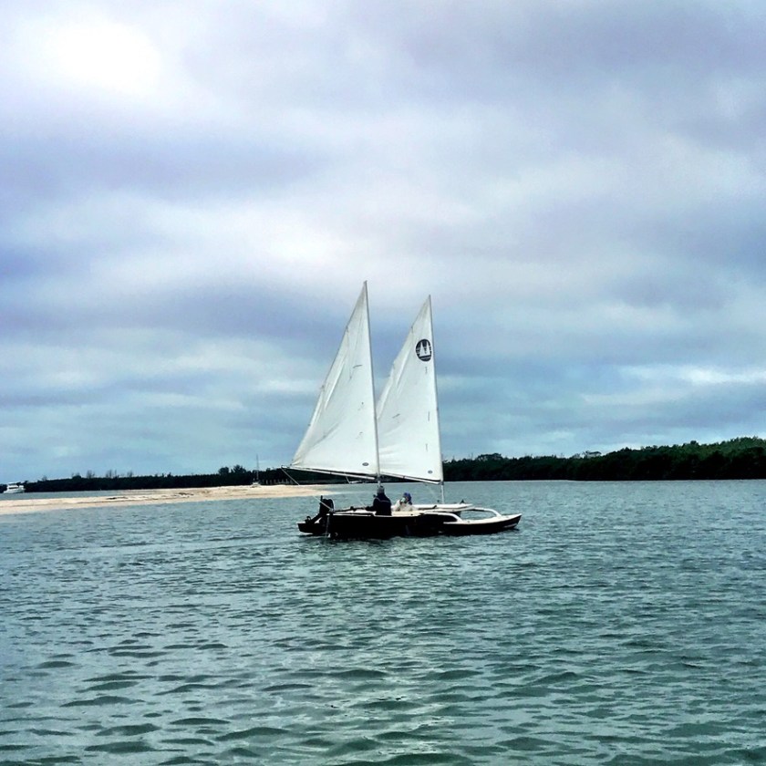
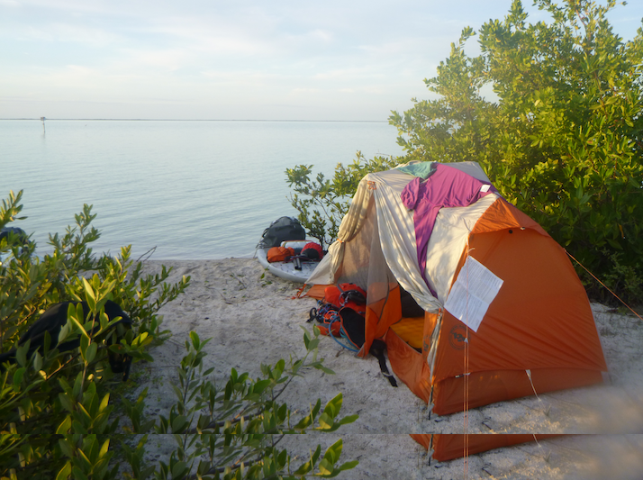
KneeDeep 1, our floating tent
Bivy gear for when plans go awry
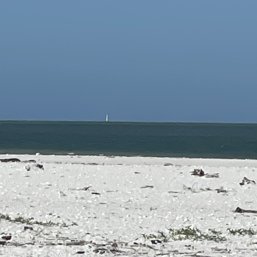
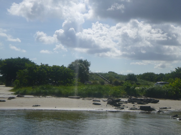
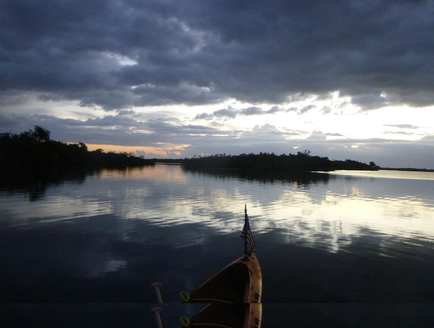
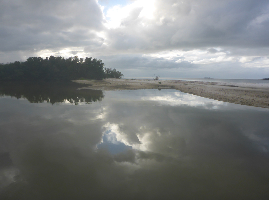
Friday’s goal: a Johnson Bay anchorage. Kevin sailed out Caxambas Pass, along the outside, and back up Big Marco Pass. I paddled up the Marco River past Goodland, though the mangroves near Paddlers Park, and into Johnson Bay. I sat on the beach at the mouth of the pass, watching for Kevin and enjoying the clear water and white sand. I knew the boat wake and shoals would make for a challenging sail up the pass. The tides didn’t favor either of us that day, but we still made it to our anchorage on time.
From Goodland to Johnson Bay, near Isle of Capri
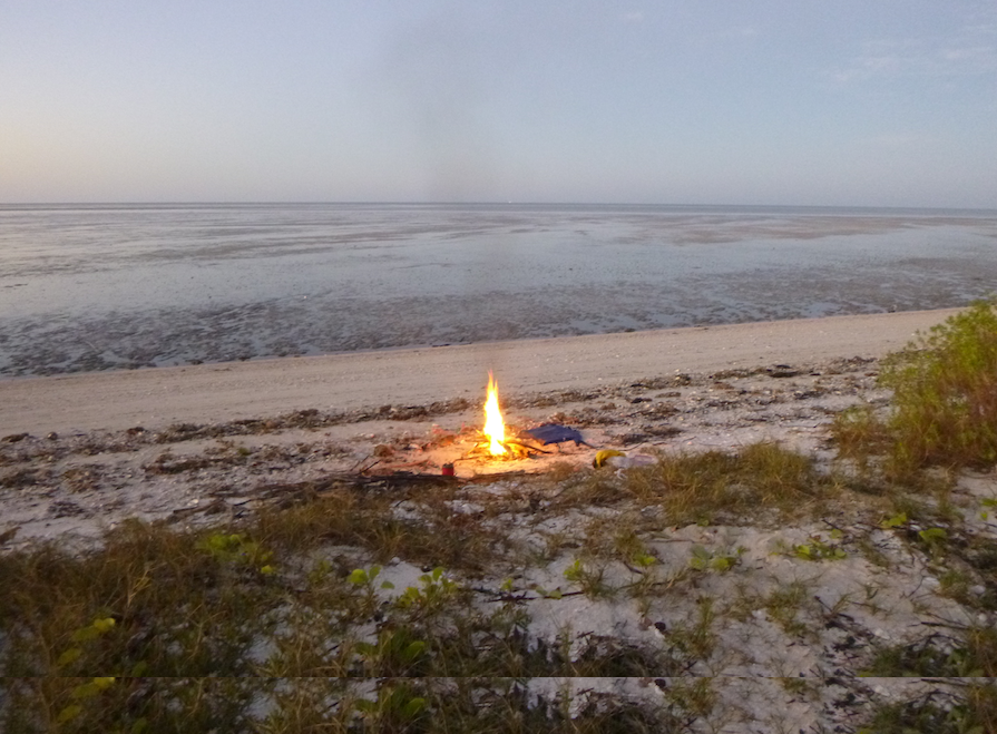
Prime viewing for sunsets and star-gazing
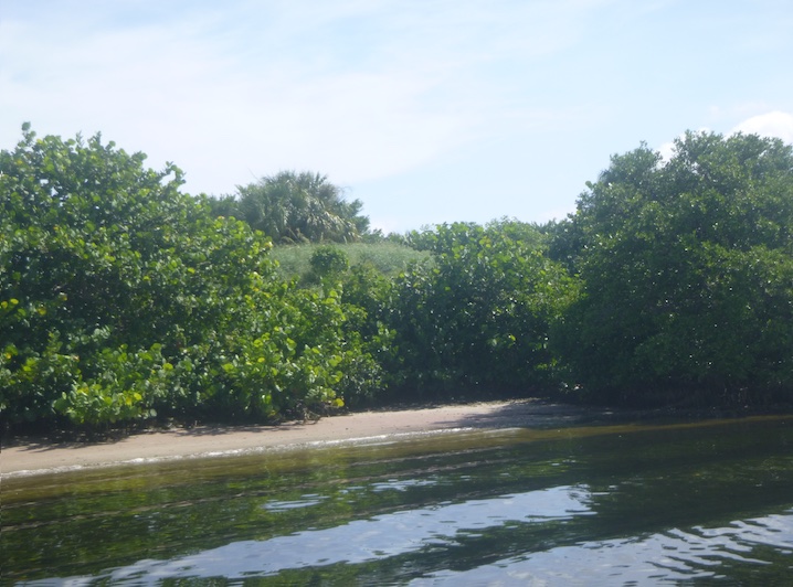
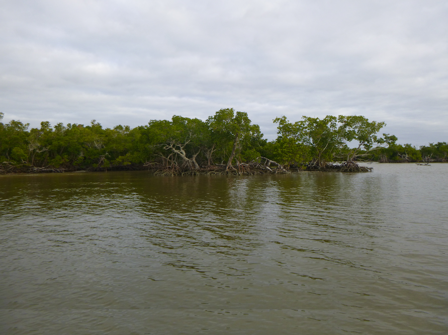
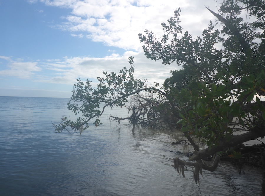
Saturday: exploring nearby bays and the islands near Big Marco Pass. Wind and waves helped us test our gear. Kevin tweaked new reefing and rigging systems, and I worked with wind and boat wake in the mangrove channels. Boat wake in narrow channels is challenging because you get both the original swell and refracting waves. The Atlantis board is a dug-out style, meaning that its higher walls give both secondary stability and keep me closer to the water. Even though this new board is narrower than my other board, it handles conditions well.
Johnson Bay to Caxambas Pass
Dickman Point
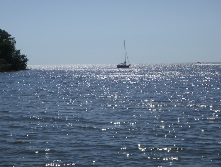
Kevin on the horizon
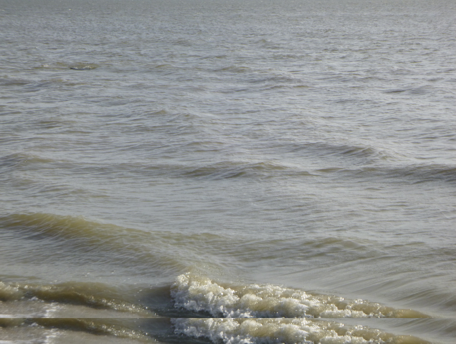
A sporty day en route to Caxambas Pass! The wind dropped, but the waves continued rolling in. We rode the tide out Big Marco Pass, and a welcome tailwind pushed us along the coast of Marco Island towards Caxambas Pass. I had to stay outside the breaking waves or risk getting barrel-rolled in the surf. Not fun with a loaded board. Kevin sailed around the outside, while I explored bays and islands around Caxambas Pass and Dickman Point.
Parade of barges in Caxambas Pass
We anchored in Caxambas Pass that night. hoping for protection from a north wind. The wind never rose as expected, but the strength of the current in Caxambas Pass surprised us. Tying off the board to the boat was difficult as I held a rope in one hand while tying off with the other. Failure was not an option.
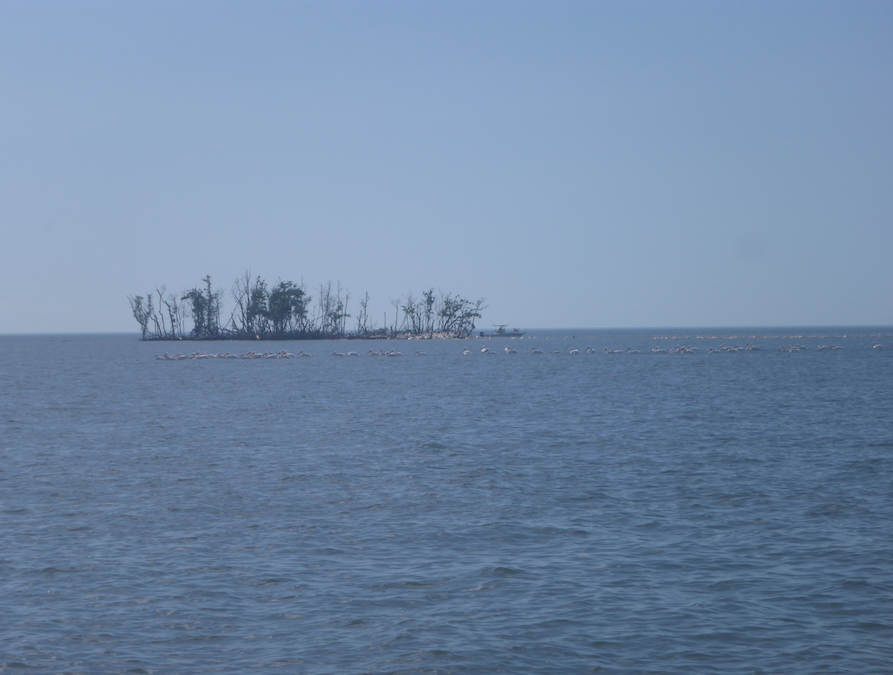
Roseate spoonbills in Caxambas Pass
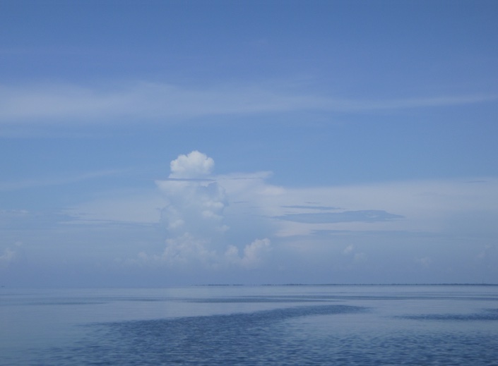
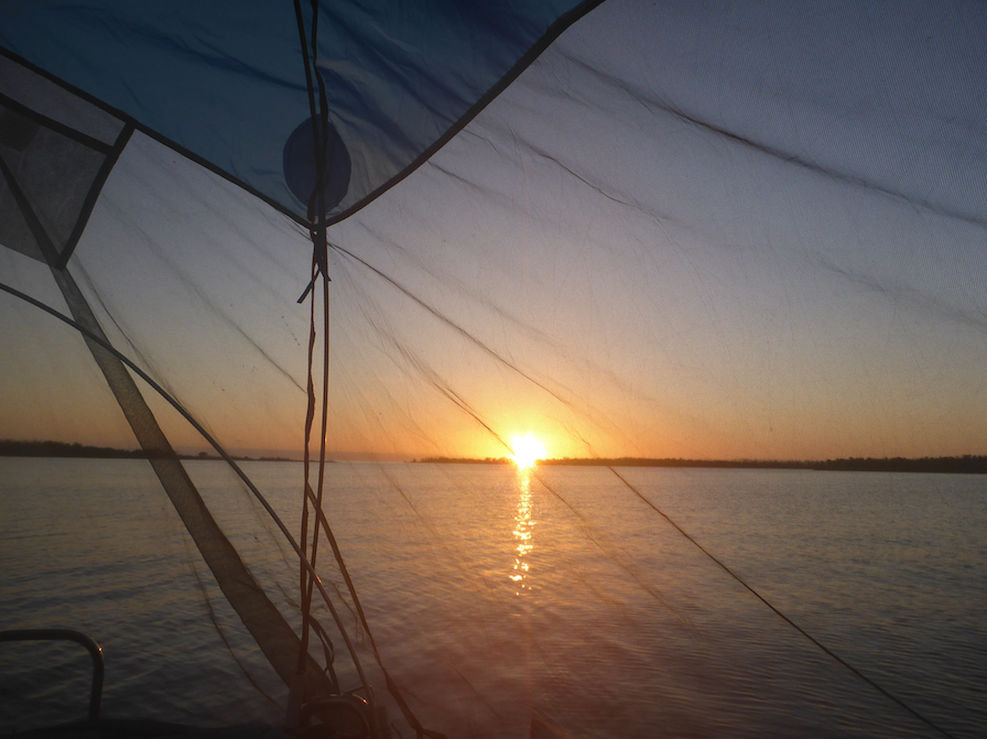
Sunday — a glorious day for me with clear skies and no wind. For sailors, not so much. I saw birds along the Morgan River, relaxed on Cape Romano, and watched sea life below as I crossed the sand flats in Gullivan Bay. Meanwhile, Kevin dozed while KneeDeep heaved to and drifted slowly.
Clear water on the sandflats in Gullivan Bay
Caxambas Pass to Tripod Key
Morgan River near Cape Romano
Cape Romano
Gullivan Bay
We met later that afternoon near Tripod Key, a short distance from our take-out in Goodland. Even then, as predicted, the weather was changing, and we wanted an easy exit. As I was paddling up Coon Key Pass, I chatted briefly with a paddler headed out for the night. It turned out to be Kayak Flexafari, a paddler whom I followed but had not yet met in person. Small world and great to meet in person.
Flock of pelicans
As predicted, the wind came up the next morning. Fun enough for a sporty sail and paddle in the morning, but seriously gusty by the afternoon. Taking out the sailboat was the biggest challenge of the trip. Overall, we lucked out with our weather window. Enough conditions to make things interesting, but no white knuckles. And we almost followed our Plan A. Usually we’re down to Plan G by the time the trip is over.
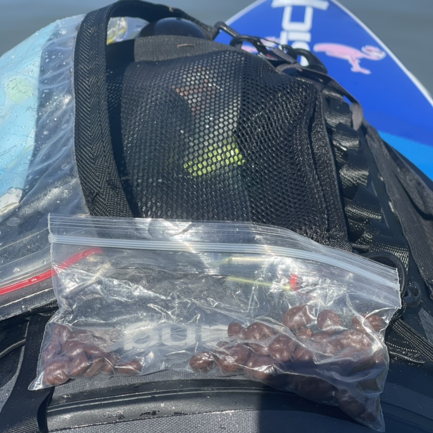
Raisinets–a poor choice in south Florida heat
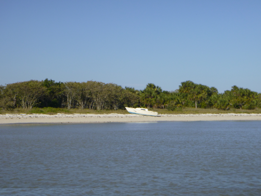
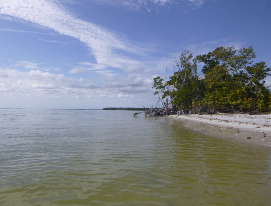
The Ten Thousand Islands, Rookery Bay, and Everglades region is one of my favorite places in Florida. White sand beaches and spectacular sea and bird life. With all the islands, rivers, and channels, I always find something new to explore. On this SUP and sail trip, Kevin and I had the luxury of our floating tent. But Rookery Bay and the Ten Thousand Islands offers plenty of white sand beach camping opportunities, sites I have used on previous trips. I’m looking forward to our next trip back in January.
SUP and Sail in Tampa Bay in August? But why? The weather swings between dead calm and squalls, making both sailors and paddlers cranky. But we needed to test our Sanibel 18 sailboat—KneeDeep 1, newly rebuilt after two years languishing in the yard. So off we went, boat and board, to Terra Ceia, Florida at the south end of the Sunshine Skyway Bridge.
On the roadOur Tampa Bay PlaygroundTerra Ceia
Our mission: prepare KneeDeep l to be our floating home for upcoming sailing and paddling trips. On our SUP and Sail trips, Kevin sails, I paddle my SUP, and we meet at a designated anchorage at the end of the day. A good test of our navigation skills as well as our relationship. With an 14″ draft, KneeDeep l is ideal for navigating the shoals of southwest Florida and the Everglades. But if our larger sailboat, an O’Day 222, is a floating tent with a vestibule, KneeDeep l is a floating bivy. A floating bivy that will shelter us for West Coast Trail Sailing Squadron trips and, more important, house Kevin during the Everglades Challenge in March while I’m paddling.
With help from Andy Bartley and Mary Mangiapia, we launched the boat just past high tide on Sunday afternoon.
Terra Ceia and the south end of Tampa Bay was new to me, so I consulted Florida Paddling Trail Association‘s (FPTA) website which suggested several routes. Additionally, the Manatee County Paddling Guide offered routes as well as information about local history and the ecosystem. Brooke Longeval also shared a route around Rattlesnake Key and Emerson Point. In the end, I created my own routes, but these resources gave me a start.
Over the four days, I paddled to Emerson Point and around Rattlesnake Key, under the Sunshine Skyway Bridge, and partly across Tampa Bay towards the large American flag on Mullet Key, the start of the Everglades Challenge. The afternoon storms limited my range—I never wanted to be too far offshore when the inevitable storms blew up. And after a 52-mile training paddle the previous weekend, I needed to ease my way back into my Paddle Monster workouts. But I feel like I barely scratched the surface of the paddling this area offers.
A speck on the horizon
In past years, Kevin and I have done multiday SUP and sail trips to southwest Florida, the Ten Thousand Islands, and the Everglades. Each trip has been a learning experience, both for Kevin on the boat and me on my board, and we debrief after each trip. What have we learned? What went wrong, or could have but fortunately didn’t? Our expedition sea kayak training has given us skills in open water, navigation, and marine communication as well as lessons in self-reliance. The latter is especially important because we are alone on our individual crafts, often miles apart. In particular, during the Everglades Challenge when I will be paddling and camping from my board, and Kevin will single-hand the sailboat.
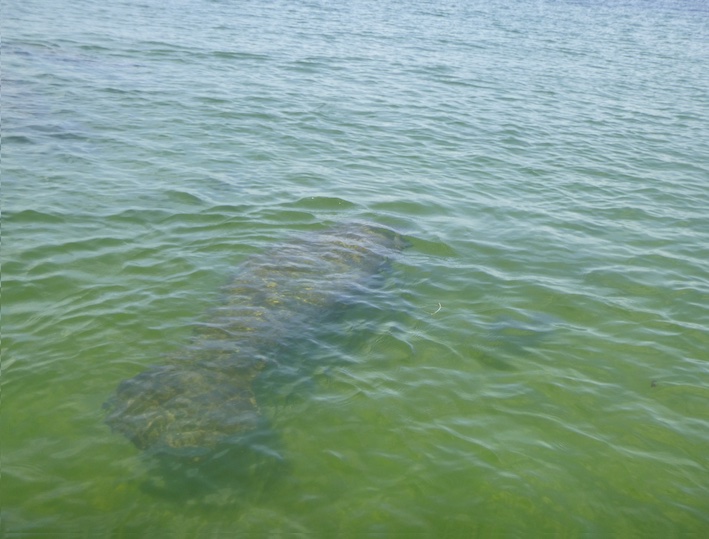
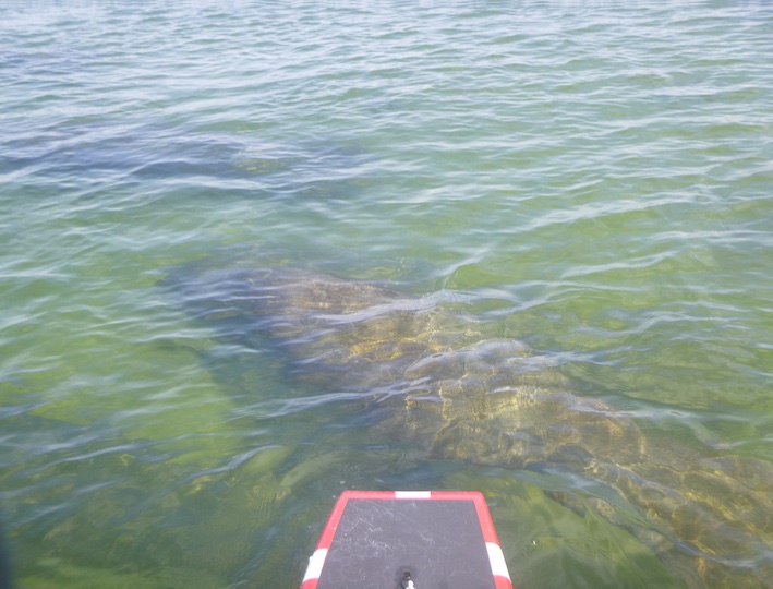
A pod of manatees
And more manatees
Grassy Flats Make Happy Fish Until…
Baby Shark Do Do Do
Fins to the Left, Fins to the Right
Terra Ceia is a small community in Manatee County surrounded by nature preserves, including the Terra Ceia Preserve State Park and the Terra Ceia Aquatic Preserve. Many of the areas I paddled were shallow grassy flats that provided habitat for juvenile fish, baby sharks, rays, and manatees. One day I ate lunch surrounded by a pod of manatees, and another morning I watched baby sharks stalk their breakfast, tiny fins thrashing left and right.
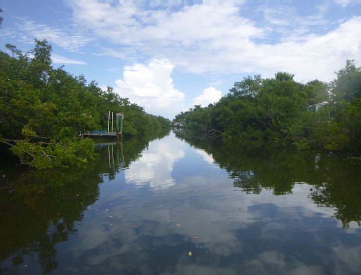
Canal to our rented house in Terra Ceia
Miguel Bay to Tampa Bay
Heron at Emerson Point
Spoil Island
I hadn’t realized how significant this area was to Native American history. Terra Ceia and Emerson both house ceremonial mounds in which archaeologists have discovered multiple periods of Native American culture. The Madira Bickel Mound State Archaeological Site is accessible by both road and water, the backside anyway.
Under the bridge to the Madira Bickel siteStairs to Emerson Point moundEmerson Point Mound
After paddling and sailing under the August sun, Kevin and I met most afternoons for a float.
Cooling offGlassy seas
Sailors and paddlers are never happy—either too much wind or too little. One afternoon, we floated and commented on the beautiful cloudscapes. But in the beauty lurks danger. I wondered if we weren’t tempting fate. Of course, we were.
Where’s my wind?
Building Clouds
Something Wicked This Way Comes
The inevitable happened—a storm blew up over Bradenton, and Kevin rode it out on the boat while I, safe at the house, followed the storm’s progress on my phone. A stark reminder of how fast Florida’s weather can change.
Sunshine Skyway Bridge
Over adult beverages that evening, we pronounced our shake-out cruise a success. Kevin determined what KneeDeep l needed, and I explored the south end of Tampa Bay. Our next step: preparing KneeDeep l for multiday trips into the remote and shallow waters of the Everglades. We’ve done these trips on our larger boat, but how will this smaller boat fare in rough conditions? Let the training begin. March and the Everglades Challenge will be here before we know it!
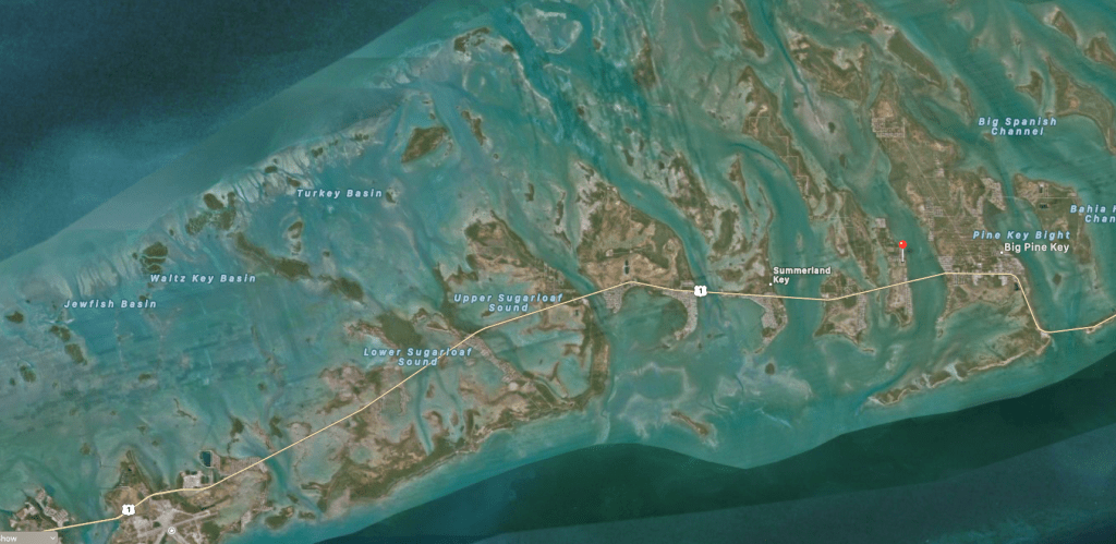
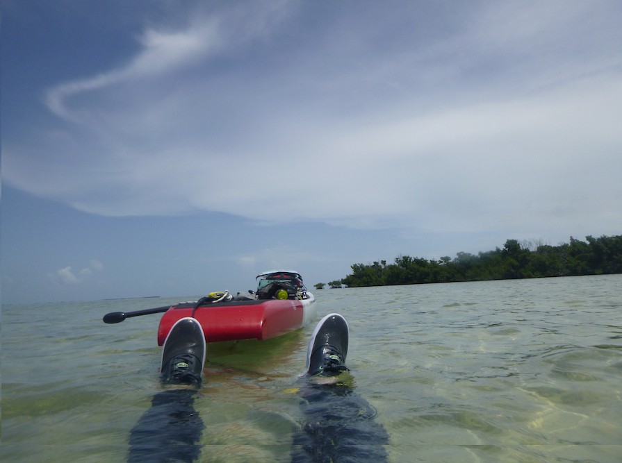
Paddling the Florida Keys felt like entering a dreamscape—the horizon stretched out endlessly over calm clear waters. Kevin and I had come to the Lower Keys for a real vacation, defined as no training, no ambition, and no goals. The Lower Keys, broadly defined as the islands west of the 7-mile bridge to Stock Island (MM40-5), offer paddlers miles of bays and tiny islands to explore—perfect for Kevin’s 16′ Dagger Meridian kayak and my 14′ SIC Maui RS SUP.
Sunrise from our room aptly named ‘Flamingo,’ my watertribe name
Kevin and I checked into Parmer’s Resort, located north of Route 1 on Little Torch Key, MM 28.5. This location gave us easy access to numerous paddling routes both bay/gulf side or oceanside, or north or south of Route 1. Almost every morning, I paddled my SUP right from Parmer’s, and from my paddleboard spotted schools of parrotfish just north of the resort. That perspective is one reason I love paddleboarding so much. I saw parrotfish, nurse sharks, barracuda, baby black tip sharks, and a fairly sizable bonnethead.
Parmer’s Resort in the Lower Keys
Where Should We Paddle?
Over the week, Kevin and I explored areas around Little Torch Key, Knock ’em Down Keys, Little Swash Keys, and Big Pine Key. We carried paper charts as well as a GPS for onwater navigation, but prior to paddling we consulted both the GO Paddling app and the FPTA website for information. GO Paddling provides information about and directions to launches across the US. The Florida Paddling Trails Association (FPTA) website offers more detailed information about specific routes across the state of Florida. FPTA provides a brief description of the route and its difficulty, the launch site, and kmz files. The kmz files can be translated to gpx for Garmin or imported into a variety of navigational apps.
From the FPTA Website
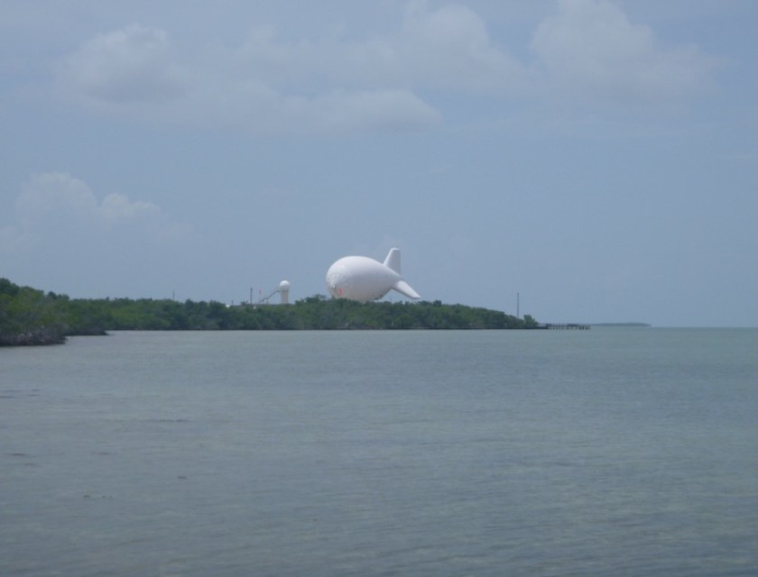
Perhaps my favorite trip was our launch from Cudjoe Key, home to Fat Albert the blimp, where we explored the Little Swash Keys. We paddled, floated, and watched fish until darkening skies hinted that it was time to return to our launch site.
As we paddled under Fat Albert, Kevin noticed that Fat Albert was descending. I looked up and, indeed, Fat Albert was getting lower, a unique and slightly disconcerting experience. Later, we discovered that Fat Albert is lowered when storms approach, so it turns out to be another source of weather information. Fat Albert was initially set up to counter drug-smuggling. I wonder if the presence of the restaurant Square Grouper at the end of the road is a commentary on its effectiveness.
Wind and Tide
Each day when deciding where to paddle, we checked wind and tide predictions. This is especially important for paddleboards because, in general, SUPS are more affected by these conditions than kayaks. Inflatable SUPS even more so. There are no shortage of apps for wind and tides, but few apps give information for tidal currents in the US. Boating HD (or Navionics) offers speed of tidal currents in some locations in Florida, mostly larger passes such as Boca Grande Pass in SWFL.
While tidal variations in the Florida Keys are generally not large, currents can be swift in small channels. And some areas are impassable at low tide, especially on a paddleboard with a fin, such as the south end of Little Torch Key.
Parmer’s Beach
Floating in Newfound Harbor
The winds blew in a southerly direction for most of the week, so we launched from the north ends of the islands when we could. Fat Albert was flying high in clear skies when we droves to the end of Niles Road on Summerland Key. This kayak launch brought us to the Knock ’em Down Keys, just across the Kemp Channel from Cudjoe Key.
Splendid Isolation
Kevin and I love this part of the Lower Keys because it feels so remote. Few houses dot the northern ends of these keys, and it was quiet. We saw very few boats and very few people.
Key Deer
Someone is living the life
There’s More Than Paddling
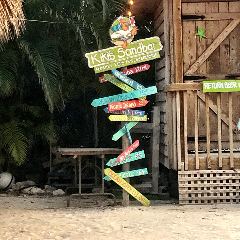
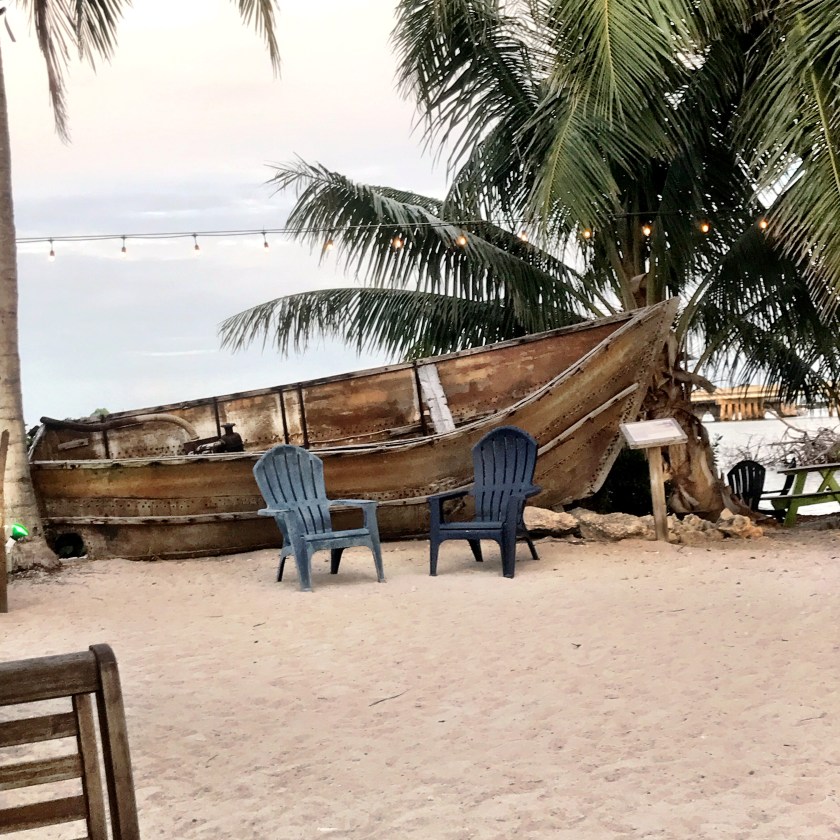
We visited the Turtle Hospital in Marathon where the rehabilitate and release a variety of turtles. Looe Key Reef Resort and Dive Center brought us the Florida’s cleanest reef to snorkel. Other than looking beautiful, coral reefs help buffer coastlines from storm surge. Kiki’s Sandbar provided great food and drink as well as a reality check. The boat and placard demonstrated the tenacity of immigrants and refugees to reach the freedom of North American soil.
{
Next Steps
Kevin and I have been to the Florida Keys numerous times before, first with Paddle Florida and then later with our 18′ sailboat KneeDeep 1. In those early visits, we explored with our sailboat and my 10 1/2′ inflatable paddleboard, and each time we quickly realized the limits of our skills and equipment. Now, with years of SUP and sailing expedition experience under our belts and better equipment, we’re eager to explore the more remote islands of the Lower Keys. We always say that all our trips are scouting trips. I suppose we had more ambition that we thought.
“Get the picture. It’s time to go,” as our quintet of two SUPs, two sailing canoes, and one kayak struggled to hold a pose. The rising breeze, harbinger of winds to come. We had come for Scott Baste’s, owner of Tavernier-based Paddle! the Florida Keys, Everglades Challenge (EC) January Preview, to learn the routes, passages, and campsites between Everglades City and Key Largo. A collection of EC veterans and newbies, all of us were eager to escape into the Everglades wilderness.
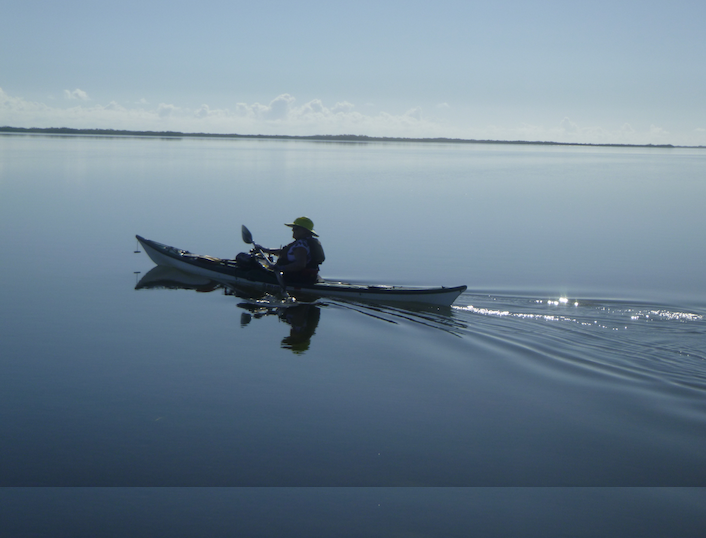
What my Inreach says I did
Loaded up
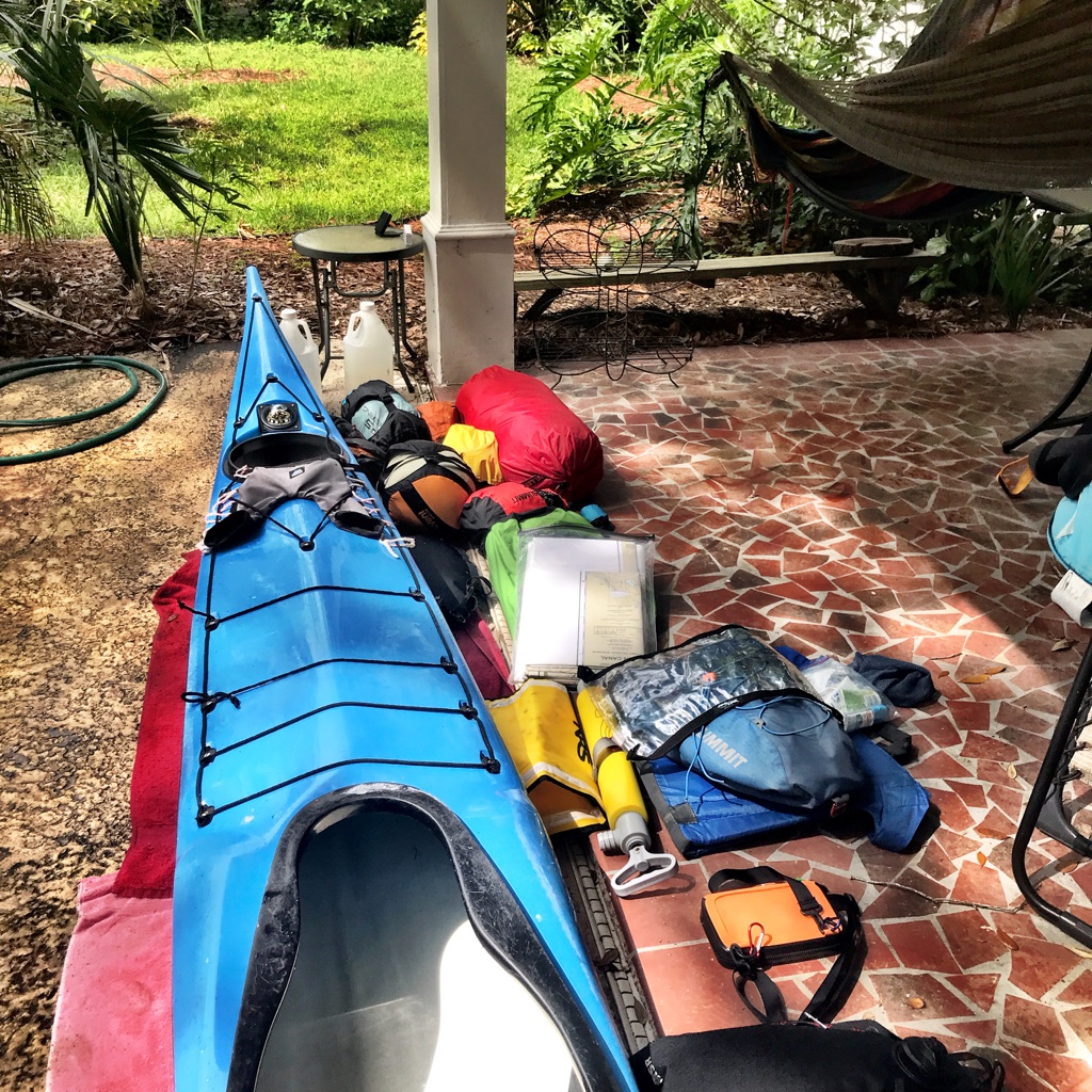
This trip would be a series of firsts for me: my first time on the Wilderness Waterway, my first multiple 25+ miles days, and my first solo SUP camping. My 14′ Bishop A’u paddleboard carried almost 80 pounds of gear, food, and water, enough to last at least 8 days. A Yeti Panga duffel strapped to my stern held my clothing, camping, gear, and food. My safety gear, including lights, flares, repair and first aid kit, was stuffed into an NRS Taj M’haul deck bag in front. I carried a 3-piece Werner Rip Stick as a spare.
A Seakayaker on a SUP?
Why SUP? After all, I have done numerous training and coastal expeditions in my NDK Pilgrim Expedition. But I fell in love with stand-up paddleboarding even before I stood on a board, and the board plays well with our sailboat on Kevin’s and my SUP and sail trips. But there is a learning curve. SUP surf and SUP touring/expeditions have challenged me to adapt my kayak skills to a board. Wind and waves affect board and boat differently, for example, and I am experimenting to determine my limits. I recently began a SUP technique training program with Coach Larry Cain through Paddle Monster and am already seeing the benefits. Most important, I like my view of the world from a board.
Brian and sailing canoe striking a pose on the Crooked Creek Chickee
Starting Out: Eight Miles to the First Chickee
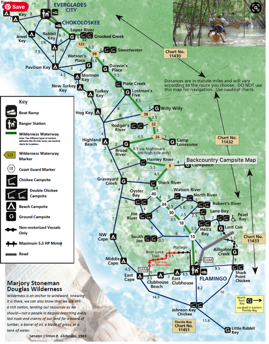
Buoyed by a rising tide, the paddle to Crooked Creek Chickee went quickly, and we reached the platforms just before sunset. Joe and I paddled straight there, past Chokoloskee and up the Lopez River, while Scott, Brian, and Don added miles by going up the Turner River and through Mud Bay. Cramming five people’s gear and tents on the platforms is an exercise in geometry—especially after dark. Mangrove forests line the rivers in the Everglades, and there are few spots dry enough for camping. So, the Everglades National Park built a series of chickees, or raised platforms, along the Everglades’ rivers and in Florida Bay.
Lulled by the evening calm
A 30 Mile, Windy Day
Our Everglades Challenge Preview started here: a 30 mile slog upwind, not even a real wind by EC standards. I left early, knowing that I am slower than the others. I relished the early morning calm as I paddled up the Lopez River to Sunday Bay, Oyster Bay, and Huston Bay. I followed my GPX track on my Garmin Fenix watch, but the occasional signs for the Wilderness Waterway, the 99 mile route between Everglades City and Flamingo, reassured me that I was on track. By the time I reached Last Huston Bay, the winds and my friends had caught up.
Break time in Huston Bay
Reality set in, when we turned into the wind. The bumpy waters of Last Huston Bay grew to whitecaps and small waves in the long fetch of Chevelier Bay. I paddled my board up and over the waves, grateful for my long board surf sessions on Tybee Island. (When I returned to Chevelier Bay several weeks later, I had my best downwind surf run ever.) The tiny creeks linking the bays offered some respite from the wind and a chance to appreciate the beauty of the region. But, long days into headwinds are the reality of the Everglades Challenge.
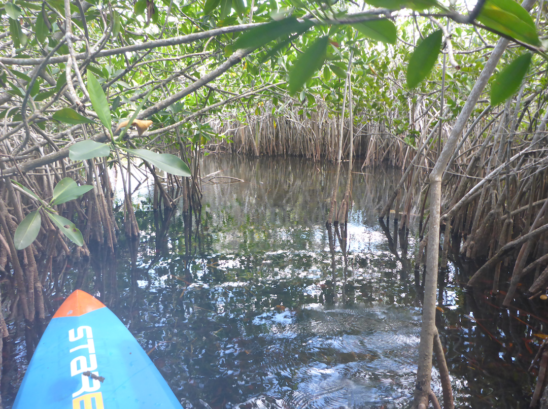
The cuts offer a break from the wind
The Everglades Challenge
According the website, “The Everglades Challenge is an unsupported, expedition style adventure race for kayaks, canoes, and small boats. The distance is roughly 300 nautical miles depending on your course selection. There is a time limit of 8 days or less. Your safety and well being are completely up to you.”
A daunting challenge, especially on a paddleboard. But even more important to me, preparing for the challenge has sharpened a range of skills and introduced me to “kindred spirits”, in EC lingo. In 2020, I did the Ultramarathon, the shorter version of the Everglades Challenge, and planned to enter the EC in 2021. (Ultimately, I postponed until 2022.) This 30-mile paddle might have seemed long, but EC days can stretch to 40-50. I was tired when I reached Rogers Bay Chickee just before dark, but I felt surprisingly good both that night and the next morning.
Going It Alone
I faced a decision the next morning: remain with the group until Flamingo or separate and begin heading north to beat a projected front. Given the weather forecast and cumulative distance, I questioned my ability to complete that paddle. I assessed my water supply and realized that I needed to either continue to Flamingo or begin my trek back to Everglades City. I was sorry to leave the group—I loved the banter and cameraderie. But I also didn’t want to risk injury, and I knew that I needed to practice solo paddling.
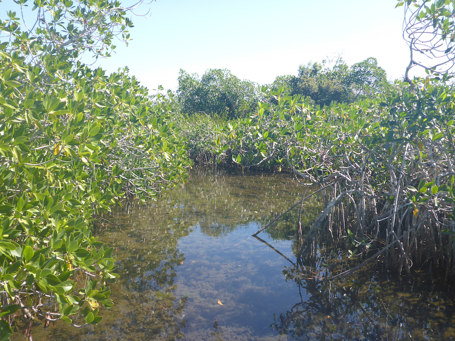
Mangroves, mangroves, and more mangroves
Alone, I retraced my route through Rogers Bay, Big Lostmans Bay, and Third Bay, then headed west through the creatively named Second and First Bays to the mouth of Lostmans River. It felt strange to be on my own, but also exhilarating. I was confident in my abilities to handle the conditions and navigation, but now I needed to be completely self-reliant. By the time I reached the mouth of the river, the wind had picked up, and the tide was coming in. I made camp on a small beach just north of the river mouth and settled in for the night. It had been a 15 mile day.
Lumpy waters
I placed my tent in vegetation that looked both hidden and above the high tide line. (Despite multiple washings, those leaves still cling to my clothing.) I built a small fire on the beach and reflected on my trip and the solitude. I hadn’t seen anyone after I left Big Lostmans Bay, and the horizon was empty. I was really alone.
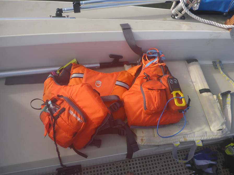
Tricked out NRS Chinook PFD
I carried multiple communication devices in case of emergency, including a VHF radio, PLB, and a Garmin Inreach, I also carried two GPS, heeding Chief’s admonition that ‘two is one, and one is none.’ Redundancy, redundancy, redundancy. Since I had preloaded GPX tracks onto my Garmin Fenix watch, I rarely turned on the GPS instead glancing at my wrist for route and waypoint information.
Day 4: Lostmans to Highland Beach, 26 miles
Where to paddle? The north winds that were giving my friends a killer downwinder would have made my north-bound paddle hell. So, I decided to take advantage of those winds and paddle back up Lostmans River, past Rogers Bay, and down the Broad River to Highland Beach, just several miles south of Lostmans River. By now, some of these bays felt like old friends, but with benefit of tailwind. Bays I had struggled through now passed quickly. That is, until Broad River Bay where I fought for every inch.
Lounging gator
Slightly more active gator
I dragged my board and myself through the bay, down the river, and across the very, very shallow river mouth. I wanted to get as far from the delta and its tidal flats as possible. I knew that the next morning’s low tide would trap me on the beach if I didn’t get far enough up the coast. The west wind pushed me towards the shore, and I felt like I was paddling through mud, which I was. Later, I realized that I had been dragging my fin though the mud.
Tracks of my fin
Highland Beach, several miles south of Lostman’s River
Paddleboard wind block
Highland Beach was my second night solo camping, a skill I knew I would need for the EC. It seemed odd to be so far removed from any signs of people, although I wasn’t fully cut off. I texted Kevin through the Inreach, and frequently checked the forecast on the Inreach, itself a form of entertainment. (In return, the Inreach taunted me with promises of a tailwind.) Further, the occasional chatter on my VHF radio was interesting. But I was never bored.
Unintended relaxing morning
Stalled by Tidal Flats, Then the Wind
Despite my best efforts at an early start, the tidal flat trapped me for several hours. I started a fire and watched the water creep over the mud. Eventually, the water had risen, and so had the winds.
Someone had a bad day
After paddling for several hours, I did the most un-EC thing ever—I declared a beach day. I spent the afternoon bathing and reading on Hog Key. That evening, I burnt through even more of my required fire survival kit. A glorious day.
Somewhere in the Everglades
Day Six: 28 Miles and Too Many People
Northward bound, I passed New Turkey, Mormon, and Pavillion Keys then ran into a group of kayakers from Iowa near Jewell Key. It started to feel crowded!
Perfect paddling conditions
I reached Lulu Key, where I intended to camp, but music-blaring jet skiers were too much after days of solitude. I doubled back to Tiger Key, where multiple raccoon prints alerted me to my evening adventure. I hadn’t seen any critters until then. I stored my food in a bear barrel and my water in a heavy plastic container, and each night I placed my water bag under the weight of the board. The raccoons came out at dusk, not daunted by my fire. I slept with my paddle nearby and woke to a raccoon licking condensation off my board.
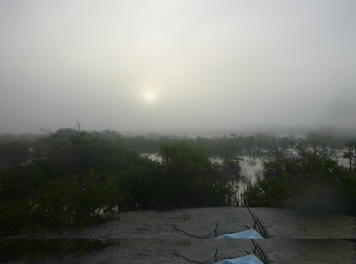
Foggy departure
The Last Leg: Tiger Key to Everglades City
Tired, happy, and stinky, I rode the tide into Everglades City. My only complaint: after miles of fantasizing about lunch, Nelys was closed that day.
This trip was an enormous learning experience and confidence builder. I paddled distances unimaginable the year before and explored a remote and fascinating part of the Everglades. It was the culmination of a year of skill-building and training, including SUP and sail trips with my husband and an overnight crossing of Florida Bay in December. I’m sorry I wasn’t able to do the Everglades Challenge in 2021, but I’ll be ready for 2022.
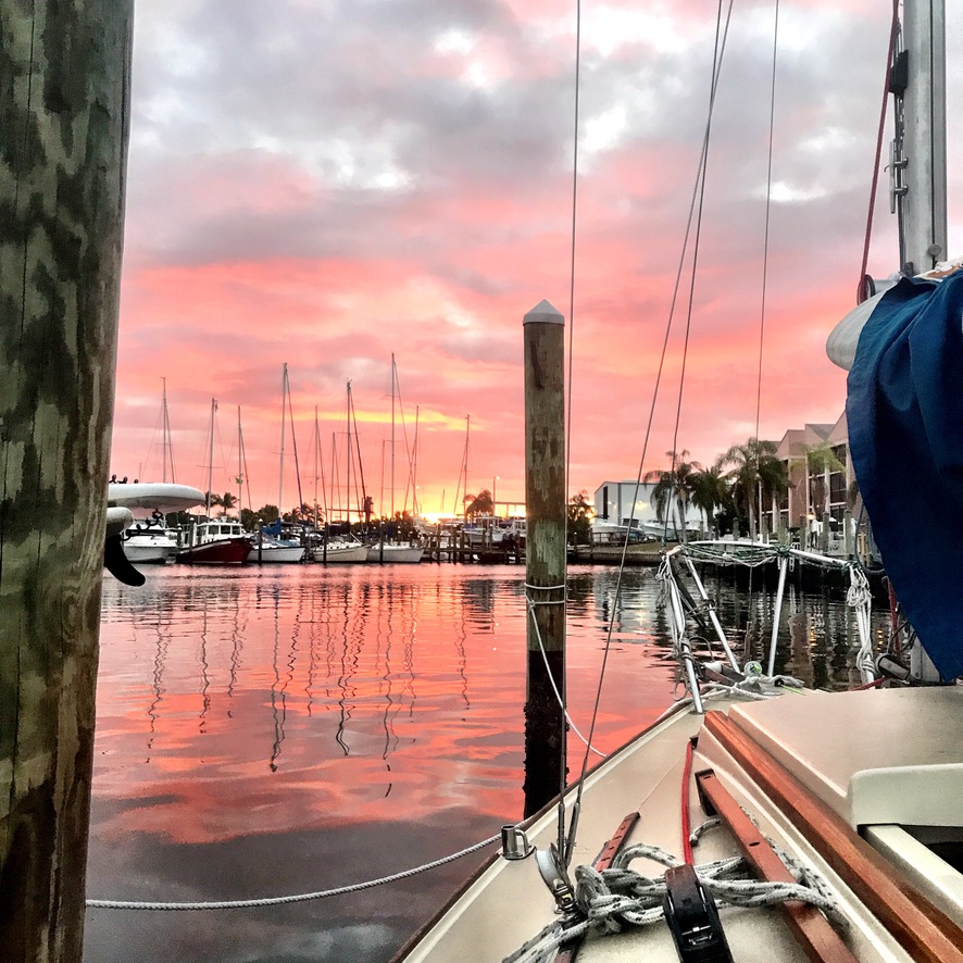
Tuesday: In the early morning calm, Kevin and I launched boat and board from the Laishley Marina in Punta Gorda, Florida and headed southwest toward Charlotte Harbor. Destination: Cayo Costa and our first trip with the West Coast Trailer Sailing Squadron (WCTSS). Blissfully unaware that those “firsts” would keep piling on, we aimed for our first anchorage, just outside of Pirate Harbor on the eastern side of Charlotte Harbor.
My track from Laishley Marina to our first night’s anchorage, 16 miles
For the past several years, Kevin and I have used our SUP and sail trips to develop individual and team skills. Our increasingly longer and more difficult journeys have pushed his sailing and my paddling boundaries in areas of navigation, endurance, and rough water skills. Once again, this trip of firsts would test our skills.
Before we left home, we plotted out our respective journeys. On my 14′ Bishop A’u paddleboard, I anticipated a 12 mile paddle, hugging the shore and ducking into mangroves for wind protection. On our 22′ O’Day sailboat, Kevin’s sail would be considerably longer, given the projected wind direction and the number of required tacks. We planned to meet at the anchorage around 3 pm.
Shelter from the wind
Once I rounded the ‘hump’ of Punta Gorda, the predicted southerly winds arose. Kevin called me on the VHF radio, thrilled at his 6 knots of speed. Thrilled did not describe my mood as I battled against some of the stronger gusts. I ducked into the mangroves, and my chart, GPS, and Fenix watch helped me navigate a path through this very creepy mangrove maze. Shortly after our designated time, we dropped anchor and set in for the night.
Kevin arrives!
Wednesday morning, we paddled and sailed 12 miles to the Burnt Store Marina where we had booked a slip for two nights. Our chance to power the boat’s systems for our anchorage in Pelican Bay on Cayo Costa. Our timing was impeccable and lucky—big winds kept us off the water the following day.
Nestled all snug in their beds
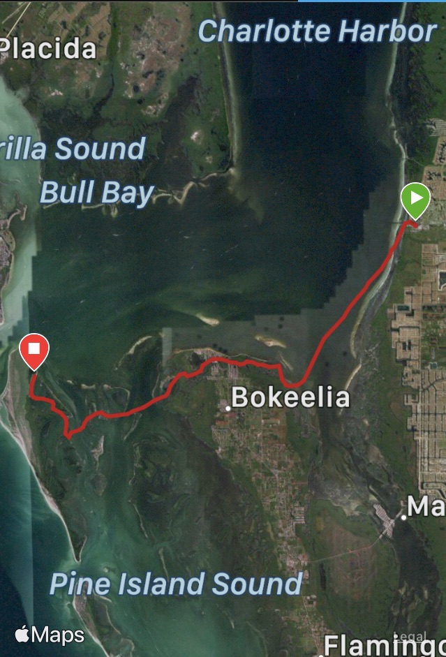
Cayo Costa ho! Friday morning, I awoke eager to begin the day’s paddle. I faced several highly-trafficked crossings, and and I knew I had a short window before the wind came back up. In retrospect, the trip from Burnt Store Marina to Cayo Costa turned out to be one of my most difficult paddles due to wind, waves, and boat traffic. Surprisingly more difficult even than the 25+ mile training paddles I had done. Shortly after leaving the marina, I headed southwest towards the entrance to Bokeelia, an approximately 6-mile crossing. The sidechop and occasional breaking waves challenged my board steering as I struggled to maintain my heading. My early departure had paid off—the wind didn’t pick up significantly until I had almost reached the other side.
Burnt Store to Cayo Costa, 18.1 miles
I followed the channel markers across the north end of Pine Island, past Jug Creek, Back Bay, and finally Little Bokeelia Bay where I saw several boats from the WCTSS. Finally, my destination was near. From Little Bokeelia Bay, I would paddle south of Patricio and Mondongo Islands, cross the ICW, and head slightly north to our Pelican Bay anchorage.
A bumpy ride
By this time, the wind had picked up, and each of the short mile-long crossings was a slog. I have never worked so hard just to see my Garmin watch read 0.0 for speed. For safety, I crossed the ICW south of my destination, meaning both that I had to battle the north winds to the anchorage and that final mile expanded to three. My three hour mile. Though at times I doubted if I could make it, I knew I had to. I stopped on a small key, revised my route, and powered on.
The circus arrives (Video credit: Dan Roeder)
Sailboat without sails?
A pair of pearls
“How many sailors does it take…”
Never have I been so happy to reach an anchorage. We laughed, relaxed, and visited with friends, old and new. A perfect end to a crazy day.
Catching fish and rays
One night in the anchorage
Saturday was beautiful. Some explored Cayo Costa, and others sailed around Charlotte Harbor and around Boca Grande Pass. I discovered lagoons with manatees, and the spring breakers discovered our paradise.
Spring break
Scenic cruise
Back to the anchorage
Boca Grande Pass
By the late afternoon, the winds has risen, and the temperatures fell. The cold front had arrived. Why didn’t I bring socks? Thank you Kevin.
The joy of Sox
Strange light
Our next “first” was almost upon us. We anchored our shallow draft boat just off the beach, as we had the night before. One anchor in front, another astern. Several hours later, after dark, our mistake became apparent as the boat listed sideways. The north winds were blowing the water out of the anchorage, and we almost aground. We rocked the boat and pushed, anything to push the boat into deeper water. Finally, Kevin started the motor and winched in the rear anchor while I rocked the bow. Finally, the bow sprang free, leaving me onshore. Oops. The wind prevented Kevin from motoring close enough to shore. Another Kevin from our group heard the commotion and brought a rope. Finally I reboarded, and we anchored in deeper water. Now that was a first.
And I’m going to paddle in this?
Off to home port
Sunday morning was grim. No spring breakers on that cold dreary day. The wind was up again, and we were cold and tired. There would be no sailing or paddling for us. We towed the board and motored back to Burnt Store Marina.
No sail, no paddle
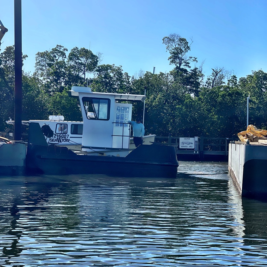
Monday morning, we took the boat out, staging the boat alongside a barge, a very strange first. Doug Buuck of All Marine Canvas brought our car and trailer to us, and we later visited him at All Marine Canvas. Doug had helped us out several times over the week. Meeting him was hands down our best “first.”
Each “first” challenged us develop new skills with wind and anchoring, among others, and the cold front reminded us not to get lulled by the idea of spring. The conditions pushed our abilities to communicate and work as a paddle-sail team even when separated by miles. I’m grateful to have these experiences as I work towards the Everglades Challenge 2022 and more SUP and sail trips with Kevin. And we’re both glad—after this year of Covid, that we have reconnected with WCTSS.
I promised sun, sand, and beach camping. Nothing epic, I said. Yet there we were, on boat and board, paddling overnight across Florida Bay, the 28-ish miles from North Nest Key to Flamingo. But, to put it in perspective, our overnight paddle, including fish with big teeth, side chop, and hallucinations of trees, was less scary than driving home on I-75.
Florida Bay (courtesy of Google Maps)
Several days before, we launched from Flamingo in the Everglades National Park and paddled 9 miles to the Shark Point Chickee. Windy days and the low waters of a new moon made navigating the shoals around Joe Kemp Key challenging, but we followed the Tin Can Channel east towards Shark Point. Learning my way around Florida Bay would help me prepare for the 2021 Everglades Challenge, a 270-mile expedition/race from Tampa to Key Largo.
Our original plan: one night at the Shark Point Chickee, three nights at North Nest Key, and then a final night at Rabbit Key before paddling back to Flamingo. This route gave us proximity to the Everglades Challenge route as well as a campsite with cell service so Janice could phone into her Wednesday night board meeting.
Shark Point Chickee
Janice in our ‘living room’From boat and board to platform above
We set up our tents on one side and kitchen/living room on the other. The light breeze—perfect for keeping mosquitos at bay—made putting up the tents a challenge as the wind transformed tents into sails. My biggest fear was dropping something through the slats of the platform into the water below. That night, shooting stars danced across the sky, and we saw the multitudes of stars normally obscured by light pollution and moonlight.
The following morning we had coffee under stars and prepared for our 22 mile paddle to North Nest Key. I loaded my gear onto the board while it was on the platform, thinking I could carefully lower it into the water. Epic fail. Janice heard a splash followed by some unprintable language, then another splash as I jumped into the water to right the board. Lesson learned, and a test of my attachment points on the board.
Skating across a glassy sea
What are these strange things?
A picture perfect day as we navigated Crocodile Dragover and Madeira Point en route to North Nest Key. The waterscape near Madeira felt like a painting—a flat expanse of water punctuated by emerging mangrove islands that resembled boats from a distance.
Hidden beaches
We wound our way around shoals and through passes, continuing our trek east. Oddly enough, we missed Lake Key Pass in broad daylight, but found it in the dark two days later. And, in another navigational highlight, we circumnavigated North Nest Key, looking for the camping area. Construction and day boaters had obscured the signs. Oh well, more training miles!
Our back yardNorth Nest camp
North Nest Key is the only designated camping spot in the east part of Florida Bay and is considered a ‘ground’ site as opposed to a beach site. Nonetheless, the sand and clear water had a distinct Caribbean feel to it.
Tuesday morning, a dense fog passed through, a good warm-up for our night navigation. We reached the official Everglades Challenge finish—the Pelican Hotel in Key Largo—and ordered lunch from Mrs. Macs Kitchen next door, a 14+ mile round trip, which felt like a rite of passage.
Foggy morning
Navigation practice
Reflections
Sated with fish sandwiches and key lime pie from Mrs. Macs, we checked the weather and realized that the predicted cold front was moving in faster than planned. Was heading south to Rabbit Key, then paddling 20 miles north into a really our best option? We re-evaluated our plan and decided to leave immediately after Janice’s board meeting on Wednesday evening. Until then, it was beach life for us.
Cold front? No worries.
We launched at 6 pm onto a blissfully glassy bay. The lingering light allowed us to see islands immediately westward, but soon the light faded and stars emerged. I had attached my red and green navigation lights to my Yeti bag behind me, but left dark the blinding white light on my PFD. Between GPS, my Garmin Fenix watch, and our deck compasses, we found Lake Key Pass that had eluded us in the daylight.
Almost time
Changing weather
We retraced our path westward past Madeira Point and Crocodile Dragover, taking a quick break in the shallow waters near Madeira. In the long crossing towards Buoy Key, the wind and sidechop kicked up enough to make tracking my board difficult. Just one stroke on the left turned me north, surfing the board, so I paddled and paddled on the right. Far south in the Atlantic, distant lightning punctuated the darkness, revealing the cause of the southerly winds. We trusted the VHF radio weather forecast that placed those eerie storms far far away.
About 10 miles from Flamingo, we saw Flamingo’s red lights. Yet, occasionally those red lights appeared closer, in a tunnel of trees that reminded me of the Narnia Chronicles. My height on the board let me see things I wished were hallucinations. One very large fish, probably sporting many teeth, shot by and bumped Janice’s boat. And strange songs ran through my head, which I dared not sing out loud.
Our track
Finally, that light, our grail, was within two miles! Strangely, both my GPS watch and Janice’s GPS went wonky for about 5 minutes, guiding us in directions we knew were wrong. And suddenly we were back at Joe Kemp Key and entering the Flamingo Marina somewhere around 4 am. We made it!
Keeping it classy in the campground
The next day, we dried gear, ate ice cream, and explored the park. A 28.81 mile overnight crossing was a big accomplishment for us, both in terms of fitness and navigation. I realize that I have much training remaining before the Everglades Challenge, but this trip got me much closer. I hear the drums!
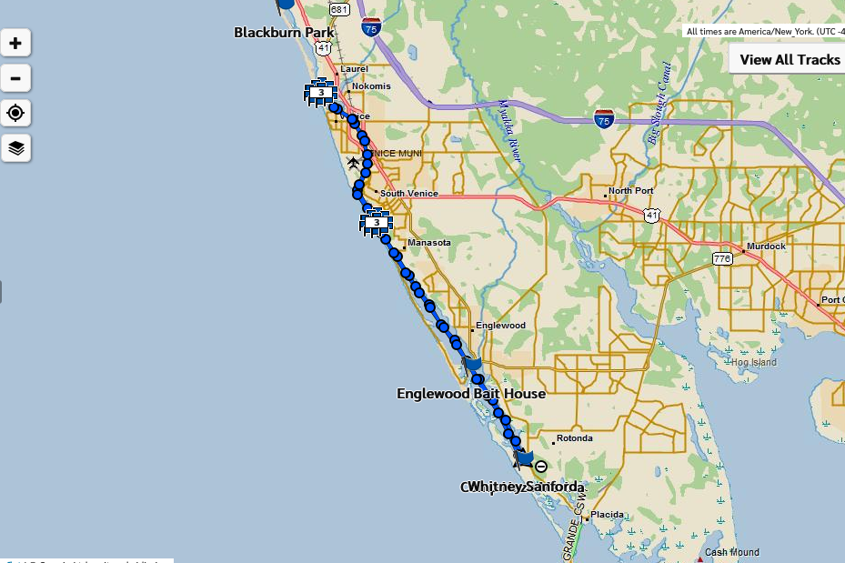
Cape Haze Marina to Snake Island (Venice Inlet) and back, approximately 60 miles. This was Plan B for WaterTribe 2020. At 3 pm, I launched my loaded 14′ board and headed north. Finally, after a year of training, testing gear, and creating routes, I, aka Flamingo, joined the tribe of Kindred Spirits. Kindred Spirits because not everyone considers paddling or sailing the Everglades Challenge (270 miles in 8 days) or the Ultramarathon (62 miles in 35 hours) a vacation.
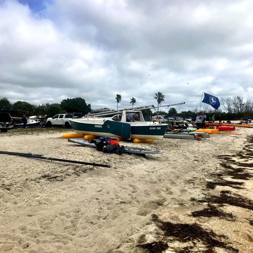
Boards and boards lined up for launch
Gearing up (Photo credit: Chris Sheridan)
Twenty-four hours before, all participants gathered on Fort De Soto’s east beach for briefings and an extensive gear check. If all went well, a flotilla of sailboats, kayaks, and paddleboards would launch at 7 am the next morning, cross Tampa Bay, and continue south. Stiff winds blew as we unloaded boards, boards, and gear, and we all hoped the winds would lie down by the next morning. A small craft advisory would be enough to delay, or worse, cancel the event.
Southwest Florida (Courtesy of NOAA.gov)
The wind did not lie down. Tribers, friends, and family gathered in the predawn darkness, hoping for a 7 am launch. Under cover of twilight, the water looked calm. But it was the swells of Tampa Bay, beyond my line of sight, that concerned me. I wasn’t sure I was ready for that, given these winds. Race director Chief and race manager PaddleDancepeannounced a delay, then another, and ultimately, the option of Plan B. Those in the Everglades Challenge could launch anywhere below Tampa Bay, and Ultramarathoners would do an out-and-back from Camp Haze. Like many, I opted for Plan B. I might not have gone if there was no Plan B. So, Kevin and I packed up and drove to Cape Haze.
My one picture: Sunset somewhere north of Stump Pass
Nervous energy and excitement propelled me out of Cape Haze Marina and northward. I had no idea whether I could finish the race in time or if I could paddle that far. I had never paddledboarded more than twenty miles in a day and only twice in the dark. But I settled into a comfortable rhythm and recognized landmarks from previous visits. Paddling felt good. To pass the time, I sang loud and proud, creating mashups of random songs. I thought I would be afraid when darkness fell, but I wasn’t. I paddled on.
My Inreach Track
Somewhere past Englewood, I met other Tribers, who wondered why I was heading north. Several were concerned that I was lost or disoriented until I explained Plan B. First I saw fellow paddleboarders Staright and ChesapeakeTJAM, then Kayakvagabond and other kayakers. After Manasota, I entered the ditch, a rock-walled canal that circles Venice Airport. It wasn’t easy. I fought both wind and tide going north. At that point, I was determined to reach my turnaround point and take advantage of the wind and tide heading south.
Somewhere in the ditch that I realized I could complete this race. Around 10 pm, I stopped at a boat ramp in Venice to consult my charts, eat, and put on warmer clothes. Surprise—Snake Island was much closer than I thought. I crossed Venice Inlet where I saw Conquistador. Then I circumnavigated Snake Island where I think I saw a group of Tribers known as the ‘flock’, and then I headed back south. No more questions about why I was headed north! Back through the ditch, wind and tide at my back. The ditch is a seriously creepy place, especially in the middle of the night. Beyond the ditch, I heard several other groups making camp. Not long after, I found a sandy spot, set up my bivy, and grabbed several hours of much-needed sleep.
14′ holds plenty of gear
I had been thinking about Watertribe ever since I attended Chief’s Bootcamp in 2019. Listening to Chief and others revealed the combination of necessary skills and conditioning. In summer of 2019, I paddled the coast of Alaska and hiked a portion of Maine’s Appalachian Trail. These trips taught me to pack light with no-fuss meals. I made multiple trips to the 10,000 Islands and Everglades where I tested gear combinations and practiced navigation. During this time, a shoulder injury, ironically from my hike and not paddling, convinced me to set my sights on the Ultramarathon rather than the longer Everglades Challenge.
Tricked out NRS Chinook PFD
Body or board—where to carry gear. In practice paddles, I shifted items back and forth between body, board, and belt before settling on the right balance. Multiple pockets on my NRS Chinook PFD, designed for fishing, held small food and safety items I wanted close. A Hipster Wave hydration belt kept water off my back and added pockets for energy bars. A large Yeti bag held my repair kit, food, and camping gear. I am grateful to the Tribers who were so generous with advice as I made gear and training choices.
Shortly after daylight, I crawled out of my mangrove nest, inhaled several canned coffee drinks, and hopped back on my board. Perhaps a little less sprightly than yesterday afternoon. I had lost an hour due to daylights savings time. Ugh! I wanted to reach Cape Haze Marina before noon, my deadline.
The last few hours were a grind. I fought a headwind, or at least it felt like I did. A boat named Fat Bottomed Girl sailed by. But I knew that I would make it. My husband Kevin waved me into the marina, and I was done. Checkpoint captain Lori Bell greeted me with a paddle. I was tired enough to think it was a wooden spoon. Why was she giving me a spoon?
Exhausted but happy
Done!
Now I’m looking towards the Everglades Challenge 2021. Both the Ultramarathon and the Everglades Challenge demand endurance, navigational skills, and familiarity with wind and tides, and that is part of the appeal for me. Seeing the swells on Tampa Bay made me realize that I need more training in rough water. Lots of time on the water. Now that’s a prescription I can handle.
Paddleboard training in the Keys…sign me up! Scott Baste, owner of Tavernier-based Paddle! the Florida Keys, posted a Winter SUP Camp focused on strokes, speed, and efficiency. The timing was perfect. I had been training for the Watertribe Ultramarathon, a 62-mile race from Fort De Soto to Camp Haze Marina. But I knew I had gaps in my skills, and I really really wanted to get faster.
Trying out new boards!
Part of the fun: trying out new gear! Testing shorter paddles and narrow boards made for a wobbly, but surprisingly dry, start.
Jill getting feedback
Practicing strokes
Coach Scott
Once we got our board, or sea, legs, the real fun began. Scott began with land drills to improve our strokes. Then we practiced, paddling up and down the canal behind his shop incorporating what we had learned. Later, we reviewed our progress, analyzing form and strokes through video footage. The camera doesn’t lie.
Key Largo mangroves
Shallow waters
That afternoon and the following day, we practiced our skills on Tavernier Creek and nearby waters. The wind was gusting from the west around 20 mph, so we kept to the sheltered Atlantic side.
Any eddy will do. Photo credit: Scott Baste
As we talked technique, Scott pointed out the rich biodiversity of the mangrove shallows. Eagle rays, barracudas, and bonnet head sharks, among others, swam around and under our boards. Paddleboards provide a perfect vantage point for viewing wildlife.
The following day, Paddle! the Florida Keys sponsored a SUP race and a post-race mini-clinic taught by Zach Rounsaville of Orange Beach, AL. Watching the race and joining the clinic revealed a new side of paddleboarding to me: racing and stroke finesse. In the clinic, Zach worked on body mechanics to make the forward stroke more efficient, and I am still working to incorporate what I learned.
Nine Mile Pond canoe trail
On our final afternoon, we paddled on the Nine Mile Pond kayak trail near Flamingo in Everglades National Park. High winds still challenged us, but I saw an ecosystem entirely new to me: Marjorie Stoneman Douglas’ ‘River of Grass.’
River of Grass
Where’s the trail?
Getting low in mangrove tunnels
As we ducked under branches, I picked Scott’s brain about Watertribe. So far, Conquistador (his Watertribe moniker) is one of two people to complete the 270-mile Everglades Challenge on a paddleboard. Completing the Everglades Challenge requires a broad range of skills, including navigation, backcountry camping, paddling in wind and waves, and endurance. I’ve been paddling in Everglades and 10,000 Islands to enhance my skills, but gaps remain. Nonetheless I (Flamingo) will be on the beach in Fort De Soto next March for the 2021 Everglades Challenge.
Friendly Everglades gator
This is why I was so happy when Scott announced his Winter SUP Training, and I hope there will be more of them. SUP is still a relatively new sport, and training opportunities seems focused on racing and SUP surf. Paddleboarders are venturing into conditions, including coastal, whitewater, and multiday expeditions, typically paddled in kayaks or canoes. Some skills such as navigation are transferable from kayak to SUP, but others might require a SUP-specific focus (paddling in wind, for example). I need to work on paddling a loaded SUP through swells, a skill I have in a kayak. As the SUP world grows, ideally SUP-specific training opportunities will follow. Right now I’ve got my eye on a SUP trip down the Salmon River, an entirely different form of the sport. These are exciting times for paddleboarders!
With the wind at our backs on a blustery day, Kevin and I rode the current toward our White Horse Key. anchorage. Kevin manned KneeDeep ll, our 22′ O’Day sailboat, and I rode my 14′ A’u paddleboard down Coon Key Pass towards the Ten Thousand Islands National Wildlife Refuge and the Gulf of Mexico. We didn’t get far though. Somewhere between channel markers 4 and 6, we reversed course, paddling and motoring upstream against a 20 mph headwind, and returned to our launch site in Goodland, Florida. Why? The little things. In Tom Noffsinger’s assessment of a kayak training that devolved into a shit-show, he demonstrates how small mistakes can lead to mayhem. In our short time on the water, Kevin and I realized that our small errors had the potential to cause big problems. After re-evaluating our plans and a good night’s sleep, we sailed and paddled through the Ten Thousand Islands/Everglades for four wonderful days. And we learned some important lessons along the way.
Ten Thousand Islands (Courtesy of nauticalcharts.noaa.gov/)
What went wrong? Kevin and I had pored over charts, plotting a course from Goodland to Pavillion Key in Everglades National Park, complete with multiple bail-out points. Our trip would combine SUP and sail and fulfill some specific goals: Kevin wants to hone his solo-sailing skills, and I am training for the 2020 Everglades Challenge. We loaded the car, attached the trailer, and headed south.
Car and boat at the Pink House
Driveway sailing
En route, the heavens poured down, and the trailer brakes froze up. We arrived late into Goodland and discovered that the marina was closing early the next day, Christmas Eve. The next morning, we rushed to step the mast before the wind kicked up. In short, we were frazzled.
Staging at Calusa Marina
I loaded my gear on the paddle and paddleboard, and we were off. Big winds and following seas towards Coon Key Pass, and it felt great to finally be on the water. But soon the rush and chaos of the past 24-hours caught up with us. We had neglected critical details. Kevin hadn’t set up the anchoring system, and I had buried my compass. We needed a do-over. That night and over the next several days, we discussed our mistakes and what we had learned.
Kevin emerges from the hold
Board and boat nestled up snug
The next morning, we woke to blue skies and fair winds and headed out to the Gulf. The night before, we re-evaluated our route, tested our VHF radios, and set up board and boat for paddling and solo sailing. For Kevin, this meant rigging the anchor for solo-anchoring, and I took the time to set up my navigation gear. One lesson learned: stop and re-assess when conditions change. Both the weather and our emotional states had changed, rendering our planning obsolete. In our rush to launch, both of us had misgivings, but neither of us spoke up.
Kevin setting anchor
Mangrove beach
Our destination that night: an anchorage near White Horse Key. I paddled, and Kevin sailed out Coon Key Pass into the Gulf, around mangroves and keys, and into the bay near White Horse Key. We tested our VHF radio communications as Kevin headed out into the Gulf and I circumnavigated islands, trying to increase my mileage. We were able to give each other frequent updates regarding location and heading. One challenge: balancing the needs of very different watercraft. On days with little wind, my board can easily outrun our sailboat. On windy days, a very different story. More factors to consider when deciding upon our course each day.
Sunset near White Horse Key
Combining paddleboarding and sailing has been a goal and a challenge for us. In our White Horse Key anchorage, over a glass of wine, or perhaps more, we realized yet another lesson learned from the first day: Too much, too soon, and all at once. We should have practiced each skill first, e.g., solo anchoring, rather than learning several things at once.
Tricked out NRS Chinook PFD
Taking in the scenery
My challenge: working with safety gear and electronics while standing, without benefit of a kayak deck. The Ten Thousand Islands and Everglades are fantastic places for paddleboarding, but paddling in these wilderness areas requires safety considerations. In addition to extra food, water, and clothing, I also carried an emergency bivy and a Garmin Inreach. I tested my new NRS Chinook Fishing PFD which has plenty of nooks and crannies for PLB, VHF radio, GPS, and knife, among other things.
KneeDeep ll through the mangroves
Mangrove point
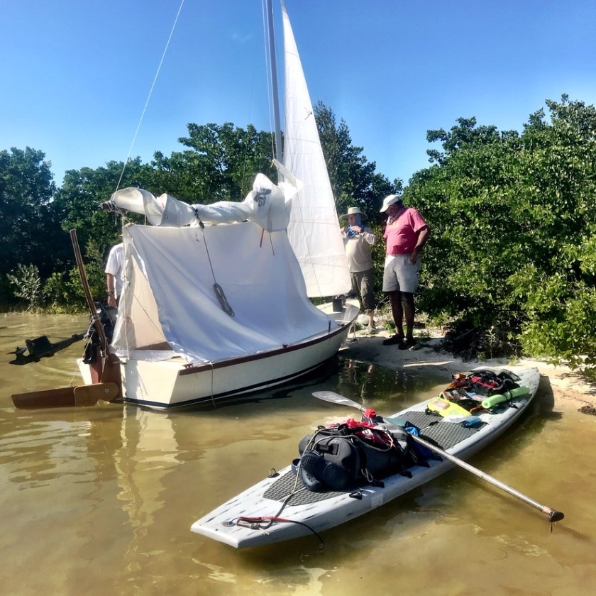
We woke to clear skies the next morning and agreed to meet for lunch at Round Key, a little speck on the charts near Camp Lulu Key. We paddled and sailed all morning, Kevin out into the Gulf, and me up and around Panther Key. As our meeting time neared, the skies darkened, and the wind picked up considerably. A squall was approaching. I radioed Kevin and told him I was taking shelter on a beach a mile north of Round Key. Round Key, as we discovered, was little more than several scraggly trees, surrounded by shoals and floating white pelicans. Little shelter for boat or board in a storm. Yet another lesson in choosing a meeting spot.
Camp Lulu Key
Three cheers for Kevin’s bug screen
The storm passed, and we anchored near Camp Lulu Key that night. Kevin’s well-designed screen house protected us from the no see’ums, aka flying teeth. Camp Lulu Key lies on the border between the Ten Thousand Islands and Everglades National Park. As I passed, I saw campers setting up their tents. The west-facing beaches of the Ten Thousand Islands make perfect campsites. Though I stayed on the sailboat for this trip, I have enjoyed camping here in the past. On my next trip through this area, I will be self-sufficient, carrying all my gear on the board.
White Pelicans near India Key
Taking in the scenery
Low low tide
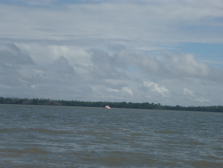
Roseate spoonbill flying
Back home and so many lessons learned. Kevin and I both advanced in both our individual and team abilities. Neither of us journeyed the miles we had hoped for, but we learned a great deal about coordinating a sail and SUP trip. Our plans met, and largely survived, reality. Our biggest take-away: slow down and take time to go over everything. In retrospect, we should have gone out to breakfast, drank more coffee, and re-assessed our plans on day 1 in Goodland. In the end, our trip was fantastic, but things don’t always turn out that way.
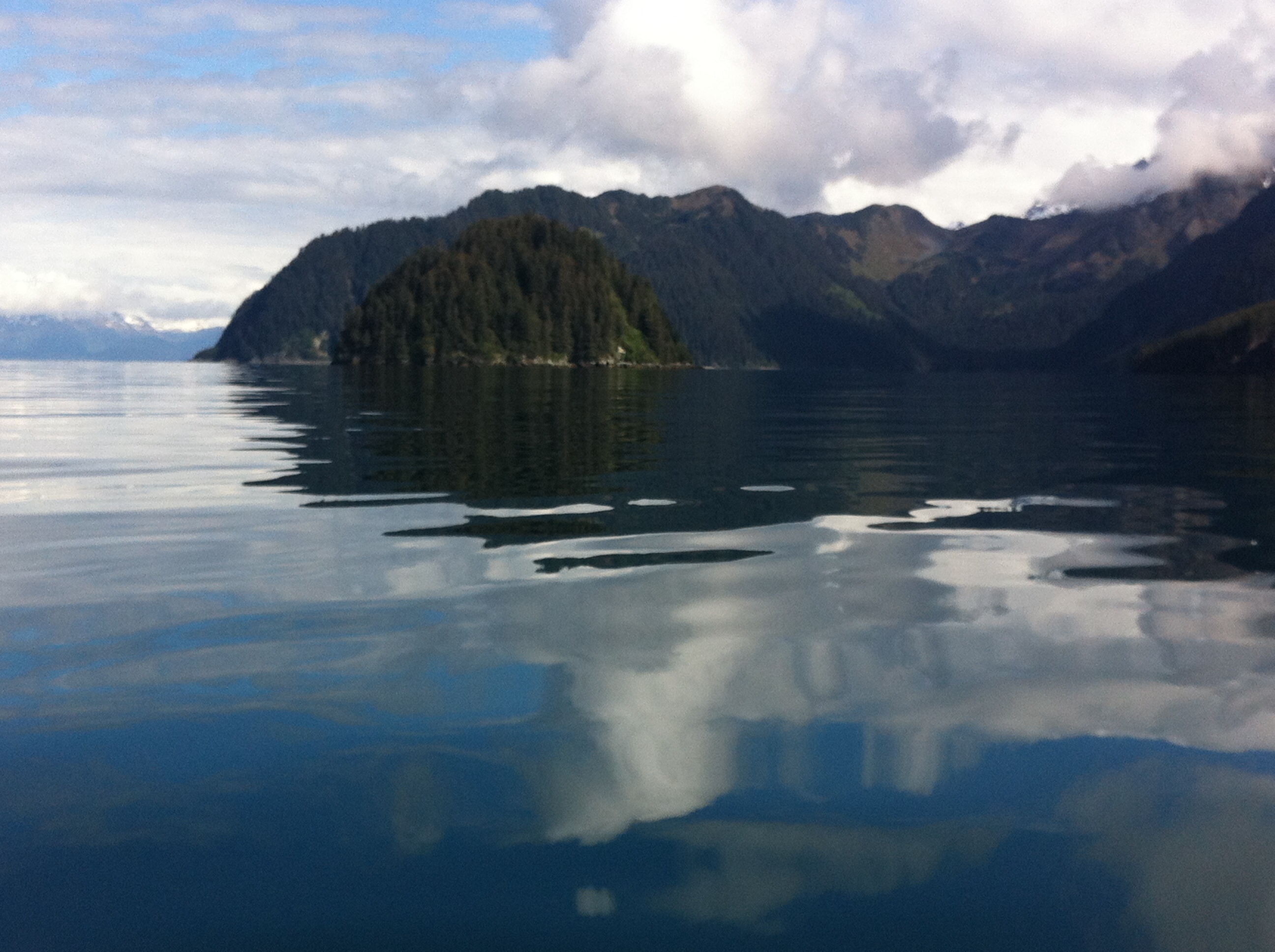
Forty days and forty nights in a Pilgrim Expedition on Alaska’s Inside Passage? Which boat, some ask, assuming I’ve booked a cruise. No casinos, midnight buffets, or lounge chairs on the mighty Pilgrim Expedition, a 17′ sea kayak designed to handle the rough waters of the Irish Sea. Or, in this case, the Gulf of Alaska. My task: cramming food, gear, water, and clothes into my boat without sinking it.
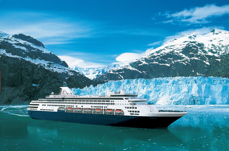
S.S. Solitude? (Courtesy of Alaska Tours.com)
Pilgrim Expedition basking in warmer climes
What is the Inside Passage? The Inside Passage extends over 1,000 miles from Seattle, WA to Skagway, AK. The barrier islands buffer the wind and swell from the Gulf of Alaska and create a relatively sheltered passage for boats of all kinds. The Alaska segment runs approximately 500 miles, depending on route. Many of these areas are roadless, so the Marine Highway system is essential for travel in southeast Alaska.
Alaska’s Marine Highway (Courtesy of Alaska.org)
Our plan. Our team of four (Anthony, David, Dawn, and myself) will kayak from Skagway, AK to Prince Rupert, BC, just south of the US-Canada border. We anticipate thirty to forty days on the water, depending on weather. Logistically, paddling north to south made sense. Months ago, we secured our ferry reservations from Prince Rupert to Skagway so we can paddle back to a car in Prince Rupert. David is dodging tornados driving boats and gear across the US to Prince Rupert. Dawn and I bought one-way tickets so getting home will be part of the adventure.
Like a jigsaw puzzle
It fits!
Our gear. Kayak camping always requires lots of gear, but Alaska’s remoteness and rough conditions demand even more. I’ve packed and repacked drybags of all sizes. Warm clothes, an back-up stove, and water filters. Sets of clothes for sleeping and a different set for cooking. A drysuit and underlayers for paddling. My dromedary water bags hold over 24 liters of water. Somehow it fits. Now. I’m sure there will be hard choices at the last minute.
I’ve already forgotten what’s in TVP Surprise
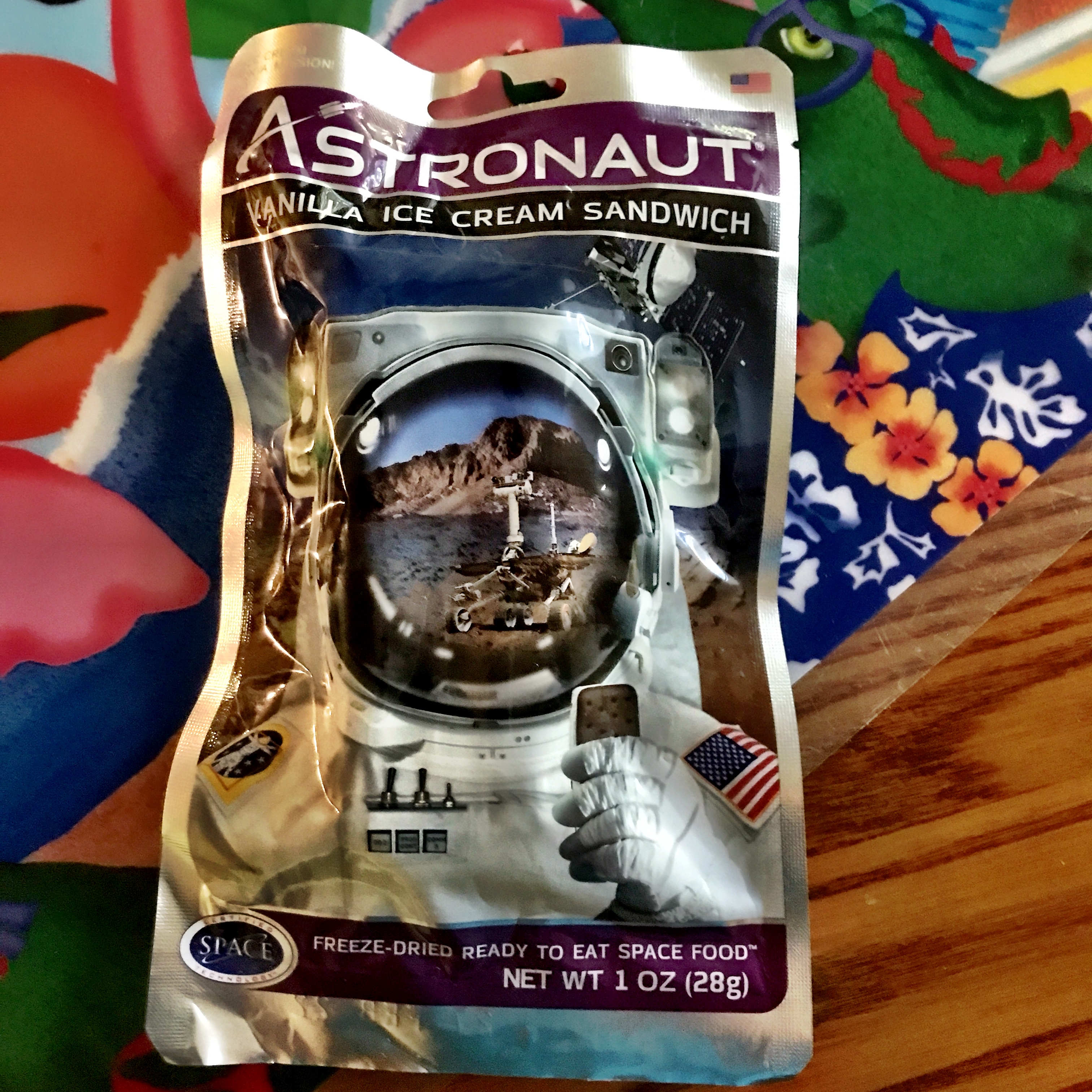
At home, I experimented with dehydrated and freeze-dried foods and a vacuum sealer. Kevin, my guinea pig, was a great sport about testing new concoctions on our sailing trip to Flora-Bama. After a hard day of paddling, even TVP Surprise will taste fantastic. And I can’t wait to try my dehydrated Ice Cream Sandwich.
I will savor this one night
One decision point: how much food to pack. We need to carry enough food to account for the inevitable weather delays. Many paddlers mail packages to themselves along the way, and I might do this on my upcoming hike along the Appalachian Trail. Others purchase food along the way, trusting what appears on the shelves of local stores. I decided to pack approximately half of my meals and make do with whatever I find in Juneau, Ketchikan and towns along the way. Some creative meals perhaps, but that’s part of the fun.
Culinary delights (Valero.com)
Lions and Tigers and Bears, oh my. Brown bears (or grizzlies) and black bears populate Alaska, and we are paddling through their kitchen. Bears are apparently less habituated to humans on the islands along Alaska’s Inside Passage, and we hope to minimize bear-human interactions. Our group of four is small enough to fit on postage-stamp size campsites, but large—and loud—enough to repel curious bears. On previous Alaska trip talking and singing has kept bears at a good distance. (Go away little bear..) Odor-proof bags, bear barrels, a bear-proof Ursack, and good campsite hygiene should minimize encounters. These precautions matter for our safety and for the safety of future campers and the bears themselves. We will carry bear spray but I hope to never use it.
What’s left of my charts
Two bags of charts
From Paper charts to GPS. I hated to do it, but I cut up my charts, taking care to keep the compass rose and lat/long lines. They might look funny, but it gained me some much-needed space. I marked what remains with possible campsites and water sources. As much as I love paper charts, I also have a GPS. Denis Dwyer’s blog Sea Kayaking the Inside Passage has been a terrific resource.
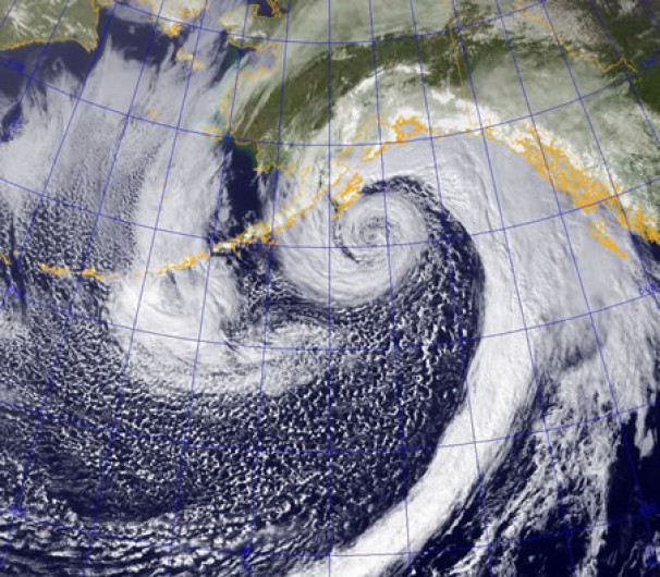
My dream weather
More realistic
Oh for calm days and daily whale sightings, but storms and rough weather are Alaska’s reality. Think Deadliest Catch. We’ve all trained in rough water conditions and carry multiple communicatin devices, e.g., VHF radio, a PLB (personal locator beacon), and a Garmin Inreach, just in case. The weather will dictate our paddling, and I’m sure we’ll have some weather days holed up in our tents.
Deadliest Catch (Courtesy of HowStuffWorks.com)
My boat, gear, and food is en route to Alaska, courtesy of David. I’ll have time in both Prince Rupert and Skagway to make final decisions. I’ve been prepping for months and I’m ready to go. It’s time to dip my blades in the water and launch my Pilgrim Expedition into the Skagway River.