Ninja Spring Hunting

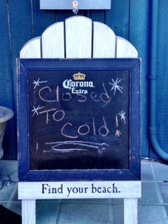
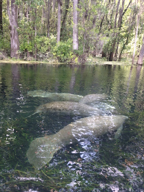
Subject line: “Looking for partners in crazy kayak adventure.” When I saw this email from Liz, I said yes, no questions asked. Liz had heard of a small spring in a salt marsh in the Big Bend Saltwater Paddling Trail between Dallus Creek and Steinhatchee. The area managers said the area was dangerous and inaccessible which was all the encouragement we needed.  We chose January 24, the only day free of bike rides, paddling trips, or hikes, and a winter date would minimize encounters with bugs, snakes, and gators. Several weeks out, who knew it would be the second coldest day of the year – and what good luck for us.

To Cold

Three of us—Liz, Steve, and I—met at the Good Times Marina and Bar in Steinhatchee at 10 to caravan to our trailhead. The Who Dat bar had been closed the day before due to the cold weather. Liz led us through Steinhatchee, around the beach road, and through the rutted forest road until we reached the locked gate where we would begin our journey.


Our plan was a combo hike/drag/paddle which Liz admitted could be ‘ridiculously easy or a serious challenge’. I had my inflatable SUP which is easy to carry, and Liz and Steve both had kayaks. Although we had all looked at the terrain on google earth, we had no what conditions we would face. So each of us had various combinations of hiking and water clothes. From our virtual scouting, we assumed we had about a ½ mile hike, dragging boats and SUP, then another ½ mile drag/paddle/slog until we reached the spring. We thought the terrain might be like this:Scrub nr Dallus Creek.jpg

We parked our cars at the locked gate and discussed our options—do we hike in and scout first, or start dragging boats? We considered our options over the still-warm brownies Liz had baked that morning and decided to scout the area first. The area was remote, seemingly in the middle of nowhere, although one man came by and told us he was undercover for the FWSA—a non-existent agency. I think we seemed as sketchy to him as we probably looked to him.

Whit and Liz.jpg

The morning was still very cold, and we knew that we would be hiking through streams and swamp, possibly falling in. The three of us had fairly different ideas of what constituted appropriate gear for swamp hiking – Steve had hip waders; Liz had drypants; and I had neoprene. We debated bringing our PFDs in case someone fell into a hole. After all, this is a karst landscape.

Road

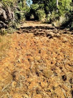
As soon as we walked around the locked gate, we realized that dragging boats would be impossible. The road was chewed up and muddy. We slogged along for about ½ mile until we came to a small canal. At this canal, we knew that we had to cross a small stream and head cross-country (or cross-swamp) for another 1/2 mile southwest. From the google terrain, it looked like we would go along a tree line, across several hammocks, and across a marsh to reach the spring. We also all knew that there was a good possibility we would not be able to find the spring.

Wet marsh.jpg

We crossed the stream and went into the grass on the other side. Once we left the line of trees, the landscape opened up to a vista of sawgrass punctuated by hammocks with palm tress and pine trees. We also saw areas of needlegrass where the terrain was likelier to be lower and wetter. The day was beautiful, not a cloud in the sky—it was a great day for a walk in the swamp. At first, we headed into the needlegrass, but it was mucky and difficult for footing. We corrected our course, aiming for a series of hammocks. Skirting the hammocks would put us on higher ground, better footing and easier to see the terrain. The sawgrass and needlegrass was almost as tall as we were, so finding this spring would not be easy or obvious.

Tangle.jpg

We bushwacked through saw grass and needle grass, and across several hammocks, taking care not to follow any gator trail deeper into the swamp. The sawgrass was sharp, and my hands stung from the cuts when I took a shower back at home. We mostly walked through water except for when we climbed onto the hammocks—a little bit of hog heaven— which got our feet out of the water. We had seen a road sign Hog Root Rd and hoped we didn’t surprise any feral pigs. We continued through the grass, consulting the GPS, necessary because we had so little visibility. The GPS said we were only ¼ mile away, so after a brief water brief, we continued.

IMG_1192.jpg

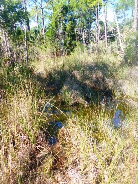
With .17 to go, we plunged into the needlegrass where we thought we might find the spring. The area was lower, wetter, and likely to be muckier. We debated the risks and should we continue and finally decided to turn back. All of us admitted that twenty years ago, we probably would have continued on, but I suppose we are all wiser now. We followed our tracks back through the grass back to the muddy car and back to the road. Even though we did not find the spring, perhaps an airboat is the only way to get there, we had a fun hike through stunningly beautiful terrain. And, at least for now, the spring remains a hidden gem.Palm in marsh.jpg

Learning to Love a Landscape

When I moved to Florida 9 years ago, Like many new Floridians, I was all about the beach and the surf.  I moved to Florida as a whitewater paddler. So, I raced out to the beach whenever I could and surfed my whitewater kayak in the waves at Crescent Beach. I loved Florida’s tidal waters and estuaries, and what could be better than playing in the surf in December and January—especially after many long winters in the north. It took a while to fall in love with Florida’s rivers and springs, but when I did, I fell hard.

My friends and my now-husband raved about the springs and the rivers of north central Florida, and I wondered what the fuss was all about. I had floated down plenty of rivers in Iowa, where I had lived before. I wanted to surf!2014-03-15 17.33.46.jpg

On our first date, Kevin and I paddled on Juniper Springs, along with biologist Stephen Kellert and a group of biology graduate students. Soon, we paddled up and floated down the Ichetucknee spring run, which I loved. Looking down from my boat, I saw fish and manatees swimming below me.Manatees on the Ichetucknee.jpg

I began to learn the rich history of Florida’s waters and explored the sheer variety Florida offers. We paddled and camped in the Keys and the 10,000 Islands, visited rivers and springs, and continued to surf in the Atlantic. But now, the springs have stolen my heart——seeing the tannin line where spring meets river, paddling under the trees on the Suwannee Rivers, and swimming in the springs along there Santa Fe River.Suwannee

I didn’t realize how much I had come to love the springs until a recent visit to Oregon, a place we had wanted to visit for years. Kevin and I sat by the river in the spectacular Columbia Gorge, sipping a glass of wine and enjoying the sunset. But I was homesick. I had spent my summer paddling on different springs, and I wanted come home. And as soon as I came home, I took my paddle board to the Ichetucknee and felt at home.

2014-03-31 12.44.38


Strange and Wonderful Everglades, Pt. 2

We paddled from the Everglades City Ranger Station on an unseasonably warm December morning, riding the tide 9 ½ miles towards our campsite on Lulu Key. Melodi, Scott, Jill, Kevin, and I are all seasoned wilderness paddlers, but we signed up with Everglades Area Tours to learn more about the human and natural history of the region. Don McCumber and Mike Akerman of Everglades Area Tours regaled us with the strange but true stories of human, plant, and animal life of the Everglades.

Lulu Chart.jpg

Don gave us the option of a mangrove tunnel or white pelicans. The pelicans won unanimously, so we headed out Indian Key Pass towards Indian Pass Key. As we neared the island, we saw hundreds of white pelicans crowded on the beach. I had never seen a white pelican before—they are much larger than brown pelicans. Coached by Don, we remained a good distance from the beach to avoid spooking the birds.

Pelicans.jpg

We paddled slowly, watching for signs that the birds noticed us.If a number of birds started moving towards the water, we would back off. We paddled slowly around until we were able to land on the outer edge of the island, unseen by the birds, and watched the mix of brown and white pelicans, just hanging out doing what pelicans do. If a number of birds started moving towards the water, we would back off. We paddled slowly around until we were able to land on the outer edge of the island, unseen by the birds, and watched the mix of brown and white pelicans, just hanging out doing what pelicans do.


After we left Indian Key, we went west along the outside of the islands until we reached Lulu Key, our home for the next three days. Lulu Key sits on the boundary of the Everglades National Park and the Ten Thousand Islands. Kevin and I had paddled to Lulu Key from Goodland, Florida on an earlier 10,000 Islands trip, but had never approached from Everglades City.


Today was New Years Eve. I had heard about the legendary New Years Eve celebration on Lulu. Mike Ward, now represented by a pair of white shrimper boots, had homesteaded on Lulu Key for years and took care of the island—much like Naked Ed on the Santa Fe River in north Florida. A number of people had been on the island for several days, and a row of tents lined the beach. Later tonight, friends would gather for happy hour and later an impressive fireworks display.tents

We found space at the far end of the beach and set up our tents with a water’s edge view. Our hard work done, we floated in the balmy water for the rest of the afternoon.

One of our strangest neighbors on the beach—sea pork, a gelatinous looking blob that is not edible.  It looks like a squishy rock underwater. Sea pork.jpg

(http://www.projectnoah.org/spottings/24422254)

This blobby creature apparently has the beginnings of a spine at the embryonic stage, making sea pork a distant relative. (A new perspective of strange relatives.). Don also showed us carnivorous mollusks that stalk and eat other mollusk, surprising all of us, especially the vegetarian, since we assumed most mollusks and shelled creatures were scavengers.

Lulu Key treated us to beautiful sunrises and sunsets. Greeting the sunrise with a cup of coffee is one of my favorite parts of camping.

campsunset7.jpg

The next day—New years Day, we paddled the short distance to Picnic Key where Don had seen rare African orchids in bloom.  We beached our boats and walked about fifty feet inland, to the edge of the swamp.Africaorchid2.jpg

No orchids were blooming at the time, but we saw a number of orchid plants. The tiny seed pods had traveled with the wind, from Africa to Florida, and found fertile soil here, making me wonder about the term ‘invasive’. What counts as a native plant?

Don also pointed out a small field of sea purslane, an edible plant with a slightly salty taste. He later showed us a native Florida coffee plant; its beans were so small that making a cup of coffee would be a Herculean effort, though perhaps worth it under the right circumstances.

seapurslane.jpg
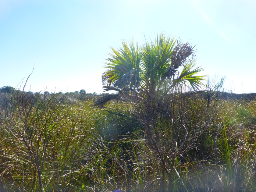
We continued paddling around Picnic Key until we came to a tunnel leading to a hidden lake.

mangroavelake.jpg

On our final day, we paddled through the interior islands back to the Everglades Ranger Station.stillwaters3.jpg

The day was still, and the water glassy, but the clouds told another story. Our three days on Lulu Key were warm and sunny, but a system was moving in. The next day would bring a cold front, with rain and dropping temperatures. Before we reached the Ranger Station, we had a final float, luxuriating in the warm water before we all headed north to the Florida winter awaiting us.

This trip whetted my appetite for the Everglades, and I realize that I have quite a bit to learn about human and natural history. Maybe we’ll come back for next year’s New Years Eve celebration.

mangroavewide.jpg

Everglades Part 1: Paddling a Re-inhabited Landscape

On December 31, our kayaks packed and loaded, our group of six left the Ranger Station at Everglades City and headed for Lulu Key. Lulu Key  straddles the borders of the Ten Thousand Islands and the Everglades.  Interestingly, though we wanted a wilderness paddle, to spend New Years Eve ‘away from it all’, we entered an area that has hosted waves of residents, from the Calusa to turn of the century homesteaders and outlaws to contemporary visitors. stillwaters3All of us are experienced wilderness paddlers, but we went with Don McCumber and Mike Akerman of Everglades Area Tours to learn more about the human and natural histories of this region. We all knew that Don is a self-proclaimed story-teller, and, over the three days, Don regaled us the strange and bizarre habits of people, plants, and animals.

I had just finished reading Killing Mr. Watson by Peter Mathiesson, an historical novel about Ed Watson—farmer, entrepreneur, and possible serial killer who homesteaded on the Chatham River in the Ten Thousand Islands. Mr. Watson apparently killed his hired men instead of paying them—a rather chilling austerity measure, and this book depicts the wild west character of life in this remote part of Florida in the early 1900s. As I read the book, I recognized some of the rivers and keys from previous paddling trips, but I had yet looked into the region’s history before.  The store on Chokoloskee Island run by Ted Smallwood, a character in Killing Mr. Watson, is now a museum about Chokoloskee history.

Camp Lulu Key is relatively easy to find because it is on the exterior, on the gulf. Without map, compass, and gps, it would be easy to get lost. And, for several hundred years now, people have come to this area of Florida to disappear, escaping the law or persecution, among other things.Fakahatchee area.42 From Lulu Key, we paddled north, inward, first to West Pass, matching the shapes on our charts to the land masses we passed. We wove our way through passes and channels, all lined with mangroves. The subtly different shades of green alerted us to the narrow channels between islands.

mangroavelake.jpg

We rode the incoming tide to Fakahatchee Island, home to a small fishing community in the early 1900s. We beached our kayaks on the boat landing, after receiving permission from the two men who were camping there. Anderson GravestoneInland, we found a small cemetery with headstones mostly from the Daniels and Anderson families. The islands hold other ruins but the ubiquitous mosquitos discouraged us from further exploration. Although there has been no official settlement on Fakahatchee Island for decades, the island shows evidence of recent habitation.Fakahacheecamp4 copy

We left the boat ramp, circumnavigating the island counter-clockwise and saw the cistern and the pilings that once supported the fish-house, where the homesteaders kept their fish on ice. Today, pelicans and other birds appreciate the perch.pelicanonmangroave

The other side of the island exposed the layers of shells that the Calusa had much used to build up the island, centuries before. Fakahatchee was one of the higher elevations among these low-lying islands, and the mounds laid by the Calusa provided habitat for turn of the century settlers and later campers.

Fakshellmound


After we left Fakahatchee Island, we wended our way back through the mangrove islands, now fighting the tide, and finally reached our camp on Lulu Key in time for the sunset. I was glad to be back in the open, on the gulf. The interior is beautiful, but its convoluted and quiet passages remind me that the Ten Thousand Islands and the Everglades can still provide refuge for those who wish to slip away into the wild.

%d bloggers like this: