Cruisin’ Down Florida’s Grand Highway (St. Johns, Part 2)

View On the St. Johns River_Mandarin Fla._Home of the Late Harriett Beecher Stowe_Near Jacksonville.jpg
Courtesy of Matheson History Museum

In the late 1800s, Harriet Beecher Stowe (1811-1896) followed a seasonal migration pattern now familiar to all Floridians—snowbirds landing in Florida to bask in our balmy winters. Today people cruise down I-95 and I-75 in RVs. In Stowe’s time, they cruised down the St. Johns in steamships.

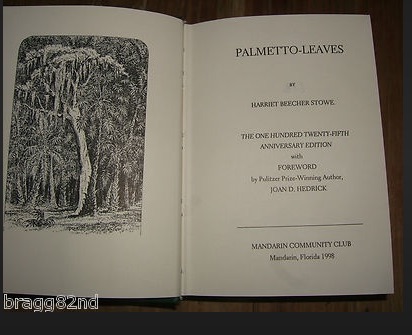
Stowe wintered in Mandarin, Florida in a house overlooking the St. Johns River, a river she came to love. Her book Palmetto Leaves describes her life and community in Florida and offers advice for other northerners heading south. In particular, she reminisces about sailing and boating on the St. Johns River. In the St. Johns lower basin, near Mandarin, the river is slow and wide, almost a mile wide at some points. Preparing for a day of boating, she describes her view as

…five good miles of molten silver in the shape of the St. Johns River, outspread this morning in all its quivering sheen, glancing, dimpling and sparkling, dotted with sailboats, and occasionally ploughed by steamboats gliding like white swans back and forth across the distance.

black-knight
View from Black Knight Boat ramp

Palmetto Leaves.jpg

The St. Johns River was Florida’s “grand river highway,” and travel by steamship was more comfortable and safer than travel overland. Florida’s dense scrub landscape made land-based travel extremely difficult, so boats and rivers were a lifeline to Florida settlers, traders, and tourists.

Steamships helped open the market for Florida tourism. In Palmetto Leaves, Stowe wrote that the

St. John’s is the grand water-highway through some of the most beautiful portions of Florida; and tourists, safely seated at ease on the decks of steamers, can penetrate into the mysteries and wonders of unbroken tropical forests.

Passengers from the north could enjoy Florida’s warm winters and reach locations such as Sanford, Silver Springs, and Palatka by ship.

rc09286
1873 Steamer Routes (Florida Memory)
screenshot-2017-01-26-10-22-52
Palatka News timetables (Chronicling America)

By the mid-1800s, steamships plied the route between Jacksonville and Sanford, carrying goods, people, and agricultural products.  Boats that took passengers on the Ocklawaha and the Silver River required the smaller, more maneuverable sternwheeler, as in the Okahumkee below. Passengers heading northward transferred to larger ocean-going side-wheel paddleboats in Jacksonville.

th.jpg
City of Jacksonville Sidewheeler (Photo credit: St. Johns River Ship Co.)

Stowe describes her overnight cruise upriver—south—to Enterprise. This grand round, or tour, up the St. Johns River to Enterprise, across to St. Augustine, and back, she wrote, marks the “accomplished Floridian sight-seer.

Turning our boat homeward, we sailed in clear morning light back through the charming scenery which we had slept through the night before. It is the most wild, dream-like, enchanting sail conceivable. The river sometimes narrows so that the boat brushes under overhanging branches, and then widens into beautiful lakes dotted with wooded islands. [Palmetto Leaves]

Only the “constant and pertinacious firing kept up by that class of men who think that the chief end of man is to shoot something” detracted from her trip.

shooting_from_boat_on_ocklawaha
Log of the Okahumkee

The city of Enterprise on Lake Monroe was the southern terminus of the navigable section of the St. Johns River. Even today, most navigational charts stop at Sanford. In Stowe’s day, visitors to Sanford could stay in the elegant Hotel Sanford, built in 1886.

rc03808.jpg
Hotel Sanford (Florida Memory)

Henry Shelton Sanford (1823-1891) established the city of Sanford in the 1870s. He imported thousands of citrus trees to develop the citrus industry and established Sanford as a commercial and tourism hub of central Florida.

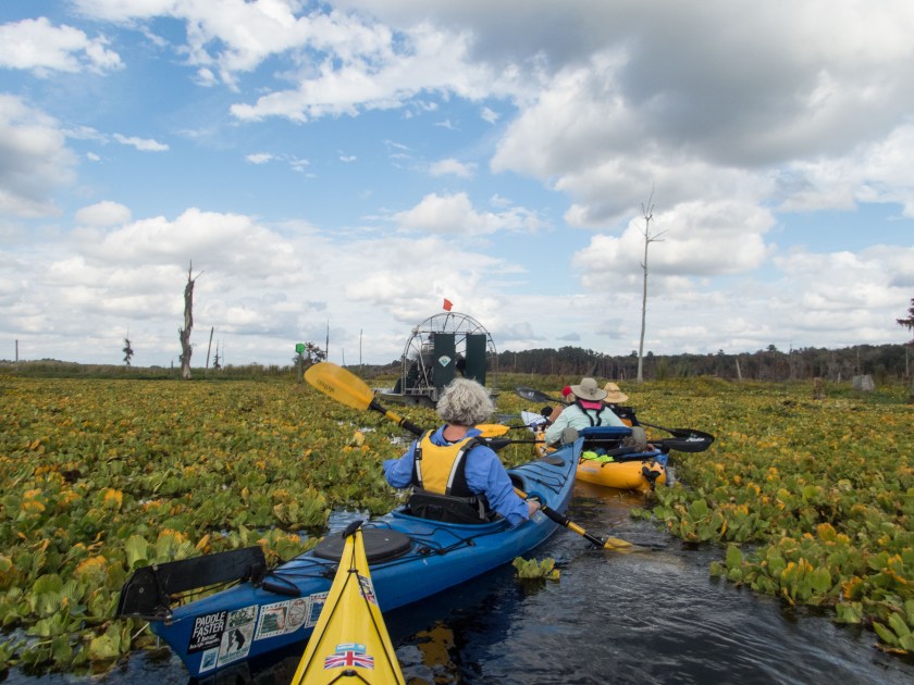
Today, most visitors arrive in Florida by car, plane, and occasionally, train, and the big rat dominates the tourism scene. Beecher’s slow trip up and down the St. Johns might not offer the excitement of Disney’s Splash Mountain, but traveling Florida’s waterways gives us a glimpse into the past, when rivers were our highways. Today, the Barbara-Lee, a stern wheel paddleboat, takes visitors for a slow cruise along the river, revealing birds and other wildlife. Others enjoy the St. Johns on pontoon boats, kayaks, and sailboats, seeing aspects of Florida only visible from water. These trips remind us that we have—and still do—rely on our rivers for commerce, transportation, and recreation. The St. Johns River is still the River of Life.

matheson

Visit the River of Dreams at the Matheson History Museum, 513 E University Avenue, Gainesville, FL 32601   Phone: (352) 378-2280

Hours:  11:00 a.m. – 4:00 p.m., Tuesday – Saturday

The Matheson will offer related programming from now through June, ranging from talks at the museum to paddling tours guided by Lars Anderson at Adventure Outpost. Visit the Matheson’s events page for details.

This exhibition emerged from the research of Dr. Whitney Sanford, Florence Turcotte, and students in the UF Religion Department, and was made possible by the generous support of Visit Gainesville; the State of Florida, Division of Cultural Affairs; and the Center for the Humanities and the Public Sphere at the University of Florida.

Thank you to our partners the Special & Area Studies Collections of the George A. Smathers Libraries at UF, UF Religion Department, and the UF Museum Studies Program, as well as the UF Florida Puerto Rico Digital Newspaper Project, the Laboratory of Southeastern Archeology, Department of Anthropology at UF and the National Park Service, Timucuan Ecological and Historic Preserve.

Curator: Briley Rasmussen

Associate Curators: Alexis Schuman and Lauren O’Neill

Guest curators: A. Whitney Sanford, Florence Turcotte

Assisted by:  Peggy Macdonald, Sarah ‘Moxy’ Mocyzgemba, Amanda M. Nichols, Brian K. Szymborski 

Exhibition Photographer: Anne Ledbetter

Mural Artists: Gillian Fazio and Laura North

Graphic Designer: Brianna Ostrowski

Save

Save

Save

An Ocklawaha Odyssey with Paddle Florida

riverand clouds3 copy
Ocklawaha River

On December 3, over sixty intrepid kayakers gathered in Silver Springs State Park for a four-day adventure down the Silver and Ocklawaha Rivers. Our journey began in the crystal clear headwaters of the Silver River and ended in the murky waters of manmade Lake Ocklawaha near the Rodman Dam. Our float down these rivers helped us better understand the lives of those who once made the Ocklawaha home and contemporary controversies over the fate of the Ocklawaha River.

On our first morning, we paddled six miles down the Silver River. Some paddlers saw monkeys and a couple rare manatees that make it past the dam. Herons, ibis, and anhingas sunned themselves on this warm December day. After lunch at Ray Wayside Park, we continued down, or up geographically, the north-flowing Ocklawaha. The river was surprisingly clear—perhaps an effect of the drought.

OLYMPUS DIGITAL CAMERA
Herding cats for a photo Photo credit: Henry Dorfman
OLYMPUS DIGITAL CAMERA
Manatee on the Silver River Photo credit: Henry Dorfman
OLYMPUS DIGITAL CAMERA
Monkey on the Silver River Photo credit: Henry Dorfman
OLYMPUS DIGITAL CAMERA
Sunning bird Photo credit: Henry Dorfman


Sixteen and one-half miles down river from our start, we set up camp at Gore’s Landing. That night, Peggy MacDonald, Executive Director of the Matheson History Museum in Gainesville, Florida, and I spoke about the Ocklawaha River and its springs, in anticipation of our forthcoming exhibit at the Matheson: “The St. Johns River and Its Springs.” In her book Marjorie Harris Carr: Defender of Florida’s Environment, Peggy describes Carr’s efforts to stop the Cross Florida Barge canal. The canal was never completed, but the Rodman Dam on the once free-flowing Ocklawaha River remains, creating an artificial reservoir called Lake Ocklawaha. The high waters have dramatically altered the river’s ecosystem, drowning trees and disturbing habitat of fish and fowl. Captain Karen Chadwick and filmmaker Matt Keene (River Be Dammed) were also present to discuss contemporary efforts to free the Ocklawaha.

Sunday’s paddle from Gore’s Landing to Eureka was a quick 9 miles, and we reached camp by lunchtime. The Ocklawaha was still remarkably clear, but we all knew that would change as we reached Lake Ocklawaha.

That night, University of Florida archivist Flo Turcotte spoke about acclaimed author Marjorie Kinnan Rawlings, moonshine, and life on the Ocklawaha River. Rawling’s novel South Moon Under depicts the lives of the Jacklin family who lived in the scrub along the Ocklawaha and relied on their moonshine income as farming and trapping became less economically viable. Paddling through the dense scrub made me realize how tough their lives must have been. After the talk, Flo passed out samples of moonshine, which would help power us up for Monday’s 13-mile paddle to Orange Springs.

On Monday, most people made the short detour to see the Cannon Spring, one of the lost springs drowned by the flooded Ocklawaha. Karen said that this spring captured the imagination of the public and was one of the most valuable tools in the initial efforts to restore the Ocklawaha. Later, during the 2015-6 drawdown, images of Cannon spring on social media introduced many to this once-hidden gem, and scores of people visited Cannon during its short window of visibility (Searching for—and Finally Finding—Cannon Springs. After the drawdown when the waters rose, many would mourn the re-drowning of this treasure (Losing Cannon Springs).

OLYMPUS DIGITAL CAMERA
Entrance to Cannon springs Photo Credit: Henry Dorfman
cspring4 copy
Cannon springs freed

fishface2

Lizfloodedcannon2
Flooded Cannon Spring–2016

After our side trip to Cannon Springs, we searched for our lunch stop, just past the sign for Payne’s Landing. The Treaty of Payne’s Landing in 1832 commemorates some of the worst episodes of our nation’s history. The treaty forced Seminoles to relocate to Oklahoma along the Trail of Tears. Further, escaped slaves would lose the protection they had gained by joining with the Seminoles.

After this point, the river became slower, wider, and clogged with vegetation. The Ocklawaha River is lowered every three to four years to eliminate the vegetation that makes the river impassable. Although the drawdown ended less than a year prior, the main channel was already blocked. Fortunately, Paddle Florida Executive Director Bill Richards had arranged for help from Mickey Thomason with the Office of Greenways and Trails.  Possibly for the first time in history, kayakers cheered the sound of an airboat.Florida’s version of a snowplow, an airboat with a rake attached to the front, cleared a route through the thick vegetation, and we paddled single file through the narrow path that remained open only briefly.

OLYMPUS DIGITAL CAMERA
Photo credit: Henry Dorfman
OLYMPUS DIGITAL CAMERA
Airboat to the rescue Photo credit: Henry Dorfman
OLYMPUS DIGITAL CAMERA
Photo credit: Henry Dorfman
OLYMPUS DIGITAL CAMERA
Photo credit: Henry Dorfman

Paddling through the weeds was difficult, but a tailwind pushed us towards our camp at Orange Springs. The day was sunny, but winds signaled that the weather would be changing. Fortunately, the rain held off long enough for us to enjoy a concert under the stars by Whitey Markle and the Swamprooters. Hearing him sing “The Poor Old Ocklawaha” reminded us that this still beautiful river—and all the wildlife that lives in and around it—will suffer as long as the dam remains.

Before going to bed that night, everyone checked their tents and tightened stakes and lines. We had all heard reports of rain and storms, and we wondered about the next day’s paddling conditions. To be continued in Ocklawaha Odyssey, Part 2.


%d bloggers like this: