Testing the Waters: WaterTribe Boot Camp 2019

2019-01-12 11.41.28.jpg
Ready to go at Fort De Soto Boat Ramp

Can I paddle 300 miles in 7 days on a paddleboard? Do I want to attempt this feat? The WaterTribe Everglades Challenge is “an unsupported, expedition style adventure race for kayaks, canoes, and small boats” from Tampa to Key Largo, approximately 300 miles. The shorter Ultramarathan—the sprint version—extends the 67 miles from Tampa to Placida. The Watertribe blend of endurance, navigation, and expedition has tempted me ever since I first learned of this event. In January 2019, I attended the WaterTribe Boot Camp in Fort De Soto Park to see if I had the right stuff to enter the race in 2020.

2019-01-12 11.41.34
Boards Loaded and Ready to Go

The Boot Camp format consisted of a talk by Chief followed by a paddle and camping trip on Shell Island. Chief’s talk covered a range of topics critical for both starting and completing the challenge safely. A paddle or sail down Florida’s coast through the Everglades and Florida Bay is a serious undertaking. I already own and carry much of the safety gear based on my kayak training, but he reinforced the idea that critical gear should be carried on our bodies or PFDs. In my 5* BCU class, Gordon Brown emphasized the same point as we practiced on-water boat repairs. Chief’s mantra regarding GPS devices stuck with me: Two is one, and one is none, an accurate reflection of my experience with marine devices. Salt water and GPS’ do not play well together.

screen shot 2019-01-16 at 4.45.51 pm
Courtesy of WaterTribe.com

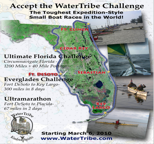
Chief also posed a question that each of us can only answer for ourselves. What are your goals in this challenge—to win your division or to finish? To me, finishing would be a victory. As Chief spoke, I did the math in my head. The event is almost 300 miles, and you have 8—really 7—days to get to Key Largo. The final party is in Key Largo on the 7th day, and I am not one to miss a party. That means approximately 45-50 miles per day. Can I handle the mileage and pace for 7 days straight? I have a year to figure that out.

My first challenge was finding a trail name. All long distance paddlers and hikers need a trail name. Through hikers on the AT and PCT have creative names, and I wanted a name that would also work for my upcoming AT hike. So I became Flamingo, and Janice chose HighTea in homage to her British heritage.

screen shot 2019-01-16 at 4.50.18 pm
Courtesy of WaterTribe.com

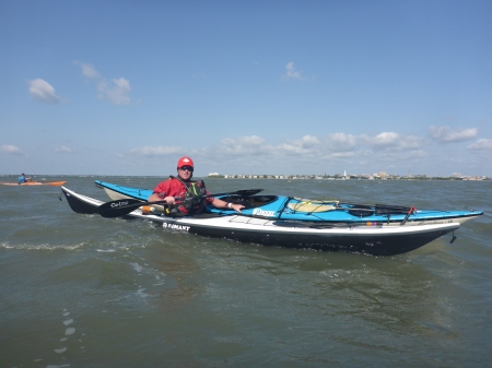
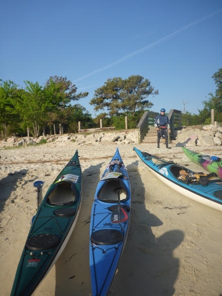
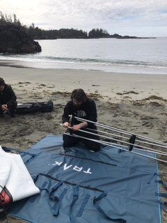
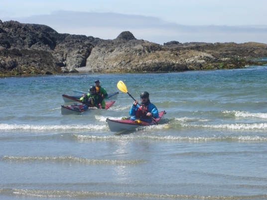
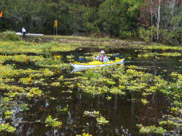
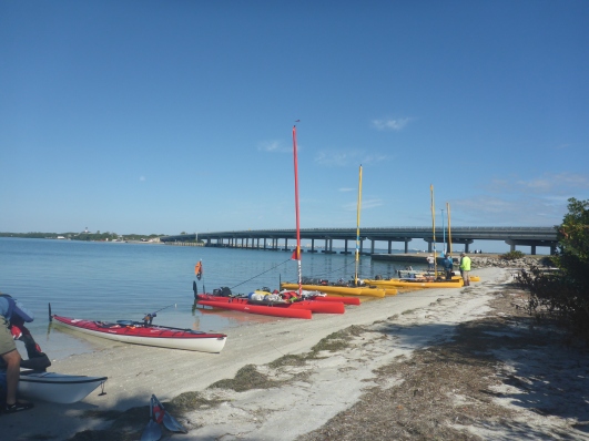
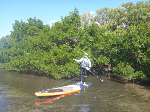
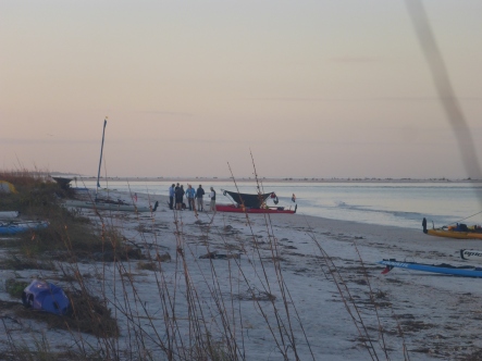
After Chief’s talk, the group headed to the beach where an array of boats and boards lined the shore. I was relieved to see another paddleboard there, but I was surprised to see so many sailing Hobies. I had assumed there would be more kayakers or canoers. One kayakers was incredulous when I revealed that I had a kayak at home. Why a paddleboard, he asked? I don’t think I can answer that, other than that I love the freedom of standing on a SUP.

2019-01-12 12.11.54
Crossing the bay
2019-01-12 12.11.43
Clear waters around Shell Key

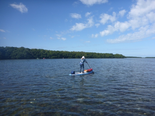
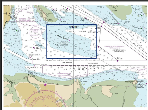
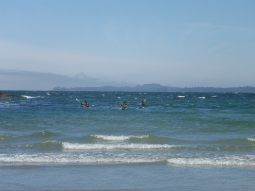
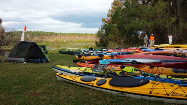
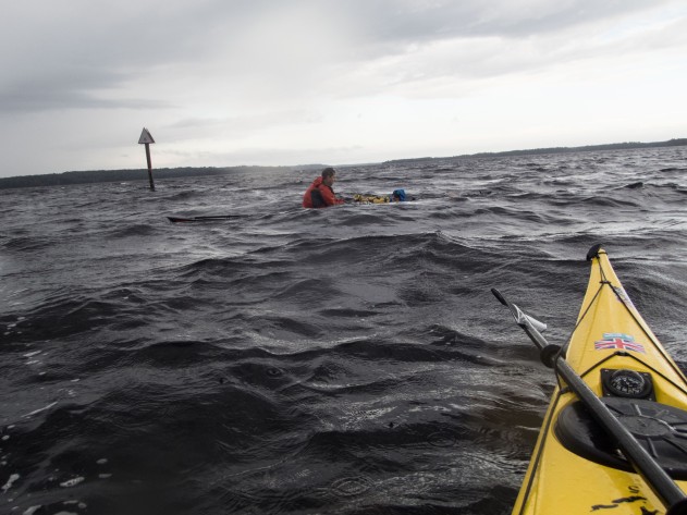
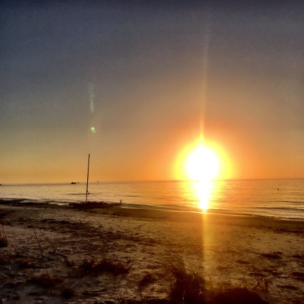
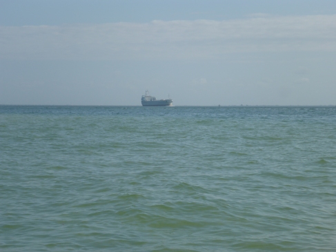
We launched from the boat ramp for the short paddle to Shell Key. Chief had sent us coordinates and waypoints for the campsite on Shell Key and for several paddling options. The Challenge itself leaves from a beach facing the Tampa Bay shipping channel, and crossing a shipping channel is always nerve-wracking. For the Boot Camp, the weather was sunny and warm, and the water glassy, but conditions are rarely that benign for the Challenge.

2019-01-12 12.24.46
A tight squeeze
2019-01-12 12.33.20
Wrong way

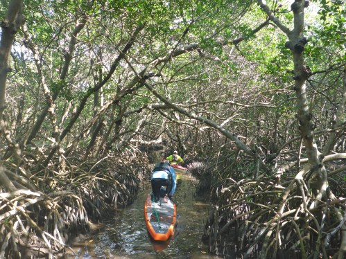
Plan A involved paddling through a mangrove tunnel, then through Bunce’s Pass to the outside of Shell Key. We paddled around a small island searching for the promised mangrove channel. We made it about 50 feet then realized it was a dead end. Since it was too narrow to turn around, we paddled backwards—fin first which might turn out to be a useful skill. On to Plan B, we crossed the shallow flats, passed the motorboats lining Bunce’s Pass, then headed north to find out campsite.

2019-01-12 17.06.17
Drying gear
2019-01-12 14.42.43
Beach camping

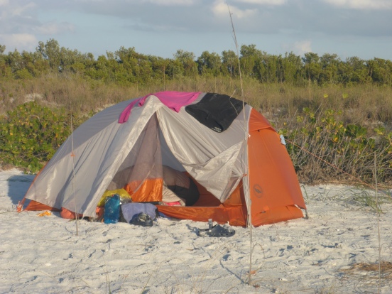
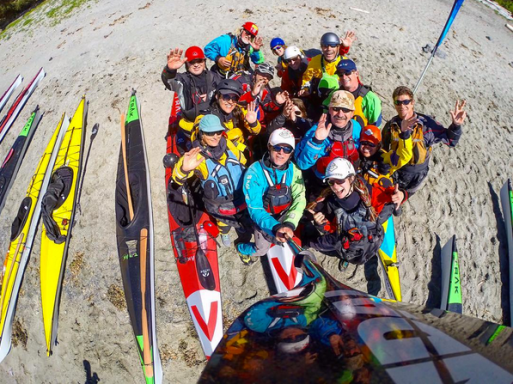
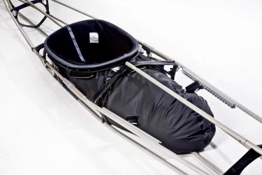
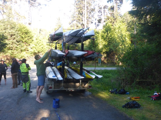
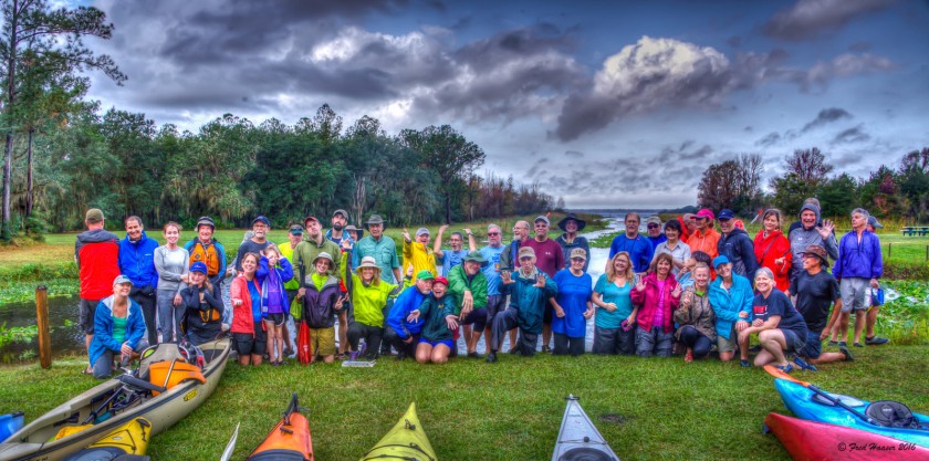
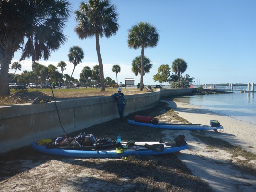
Our group camped midway up the beach. It’s hard to believe this level of wilderness camping exists so close to St. Pete and Tampa. I set up my 1-person tent that I bought for the Appalachian Trail. Packing like a backpacker is crucial to SUP expeditions. The weight must be balanced and centered. The Hobie Mirages might carry 80 pounds of gear, but I can only carry approximately 30 pounds, including water, on my board. One new tip: pool noodles. From now on, I’ll stow them in my gear bags to increase flotation in case of capsize. One of the best parts of the Boot Camp was picking up tips about gear and packing. The other part: the people.

img_2163
Sunset
2019-01-13 07.38.36
Early morning coffee klatsch

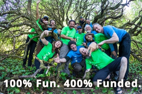
The WaterTribe draws kindred spirits. After all, only so many people want to paddle from Tampa to Key Largo in any vessel, much less a paddleboard. After the sun set, we gathered around the campfire and traded stories. Though people came from all walks of life, it was a congenial and helpful group. I now understand why people come back year after year.

2019-01-13 09.55.06
Abandoned boat near Bunce’s Pass
2019-01-13 11.36.14
Skyway Bridge
2019-01-13 11.36.09
Cargo Boat in the shipping channel

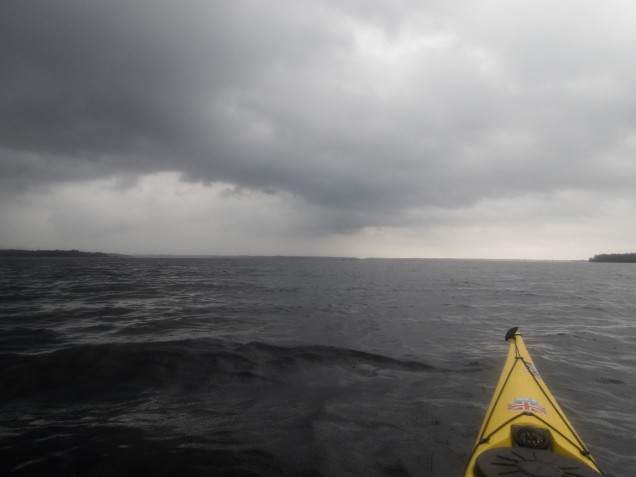
The next morning, I drank coffee as the sun rose, a luxury I might not have during the Challenge. To make miles, I assume that I’ll be on the water before dawn. Most people savored the slow morning and moved on to their own adventures by 10 am. Janice and I paddled around Mullet Key to see the launch site. As we headed back, the wind came up, a premonition of future conditions.

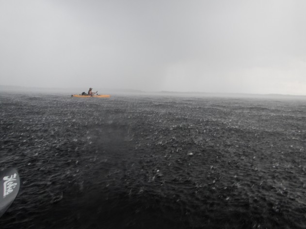
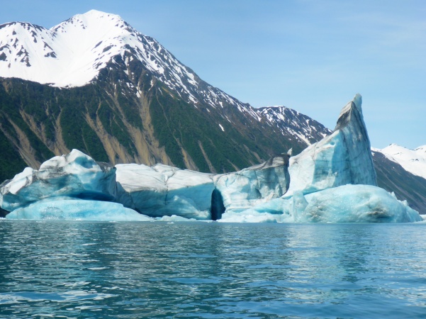
I have no doubt the Everglades Challenge will be difficult, probably one of the hardest things I will ever do. Between now and Challenge 2020, I’ll hike the Maine section of the AT and kayak Alaska’s Inside Passage which will prepare me. I’ll also train on the paddleboard and consider what size and length board will work best for me. I already know that my 12′ Fanatic is too slow. But I look forward to the next year of training, planning routes, and figuring out gear. Do I have the right stuff? I’ll never know unless I try.

bird


Paddling and Plunder in Matanzas Inlet

It’s that time of year. The best time of year–Matanzas! Only four more days.

Heading out

Every February Dale Williams of Sea Kayaking USA gathers his band of paddlers for a week of rough water training in Matanzas Inlet. Shaped like a ‘C’, the Matanzas River flows from St. Augustine Inlet southward to Matanzas Inlet so tidal flows and currents affect both north and south inlets. St. Augustine was the first permanent European settlement in what would later become the United States, and this historically-rich region reveals much about our past, missions, battles, pirates and plunder. But who can focus on history in the surf? As I bounce around in the chop, surf, and shoot through standing waves, enjoying the coastal chaos that river mouths offer, my world shrinks to body, boat, and blade.

Matanzas Inlet
Matanzas Inlet in north Florida (Courtesy of Google Maps)

We’re paddling sea kayaks, many of us in 16′ NDK Pilgrims and Romanys, designed by Nigel Dennis from Anglesey Island in Wales. Nigel designed these boats to handle the lumpy waters, or ‘jobbledy bits’, off the coastal UK. We’ve discovered that these kayaks make terrific surf boats, and we have plenty of surf in the southeast.

With the right conditions—swell, wind, and current, Matanzas Inlet offers near perfect waves for surfing our 16′ kayaks. Long boat surfing occupies a tiny niche in the kayak world, but the few of us who surf are addicted. Dale chose Matanzas Inlet because its shifting sandbars provide both excellent surf and a range of conditions to accommodate different skills levels. Not surprisingly, these conditions result in numerous opportunities for self- and assisted rescues.

Matanzas Inlet
(Courtesy of http://www.skypic.com)


We gather from many points in the US. The Texans, Louisianians, and Floridians among us don drysuits against Florida’s February chill, while some of the braver folks from Michigan and New England wear shorts. For them, Florida’s February might as well be summer.

On the beach

Some of us are training for the American Canoe Association’s (ACA) Advanced Coastal Kayaking Instructor Award, which requires a combinations of factors including 3-5 foot seas, 15-25 knots wind, 3-4 surf break, and 5 knots current. This means not only surviving these conditions but teaching, playing and rescuing in them. Each morning and evening, we meet on the porch of our shared house for Dale’s “academics”, where we discuss surf and rescue techniques and topics such as navigation and marine weather. By the time we reach our launch site, the day has warmed to a temperature even I can tolerate.]

Matanzas Launch
Preparing to launch
Massacre of the French Marker, Matanzas Inlet
Photo credit: George Lansing Taylor, Jr. UNF (https://digitalcommons.unf.edu/historical_architecture_main/3343/) Sponsors: in cooperation with St. Johns County Historical Commission

An historical marker describing the 1565 ‘Massacre of the French’ marks our path through the dunes. We refer to ‘Matanzas’ so casually—”Are you coming to Matanzas this year?” Even though Fort Matanzas National Monument sits just upstream, it’s difficult to imagine that this tranquil inlet hosted such bloodshed and cruelty. The Spanish massacred over 300 stranded French mariners in this place. I’d reflected on this before, the incongruity that places of great beauty and tranquility mask bloody histories. Just north, for example, Fort George Inlet near Jacksonville was the southernmost point of the Low country slave trade.

Our schools teach a myth of origin that revolves around New England, pilgrims, and religious rebellion, but Spanish rule of Florida began in 1513, prior to any British settlements. The First Coast endured waves of French, Spanish, and British newcomers who eradicated indigenous populations, and, often, each other. In 1742, the Spanish built Fort Matanzas to guard against British incursions, and they ruled Florida until 1763. The British gained control from 1763-1783, ceded Florida back to the Spanish in 1783, and regained the territory in 1821.

The sandbars that guard the entrance to the river mouth shaped Florida history. The shallow waters of Matanzas Inlet protected Fort Matanzas and St. Augustine from British invaders, but they also led to plunder and piracy. Pirates chased ships aground onto sandbars along the Florida Coast and plundered the cargo. Wreckers, as described in Tim Robinson’s Tales from Old Florida later replaced pirates and salvaged materials from ruined boats, establishing settlements in the process. River mouths were treacherous to anything other than small, nimble boats.

Map of Matanzas 1742
Map of Matanzas 1742 (Courtesy of Florida Center for Instructional Technology)

This 1742 map shows how the Matanzas Inlet shoreline has changed, which is what happens with sandy coasts. Unlike the rocky coasts of the northeast and Britain, our river mouth hydrology changes with every hurricane and every major storm. NOAA charts illustrate permanent land masses and static navigational features, but sandbars come and go, so that we re-learn our coasts after every storm.

Matanzas WavesMatanzas NDKs

And this is why we train here. To learn how to navigate through the changing hydrology of sandbars and river mouths. Some paddlers were exploring these features for the first time, learning to brace and roll in the waves. Others, like myself, were learning to lead other paddlers, to bring groups safely through a surf zone with breaking waves up to four feet. This means not only leading groups out through waves, but bringing them back through the waves. Like climbing, it’s easier to go up or out than down or in.

The strong tidal currents of the Matanzas River, combined with strong winds, made rescues and group cohesion difficult. An out-going tide could sweep boat, victim, and rescuers out to sea. We had some unusual challenges, one afternoon, a bank of fog descended on us, rare for Florida. This is why we practice in this venue, to be prepared when the rescues, capsizes, and out-of-boats experience are real.

Surfing at Jax 3
Surfing at Jax Beach Photo credit: Joe Crespi

On our first morning, the conditions were big, maybe too big, but the waves were clean. Dale gave us free time to play and surf as a warm up for our subsequent training. At one point, I realized that we had company—two dolphins were also playing and surfing in the waves. As they leapt over the waves, they exposed their full bodies—nose to tail, something I rarely see. It’s a gift and a privilege to play with dolphins. So, forgetting the pressures of training and the ravages of history, I surfed under the bright February sun.

Paddling

What Practicing Kayak Rescues with the Coast Guard Taught Me

Lowering rescue swimmer
Coast Guard helicopter lowering a rescue swimmer

Mayday, Mayday, Mayday…These are words I hope never to say, but there I was in Charleston Harbor hailing the United States Coast Guard. I pulled my marine VHF radio from my PFD, or life jacket, and requested medical assistance for a 62-year old male with chest pains and dizziness. Fortunately, this call was only part of a training exercise. The designated victim—my husband—played the role of victim in our rescue scenario. Nevertheless, seeing my husband stretched out on the deck of a 45′ Coast Guard Response Boat Medium reminded me that someday one of us might need to make a similar call.

P1030273
Medical care for “Victim” Kevin

Kevin, myself, and five others came to Charleston to participate in a kayak-Coast Guard training exercise. Every April, Scott Brown and Jeff Atkins run the Joint Incident Management Program prior to the East Coast Paddle Sports Festival. Scott is a retired army officer and helicopter pilot who conducted combat search and rescue exercises, and Jeff is a kayak instructor and park ranger in South Carolina. Scott designed this exercise to help the coast guard and paddlers partner in real rescue situations, so the training works both ways. Kayakers learn the correct language to hail the coast guard and guide the rescue boat and helicopter to their location, and the coast guard personnel learn how to locate and assist people in small boats.

Our team of nine gathered in Demetre Park gathered at 7:30 am on a windy morning. Several days before, we ‘met’ on a conference call to go over call signals, safety protocol and the morning’s program. I had been checking wind and waves daily, hoping conditions would be small enough to conduct the exercise but big enough to be somewhat realistic. As soon as we arrived, we prepared our boats and gear to launch in case the weather deteriorated. Everyone carried VHF radios, tow belts, contact tows, and a variety of rescue and safety equipment, including extra clothes and first aid kits. We paddled out to a day mark, a navigational marker, in the area of ‘Middle Ground’ between Castle Pinkney and Fort Sumter, to prepare for exercises with the coast guard boat and helicopter.

Middle Ground
Middle Ground in Charleston Harbor
P1030299
Rafting up to create a stable platform
P1030321
Holding position in waves

First we practiced ‘rafting up’, that is, holding our boats together. In case of an actual rescue, gathering the boats both makes us visible to rescuers and also provides stability to care for a victim and call for help. In rough conditions, a victim who is ill or has sustained an injury such as a shoulder dislocation will not be able to remain upright and needs the support of at least one other kayak. Another paddler might tow the entire raft to prevent drifting into a hazard. Kayakers frequently use the term ‘raft up’ when we want or group to come together, and I had never considered whether this term is useful to others. One participant associated with the Coast Guard pointed out the term ‘raft’ is meaningless to the Coast guard. Another wondered if they might not look for a large gray raft, not a group of kayaks. Scott warned us to avoid jargon—“Use plain language.” Lesson learned.

P1030285
Working with big and little boats in waves
P1030269
Lee stabilizing a boat

At 10 am, on military time, we began our exercises with the Coast Guard boat and helicopter. I made the first Mayday call, requesting help for Kevin’s “heart attack”. I noted our location, the number of  people in our group, and our problem. And the Coast Guard always asks if everyone is wearing a PFD. After approximately ten minutes, the rescue boat arrived—this might be much longer in a real situation. Lee and Ted stabilized Kevin’s boat and brought him parallel to the rescue boat so that he could be lifted on board. Doing so gave the crew practice working with 16’ kayaks in rough seas and helped us understand how to help the coast guard help us.

P1030385
Awaiting the helicopter

Next, the part we had all been waiting for— the helicopter ops. Imagine being injured and floating out to sea on an out-going tide. A helicopter flies overhead, but can they see you? From a distance, the bright white, yellow, and orange colors of our kayaks are specks in a vast ocean. A helicopter or boat might see the smoke from our flares, assuming we carried them, and most of us carry PLBs (Personal Locator Beacons). Search and rescue helicopters fly multiple search patterns looking for survivors, but we can increase our odds by guiding the aircraft using our VHF radios. Each of us practiced directing the USCG HH-65 Dolphin —‘right turn, stop turn, we’re on your nose,’ learning the language to best communicate with the crew. Then an Aviation Survival Technician “rescue swimmer,” with fins, snorkel, and helmet, jumped from the helicopter and swam to our boats, sharing tips on how to be spotted from the air. The helicopter crew raised and lowered him on the hoist, replicating what might happen in an actual rescue. If Kevin’s heart attack were real, the crew would have placed him in a rescue basket, raised him up, and immediately began medical treatment, probably saving his life.

P1030397
Search and rescue practice
P1030363
Coast Guard Rescue Swimmer
P1030367
Learning from the rescue swimmer

When life, limb or vessel are at risk, that calls for a Mayday. This is nothing to take casually. Asking for help puts other lives at risk, the rescuers and other victims, for example. However, in an emergency such as a heart attack far from shore or a serious injury, calling for help saves lives. While debriefing after the exercises, we debated about what situations call for a Mayday. In our second practice round with the coast guard 45’ Response Boat Medium, I played the victim, a 57-year old woman with a dislocated shoulder. Was a Mayday call necessary, we asked? As usual, it depends. If we had been surfing 50 yards off Folly Beach, then no because my friends could help me ashore and call 911. I would get medical care within the ‘Golden Hour.’ On the other hand, if we were a mile off-shore in an out-going tide, my inability to paddle would place the entire group in danger if we drifted into bigger conditions. In that case, calling the coast guard would reduce risk for the entire group and perhaps prevent a multi-victim rescue.

Ultimately mitigating risk is the best way we can help the coast guard and ourselves. Reducing risk begins the moment we plan the activity and does not end until everyone is home safe. This means asking questions, even ones that might seem intrusive. Is all equipment functional, and are all members of the group healthy and prepared for existing conditions? For kayakers in the coastal Southeast, understanding tides, sandbars, and currents is critical. In a incident or capsize, will we drift towards safety or out to sea? Scott adapted a set of questions from Eric Soares’ Sea Conditions Rating System. These systems quantify risk, making assessment less subjective and easier to communicate. Answering these questions helps avoid complacency, especially if we know an area well.

Scotts Adaptation of Soares System
Soares Sea Condition Rating system
Eric Soares Sea Conditions Rating System
Scott Brown’s adaptation for SE coastal conditions

Practicing with the Coast Guard was fun and instructive—everyone loves helicopters, but someday the call might be real. I’ve rehearsed Mayday calls several times, learning radio protocol in low stakes situations. I hope these drills will steady my hand and voice if one of my friends is injured or ill, when we desperately need help. My friends and I carry rescue and safety gear on our PFDs and in our boats, and we practice rescues in a range of conditions. We train for the worst and hope for the best. On any given day, you just never know what might happen, and we want to be prepared. Thanks and a big shout-out to the crews of USCG HH-65 6526 from Air Station Savannah and Response Boat Medium 45709 from Station Charleston.

P1030250
Boats and gear ready to go

On TRAK to Adventure in Tofino, BC

Screen Shot 2017-06-11 at 1.16.25 PM
Team 2020 (Photo credit: Jamie Sharp)

How does a skin on frame kayak respond to rough water? What better place to test a redesigned TRAK kayak than Vancouver Island? The TRAK Team 2020 had come to play in the surf and give a final round of feedback on the new TRAK 2.0.

Nolin Veillard, founder and managing director of TRAK kayaks, had invited the team to come for a surf camp and a chance to learn about TRAK 2.0’s new features. Half the team already owned TRAK kayaks, while the rest were new to TRAK. My husband Kevin and I bought one of the earliest TRAKS for a self-supported kayak trip through the Exuma Island in the Bahamas where we snorkeled and paddled in paradise (TRAK Unleashed: PADDLERS IN PARADISE). We loved the boat as an expedition boat, but I was curious to see how it would hold up to wind and waves.

Most of our team had met virtually, on group chats and a group forum, but I was looking forward to meeting everyone in person. In addition to Team 2020, Hans Trupp had coordinated the event, and Fabio Raimo Oliveira and Jamie Sharp had come to help us become better surf instructors. And most important, Buffy Trupp fed us gourmet meals.

Nolin had reserved an assortment of lodges, yurts, and campsites the Wya Point Campground and Resort, just at the edge of the Pacific Rim National Park Reserve. My home for the next several days was Yurt 14, which, conveniently, was also the group headquarters for meals and meetings. (Since my gear was trapped in Delta’s black hole of lost luggage, I was thrilled to stay in the yurt.) Our yurt was just yards from the Pacific beach, and forest went right up to the edge of the beach.

On our first afternoon, we readied our kayaks for the next day’s paddle. Since I owned one of the first models, I was excited to see the improvements Nolin had made over the years. I was especially happy to see improvements in portability–Nolin shaved almost 10 pounds off the earlier models that Kevin and I dragged through airports. Thank you Nolin!

IMG_4319
Assembling the TRAK
TRAK-Sea-Sock
Inside a TRAK (Courtesy of Awesome Kayak)
TRAK on the beach
Wya Point Beach
Screen Shot 2017-06-11 at 1.17.31 PM
Photo credit: Jamie Sharp

Everyone was eager to get on the water the next day. In the morning, operations manager Jason Guindon demonstrated the newer features, and after lunch, we carried our boats to the beach. The water was calm, with small waves lapping the shore, a perfect opportunity to exchange tips on strokes, rescues, and rolls in skin on frame boats. For me, playing in the surges–rock gardening 101–was a real treat and the most different from my own southeast surf zone. Later, we paddled out beyond the rocks enclosing our cove and saw a massive sea lion guarding his perch.

IMG_4324
Flying over our route


The first day’s calm gave way to higher winds and slightly higher onshore waves. Nonetheless, the conditions bode well for our trip to Wickaninnish Beach. The Tofino area, I discovered, is Canada’s surf capital, and Wickaninnish Beach promised good clean surf. We paddled out of the cove and headed towards north. We paddled along the coast, that alternated rocky islands and sandy beaches. I didn’t expect to see so many sandy beaches; my image of the Pacific northwest was all rocky beaches. I had thought the Pacific Northwest was all rocky coast; I had no idea I would see so much sand. After about an hour, we reached a rocky island where the group reconvened. We lingered for almost an hour. Some fixed gear while others took the opportunity to rock garden. The island offered several play spots, and we practiced our skills timing the surges along the rocks. I was impressed with the TRAK’s responsiveness. I had never used mine in situations with rocks and fast moving water.

Soon after we left the island, we paddled through a narrow channel made by rocks, and the conditions changed for the worse. The winds grew stronger, and the water rougher. Boats and paddlers dipped in and out of view as we rose and fell with the swells. We paddled on, watching the coast, but staying out far enough to avoid refracting waves. I felt my boat flex with the waves, but it paddled solidly in these force 4 conditions. This was the test, and the boat passed with flying colors. Finally we rounded the headland and surfed in to shore — after all, we had come to surf. It was an exhilarating day and a new challenge for many, but we all agreed that our boats had passed a critical test of seaworthiness.

2017-05-20 16.37.16.jpg
Coming in for a landing
Coming ashore
On shore
TRAK flag
TRAK flag
2017-05-20 20.28.20
A trailer of TRAKS


We had so much fun that we returned to Wickaninnish the next day.  The conditions had calm considerably, but everyone was happy to have a day just to surf. Fabio and Jamie gave up pointers on surf instruction, but the highlight was playing in the waves. That night we debriefed over fish and chips from a food truck in Tofino and prepared to head home.

On our final morning, we disassembled our boats and offered a final round of feedback on the TRAK. I was sorry to say goodbye to so many new friends, but we are already planning new surf adventures. TRAK’s Kickstarter campaign is well underway, while we eagerly await the unveiling of TRAK 2.0.

0fcc9234877ccd977c61de44bfc63fe6_original-1.jpg
Our successful Kickstarter campaign

Under Darkening Skies: Meeting the Challenge, Ocklawaha Odyssey, Part 2

Ock2016-57.jpg
The skies darken Photo credit: Jill Lingard

Our final challenge: Orange Springs to the Rodman Dam campsite. Although we only had six miles to paddle, dark skies loomed overhead and paddlers hunched over cell phones assessing the possibility of rain. The Paddle Florida truck was loaded with gear, wet from the night’s rain, and we waited, some more patiently than others, for permission to launch.

Today’s paddle would take us across Lake Ocklawaha, or the Rodman Reservoir, over the barely submerged stumps of drowned trees. Karen Chadwick warned us to follow the channel markers and avoid taking the shortcuts that looked so tempting. Hitting a submerged log could lead to a dangerous capsize. I paddled through this tree graveyard last spring after the drawdown and was struck by its eerie beauty (Requiem for a River).

herontrees
Floodscape
2016-03-17 10.56.36
“Hold my beer”
submerged-logs
Danger lurks below
OLYMPUS DIGITAL CAMERA
Photo credit: Henry Dorfman

At 8:45, Bill cleared us to launch and we retraced our path from Orange Springs to the main channel of the Ocklawaha River. During our paddle from Eureka to Orange Springs, the character of the river changed: it widened and became choked by vegetation. Without a little push from the river current, this final paddle across Lake Ocklawaha was destined to be a slog under any circumstances. We embarked, all hoping to cross the lake before the impending storm.

The route was obvious in the beginning—a clear line of channel markers led the way. After we passed the Kenwood boat ramp on the left, our goal—Rodman Dam campground—lay exactly due east across the lake. Easier said than done, however. As most of the group entered the widest part of the lake, the skies darkened and a squall passed overhead. The winds picked up and it was difficult to see more than several boats lengths ahead. I followed my compass heading to the east, trusting my heading was correct.

OLYMPUS DIGITAL CAMERA
Clouds gather Photo credit: Henry Dorfman
OLYMPUS DIGITAL CAMERA
The deluge begins Photo credit: Henry Dorfman
OLYMPUS DIGITAL CAMERA
Rescue at sea Photo credit: Henry Dorfman

The wind, waves, and rain challenged everyone. As I waited by a channel marker trying to guide paddlers in, I struggled to hold position against gusts that threatened to capsize my boat. The storm passed, everyone arrived safely to the campground, and skies brightened for a final group meal, catered by Backwoods Smokehouse and Grill. The sunshine and abundant food left everyone in good cheer as we returned to our cars and said our final goodbyes to new and old friends.

ock2016-58
After the storm Photo credit: Fred Haaser

The storm challenged everyone, including rescue boaters, and several people asked how they might improve their skills. How can strokes and edging help you control your boat in the wind? Where can you learn rough water skills to prepare for the open waters of large lakes or coastal waters? There are many pathways to improve paddling and safety skills. Learning self-rescue techniques, including the roll, provides the capability and confidence to tackle bigger challenges.

Classes and certifications:

ACA (American Canoe Association) and Paddlesports North America (the American version of BCU, British Canoe Union) offer certifications and sequential instruction in kayaking and other paddle sports. Their webpages show the skills required for the different certifications and list instructors and programs that teach these skills. The sites mentioned below offer ACA and PNA/BCU programs in the southeast.

Symposia and instruction in the southeast:

The East Coast Paddlesports Symposium, held annually each April in Charleston, SC, offers a range of on and off-water classes and the opportunity to demo equipment. Many retailers bring boats, paddles, and other gear, and this is one of the best places to see a wide range of equipment. Classes are held on the lake and on the more challenging waters near Folly Beach.

Sea Kayak Georgia located on Tybee Island, and Savannah Canoe and Kayak offer private kayak and paddle board instruction and expeditions. The waters around Tybee Island provide a good instruction to rough water. Dale Williams of Sea Kayaking USA , also on Tybee, offers more advanced instruction.

Each October, Ronnie Kemp and Marsha Henson of Sea Kayak Georgia bring in world-class instructors such as Dale Williams, Nigel Dennis (Sea Kayaking UK) and Eila Wilkinson (Tidal Waters) for their symposium. Sea Kayak Georgia’s symposium offers instruction and assessment for PNA/BCU three and four star levels.

Russell Farrow of Sweetwater Kayaks in St. Petersburg, FL provides instruction in and around Weedon Island. Their annual symposium in March brings in world-class instructors, offering classes from rolling to Greenland-style paddling.

For those who have caught the kayak surf bug, Cross Currents Sea Kayaking offers the Kiptopeke Symposium in the rougher waters in coastal Virginia.

This list is not exhaustive. Opportunities for instruction abound in the southeast and beyond. Playing and surfing in rough coastal waters is safe and fun once you have mastered some basic skills. So get out there and have fun!

small-whit-waves
Fun in the surf

Save

Exploring Bear Glacier by Kayak

2016-05-26 16.24.34 (1)
Icebergs at Bear Glacier, Resurrection Bay, Alaska

Crackle swoosh boom! …. The sounds of a melting and calving glacier. Twelve kayakers awed by the ethereal blues of house-size icebergs floating in a glacial lake. We sat quietly, in communion with this living glacier until one large splash of falling ice broke the spell. We were in Alaska, far from my home in Florida.

2016-05-26 16.11.19.jpg
Paddling around the icebergs


2016-05-26 16.47.07
Brian enjoying the view

We paddled to Bear Glacier on our last full day of a week-long trip to Resurrection Bay. Our home base was the Kayakers Cove Hostel, about a 12-mile paddle from Seward, on the Kenai Peninsula. During our week there, we watched whales, otters, and sea lions and explored caves and rock gardens. With Levi Hogan of Turnagain Kayak, along with Dale Williams of Sea Kayaking USA, Tom Noffsinger, and Tony Hammock, we practiced rescues, rock gardening, and strokes along the rocky coast.

Our weather was spectacular, mostly clear and sunny, which meant we traded rough conditions for terrific views. Kevin and I had done the Resurrection Bay trip in 2015 with rougher conditions, so this seemed like an entirely different experience. A combination of sea swell, tide, and wind direction dictated each day’s activities. Last year, the winds mostly blew from the north, so we headed out towards the open waters of the Gulf of Alaska. This year’s winds blew southerly, offering a different set of explorations.

Towards the end of the week, Levi announced that conditions were favorable for Bear Glacier, and we leapt at the chance to kayak among icebergs. We would paddle the 10-ish miles to Bear Glacier, then return by water taxi in two shifts, six paddlers and six kayaks on each trip.

Bear Glacier
Bear Glacier from Google Earth

We launched at 9 a.m. with drysuits, helmets, and extra food and clothes – just in case. As we passed the southern tip of Fox Island, Levi checked for confirmation of our pick-up. We had little or no cell service at Kayakers Cove—a wonderful cyber-vacation, but missing a text from Joe, the boat captain, would have resulted in a long, cold, and unexpected paddle home. As we paddled around to the east of Fox Island, we moved to the middle of the channel to ferry glide across and surf the wind swell. To quote Tom Noffsinger, “When asked if you want to surf, the correct answer is always ‘yes’”. I agree. The wind and swell gave us an easy ride across Resurrection Bay, and we soon reached Callisto Head.

As we paddled around Callisto Head, Bear Glacier appeared in the distance. Resurrection Bay gave us some small swell, and we played among the rocks along the way. Navigating a 17’ kayak through rocks can be like threading a needle, and a fun challenge with the right swell. Levi reminded us that fiberglass NDK boats and rocks do not mingle well and warned us not to go over any overfalls, where swift currents flow over exposed rocks. A severely damaged boat would be dangerous in this remote area. Soon after, I misjudged a swell and flew towards an exposed rock. Fortunately, an opposing swell covered the rock, and I sailed over it unscathed. I did not make that mistake again.

2016-05-26 14.10.58
Bear Glacier and a visit from a seal
2016-05-26 14.41.22
Ed playing in a tidal race

The entrance to Bear Glacier Lake was still several miles away. As we paddled across, seals and seal lions popped their heads up, curious about our strange crafts, and played in our wake. The mouth of the Bear Glacier River created a tidal race where we surfed in the waves. This water was cold—glacial melt.

After we played, we landed our boats, carried them up and over the rocky ridge, and launched again in the slower and deeper section of the river. This shallow braided river is the only access to Bear Glacier, so only those willing to paddle or walk (or pay an exorbitant helicopter fee) get to see the glacier. (In 2015, Kevin and I saw the Aialik Glacier on a Kenai Fjords tour.)

Resurrection Bay Map
Resurrection Bay (Photo credit: http://www.wildernessimage.com)

We eddy-hopped our way upstream, where house-sized and larger icebergs floated in the lake. Although we were still at least a mile from Bear Glacier itself, its presence enveloped us in the sights and sounds. We paddled carefully around the floating ice, knowing that our helmets offered little protection from falling chunks.

I sat in my kayak, mesmerized, but I wondered about its future. What will Bear Glacier look like in twenty years in an era of rapidly retreating glaciers? In India, Gangotri Glacier, the source of the Ganga and sacred to Hindus, has receded dramatically in recent years. In the late 18th century, Gangotri Temple sat at the foot of the glacier, but by 1992, when I visited, pilgrims trekked 12 miles over two days from the temple to Gangotri Glacier.

gangotri_ast_2001252
Retreat of Gangotri Glacier (Photo credit: http://earthobservatory.nasa.gov/IOTD/view.php?id=4594)

Though Alaska seems remote from Florida, retreating glaciers and melting sea ice contribute to the rising sea levels that erode our shores and flood our seaside cities. Maybe Alaska and Florida are not so far apart after all—a baked Alaska means a soggy Florida.

2016-05-26 20.46.32
Sea lion haul-out in Resurrection Bay
Driving the boat
Driving the boat home

We paddled back towards the river, carried our boats back across the ridge, then headed towards our pick-up point. Our captain Joe ferried us back in two groups and took us past a sea lion haul-out. I was fortunate to be in the second group, leaving me with more time to relish this exquisite beauty and to play among the rocks. Back at Kayakers Cove, we relaxed over wine and fresh-caught fish, cleaned and caught by Joe, demonstrating Alaskan hospitality. Bev and James treated us to their amazing fish-cooking talents that evening. Our week in Resurrection Bay was filled with highlights—great paddling and great friends, but our trip to Bear Glacier stands out among these highlights.