Hiding in Plain Sight: Ropes, Nets, and Plastics in Alaska

IMG_1842
Excited for our ride to Shuyak Island

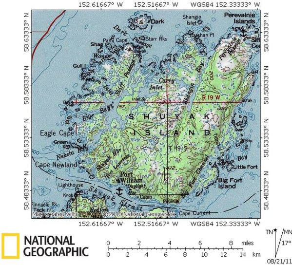
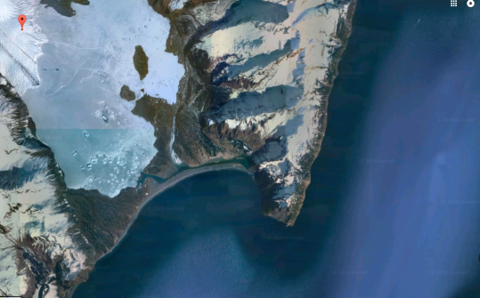
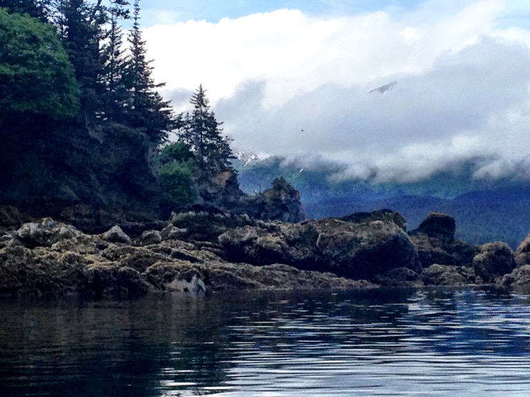
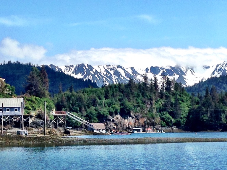
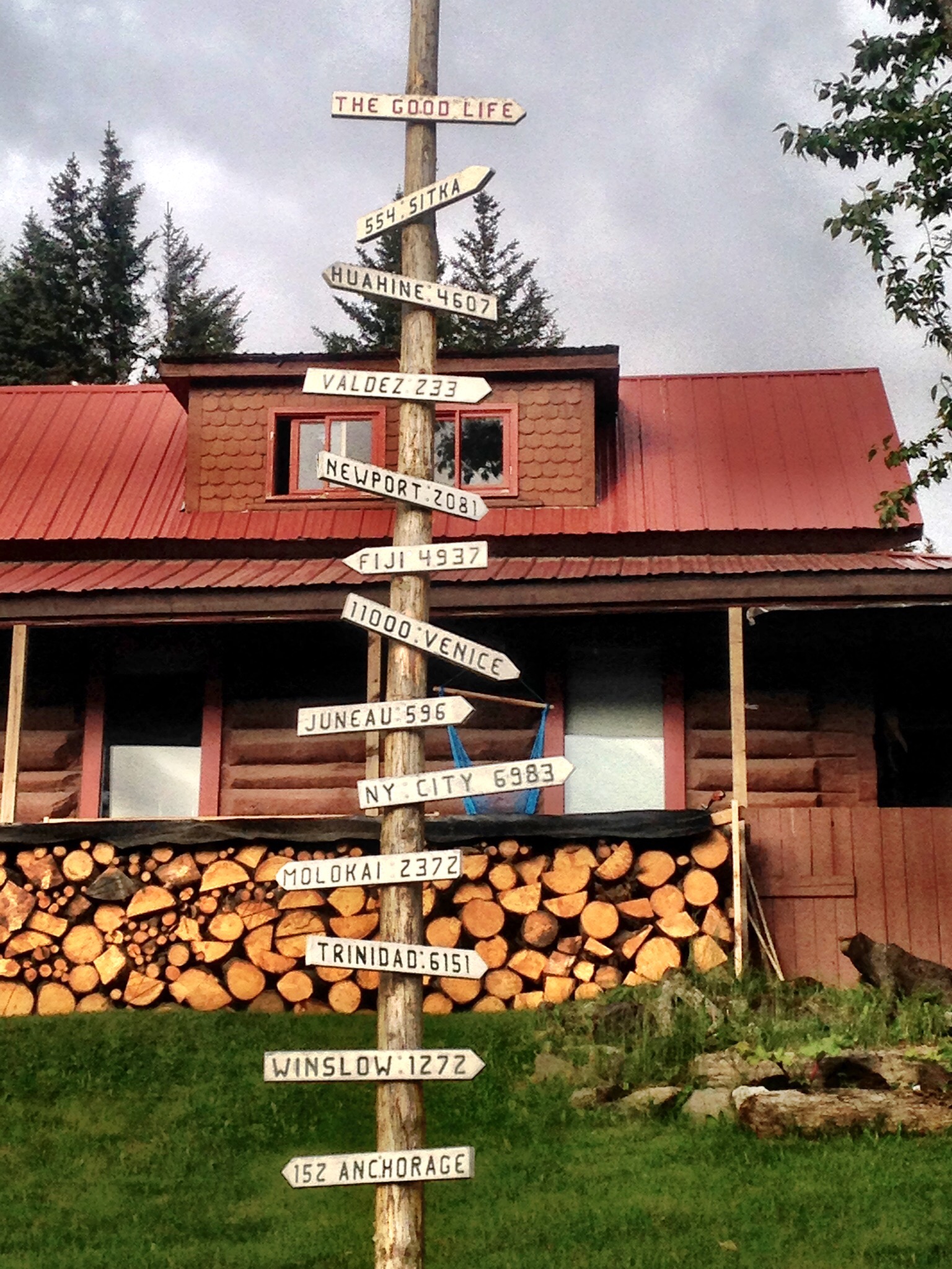
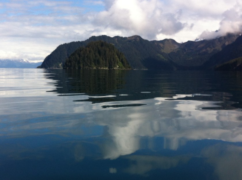
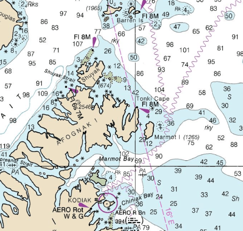
On Sunday, June 12, I awoke early, excited for my first ride on a float plane. We were headed for Shuyak Island State Park to collect marine debris using sea kayaks. Shuyak Island is the northernmost island in the Kodiak Archipelago, and the winds and currents of the Gulf of Alaska deposit tons of marine debris on its shores each year. Tom Pogson of the Island Trails Network received a grant from NOAA Marine Debris Program, and months ago, we had applied to participate in this great adventure—paddling in Alaska, float planes, abundant wildlife, and a chance to give back to a sport we love. How could any of us pass up this opportunity?

Tent at Big Bay ranger station, Alaska
Kevin’s and my home for two weeks
Kodiak brown bear
Brown bears sauntering down the beach

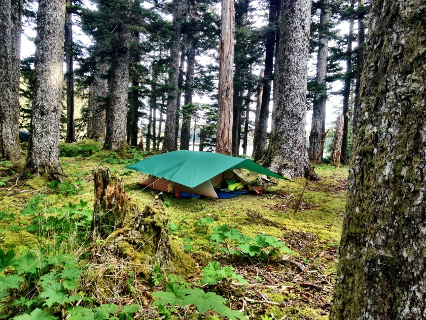
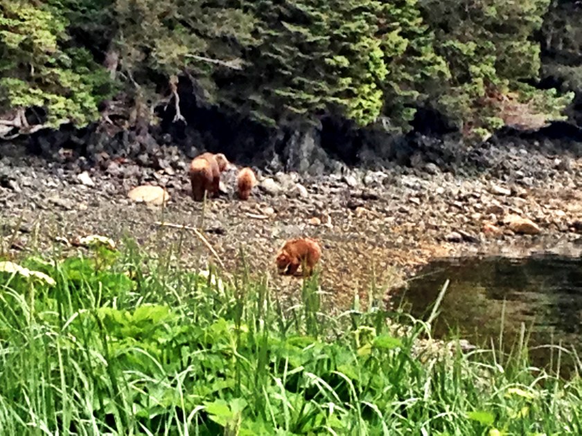
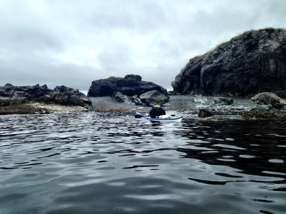
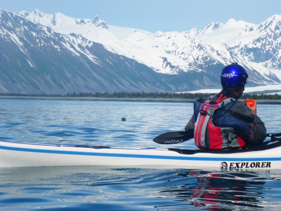
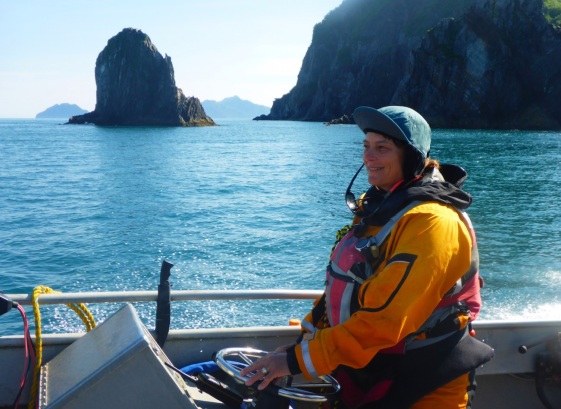
Our team of five had arrived in Kodiak several days early in case Kodiak’s notoriously changeable weather went bad. Dawn, Kevin, and I knew each other from previous kayak trips, and we met Fiona and Kate  at Kodiak Island Brewery the night before. Fortunately. Sunday’s weather was clear and beautiful, and the pilot gave us a tour the land and water between Kodiak and Shuyak. Soon after we arrived, a mama brown bear and her two cubs sauntered down the beach and then up the hiking trail. After sorting out our tents, boats, and gear we paddled out around Eagle Point into the Gulf of Alaska, then surfed the swell home.

Map of Shuyak Island
Shuyak Island Photo credit: National Geographic

Over the next two weeks, we tackled Gulf-facing beaches as well as the protected shores inside Big Bay—the wind and swell determined our daily destinations. Big surf landings onto rocky shores would have been dangerous for both boats and bodies, and we knew that any rescue situation would be difficult and hazardous. An accident that might be a minor inconvenience in highly populated Florida could be life-threatening in remote Alaska.

IMG_2103
Dawn with logo fly swatter

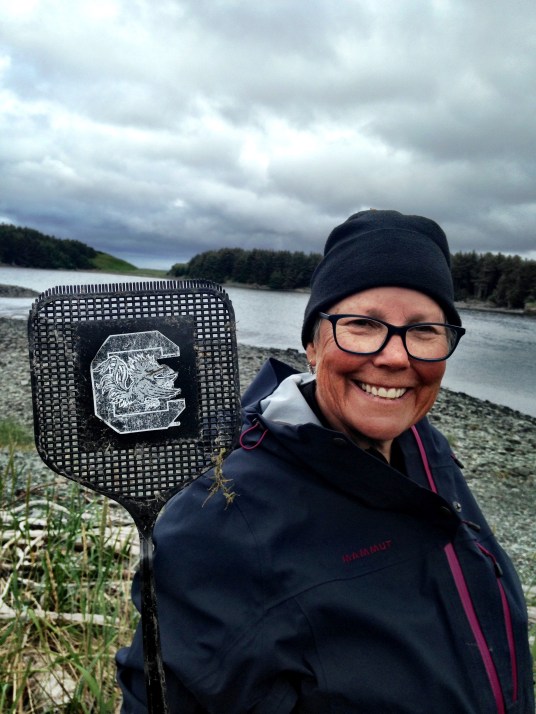
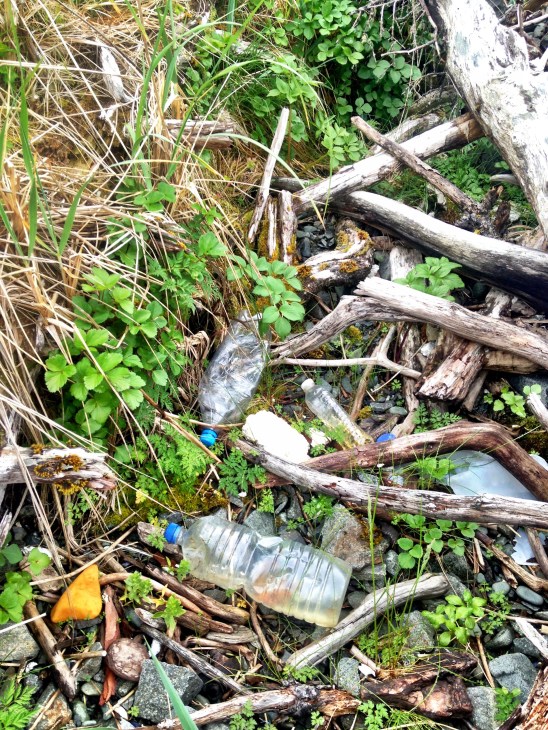
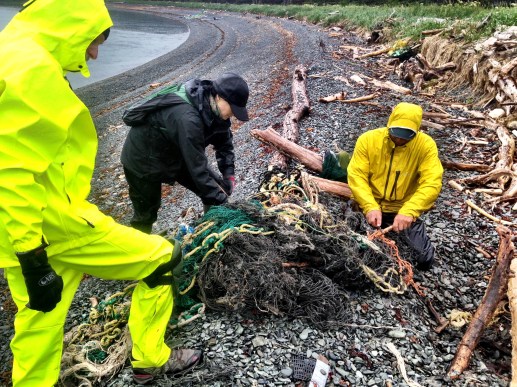
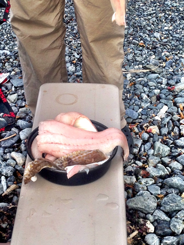
We spent several days cleaning Dead Bird Beach, a two-mile stretch that faced southwest. In addition to a variety of small skeletons (hence the name), Dead Bird Beach was littered with plastics, ropes, and nets. The large plastic objects and buoys were easy to spot, while the nets and smaller plastics blended into the sand, rocks, and wood. Some objects were immediately identifiable—water bottles, fishing lures, and fly swatters. A Wal-Mart shipment of fly swatters and mini-basketballs marked with team logos had fallen off a cargo ship several years prior. Other materials less so, such as the Japanese fishing baskets and bait buckets carried by the tsunami. We learned that light items such as water bottles are driven by the wind while heavier items such as baskets float just under the surface and drift with currents rather than wind.

IMG_1948
A tangle of water bottles and nets
water bottles
Wind carries plastic bottles
IMG_2095
Tom with super sacks
IMG_1930
A small beach on a calm day


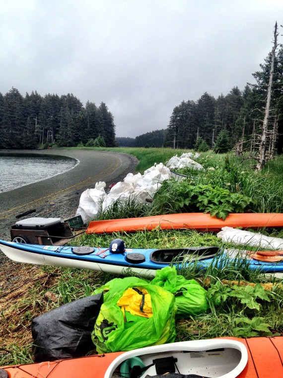
We removed approximately eight super sacks of debris from Dead Bird Beach, and Tom will collect the bags later this summer with a landing craft. (Super sacks are woven polypropylene bags, approximately 3′ x 3′ x 3′.) We labelled each bag with the appropriate two-mile segment, and NOAA and the Island Trails Network will analyze this data in the fall.

IMG_2095
Tom with super sacks
IMG_2039
Piles of super sacks in front of headquarters—Big Bay Ranger Station


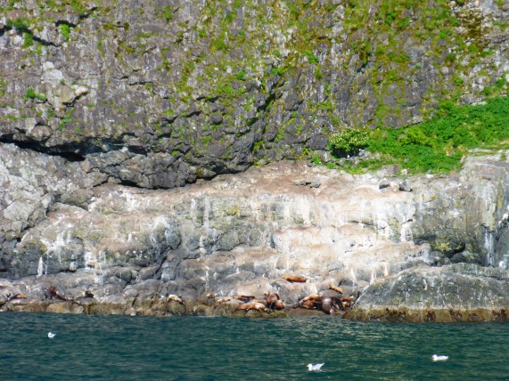
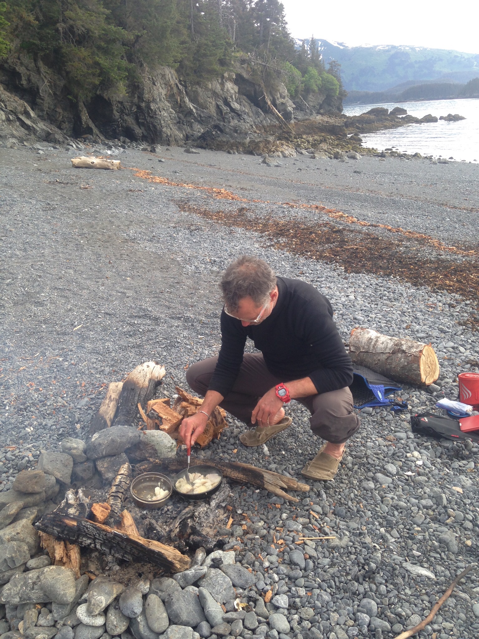
After a week, the winds shifted and intensified, so we moved to the calmer waters of the bay. We worked in teams of two which was sometimes creepy given the possibilities of bears. As we walked along the beaches, we sang out “Hey bear, Hey bear”, the best response being no response. At first glance, these inland shores seemed much cleaner, but we discovered how well the sand and logs camouflaged nets and ropes. In addition to being unsightly, nets pose a hazard to marine mammals, like seals, otters and whales.

IMG_1935
Cutting through gnarly nets on a rainy day

Tom warned us about the amounts of debris we would find on Shuyak Island, but it still surprised me that we found over ten thousand pounds of ropes, nets, and plastics in two weeks. No one lives there, and the island receives few visitors, so all the debris comes from somewhere else. I recalled reading Religious Studies scholar Kimberley Patton’s book The Sea Can Wash Away All Evils: Modern Marine Pollution and the Ancient Cathartic Ocean in which she explores the longtime human habit of throwing our waste into the sea. Perhaps it mattered less two thousand years ago, before people owned so much stuff.

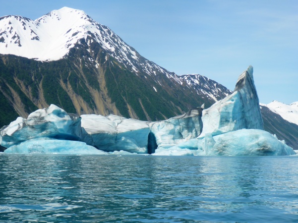
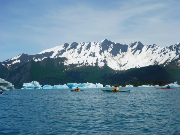
Last February, I participated in Exxpedition, a sailing voyage on the 72′ Sea Dragon, assisting scientists investigating how disintegrating plastics disrupt the endocrine system. Exploring Shuyak Island in a 16′ kayak offered a different perspective, and I learned how larger plastics and debris migrate with wind and current. Nonetheless, the marine debris in both Alaska and the Caribbean primarily comes from somewhere else until it reaches that magical place called away.

IMG_2070
Loading and unloading on our return to Kodiak

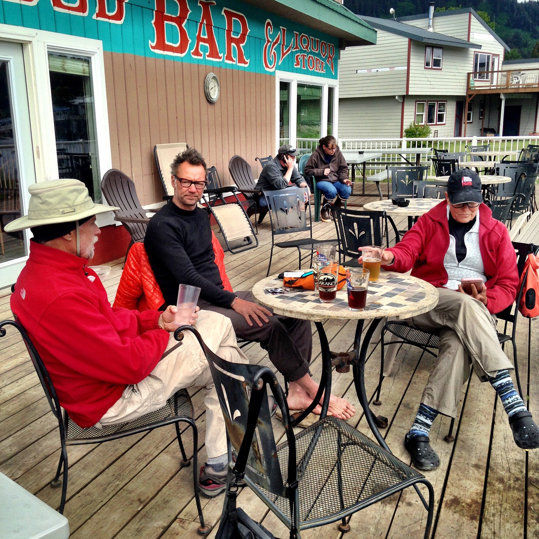
On a cold rainy Sunday morning, the float plane brought our crew back to Kodiak and flew a new crew. As we flew away, I looked back at the super sacks on the beach and thought about what we had done. Overall, the trip gave me a terrific opportunity to spend time camping and paddling on a remote island in Alaska and to meet others who share these interests. But my experiences in the Caribbean and in Alaska have made me even more concerned about threats to our water, especially those at home in Florida. Perhaps, at one time, the sea washed away all evils, but today, the garbage we throw in the water comes back to haunt us.

Exploring Bear Glacier by Kayak

2016-05-26 16.24.34 (1)
Icebergs at Bear Glacier, Resurrection Bay, Alaska

Crackle swoosh boom! …. The sounds of a melting and calving glacier. Twelve kayakers awed by the ethereal blues of house-size icebergs floating in a glacial lake. We sat quietly, in communion with this living glacier until one large splash of falling ice broke the spell. We were in Alaska, far from my home in Florida.

2016-05-26 16.11.19.jpg
Paddling around the icebergs


2016-05-26 16.47.07
Brian enjoying the view

We paddled to Bear Glacier on our last full day of a week-long trip to Resurrection Bay. Our home base was the Kayakers Cove Hostel, about a 12-mile paddle from Seward, on the Kenai Peninsula. During our week there, we watched whales, otters, and sea lions and explored caves and rock gardens. With Levi Hogan of Turnagain Kayak, along with Dale Williams of Sea Kayaking USA, Tom Noffsinger, and Tony Hammock, we practiced rescues, rock gardening, and strokes along the rocky coast.

Our weather was spectacular, mostly clear and sunny, which meant we traded rough conditions for terrific views. Kevin and I had done the Resurrection Bay trip in 2015 with rougher conditions, so this seemed like an entirely different experience. A combination of sea swell, tide, and wind direction dictated each day’s activities. Last year, the winds mostly blew from the north, so we headed out towards the open waters of the Gulf of Alaska. This year’s winds blew southerly, offering a different set of explorations.

Towards the end of the week, Levi announced that conditions were favorable for Bear Glacier, and we leapt at the chance to kayak among icebergs. We would paddle the 10-ish miles to Bear Glacier, then return by water taxi in two shifts, six paddlers and six kayaks on each trip.

Bear Glacier
Bear Glacier from Google Earth

We launched at 9 a.m. with drysuits, helmets, and extra food and clothes – just in case. As we passed the southern tip of Fox Island, Levi checked for confirmation of our pick-up. We had little or no cell service at Kayakers Cove—a wonderful cyber-vacation, but missing a text from Joe, the boat captain, would have resulted in a long, cold, and unexpected paddle home. As we paddled around to the east of Fox Island, we moved to the middle of the channel to ferry glide across and surf the wind swell. To quote Tom Noffsinger, “When asked if you want to surf, the correct answer is always ‘yes’”. I agree. The wind and swell gave us an easy ride across Resurrection Bay, and we soon reached Callisto Head.

As we paddled around Callisto Head, Bear Glacier appeared in the distance. Resurrection Bay gave us some small swell, and we played among the rocks along the way. Navigating a 17’ kayak through rocks can be like threading a needle, and a fun challenge with the right swell. Levi reminded us that fiberglass NDK boats and rocks do not mingle well and warned us not to go over any overfalls, where swift currents flow over exposed rocks. A severely damaged boat would be dangerous in this remote area. Soon after, I misjudged a swell and flew towards an exposed rock. Fortunately, an opposing swell covered the rock, and I sailed over it unscathed. I did not make that mistake again.

2016-05-26 14.10.58
Bear Glacier and a visit from a seal
2016-05-26 14.41.22
Ed playing in a tidal race

The entrance to Bear Glacier Lake was still several miles away. As we paddled across, seals and seal lions popped their heads up, curious about our strange crafts, and played in our wake. The mouth of the Bear Glacier River created a tidal race where we surfed in the waves. This water was cold—glacial melt.

After we played, we landed our boats, carried them up and over the rocky ridge, and launched again in the slower and deeper section of the river. This shallow braided river is the only access to Bear Glacier, so only those willing to paddle or walk (or pay an exorbitant helicopter fee) get to see the glacier. (In 2015, Kevin and I saw the Aialik Glacier on a Kenai Fjords tour.)

Resurrection Bay Map
Resurrection Bay (Photo credit: http://www.wildernessimage.com)

We eddy-hopped our way upstream, where house-sized and larger icebergs floated in the lake. Although we were still at least a mile from Bear Glacier itself, its presence enveloped us in the sights and sounds. We paddled carefully around the floating ice, knowing that our helmets offered little protection from falling chunks.

I sat in my kayak, mesmerized, but I wondered about its future. What will Bear Glacier look like in twenty years in an era of rapidly retreating glaciers? In India, Gangotri Glacier, the source of the Ganga and sacred to Hindus, has receded dramatically in recent years. In the late 18th century, Gangotri Temple sat at the foot of the glacier, but by 1992, when I visited, pilgrims trekked 12 miles over two days from the temple to Gangotri Glacier.

gangotri_ast_2001252
Retreat of Gangotri Glacier (Photo credit: http://earthobservatory.nasa.gov/IOTD/view.php?id=4594)

Though Alaska seems remote from Florida, retreating glaciers and melting sea ice contribute to the rising sea levels that erode our shores and flood our seaside cities. Maybe Alaska and Florida are not so far apart after all—a baked Alaska means a soggy Florida.

2016-05-26 20.46.32
Sea lion haul-out in Resurrection Bay
Driving the boat
Driving the boat home

We paddled back towards the river, carried our boats back across the ridge, then headed towards our pick-up point. Our captain Joe ferried us back in two groups and took us past a sea lion haul-out. I was fortunate to be in the second group, leaving me with more time to relish this exquisite beauty and to play among the rocks. Back at Kayakers Cove, we relaxed over wine and fresh-caught fish, cleaned and caught by Joe, demonstrating Alaskan hospitality. Bev and James treated us to their amazing fish-cooking talents that evening. Our week in Resurrection Bay was filled with highlights—great paddling and great friends, but our trip to Bear Glacier stands out among these highlights.


Halibut and Mussels: Gorging on Alaskan Hospitality

I am sitting here at Susitna Place Bed and Breakfast in Anchorage, reflecting on our amazing run of clear and sunny weather. Denali is playing hide and seek, poking its head out from behind the few clouds that dot my horizon. Dawn, Kevin, and I are staying in Anchorage for a few days of r and r, relaxing after our Kachemak Bay paddling trip and gearing up for Shuyak Island.

Levi of Turnagain Kayak
Right Beach campsite

We paddled along the Kachemak Bay Water Trail for one week, camping on beachfront campsites. although we had expected conditions that would let us play in tidal races and caves, the calm weather allowed us to bask in the beauty of the Alaskan waterscape.

Sadie cove waterfall

The previous Sunday morning, Levi Hogan of Turnagain Kayak left the four of us, our boats,and a mountain of gear at Homer Spit. Homer Spit extends about six miles into Kachemak Bay, and from there, we could see almost all of our intended route. Our winds favorable, we launched into the calm waters of the Bay towards Gull Island, 2 1/2 miles across the Bay. A strong tailwind gave us a welcome assist, and small waves pushed our loaded boats towards our first campsite. After a quick nine mile paddle, we reached our campsite at Right Beach, our home for two nights. On our layover day at Right Beach, we explored Halibut Cove and the nearby islands. Humpback whales put on a whale show in front of our campsite.

Halibut cove

Most of the Kachemak Bay Water Trail lies in the Kachemak Bay State Park, and the campsites and their amenities are clearly marked on the park map. Right Beach offered an outhouse and a water source, but the bear lockers excited us the most. Levi had given us bear canisters to hold our food, but the canisters proved to be Dawn- and Whitney-proof in addition to being bear proof. I stored my coffee in the bear vault over night, rightly surmising that fighting with the tabs on the canister BEFORE coffee would not work out well.

My nemesis — the bear canister

Two days later, under an overcast sky, we left Right Beach and headed for Kayak Beach, our home for three nights. We paddled past Halibut cove and Gull Island and around the point. As Kayak Beach came into view, we saw that the beach was full of tents and people, a surprise after the relative isolation of Right Beach. The several families present had been part of a larger group who camp there each year over the Memorial Day week. Over the years, they have created plumbing systems, a hot tub, and sophisticated cooking systems. They were just packing up to leave, and we wondered how they would fit the mountains of gear into their boats. These campers demonstrated what we have found to be Alaska generosity — they offered us water from their taps and home-smoked maple salmon.

Later that afternoon, two fisherman and their young sons came to stay in the campsite’s yurt. Most of the campsites have a yurt, complete with cots and wood stove. These fisherman too shared their bounty, giving us halibut, moose, and mussels. The two boys — about 8 and 11 — showed us how to collect mussels and cook them in sea water for flavor. They, too, were incredibly kind, but I wondered if they didn’t look at us with a bit of pity — like baby otters who couldn’t fend for themselves.

Halibut and cod
Ed cooking fish

On our two layover days, we explored nearby coves and islands, first Tutka Bay, graced with waterfalls, and saw the salmon hatchery in Jakaloff Bay. Later, we paddled through the arch on Elephant Rock, just off the tip of Yukon Island, then down Sadie Cove, hoping for a glimpse of the rumored $5,000 per night lodge. The tidal range in Kachemak Bay is enormous, and our last night at Kayak Beach co-incided with one of the highest tides — 21.5 feet. On our last night there, Kevin woke us, shouting that our gear was floating away. We leapt out of our tents and dragged our gear to higher land. Sadly, the fire that we had cultivated for the past several days was lost to the sea.

Fire ring buried by high tide
Kevin in Kachemak Bay
Glassy seas on Kachemak Bay

The seas were glassy for our 12.5 mile trip to Grey Cliff, just north of Seldovia. Seeing our reflections in the water seemed surreal, almost Dali-esque, as we paddled through this otherworldly-landscape. As we rounded the Seldovia headland, we finally found a play spot, a small tidal race where the out-going river flow met the incoming tide. What we call a tide race is labeled on our charts as ‘rip tide’. We surfed in the waves, then continued on to our campsite. Our Graycliffs campsite was in the Seldovia community park—we had passed out of the Kachemak Bay State park.

Lunch on the beach
Scary stuff

Soon after we arrived, a man drove up on an ATV—our ‘trail angel’. Gary told us about the park, drove us into town, and gave us a bottle of smoked salmon-flavored vodka, again demonstrating Alaskan generosity. Thus began the civilization part of our wilderness expedition. We ate, drank, and gorged on wi-fi. Friends had told us that the Kachemak Bay Water Trail was not a ‘wilderness’ trip, and our days in Seldovia proved that.

Relaxing in Seldovia
Seldovia distance sign

Back in Anchorage, looking at the calm waters of Cook Inlet and seeing Denali, I realize that we have had a remarkable weather window. While we have had few fun ‘conditions’ for play, we have had the luxury to fully be present in the sights and sounds of Alaska’s landscape. In several days, we fly to Kodiak and then on to Shuyak Island for the third leg of our trip. Who knows what the weather will bring, but whatever happens, I’m sure it will be interesting.

Alaska: Where the Wild Plastics Are

clouds and water.jpg
Resurrection Bay, 2015

Boat repair kit — check. First aid kit — check. Three days until Kevin and I leave for six weeks of kayaking, camping, and trash hauling in southwest Alaska. Packing and logistics are complicated because our trip has three separate legs. First, a week in the Kayaker’s Cove Hostel in Resurrection Bay, exploring caves and Alaska-style rock-gardening. Second, a self-supported wilderness kayak camping trip on the Kachemak Bay Water Trail, ending in Homer. Third, we will join a team of volunteers on Shuyak Island State Park, collecting marine debris by sea kayak–a perfect blend of adventure, ecology, research, and writing. Shuyak Island lies in the eastern end of the Kodiak Archipelago.

Shuyak NOAA Chart.png
Shuyak Island

In February, I joined the crew of Exxpedition on Sea Dragon, a 72’ sailboat, and wrote about our journey in There is No Magical Place Called Away. We sailed from Trinidad to Barbados to St. Lucia, testing waters for disintegrating plastics and meeting with concerned islanders. The founders of Exxpedition are researching threats to health—especially to women’s health—from endocrine disruptors leached from plastics thrown away into the sea.

Now, I’m facing northward, towards the Gulf of Alaska where large plastics and other items float from Japan and points east. Instead of bathing suits and board shorts, I’ll be wearing neoprene booties, smart wool and a drysuit. These trips to the north and south–both focused on marine debris–seem like bookends to me and highlight the global dimensions of ocean health.

whit drysuit2.jpg
Last year in Alaska

Tom Pogson of the Island Trails Network, a community-based non-profit specializing in marine debris advocacy in the Kodiak Archipelago, is coordinating this clean-up effort. Fellow paddler Dawn Stewart saw Tom’s call for experienced sea kayakers to volunteer for two-week stints, and the three of us applied that night. It was too exciting an opportunity to pass up—wilderness kayaking and cleaning up Alaska’s shoreline. In NOAA’s Marine Debris Blog, Tom described the difficulties of accessing Alaska’s largely road-less shoreline, other than by small boat and float place. Alaska’s waters have enormous tidal flows—which make for rough water and fun kayaking!

13100912_10207938446231639_3032237687424183730_n
Our kayaks are already delivered! Photo by Tom Pogson

Tom sent us an extensive packing list, and our living room is strewn with gear that must fit into our kayaks. In addition to the expected paddling and camping gear, we have Xtratuffs–rubber boots that apparently all Alaskans routinely wear, knee pads, and heavy duty rubberized yellow rain gear. Kodiak and Shuyak Island are rain forests, so we can expect to be wet and muddy for several weeks. I’ve also packed massive quantities of coffee for survival.

Alaska gear
Alaska gear plus one black cat

Like the rest of Alaska, Shuyak Island’s weather is unpredictable, ranging from sunny and clear to gale force winds. It could look like this:

13233016_10207967359674457_4875385718279655854_n
A delightful spring day on Shuyak Island Photo by Tom Pogson

or like this:

Textbook storm explodes near Kodiak Alaska

ak-storm-1.jpg
A not so delightful Kodiak storm Photo credit: northwestpassage2012.blogspot.com.

A float plane will carry us and our gear from Kodiak to Shuyak and will resupply us with food midway through our visit. During these two weeks, our team of 7 will collect, haul, and drag–whatever it takes–junk that others have thrown away or lost. Later in the summer, others will collect and study these items. Judging from pictures of last year’s clean-up on nearby Tugidak, these wild plastics will be human-size and larger. On the Seadragon, the scientists of Exxpedition needed microscopes and tweezers to handle the microparticles we found, but on Shuyak, we will just need brute strength.

img_4145-tugidak-island-float-plane
Photo credit: Island Trails Network
imgp3609-one-of-5-yokohama-fenders-removed-from-tugidak-island-alaska.jpg
Debris from Tugidak Photo credit: Island Trails Network

Enough about the debris—we are going to an incredibly beautiful and wildlife-rich area. We should see harbor seals, birds, and, possibly, bears. Tom has been teasing us with breath-takings pictures for weeks now, and I can’t wait to see this area in person.

13221034_10207967358114418_4173191688386811368_n.jpg
Shuyak Island from above Photo: Tom Pogson

Our preparation time is winding down, and we are consolidating our gear into checked bags. From the tropics to the Arctic, we are going where the wild plastics are, to the beauty of Alaska’s waters, and whatever adventures they bring.


To Sup or Not To SUP

OLYMPUS DIGITAL CAMERA
Ocklawaha River. Photo by Liz Sparks

Despite being a diehard kayaker, when I first saw a paddleboard, or SUP, I knew I would love it. I liked the idea of being able to stand up and paddle, and I thought that SUPs would be perfect for the flat rivers and spring runs of north central Florida where I live. Now, after several years of paddleboarding, I have taken my 10′  ULI Steamroller all over Florida and Georgia, to the ocean, gulf, rivers, and springs. I also bought a 9′ AllWave Fanatic for surf, which is perfect for the baby waves I can handle.

Getting Started
Standing up on a paddleboard is fairly intuitive, and it doesn’t take much to get going. And if you fall in, just climb back up on the board, a real benefit on a hot Florida day. I first tried paddleboarding at the Sea Kayak Georgia Symposium, which although primarily a kayak event, often has several SUP options. Danny Mongno from Werner Paddles, showed me two types of paddle strokes and taught me how to do pivot turns, which helps me in the surf. As in kayaking, paddling comes from the core, not the arms, so learning proper technique has helped me avoid shoulder wear and tear. As I have become addicted to SUP surf, Ronnie Kemp of Sea Kayak Georgia has mentored me on techniques, such as turning on the wave. Just like skiing, though, learning to surf takes a lot of falls. As Ronnie reminded me the other day, I spent more time in the water than on the board.

Whit-pboard
Suwannee River. Photo by Anne Ledbetter

Paddleboarding is a different workout than kayaking, and it engages different muscle groups. When I first began, my feet hurt from gripping the board, and my legs get a workout from constantly balancing–especially in choppy water. Paddling through the surf is a full body workout, and I have learned to loosen my legs to paddle over waves.

Where to SUP
Florida’s calm rivers and springs are ideal places to SUP, and standing up on the board offers a terrific vantage point to see manatees, fish, and turtles.

Manatee from a SUP
Manatee on the Ichetucknee

I often paddle the Ichetucknee River, starting at the south entrance and paddling upstream to the headspring at the north entrance, then floating back down. Paddling upstream on the Ichetucknee–and most springs–is not difficult. In places where the river narrows and the flow is stronger, I hop from eddy to eddy, working my way upstream. Last week, I paddled up the river and swam down, pulling the board behind me, and experienced the river from above and below. Spring runs like the Ichetucknee, Wakulla, and Rainbow Rivers are perfect places to get your ‘board legs,’ and the Ichetucknee State Park’s new outfitter rents extremely stable boards.

P1000912
Jill Lingard on the Ichetucknee River
Lis Sparks DeLeon
Liz Sparks near DeLeon Springs
kayakinspring2
Kayaks on Cannon Spring during the drawdown

The shallow water of the Florida Keys is perfect for paddleboards. I’ve seen a variety of marine life, including baby nurse sharks hiding in the mangroves around Bahia Honda, Knight’s Key, and Curry Hammock State Park. At times, I’ve had to lie flat on my board to get through mangrove tunnels, a challenge to boarders. The shallow waters of the Keys and the darker waters of the St. Johns River and Ocklawaha River present another challenge to boarders: the fin. Several times, my fin has snagged on roots under the water and pitched me forward to an undignified face plant on the board.


To SUP or Kayak?
I am equally happy on a board or in a boat, so how do I choose? For spring runs or anytime I want to swim, I usually choose the board. To me, it’s just an excuse to jump in the water and swim, then climb back on. I love it for spring-hopping on the Santa Fe and the Suwannee rivers. For longer paddles, especially where the water might be choppy, I generally choose a kayak. While I can easily keep up with rec boats on my ULI board, I can’t keep up with longer sea kayaks. On Paddle Florida’s December 2015 trip on the St Johns River, the high winds and rough waters made my decision easy. I was comfortable in my 17′ kayak—paddling a SUP against those winds would have been miserable. I battled 20 mph headwinds on the Ocklawaha River earlier this week, and I think that might have been my limit.

13119114_1576860242644634_6922929419532750180_n-1.jpg
The wind-free Cannon spring run

What’s Next?
In the nine years I have lived in Florida, I have paddled all over Florida, on my own and with groups like Paddle Florida. My husband Kevin is an avid paddler, and we have explored and camped in the Keys and the 10,000 Islands and are eager to explore more of our state. I would like to try camping from a paddleboard and am looking at longer, solid boards that will carry my gear. So, you might see me on my new, longer board on the Florida Circumnavigational Saltwater Trail in the next few years.

mainmap.jpg
Florida Circumnavigational Saltwater Trail

Becoming Enchanted by the Springs

img_0095
Ichetucknee paddling gang

I find it difficult to explain the magic of our springs. You just have to see them or, better yet, swim in their crystal clear waters. Sometimes I tell people that it feels like flying, floating with nothing supporting me from above or below. And I tell them about spring-hopping down the Santa Fe and the Suwannee rivers and paddling down spring runs like the Ichetucknee.  They nod politely and ask if Gainesville is close to the beach. (No, it isn’t.)

Finally, someone bit. I just spent five glorious days introducing two friends to our own spring-shed in north central Florida and witnessed the springs work their enchantment on my friends, as they have on so many visitors before them. And this is important as those of who care about the springs know–people won’t protect what they don’t know about and love.

After a long winter in Michigan, Carol and Kiran arrived, ready to paddle and ready for spring. We had been emailing back and forth about options—I sent pictures and links about the Rainbow, the Ichetucknee, and the Ocklawaha, among others. An embarrassment of riches. “Everything”, they said, “we want to do it all.”CE2A224B-FFE9-44CF-B9B7-3A23A1AFE43C

We started with the Santa Fe. With two kayaks, one paddle board, and a car full of gear and snacks, we arrived at Rum 138 in Fort White, just 45 minutes or so north of Gainesville. While I pumped up my board, Carol and Kiran learned about the springs and features that we would see on our trip. We launched boats and board at Rum Springs and immediately paddled upstream to circumnavigate the appropriately named Rum Island. Rum Island lies between two county jurisdictions and, according to rumor, was home to moonshine and boot-leg operations.P1000916

P1000917
Paddling over Blue springs

Soon after, on the left side, we spotted the clear outflow that marked the entrance to Gilchrist Blue Springs. Leaving the tannic waters of the Santa Fe behind, we paddled upstream to the headwaters where we donned our masks and swam over the vent that releases the spring flow. The flow is strong so you need to hold on to get a good look.

img_3073
Blue spring vent
img_3068
Swimming in Blue

Diving down and looking back up toward the water’s surface gives a funhouse mirror-like distortion of the trees and clouds above.

img_3062
Springs impressions

We had some company — others were jumping off the platform into the spring below, probably students blowing off tension from final exam preparations.

Next we swam our boats to the entrance of Naked Springs and walked up to the headspring.

img_3080
Naked spring run

If Blue Spring had not enchanted my friends, Naked Spring worked its magic. The spring run was empty of people, and woods in-between silenced the noise, yelps, and music of Blue Springs . We swam around the two vents of Naked Springs, watching fish who also seemed curious about us. Swimming through the clear water transports me to another world — the quiet disorients me, and when I pop my head up out of the water, it takes a moment to resituate myself in time and place.

We floated down to Devil’s Ear, Ginnie, and Dogwood Springs, but after such a long time in Blue and Naked Springs, we were too cold to swim. Our perpetually cool springs even chilled my visitors from the cold north, and we made a note to pack neoprene for the next day. As we floated towards the Highway 47 bridge, the sky grew darker, and we quickened our pace, partly to keep warm and partly to avoid the rain that was sure to come. We heard one rumble of thunder just as the bridge came into sight—perfect timing.

Just one day in the springs, and my friends were hooked and ready for more. The next day Mary Jane and Janice joined us on the Ichetucknee, one of our premiere spring runs. We launched at the south entrance, which had been closed for renovation, and headed upstream, against the spring’s flow. The lower portion of the river gives a swampy feel — the river twists and turns under a tree canopy. Although the road is nearby, the trees and vegetation make the river feel far more remote than it is. We waved to the tubers and paddlers floating downstream, with the flow, and some wondered why we bothered paddling upstream.


Lone manatee

When we passed the mid-point entrance, we looked for the lone manatee that I had seen several days before. The river opens up at this point, and I have often seen manatees chomping away at the vegetation. No manatees, but the turtles and egrets put on their own show as we made our way towards the headspring.

img_3065
Row of sunning turtles

Heading downstream, we immersed ourselves in an underwater theater. Donning mask, snorkel, and fins, we swam, pulling boats and board behind us. We met mullet, gar, and turtles face to face. For the hour or so of the swim to the take-out, each of us was immersed in our own thoughts and our own world, completely unplugged. A rare opportunity to just be and let my thoughts drift.Nonetheless, while I love this freedom, by the end of this swim, my thoughts have usually drifted towards the possibility of alligators as I reach the warmer waters where the Ichetucknee feeds into the Santa Fe. The take-out is a welcome site.

img_3072
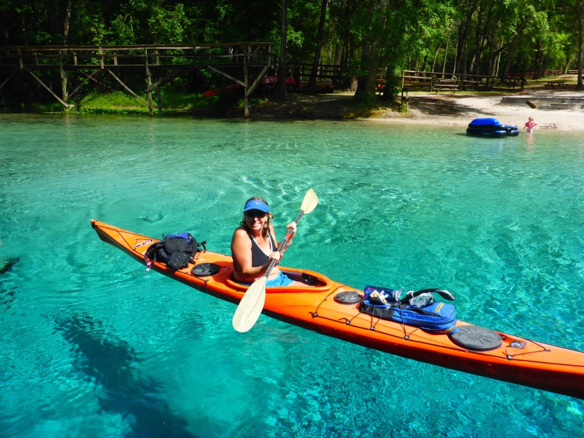
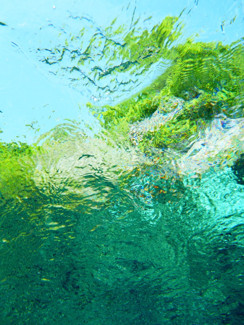
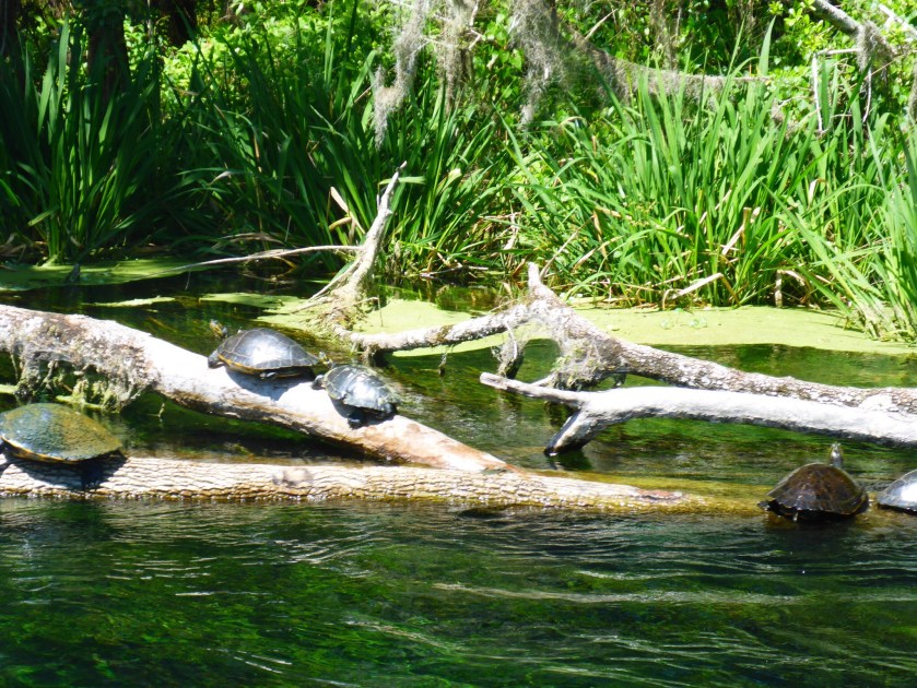
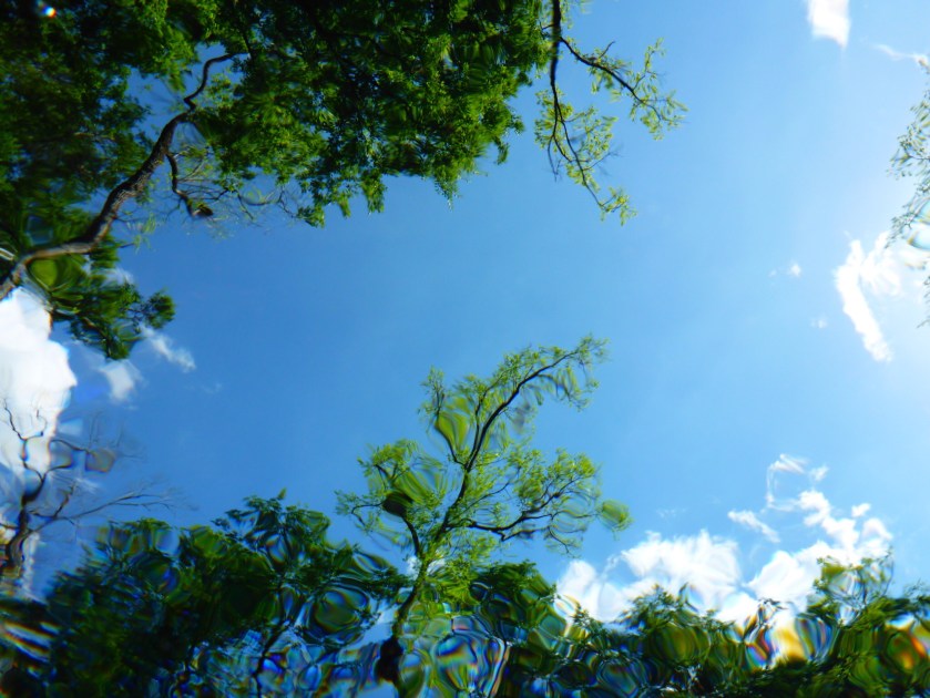
Swimming and paddling in our springs feels like a gift, but seeing them through the eyes of new visitors makes me fall in love all over again. My friend Flo Turcotte, UF archivist for Marjorie Kinnan Rawlings’ papers, detailed how Rawlings became enchanted by north central Florida’s primeval landscape in her article “For This is an Enchanted Land“. I saw the process of enchantment begin anew, and I know that my friends will come back for more.

img_3058
Devil’s Eye

When Vacation Becomes an Adventure

Blue skies on the Suwannee River.jpg
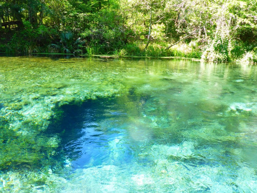
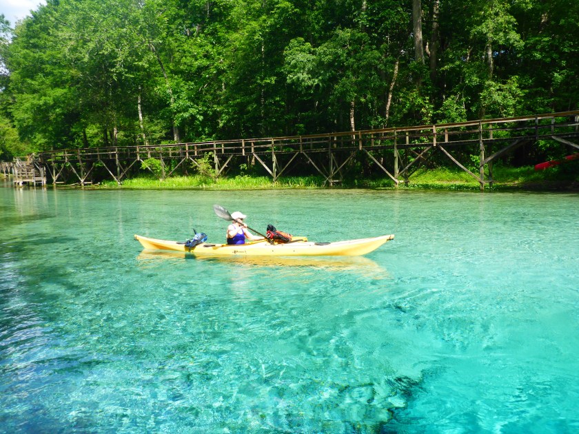
On Saturday morning, April 2, 90+ kayakers and one paddle boarder (me) launched from Spirit of the Suwannee to paddle 20 miles downstream back to our campsite at the Suwannee River State Park. We were all part of Paddle Florida’s annual Suwannee River Paddling Festival, scheduled each year for the first weekend in April. Paddle Florida‘s motto is “Inspiring. Meaningful. Adventure.”And while our performers and the river itself fulfilled the first two promises, Mother Nature served us a full plate of adventure with Friday night’s storms and flooded rivers.

Participants arrived Friday afternoon, under foreboding skies, and we all knew that storms would roll through Live Oak at some point that night. We set up our tents on the bluff overlooking the river, staking out lines with care to make them as rain-proof as possible.


The rain held off for our evening entertainment– Thomas Hawkins from Florida Defenders of the Environment, told about work to restore the Ocklawaha River, and Matt Keene’s River Be Damned documentary narrated the Ocklawaha’s contested history and portrayed river’s beauty in its free-flowing state. Many in the group had paddled on the Ocklawaha River during the recent drawdown and seen springs like Cannon that are visible only when the Rodman Reservoir is lowered. Currently, there is much dialogue and debate among those who wish to restore the Ocklawaha River to its natural flow and those who have grown attached to the lake-like ecosystem of the Rodman Reservoir. I recently wrote “Requiem for a River” about those of us grieving the loss of these springs. Thomas Hawkins brought up the point that many supporters of the Rodman Reservoir have already mourned the loss of the free-flowing Ocklawaha and cannot bear the loss of this new ecosystem they have come to love. Most everyone agrees that we never should have damned the river in the first place, but now, whatever we do will make someone unhappy.

We stayed dry for another hour while Scott Jantz led his ghost tour around the ruins of Drew Mansion and Ellaville across the river. By the time the group returned from their ghostly walk, around 10 pm, the raindrops started, and thunder grew louder. Time to hunker down in our tents. Over the next eight hours, storms rolled through the Panhandle, along the I-10 corridor, pelting us with rain and lighting up the sky. When we emerged from our tents for breakfast, the rain had slowed to a drizzle. Some tents had fared better than others, and few campers had slept well. My tent and tarp combo–described as looking like a child’s sheet fort–kept me dry, but others spent a very wet night. Everyone, it seemed, was grateful for coffee that morning.

2015-16 is an El Niño year, and Paddle Florida trips has felt the impact of that this season, from the Nor’easter on the Bartram trip in December to another overnight soaker on the Great Calusa Blueway trip in February. Someone commented that “extreme weather conditions transform a vacation into an adventure,” and rising to meet these challenges is satisfying and also gives us much better stories. I wonder how our weather apps change our experience? I camped for years without access to weather warnings, but now my iPhone alerts me when I am in the red tornado watch zone. Do I really want that information when there is little I can do about it?

The skies were gray but clear when we launched at the Spirit of the Suwannee beach Saturday morning. We floated past the limestone bluffs that line the river until we reached our lunch spot at 12 miles, Gibson Park boat ramp. The paddling was difficult- we paddled against a headwind, and while we assumed that the rains would make the flow faster, we were wrong. Many people were grateful for Paddle Florida’s signature PBJ lunch spread and perhaps even more grateful for the opportunity to take the shuttle back to the campsite. The paddle both before and after lunch was beautiful and serene, especially as the skies cleared just as most of us arrived in camp. The sunny afternoon skies allowed tired paddlers to nap, dry their tents, and, for the slightly more energetic, place bids at the silent auction. The auction which raised money for the Florida Defenders of the Environment was followed by a sunset serenade by singers Frank Lindamood and Lon and Lis Williamson.

Saturday night’s clear skies and cool temperatures let us all get a good night’s sleep for Sunday’s paddle down the Withlacoochee River. The rains in western Florida had been filling the Withlacoochee over the past week, and we heard that the river would be fast. Madison Blue Spring, our launch point, was totally flooded out, and the river moved swiftly past the spring. One by one, we walked our boats down the flooded wooden ramp, launched, and quickly entered the river’s flow. Unlike last year, we did not stop and swim in springs in either the Suwannee or the Withlacoochee. As predicted, the day’s 12 mile paddle was fast as we floated down the river, steering through the swirls and boils caused by the high water levels. In only a couple hours, we reached the confluence with the Suwannee, just downstream of our campsite. After a short paddle upstream, we were home again.Spanish moss and trees lining the Withlacoochee.jpg

The scent of our BBQ lunch wafted over the campsite as we took down our tents and packed up. It was time to say goodbye to new and old friends. Laughing around the campfire. Scott’s ghost tour. Desperately waiting for early morning coffee. Floating down two beautiful rivers. And not to forget the crazy weather. These things bring us together and make us eager to get back on the water.

Requiem for a River

herontrees.jpg

I went to the Kenwood boat ramp last week to see it for myself — how much had the Ocklawaha River risen since the end of the drawdown, and would I still be able to see the tree stumps that reveal the drowned forest below?  I paddled the river during the drawdown, when the Ocklawaha was briefly restored to its natural flow, revealing bubbling springs and sandy banks. Now I felt compelled to witness the reverse, to see how the rising waters covered the treasures below. I was surprised to see that the river level had not yet risen significantly, so I inflated my paddle board and began to paddle upstream. Dark, low clouds filled the sky—which seemed fitting, and I estimated I had about 1 1/2 hours to wind my way through this apocalyptic riverscape.

The Rodman Reservoir had been lowered for the past several months, and, like many others, I took the opportunity to see rarely uncovered springs like Cannon Springs and Tobacco Road. I joined the Florida Defenders of the Environment at Kenwood where Lars Anderson pointed out springs and historical features, and later Captain Karen Chadwick, North Star Charters, gave me a tour on her skiff. I paddled from Eureka West to the boat ramp across from near Payne’s Landing and saw fishers lining the newly uncovered banks.

2016-03-17 10.26.26.jpg

On this day, though, I came by myself, to  be in silence on the water. The overcast day was still, the quiet only broken by the occasional motorboat. The fishermen waved as they went by, and the silence was restored. Several friends told me that they did not want to see the rising water, that it would be too sad. I understood their feelings, especially those of friends who have loved the Ocklawaha for a long time. I am a relative newcomer to Florida and have become enchanted by its springs and rivers and Old Florida, but people who grew up on the Ocklawaha have entirely different stories to tell.

In “How do we Grieve the Death of a River’,  activist Winona LaDuke asks “How do you express condolences for a river, for a life, to a man to whom the river is the center of the life of his people? That is a question we must ask ourselves.” Mining tailings have destroyed the Waatuh River, or “Grandfather”, in southeast Brazil, a river central to the lives of  indigenous people .

Okhlawaha dusk.jpg
Ocklawaha at dusk
Okhlawaha.jpg
Ocklawaha near Eureka West

Many years ago longtime residents grieved as they lost access to their land and homes when the Ocklawaha was first flooded, and they grieve again as the waters rise again, drowning the the sandy banks that provided sanctuary for alligators and birds. The “Restore the Ocklawaha River” Facebook page shows sadness—some  discovered the Ocklawaha’s springs for the first time this year and now mourn the loss. Others wonder why some voices count more than others—why do the voices of the bass fisherman count more than the poor fisherman who cannot afford a boat and have lost access to much of the river? But there is hope as well. The Save the St. Johns Tour brought scores of newcomers to the Ocklawaha River and made many of us realize that we can regain what was lost.

As I paddled among the stumps, I recalled the river bends upstream near Eureka West and the times I swam in Cannon springs. The sky was darkening, and the wind was becoming stronger, so I quickened my pace. I didn’t want to be on the water during a thunderstorm. I paddled through the dead trees — the water was slightly higher than when I paddled this area previously. I had to take care that hidden roots would not catch the fin on my board and pitch me forward. I wished I had seen the forests before 1968, when the Ocklawaha was first flooded.

I paddled hard against the wind and reached the boat ramp. As I deflated the board and packed up, I watched the fishermen pull up to the ramp, also trying to beat the storm. Just as I reached the main road, the storm broke, and lightning filled the sky. I was surprised that I had become so attached to the river in such a short time. I am sorry that the state of Florida insists on drowning the Ocklawaha River, but I am glad that I came to bear witness.

2016-03-17 10.56.36.jpg


On a 72′ Sailboat, Searching for Ocean Plastics

Here is my second blog about sailing, science, and research methods in the Caribbean with Exxpedition. Next week–back to Florida and the Okhlawaha River.


Last week I sailed from Trinidad to St. Lucia aboard the Seadragon, a 72′ steel-hulled boat designed for scientific research. I joined the all-women’s crew of Exxpedition to participate in research and dialogue about the growing problem of marine plastics, and fortunately, the boat had also been adapted for novice sailors. The scientists behind Exxpedition are investigating how disintegrating marine plastics affect human health, especially women’s health, because these plastics contain endocrine disruptors. The boat crews also foster dialogue and collaboration among those concerned about marine plastics, as I wrote in There is No Magical Place Called Away. I was intrigued by the opportunity to meet representatives from Caribbean universities and environmental groups and, also, to conduct research on a sailboat. This trip illustrated some realities of scientific data collection and helped me reflect on my own research methods, which have been primarily ethnographic.

searching for microbiology and plastics partices
Jannica at the microscope in Seadragon saloon

By training, I am an historian of religion, and I study both texts and people. I have done ethnographic research, for example, interviews and participation-observation in different communities. To collect data for my projects, I have recorded songs in Hindu temples, helped plaster a straw bale house, and interviewed pundits at pilgrimage sites for the Hindu deity Balaram. Now, I am looking into people, place, and water, asking people about their connections to lakes, rivers, and the sea and how these places become home to them. How do local fishers think about the mounds of plastics that wash up in their fishing areas?

Plastic and sunken sailboat mar Trinidad beach. environmental activism.
Subsistence fishing near plastic strewn Trinidad beach

The scientists and crew of Exxpedition collected materials for three sets of scientists. Some materials would be sent to the University of Georgia, some to Sweden, and a third set would later be analyzed on board the Seadragon. The spacious starboard forward berth had been converted to a ‘science’ room and held a microscope, beakers, and sieves. I wondered how the microscope would fare with the boat aslant, heeled to catch the wind, and figured that I would soon find the answer.

We planned to collect samples, or ‘ do science’, upon reaching, first, Barbados waters, and then, several days later, St. Lucia. Our two scientists would perform the skilled scientific work, and the rest of us had supporting roles, ranging from dropping the large trawler into the water to documenting coordinates and times of the different samples. On Sunday morning, we left Trinidad for the two day sail to Barbados where we would do our first round of sampling.

Jen rainbow.jpg
Swimming under a rainbow

Two days later, we arrived in Barbados, slightly green at the gills, but excited that we made the crossing. We delayed our first Barbados sampling because since a majority of the crew had gotten seasick. I’m no stranger to throwing up in the course of fieldwork, but I have never had to tether myself into a heeling boat to do so.  Once anchored, we sudsed up and threw ourselves into the water, laughing and diving like mermaids. With fresh clothes and a hearty breakfast of eggs, cheese, and vegetables, we all felt like new women, and it was time to begin trawling for plastics.

Exxpedition in the Caribbean
Hauling in the manta trawler

Trawling required all hands on deck, a labor-intensive process that involved everyone. First, we extended a large pole, perpendicular to the boat, which would support the aptly named manta trawler, shaped somewhat like a ray. The manta trawler, about 4′ long, was designed to skim across the surface of the water, catching plastics and seaweed in the small net at its tail. Another team tossed the mantra trawler overboard, and it took several attempts to insure that the trawler’s tail lay flat upon the water. Unlike our first crossing, the Seadragon was in relatively calm waters, moving slowly at 1.5 knots, but even at the slow speeds, lowering the trawler and holding the lines was a challenge with the boat’s rocking motion.

Meanwhile, a second team filtered sea water samples through a series of sieves, then analyzed particles under the microscope below.

I watched Alice carefully pour water into beakers while the boat heeled, port side significantly higher than port. She poured a total of 80 samples, both control and variable samples, careful not to spill the data.  Soon, these materials will travel in labs in the US, the Caribbean, and Europe, and teams of faculty, students, and lab assistants will analyze the samples on solid ground.

I wonder how many of these scientists realize what was involved in collecting these samples–the physical labor, the seasickness, and the laughter among our team. The results will be presented in a scientific and objective manner, perhaps in charts or figures, that obscure the people and emotion involved. Controls are necessary in scientific research, to have points of comparison. My work, however, focuses on people and communities, and my research has no controls. Instead, in my writing, some of my richest material comes from exploring  my interactions with others and how our worlds come together. In my work on intentional communities, Being the Change, for example, I recognize that my repeated visits have shaped some of the communities I lived in, and I know that I have become a better person for these interactions.

Emily and our Trinidad beach clean up crew. Trinidad environental activism
Trinidad beach clean up team

I wish we had more opportunities for scientists, social scientists, and humanities scholars to work together and learn about each different research methods. We would all benefit from seeing our work through other eyes. After this trip, I will continue my ethnographic research, focusing on waters of the US southeast, but with a  new appreciation of scientific data collection and its translation into scientific evidence.

There is No Magical Place Called Away

I am reposting the blog I wrote for Exxpedition, an all-women’s sailing and research team exploring solutions to marine plastics.

http://exxpedition.com/2016/02/26/there-is-no-magical-place-called-away/
After several days at sea, the crew of the Seadragon disembarked in Bridgetown, Barbados. Our sail from Trinidad was rough, and we were excited to stand on solid ground and to meet fellow environmentalists in Barbados. We had arranged two days of meetings with schools, universities, and Bajan environmental organizations to share concerns about marine plastics and their effects on marine and human health. Although eXXpedition is a sea-based mission, these face-to-face conversations, to me, became the most important and interesting part of our trip. After all, the plastics that litter the world’s oceans come from the land, so our solutions, too, must be land-based, and we need to work together across borders to save ourselves and our seas.
The Seadragon had reached Barbados two days earlier, our 72′ sailboat dwarfed by the cruise boats, tankers, and container ships anchored in the island’s small port area. Once unpacked, these ships disgorge the thousands of plastic bags, wrappers, and bottles that pass only briefly through human hands on their way to landfills and, worse, the sea. Marine scientists had presumed that these plastics amass into enormous plastic islands, floating in perpetuity in 5 separate oceanic gyres. However, more recent research suggests that these plastics disintegrate into micro particles that migrate back from the ocean into our bodies. For the two previous days, in between bouts of seasickness, the crew had trawled Bajan waters to find traces of these micro particles.

We anchored in Carlisle Bay, and our skipper Shanley ferried us by dinghy to the public dock near Independence Square. From there, our tight knit group split in two and headed in separate directions. One group met with primary and secondary schools and representatives from Marriott hotels, and my group made presentations at the University of West Indies at Cave Hill and Lockerbie College. That evening, we reconvened for a brainstorming session with the Future Centre Trust and representatives from local environmental groups.


Seadragon


We told stories about our successes and failures, our victories and frustrations. We commiserated about non responsive governments and friends who turn a blind eye to debris. In particular, we discussed the difficulties of creating a cultural shift, making reusable bags and cups the norm. One of our Bajan colleagues commented that “There is no magical place called away”–our plastics essentially last forever, in the oceans, on land, and now in our bodies. We shared strategies and successes in motivating our own communities to reduce their plastic use. Most important, we came together–Bajans, Americans, and Europeans-as peers to navigate towards a cleaner future.


Ocean toxicity is a wicked problem, meaning that the problem is complicated, with no single cause and no single solution. Some of the best responses will be local and grass-roots, emerging from the specific skills, cultures, and values of different communities. It is not a matter of telling people what to do. After long histories of colonialism and overbearing development agencies, it’s time to listen, strategize, and collaborate.

In addition to our meetings and presentations, we had scheduled beach clean-ups in both Trinidad and Barbados. At first, I wondered if these events weren’t just some feel good exercise, but instead these clean-ups gave us more time to talk in more depth with our hosts. On both islands, we literally got our hands dirty, picking up bags and bags of trash with gloved hands, and learned about the challenges specific to each island. In Trinidad, over 35 people came to the cleanup, having only 2 days notice, and we met people dedicated to sea turtles, trash, and clean water. In my own fieldwork, that’s when the best conversations come–working side by side, not in formal interviews.
This collective brainstorming reminds me of what Mark Juergensmeyer refers to as Gandhi’s third way–in a dialogue or conflict, listening to others, hearing their concerns, and working to address those concerns can produce answers better than any of the parties initially proposed. To move forward and solve this wicked problem, we need ideas and solutions from multiple religious and cultural viewpoints, disciplines, and professions.
We all own this problem now. The magical “away” is now our bodies, and everybody suffers as toxics leach into human and animal bodies. Although the burden falls even heavier on those with less access to clean water and health care, nobody can buy their way out of this problem. Women’s health, in particular, will be affected because these toxics are endocrine disrupters which means they disrupt hormones. Removing large plastics such as bottles is one thing, but removing disintegrated micro plastics seems a Sisyphean task.
The opportunity to work on a sailboat and collaborate with others drew me to join eXXpedition, but some of the most gratifying moments have been on land. We set sail tomorrow for St. Lucia where most of us will disembark and return home. The Seadragon will sail northward with a new crew, but I am confident that the bonds and friendships forged in our short time together will help us continue the work that brought us together.