Navigating Uncomfortable Waters: Whitney Sanford Reflects on Place

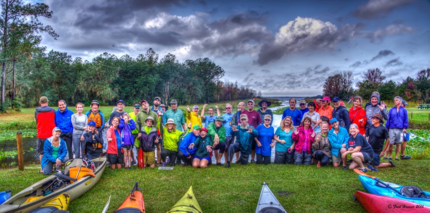
Originally posted on March 12, 2014 on Religion/Place/Pedagogy. After completing our exhibit—River of Dreams—on the St. Johns River at the Matheson History Museum, it seemed like a good time to repost this blog.

2014-02-03 17.44.40

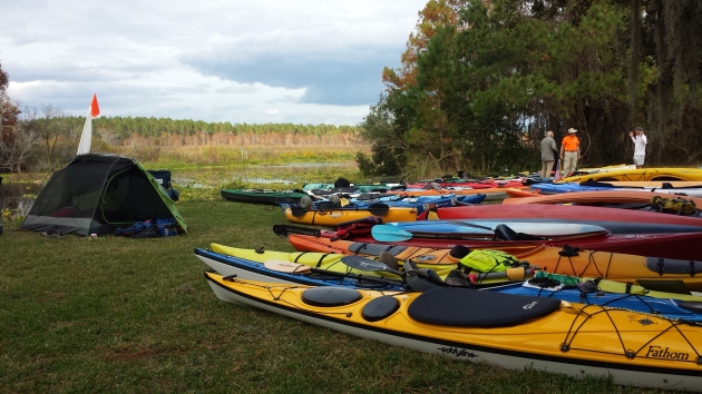
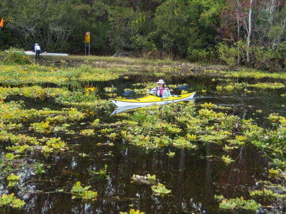
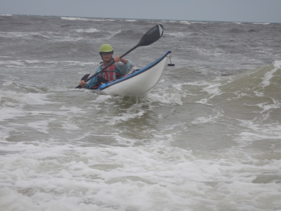
Nothing makes me happier than a day paddling through the waves in the Fort George Inlet. This estuary, just south of Little Talbot Island State Park, has become one of my favorite places to play in the surf, and this low country ecosystem, full of dolphins, pelicans, and hermit crabs, reminds me of Tybee Island, where I spent most of my childhood summers. I have camped at the Talbot House, a property recently deeded to the North Florida Land Trust. The house–and Big Talbot Island–sits in the Timucuan Preserve which includes both Talbot Islands, the Kingsley Plantation, the Fort Caroline National Monument as well as recently discovered burial native American mounds.

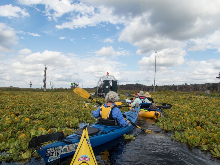
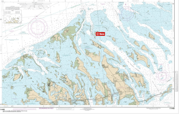
The house’s long dock extends into the marshy area of Mud Creek, a tributary of the Fort George Inlet, and from the dock, looking down the Mud River, I see the Kingsley Plantation on the opposite shore of the Fort George River.

Uncomfortable Histories

"Surfing Fort George," Big Talbot Island, Photograph by Joe Crespi, December 15, 2013.

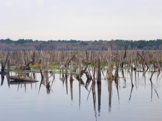
Seeing the Kingsley Plantation in the distance reminds me that I have a privileged history with this ecosystem. I have had the freedom to explore and discover the history, beauty, and wildlife on my own terms. The sixty or so slaves who worked the fields at the Kingsley Plantation did not have the luxury of appreciating the area’s beauty at their leisure. While I cannot even begin to imagine their experiences of the land, I know that our experiences are worlds apart. Perhaps the land—which has received their bodies, sweat, and blood—knows something more. Waves of residents, visitors, and invaders, from the Timucua followed by French and Spanish explorers and subsequent populations of British and Africans, have inhabited this land, drawn by its abundance and fertility as well as its strategic location. The Talbot Islands near Jacksonville, Florida are the southernmost of the Sea Islands and the region known as the Low Country–typically associated with the coasts of Georgia and South Carolina. The Low Country, so named for its extensive tidal flats and salt marshes, provides rich habitat for birds, fish, and mollusks, and its nutrient-rich mud sustained the human ecologies of rice-growing plantations.

"Kingsley Plantation," Big Talbot Island, Photograph by Whitney Sandford, March 3. 2014.

From 1814 to 1837,  Zephaniah Kingsley and his wife Anna, an ex-slave from Senegal, lived in what later became known as the Kingsley Plantation and produced commercial crops such as sea cotton and sugar cane. Also a slave trader, Zephaniah Kingsley participated in the Triangular trade, supplying human flesh to the barrier islands of Georgia and South Carolina. Like many, he sought out West Africans due to their agricultural skills, and there he purchased Anna who later became his wife.

Those of us who love Florida for its water and waves can easily forget our state’s uncomfortable histories. In 2013, Florida celebrated the 500th anniversary of Ponce de Leon’s arrival in what is now St. Augustine, approximately 50 miles south of the Timucuan Preserve. Over time, interactions with the Spanish, French, and later British newcomers decimated the Timucua populations, and only shell middens (trash piles of oyster shells and pottery, for example) and place names such as Timucua or Calusa remind us of their presence. Touring the Kingsley Plantation provides a visceral reminder of Florida’s participation in the slave trade, and the state’s Jim Crow laws maintained segregation and created a range of barriers in the post Civil War-era. In reality, these laws meant that beaches and rivers that I now enjoy were–and in some cases are–not safely accessible to people of color, and their experiences of these places might be radically different than mine.

Becoming Native to Place

When I teach courses such as Religion and Sustainability and Religion and Food at the University of Florida, I hope to make students aware of local places and their histories and ecosystems. Ideally, they will come to appreciate and maybe even love these places such as our estuaries, springs, and wild rivers. Many of my students, from a variety of backgrounds, already care deeply about our rivers, having grown up fishing, surfing, hunting, and swimming, and they are native to their place, to borrow Wes Jackson‘s term. Our students bring with them multiple histories and meanings about these places, and I need to reconcile my privilege–and that of many of my students–with the past and present exclusions experienced by others. Many outdoor areas were segregated by law and/or custom, and some of my students even today might not feel comfortable roaming through parts of rural north Florida.

"View from Alacante," Fort George Inlet, Photography by Whitney Sanford, February 3, 2014.

I have never directly addressed this topic with students, although an artist friend and I have discussed creating a mapping project to explore different experiences of places.  This mapping exercise might have two phases: first, students would learn the historical and ecological dynamics of this place; and, second, as a reflective piece, students would consider their own experiences of the encounter and how their experiences reflect larger social dynamics. I became interested in this idea after the two of us spent hours wandering through Koppers, our local super fund site, and, despite multiple ‘No Trespassing’ signs, nobody questioned us. In this case, the invisibility of white, middle-aged women was a privilege. In 2012, Michael W. Twitty, self-described culinary historian, historic interpreter and Jewish educator, embarked on a Southern Discomfort Tour through the Deep South to learn the stories of southern food ways, enslaved peoples, and cultural memories. During the tour’s visit to the Kingsley Plantation, he discussed the African’s cultural heritage and recreated some of their typical dishes.

Projects and exercise like Twitty’s Southern Discomfort Tour might provide a way to discuss the rich–and often uncomfortable–histories of places that I love. I hope my students will come to love our north Florida ecosystem and will learn to love whatever ecosystem that they inhabit in the future. I also hope they will acknowledge and appreciate that places also hold uncomfortable histories that continue to shape human and non-human relations in the present.

TRAK Unleashed: PADDLERS IN PARADISE

Happy Valentine’s Day — reposting my story about our kayak camping adventure in the Bahama’s Exuma Islands with our Trak Kayaks.

TRAK Unleashed: PADDLERS IN PARADISESwimmingPigsBarStanielKeySharkThunderball

By Whitney Sanford. All images ©2014 Whitney Sanford and Kevin Veach used by permission.

After the motorboat drove off, leaving Kevin and I, our boats, and about one hundred pounds of gear off on Big Major Cay (near Staniel Cay), we were on our own for a honeymoon paddling and snorkeling adventure in the Exuma Islands in the Bahamas. This was day 1 of a six-day self-supported kayak trip from Big Major Cay back to Barreterre, where we had started. Although we had done several self-supported kayak trips before, the remoteness of this trip called for new levels of teamwork and flexibility; we were each other’s back up and safety.

Read more… TRAK Unleashed: PADDLERS IN PARADISE

From Sail2SUP in the Keys

2016-12-29-11-18-00
Towing the paddleboard—it is behaving well here

“Should it stay or should it go”— my paddleboard presents logistical challenges for Kevin and me before any sailing trip. I can’t conceive of a sailing trip without the SUP—especially a trip to the Florida Keys. The sailboat allows me to paddle in otherwise inaccessible places. Kevin, on the other hand, focuses on the practicalities of towing a 10 1/2′ board behind an 18′ sailboat. On our recent trip to the Keys, I prevailed and the paddleboard made the trip. The clear, calm, and shallow waters of the Keys are perfect for paddleboarding (To Sup or Not To SUP). I’ve seen rays, sharks, and barracuda from the vantage point of my board, especially near the the biologically rich mangroves.

2016-12-29-09-06-55
Clear waters near the mangroves

We were aiming for the Keys backcountry, a remote shallow area on the Gulf side which is characterized by mangroves and small islands. Several years ago, we camped and paddled to the Mud and Snipe Keys. This time we hoped to reach Content Key, one of the outermost islands, after anchoring overnight at Little Pine Key.Keys Backcoutnry NOAA 11445.png
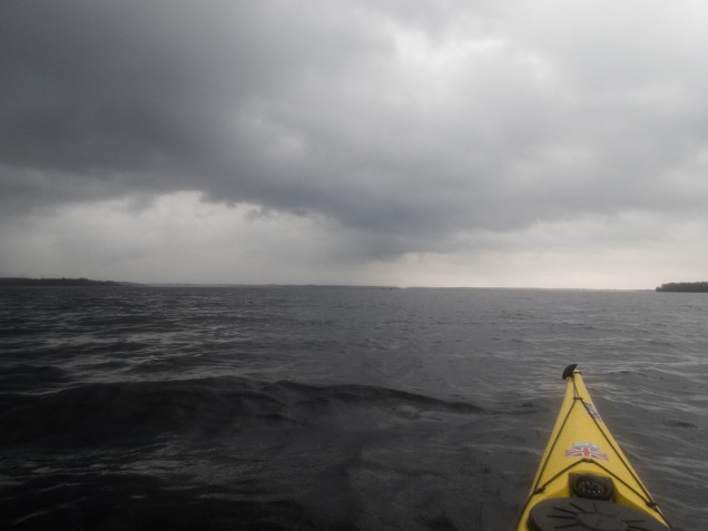
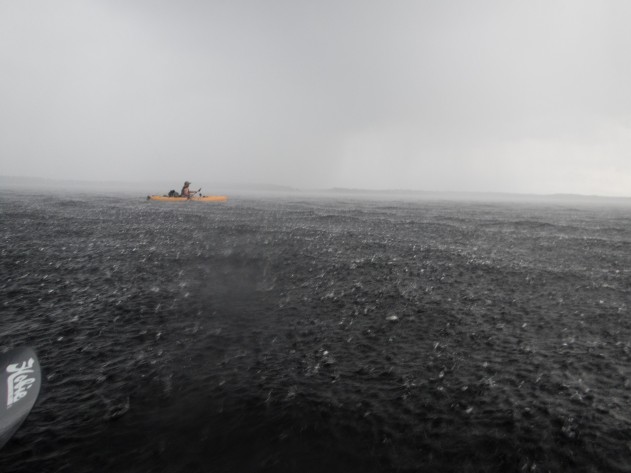
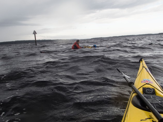
On December 28, we left our slip at Sombrero Resort and Marina in Marathon and headed north towards Little Pine Key. We motor-sailed under the high point of the Seven Mile Bridge, then sailed with favorable winds to Little Pine Key.

The winds and currents made our 15-mile journey pass surprisingly fast, and we reached the southwest side of Little Pine Key mid-afternoon. After a short scouting sail around our anchorage, we dropped anchor less than 100 feet from the mangrove shore, a mistake we discovered when the bugs came out for dinner. In our small boat, our very sophisticated anchoring technique involves me jumping into the water, towing the boat to a good location, then jumping on the anchor to set it. (Perhaps not ASA procedure, but effective.)

Once we were settled, I inflated the board and paddled around the bay. My inflatable Uli Steamroller works well for sailing trips. The board can be stowed away easily, and the soft rubber won’t hurt the sailboat when it is being towed. The still weather let me do both a sunset and sunrise paddle.

After a calm night in our floating tent, we knew our luck was about to change. A front with predicted winds of over 25 mph and gusts of 30 was moving into the area. Forecasters used terms like “surging winds” that put us on full alert. We re-evaluated our goal of Content Key and pointed south towards the protected harbor of Bahia Honda State Park. Bahia Honda Park is a jewel of the Florida State Park system, and it is always a treat to visit the park.

Our detour to Bahia Honda State Park gave us an unexpected bonus: News Years Eve on the Molasses Keys with our friends Monica and Frank Woll of Florida Bay Outfitters.  So, on yet another unnervingly gusty day, we sailed east from Bahia Honda to the Molasses Keys, only a 7 mile sail. Nonetheless, sailing into strong easterly gusts challenged us and pushed the limits of our—and KneeDeep’s—capabilities. Eventually we motor-sailed, only leaving our 150 Genoa up. This arrangement worked well until it didn’t—when the motor inexpicably stopped. A large sheet of plastic has gotten wrapped around the propeller.

While Kevin controlled the boat, I hung from the ladder and disentangled the plastic. Not quite as easy as it sounds, especially because the boat was still sailing and we were headed to shore. This incident reinforced some lessons from what I think of as ‘my year of plastics.’ My experiences on Exxpedition in the Caribbean (There is No Magical Place Called Away) and on Shuyak Island in Alaska (Hiding in Plain Sight: Ropes, Nets, and Plastics in Alaska) taught me a great deal about the dangers of marine plastics.

Tropical paradise awaited us at the Molasses Keys—rum, hammocks, and clear skies! And almost no garbage—Frank and Monica routinely clean up these islands. The Molasses Keys are privately-owned by Frank and Monica, but camping is permitted. To do so, please contact Frank and Monica through the Friends of Molasses Keys page on facebook. We spent a glorious New Year’s Eve camping on the larger of the two Molasses Keys and heard fireworks usher in 2017.

New Years Day revealed some highlights of paddleboarding and snorkelling in the Keys— calm and clear waters.  Circumnavigating Molasses Keys can be a challenge paddling through the waves on the south side.

Too soon, it was time to sail back to the marina then head back north. As always, the Florida Keys are a magical place, whether sailing, SUP’ing, or just sipping on a beer. The paddleboard gave us a number of challenges; for example, it flipped several times in following seas while being towed. Nonetheless, the board has earned its keep—it almost doubles our space while at anchor! The board stays.

Save

Under Darkening Skies: Meeting the Challenge, Ocklawaha Odyssey, Part 2

Ock2016-57.jpg
The skies darken Photo credit: Jill Lingard

Our final challenge: Orange Springs to the Rodman Dam campsite. Although we only had six miles to paddle, dark skies loomed overhead and paddlers hunched over cell phones assessing the possibility of rain. The Paddle Florida truck was loaded with gear, wet from the night’s rain, and we waited, some more patiently than others, for permission to launch.

Today’s paddle would take us across Lake Ocklawaha, or the Rodman Reservoir, over the barely submerged stumps of drowned trees. Karen Chadwick warned us to follow the channel markers and avoid taking the shortcuts that looked so tempting. Hitting a submerged log could lead to a dangerous capsize. I paddled through this tree graveyard last spring after the drawdown and was struck by its eerie beauty (Requiem for a River).

herontrees
Floodscape
2016-03-17 10.56.36
“Hold my beer”
submerged-logs
Danger lurks below
OLYMPUS DIGITAL CAMERA
Photo credit: Henry Dorfman

At 8:45, Bill cleared us to launch and we retraced our path from Orange Springs to the main channel of the Ocklawaha River. During our paddle from Eureka to Orange Springs, the character of the river changed: it widened and became choked by vegetation. Without a little push from the river current, this final paddle across Lake Ocklawaha was destined to be a slog under any circumstances. We embarked, all hoping to cross the lake before the impending storm.

The route was obvious in the beginning—a clear line of channel markers led the way. After we passed the Kenwood boat ramp on the left, our goal—Rodman Dam campground—lay exactly due east across the lake. Easier said than done, however. As most of the group entered the widest part of the lake, the skies darkened and a squall passed overhead. The winds picked up and it was difficult to see more than several boats lengths ahead. I followed my compass heading to the east, trusting my heading was correct.

OLYMPUS DIGITAL CAMERA
Clouds gather Photo credit: Henry Dorfman
OLYMPUS DIGITAL CAMERA
The deluge begins Photo credit: Henry Dorfman
OLYMPUS DIGITAL CAMERA
Rescue at sea Photo credit: Henry Dorfman

The wind, waves, and rain challenged everyone. As I waited by a channel marker trying to guide paddlers in, I struggled to hold position against gusts that threatened to capsize my boat. The storm passed, everyone arrived safely to the campground, and skies brightened for a final group meal, catered by Backwoods Smokehouse and Grill. The sunshine and abundant food left everyone in good cheer as we returned to our cars and said our final goodbyes to new and old friends.

ock2016-58
After the storm Photo credit: Fred Haaser

The storm challenged everyone, including rescue boaters, and several people asked how they might improve their skills. How can strokes and edging help you control your boat in the wind? Where can you learn rough water skills to prepare for the open waters of large lakes or coastal waters? There are many pathways to improve paddling and safety skills. Learning self-rescue techniques, including the roll, provides the capability and confidence to tackle bigger challenges.

Classes and certifications:

ACA (American Canoe Association) and Paddlesports North America (the American version of BCU, British Canoe Union) offer certifications and sequential instruction in kayaking and other paddle sports. Their webpages show the skills required for the different certifications and list instructors and programs that teach these skills. The sites mentioned below offer ACA and PNA/BCU programs in the southeast.

Symposia and instruction in the southeast:

The East Coast Paddlesports Symposium, held annually each April in Charleston, SC, offers a range of on and off-water classes and the opportunity to demo equipment. Many retailers bring boats, paddles, and other gear, and this is one of the best places to see a wide range of equipment. Classes are held on the lake and on the more challenging waters near Folly Beach.

Sea Kayak Georgia located on Tybee Island, and Savannah Canoe and Kayak offer private kayak and paddle board instruction and expeditions. The waters around Tybee Island provide a good instruction to rough water. Dale Williams of Sea Kayaking USA , also on Tybee, offers more advanced instruction.

Each October, Ronnie Kemp and Marsha Henson of Sea Kayak Georgia bring in world-class instructors such as Dale Williams, Nigel Dennis (Sea Kayaking UK) and Eila Wilkinson (Tidal Waters) for their symposium. Sea Kayak Georgia’s symposium offers instruction and assessment for PNA/BCU three and four star levels.

Russell Farrow of Sweetwater Kayaks in St. Petersburg, FL provides instruction in and around Weedon Island. Their annual symposium in March brings in world-class instructors, offering classes from rolling to Greenland-style paddling.

For those who have caught the kayak surf bug, Cross Currents Sea Kayaking offers the Kiptopeke Symposium in the rougher waters in coastal Virginia.

This list is not exhaustive. Opportunities for instruction abound in the southeast and beyond. Playing and surfing in rough coastal waters is safe and fun once you have mastered some basic skills. So get out there and have fun!

small-whit-waves
Fun in the surf

Save

An Ocklawaha Odyssey with Paddle Florida

riverand clouds3 copy
Ocklawaha River

On December 3, over sixty intrepid kayakers gathered in Silver Springs State Park for a four-day adventure down the Silver and Ocklawaha Rivers. Our journey began in the crystal clear headwaters of the Silver River and ended in the murky waters of manmade Lake Ocklawaha near the Rodman Dam. Our float down these rivers helped us better understand the lives of those who once made the Ocklawaha home and contemporary controversies over the fate of the Ocklawaha River.

On our first morning, we paddled six miles down the Silver River. Some paddlers saw monkeys and a couple rare manatees that make it past the dam. Herons, ibis, and anhingas sunned themselves on this warm December day. After lunch at Ray Wayside Park, we continued down, or up geographically, the north-flowing Ocklawaha. The river was surprisingly clear—perhaps an effect of the drought.

OLYMPUS DIGITAL CAMERA
Herding cats for a photo Photo credit: Henry Dorfman
OLYMPUS DIGITAL CAMERA
Manatee on the Silver River Photo credit: Henry Dorfman
OLYMPUS DIGITAL CAMERA
Monkey on the Silver River Photo credit: Henry Dorfman
OLYMPUS DIGITAL CAMERA
Sunning bird Photo credit: Henry Dorfman


Sixteen and one-half miles down river from our start, we set up camp at Gore’s Landing. That night, Peggy MacDonald, Executive Director of the Matheson History Museum in Gainesville, Florida, and I spoke about the Ocklawaha River and its springs, in anticipation of our forthcoming exhibit at the Matheson: “The St. Johns River and Its Springs.” In her book Marjorie Harris Carr: Defender of Florida’s Environment, Peggy describes Carr’s efforts to stop the Cross Florida Barge canal. The canal was never completed, but the Rodman Dam on the once free-flowing Ocklawaha River remains, creating an artificial reservoir called Lake Ocklawaha. The high waters have dramatically altered the river’s ecosystem, drowning trees and disturbing habitat of fish and fowl. Captain Karen Chadwick and filmmaker Matt Keene (River Be Dammed) were also present to discuss contemporary efforts to free the Ocklawaha.

Sunday’s paddle from Gore’s Landing to Eureka was a quick 9 miles, and we reached camp by lunchtime. The Ocklawaha was still remarkably clear, but we all knew that would change as we reached Lake Ocklawaha.

That night, University of Florida archivist Flo Turcotte spoke about acclaimed author Marjorie Kinnan Rawlings, moonshine, and life on the Ocklawaha River. Rawling’s novel South Moon Under depicts the lives of the Jacklin family who lived in the scrub along the Ocklawaha and relied on their moonshine income as farming and trapping became less economically viable. Paddling through the dense scrub made me realize how tough their lives must have been. After the talk, Flo passed out samples of moonshine, which would help power us up for Monday’s 13-mile paddle to Orange Springs.

On Monday, most people made the short detour to see the Cannon Spring, one of the lost springs drowned by the flooded Ocklawaha. Karen said that this spring captured the imagination of the public and was one of the most valuable tools in the initial efforts to restore the Ocklawaha. Later, during the 2015-6 drawdown, images of Cannon spring on social media introduced many to this once-hidden gem, and scores of people visited Cannon during its short window of visibility (Searching for—and Finally Finding—Cannon Springs. After the drawdown when the waters rose, many would mourn the re-drowning of this treasure (Losing Cannon Springs).

OLYMPUS DIGITAL CAMERA
Entrance to Cannon springs Photo Credit: Henry Dorfman
cspring4 copy
Cannon springs freed

fishface2

Lizfloodedcannon2
Flooded Cannon Spring–2016

After our side trip to Cannon Springs, we searched for our lunch stop, just past the sign for Payne’s Landing. The Treaty of Payne’s Landing in 1832 commemorates some of the worst episodes of our nation’s history. The treaty forced Seminoles to relocate to Oklahoma along the Trail of Tears. Further, escaped slaves would lose the protection they had gained by joining with the Seminoles.

After this point, the river became slower, wider, and clogged with vegetation. The Ocklawaha River is lowered every three to four years to eliminate the vegetation that makes the river impassable. Although the drawdown ended less than a year prior, the main channel was already blocked. Fortunately, Paddle Florida Executive Director Bill Richards had arranged for help from Mickey Thomason with the Office of Greenways and Trails.  Possibly for the first time in history, kayakers cheered the sound of an airboat.Florida’s version of a snowplow, an airboat with a rake attached to the front, cleared a route through the thick vegetation, and we paddled single file through the narrow path that remained open only briefly.

OLYMPUS DIGITAL CAMERA
Photo credit: Henry Dorfman
OLYMPUS DIGITAL CAMERA
Airboat to the rescue Photo credit: Henry Dorfman
OLYMPUS DIGITAL CAMERA
Photo credit: Henry Dorfman
OLYMPUS DIGITAL CAMERA
Photo credit: Henry Dorfman

Paddling through the weeds was difficult, but a tailwind pushed us towards our camp at Orange Springs. The day was sunny, but winds signaled that the weather would be changing. Fortunately, the rain held off long enough for us to enjoy a concert under the stars by Whitey Markle and the Swamprooters. Hearing him sing “The Poor Old Ocklawaha” reminded us that this still beautiful river—and all the wildlife that lives in and around it—will suffer as long as the dam remains.

Before going to bed that night, everyone checked their tents and tightened stakes and lines. We had all heard reports of rain and storms, and we wondered about the next day’s paddling conditions. To be continued in Ocklawaha Odyssey, Part 2.


Paddleboard Camping on Rock Springs Run

2016-11-12-11-15-36
Rock Springs Run

Paddling upstream in the dark on Rock Springs Run with loaded paddleboards—an auspicious start to our SUP camping trip? Jill, Janice, and I had set out for three nights of camping in the Wekiwa River Basin, just north of Orlando. Our destination, Otter Primitive Campsite, was several miles upstream. The calm, clear waters of the Wekiwa River and Rock Springs Run seemed like an ideal site to try out a multi-day SUP trip, and fortunately Jill and Janice quickly agree to almost any adventure.


Wekiwa-Springs-State-Park-Map.mediumthumb.pdf.png
Wekiwa Springs State Park Map

We arrived at Wekiwa Spring State Park around 4:30, later than we’d intended. Within an hour, we had ferried our boards, firewood, and gear down the hill to the boat launch. Although the three of us are experienced kayak campers, loading paddleboards with gear presents a different challenge than loading kayaks. We packed efficiently like backpackers and were pleasantly surprised at how well the gear fit on the boards. I bought my 12′ Fanatic Ray because its thick rails and quasi-displacement hull make it suitable for touring with gear. I loaded a mesh bag full of camping gear and smaller dry bags under the bungee cords on the bow and placed the food on the stern, behind my feet. Janice and Jill both packed their gear into larger drybags. We each carried a 10 liter MRS dromedary water bag on our boards—much more than we actually needed.

boards-loaded-and-ready-to-go
12′ loaded Fanatic Ray
jill-and-our-loaded-boards
Packing up at the Wekiwa River launch

To reach Otter Camp, the first of the three campsites on Rock Springs Run (heading upstream) meant paddling a short distance down the Wekiwa River until we reached Rock Springs Run, then 2-3 miles upstream. None of us had paddled loaded boards before, and we were all surprised at their stability. Finally we launched, trying to make the most of our final hour of sunlight.

The downstream section of the Wekiwa River went fast as the current moved us along. The sun’s light illuminated submerged logs that could snag a fin—a paddleboard hazard that kayakers do not face. We reached the confluence of the rivers quickly, but once we turned upstream we realized that our journey would take much longer than we anticipated. Low water conditions made the current swift, and we eddy-hopped back and forth across the river to avoid the swiftest parts.  Rock Springs Run was shallower and twistier than the Wekiwa, and the clear water made it difficult to determine depth. At a slower pace, we continued upstream, appreciating the river’s beauty in the fading light.


2016-11-11-16-36-01
Reflections on the Rock springs Run

Eventually the last of the sunlight disappeared, and we could see the moon’s rays through the trees. We put on our headlamps. [Note to self: either leave earlier or pack the headlamps on top.] Paddling upstream in the dark added an entirely new dimension to our trip, but it was strangely calming, especially after weeks of election-related noise. The only thing breaking the calm were occasional peals of hysterical laughter when one of us got snagged. We all knew that alligators lurked in the area, but none of us dared to actually mention this fact. We aimed our lights at the shore, hoping for signs of our campsite. After two  hours of paddling, we arrived at Otter Camp.

2016-11-12-11-11-35
Entrance to Otter Camp
view-from-otter-camp
Riverside view

Our home for the next three nights, Otter Camp has room for up to 10 tents, two benches, a large locking bear box to store food in, and a campfire ring. The site overlooks the river, and it is hard to believe that we were in the outskirts of Orlando. Over the next two days, we paddled up and down the Rock Springs Run, and friends came to join us. Exploring it during daylight, the stream seemed like three different rivers. Slow and wide towards the top, twisty and fast in the middle, and wide and open towards the bottom. We saw egrets, limpkins, herons, kingfishers, and ibis—and one hawk. Lots of turtles and no gator sightings until we paddled Juniper Spring Run on Sunday.

heading-downstream
A narrow stretch of the Rock Springs Run
2016-11-11-15-20-50
Ducking under trees and branches
great-blue-heron
Great Blue Heron
2016-11-11-14-46-24
Ibis on a branch

On Sunday morning, we packed up and reversed our route. With lighter loads and downstream current, the trip took one hour. Overall, I was happy with my gear selections and my paddleboard. I cover less distance on my paddleboard than I do in my kayak (NDK Pilgrim Expedition), so I’ll need to account for that on future trips. Using a basecamp worked for our shake-down trip, but the Wekiva/Rock Springs Run/St Johns area several options for moving camps daily. Sections of the Florida Circumnavigation Trail are also appropriate for a paddleboard. Even though our trip did not have the most auspicious start, our ability to adapt to—and laugh at— our circumstances set the tone for the trip. I think we got as much of a workout from laughter as from paddling. The only question is where to next?


2016-11-13-09-30-51
Coming home

St. Johns Headwaters: Finding Wildness in an Engineered Waterscape

taking-pictures-at-sunrise
Dawn on Blue Cypress Lake

Anne and I rose early to catch the early morning light on Blue Cypress Lake.  A late afternoon storm had skunked us on paddling the night before, and we were determined to get on the water. After a quick cup of coffee, we lowered boat and board into the water and paddled through the glassy waters, silently, heading towards the trees that give Blue Cypress Lake its name. (The  cypress trees did indeed look blue in the early morning light.) The day was so calm and quiet, I felt like I had melted into the scenery. Other than the one large splash that made both of us jump, the lake was dead calm.

canal-at-middleton-fish-camp
Deck at Middleton’s Fish Camp
2016-10-03-07-43-26
Moss hanging form the trees
2016-10-03-07-31-51
Another storm rolling in
2016-10-03-08-13-08
Glassy calm on a windless morning

We had spent the night at Middleton’s Fish Camp, right on Blue Cypress Lake, in a cabin that backed onto a canal. Although Blue Cypress Lake is not far from Vero Beach and the more developed coastal area, the lake felt isolated and remote. We had come to take pictures for our River of Dreams exhibit at the Matheson History Museum (Winter 2017). Most people, however, come to Middleton’s Fish Camp to catch large-mouth bass, catfish, and speckled perch (crappie), among other things. Jeanne Middleton, who writes the fishing report, the armored catfish, relatively unknown in Florida, draws fishers from Suriname where the fish is considered a delicacy.

2016-10-02-15-04-17
“Nature held in trust”

Anne and I had come to Blue Cypress Lake and Middleton’s Fish Camp to explore the headwaters region of the St. Johns River. Officially the headwaters is somewhere in the Fort Drum Marsh Conservation Area, a swampy area that lies just south of Blue Cypress Lake. I had hoped to paddle from the actual start of the St. Johns River, but I learned that noone can really pinpoint the exact start of the river. Vince Lamb, a nature photographer and environmental activist, noted that “somewhere two drops of rain fall, and one heads to Lake Okeechobee and the other heads north into the St Johns.” Many people consider Blue Cypress Lake itself to be the headwaters which, in terms of paddling and navigation, it is. 2016-10-03 11.09.55.jpg

The road north from Blue Cypress Lake towards Fellesmere parallels the river as it moved through a series of canals. On Sunday afternoon, boat trailers lined the canal, but the stormy weather and a Monday morning had driven off the fisherman. In Fellesmere, we stopped for some ‘Old Florida Cuisine’ at the Marsh Landing Restaurant.

Fueled by swamp cabbage soup and Cajun-spiced catfish (noone had heard of the armored catfish), we aimed for Stick Marsh/Farm 13, a reclaimed area known for its bass fishing. Created in 1987, Stick Marsh/Farm 13 is one of many Florida messes, like the Everglades, where our tax dollars fund both destruction and restoration at the same time. Writing about the St. Johns River Restoration Project and Stick Marsh, bass fishing guide Jim Porter describes the project as “Saving a Friend.”At one point, Stick Marsh was heavily stocked with bass and crappie, and now the area “is synonymous with trophy bass and other fishing.”

This entire area near the headwaters struck me as a confusing mix of wilderness and engineered landscape. Blue Cypress Lake itself has few access points and felt remote—even Middleton’s Fish Camp felt removed from the nearby more developed coastal areas. But the roads and the canals—obviously engineered—also felt remote and wild as well. The day before, sitting at Camp Holly near Melbourne, Vince had told us that the upper—or southern—part of the St. Johns River is much wilder than the lower, that there is more development along the river as you go further north. It is much easier to do a wilderness paddling trip along the upper St. Johns.

2016-10-03 13.22.29 copy.jpg
Canal near Stick Marsh

Engineered or not, the headwaters region of the St. Johns River is a beautiful and wild marshy waterscape, and Blue Cypress Lake took my breath away. Each section of the St. Johns River has its own beauty, and the river and the people who live, play, and fish on the river tell me their stories. I look forward to learning more of these stories as I explore the St. Johns and its tributaries and springs for our “River of Dreams” exhibit.

2016-10-03 05.58.56.jpg


SUPPing for Scallops

IMG_2206
Launch site at Rocky Creek Road


Hagens Cove cloudscape

On July 4, fueled by a hearty stack of blueberry pancakes, Jill, Scott, Kevin, and I launched three kayaks and one paddleboard from Rocky Creek Road, just south of Steinhatchee.  I had always thought that a paddleboard would work well for scalloping because it is so easy to jump on and off the board. I brought my 10 1/2 foot inflatable board which could keep up with the longer kayaks for this short distance. So boards and boats loaded with snorkeling gear, mesh bags, and water, we headed out down the creek and  out into the Gulf. Most of the area is too shallow for large motorized boats, so ideal for kayaks and paddleboards.

Loaded Paddleboard
Loaded paddleboard

We saw a line of motorboats anchored a mile or two offshore, and we paddled to an area about halfway between the boats and the shore. After twenty minutes, we reached the longer sea grasses that scallops like and donned masks, fins, and snorkels. Jill and Scott had made floating scallop nets with pool noodles and mesh bags, and we each tied one to our boats and board.

Pulling our boats and board with bow lines, we swam around the grasses looking for the tell-tale lines of glowing blue “eyes.” It was close to high tide, and the water was about 3-4 feet deep, ideal for scalloping. Shallower than that, and seeing the scallops becomes difficult because you stir up silt as you step on or swim close to the bottom. At first, I didn’t see any, and I worried I would be THAT person who came up empty-handed. As my eyes attuned, I began to catch more and more scallops. I expected them to hide in the grasses, but instead they lay out in the open, in beds of brownish muck. Catching scallops is mostly a matter of reaching and grabbing. But, when motivated, they will zip away.

We swam and swam, loading our mesh bags. I wasn’t wearing a watch and was surprised when Jill said it was almost 5 pm. We all had plenty of scallops, although nowhere near our limit. Paddleboarding out was a breeze, but paddling back with a mesh bag full of scallops was like dragging a sea anchor, so we loaded the bags into the kayaks.


IMG_2208
A cooler of scallops

Scallops in cooler and boats/boards loaded, we drove back to Steinhatchee in search of beer and scallop shuckers. Signs advertising shucking services lined the road, but the shuckers had been shucking all day and they were done—how did we not foresee this on the Fourth of July? We drove home, resigned ourselves to watching educational YouTube videos on shucking scallops, and took solace in pizzas at Blue Highway Pizza. The next day, we honed our shucking skills and feasted on garlic scallop pasta.

Scalloping at Hagens Cove
Wading out at Hagens Cove
Searching for scallops
ready for scallops
Ready for scallops
Hagens Cove Park
Hagens Cove Park

Two weeks later, emboldened by our success, Kevin and I returned to Steinhatchee with my mother, a novice scalloper. We chose Hagens Cove, north of Steinhatchee, because it offered beach access scalloping, just a quarter mile from shore. I brought my paddleboard as a platform for gear, food, and water and a floating pool chair for my mother. This area was shallow, and we waded and snorkeled out until it was deep enough to find scallops. As we got further out, the scallops grew larger and more plentiful. A darkening sky and lightning eventually drove us back to shore, and we returned to Steinhatchee. We enjoyed a terrific meal at Kathi’s Krabs while our scallops were being shucked.

Kathis Krab Shack
Kathi’s Krab Shack in Steinhatchee
Horseshoe crab
Horseshoe crab

The scallop season (from June 25-September 24) is almost half over, and the Gulf waters have warmed to bathtub temperatures. Whether I go scalloping again this season or not, I’m sure I will get out again on my board. The calmer Gulf waters are perfect for paddleboarding, and when clear, I have seen a variety of marine life standing on the board.

Save

Hiding in Plain Sight: Ropes, Nets, and Plastics in Alaska

IMG_1842
Excited for our ride to Shuyak Island

On Sunday, June 12, I awoke early, excited for my first ride on a float plane. We were headed for Shuyak Island State Park to collect marine debris using sea kayaks. Shuyak Island is the northernmost island in the Kodiak Archipelago, and the winds and currents of the Gulf of Alaska deposit tons of marine debris on its shores each year. Tom Pogson of the Island Trails Network received a grant from NOAA Marine Debris Program, and months ago, we had applied to participate in this great adventure—paddling in Alaska, float planes, abundant wildlife, and a chance to give back to a sport we love. How could any of us pass up this opportunity?

Tent at Big Bay ranger station, Alaska
Kevin’s and my home for two weeks
Kodiak brown bear
Brown bears sauntering down the beach

Our team of five had arrived in Kodiak several days early in case Kodiak’s notoriously changeable weather went bad. Dawn, Kevin, and I knew each other from previous kayak trips, and we met Fiona and Kate  at Kodiak Island Brewery the night before. Fortunately. Sunday’s weather was clear and beautiful, and the pilot gave us a tour the land and water between Kodiak and Shuyak. Soon after we arrived, a mama brown bear and her two cubs sauntered down the beach and then up the hiking trail. After sorting out our tents, boats, and gear we paddled out around Eagle Point into the Gulf of Alaska, then surfed the swell home.

Map of Shuyak Island
Shuyak Island Photo credit: National Geographic

Over the next two weeks, we tackled Gulf-facing beaches as well as the protected shores inside Big Bay—the wind and swell determined our daily destinations. Big surf landings onto rocky shores would have been dangerous for both boats and bodies, and we knew that any rescue situation would be difficult and hazardous. An accident that might be a minor inconvenience in highly populated Florida could be life-threatening in remote Alaska.

IMG_2103
Dawn with logo fly swatter

We spent several days cleaning Dead Bird Beach, a two-mile stretch that faced southwest. In addition to a variety of small skeletons (hence the name), Dead Bird Beach was littered with plastics, ropes, and nets. The large plastic objects and buoys were easy to spot, while the nets and smaller plastics blended into the sand, rocks, and wood. Some objects were immediately identifiable—water bottles, fishing lures, and fly swatters. A Wal-Mart shipment of fly swatters and mini-basketballs marked with team logos had fallen off a cargo ship several years prior. Other materials less so, such as the Japanese fishing baskets and bait buckets carried by the tsunami. We learned that light items such as water bottles are driven by the wind while heavier items such as baskets float just under the surface and drift with currents rather than wind.

IMG_1948
A tangle of water bottles and nets
water bottles
Wind carries plastic bottles
IMG_2095
Tom with super sacks
IMG_1930
A small beach on a calm day


We removed approximately eight super sacks of debris from Dead Bird Beach, and Tom will collect the bags later this summer with a landing craft. (Super sacks are woven polypropylene bags, approximately 3′ x 3′ x 3′.) We labelled each bag with the appropriate two-mile segment, and NOAA and the Island Trails Network will analyze this data in the fall.

IMG_2095
Tom with super sacks
IMG_2039
Piles of super sacks in front of headquarters—Big Bay Ranger Station


After a week, the winds shifted and intensified, so we moved to the calmer waters of the bay. We worked in teams of two which was sometimes creepy given the possibilities of bears. As we walked along the beaches, we sang out “Hey bear, Hey bear”, the best response being no response. At first glance, these inland shores seemed much cleaner, but we discovered how well the sand and logs camouflaged nets and ropes. In addition to being unsightly, nets pose a hazard to marine mammals, like seals, otters and whales.

IMG_1935
Cutting through gnarly nets on a rainy day

Tom warned us about the amounts of debris we would find on Shuyak Island, but it still surprised me that we found over ten thousand pounds of ropes, nets, and plastics in two weeks. No one lives there, and the island receives few visitors, so all the debris comes from somewhere else. I recalled reading Religious Studies scholar Kimberley Patton’s book The Sea Can Wash Away All Evils: Modern Marine Pollution and the Ancient Cathartic Ocean in which she explores the longtime human habit of throwing our waste into the sea. Perhaps it mattered less two thousand years ago, before people owned so much stuff.

Last February, I participated in Exxpedition, a sailing voyage on the 72′ Sea Dragon, assisting scientists investigating how disintegrating plastics disrupt the endocrine system. Exploring Shuyak Island in a 16′ kayak offered a different perspective, and I learned how larger plastics and debris migrate with wind and current. Nonetheless, the marine debris in both Alaska and the Caribbean primarily comes from somewhere else until it reaches that magical place called away.

IMG_2070
Loading and unloading on our return to Kodiak

On a cold rainy Sunday morning, the float plane brought our crew back to Kodiak and flew a new crew. As we flew away, I looked back at the super sacks on the beach and thought about what we had done. Overall, the trip gave me a terrific opportunity to spend time camping and paddling on a remote island in Alaska and to meet others who share these interests. But my experiences in the Caribbean and in Alaska have made me even more concerned about threats to our water, especially those at home in Florida. Perhaps, at one time, the sea washed away all evils, but today, the garbage we throw in the water comes back to haunt us.

Exploring Bear Glacier by Kayak

2016-05-26 16.24.34 (1)
Icebergs at Bear Glacier, Resurrection Bay, Alaska

Crackle swoosh boom! …. The sounds of a melting and calving glacier. Twelve kayakers awed by the ethereal blues of house-size icebergs floating in a glacial lake. We sat quietly, in communion with this living glacier until one large splash of falling ice broke the spell. We were in Alaska, far from my home in Florida.

2016-05-26 16.11.19.jpg
Paddling around the icebergs


2016-05-26 16.47.07
Brian enjoying the view

We paddled to Bear Glacier on our last full day of a week-long trip to Resurrection Bay. Our home base was the Kayakers Cove Hostel, about a 12-mile paddle from Seward, on the Kenai Peninsula. During our week there, we watched whales, otters, and sea lions and explored caves and rock gardens. With Levi Hogan of Turnagain Kayak, along with Dale Williams of Sea Kayaking USA, Tom Noffsinger, and Tony Hammock, we practiced rescues, rock gardening, and strokes along the rocky coast.

Our weather was spectacular, mostly clear and sunny, which meant we traded rough conditions for terrific views. Kevin and I had done the Resurrection Bay trip in 2015 with rougher conditions, so this seemed like an entirely different experience. A combination of sea swell, tide, and wind direction dictated each day’s activities. Last year, the winds mostly blew from the north, so we headed out towards the open waters of the Gulf of Alaska. This year’s winds blew southerly, offering a different set of explorations.

Towards the end of the week, Levi announced that conditions were favorable for Bear Glacier, and we leapt at the chance to kayak among icebergs. We would paddle the 10-ish miles to Bear Glacier, then return by water taxi in two shifts, six paddlers and six kayaks on each trip.

Bear Glacier
Bear Glacier from Google Earth

We launched at 9 a.m. with drysuits, helmets, and extra food and clothes – just in case. As we passed the southern tip of Fox Island, Levi checked for confirmation of our pick-up. We had little or no cell service at Kayakers Cove—a wonderful cyber-vacation, but missing a text from Joe, the boat captain, would have resulted in a long, cold, and unexpected paddle home. As we paddled around to the east of Fox Island, we moved to the middle of the channel to ferry glide across and surf the wind swell. To quote Tom Noffsinger, “When asked if you want to surf, the correct answer is always ‘yes’”. I agree. The wind and swell gave us an easy ride across Resurrection Bay, and we soon reached Callisto Head.

As we paddled around Callisto Head, Bear Glacier appeared in the distance. Resurrection Bay gave us some small swell, and we played among the rocks along the way. Navigating a 17’ kayak through rocks can be like threading a needle, and a fun challenge with the right swell. Levi reminded us that fiberglass NDK boats and rocks do not mingle well and warned us not to go over any overfalls, where swift currents flow over exposed rocks. A severely damaged boat would be dangerous in this remote area. Soon after, I misjudged a swell and flew towards an exposed rock. Fortunately, an opposing swell covered the rock, and I sailed over it unscathed. I did not make that mistake again.

2016-05-26 14.10.58
Bear Glacier and a visit from a seal
2016-05-26 14.41.22
Ed playing in a tidal race

The entrance to Bear Glacier Lake was still several miles away. As we paddled across, seals and seal lions popped their heads up, curious about our strange crafts, and played in our wake. The mouth of the Bear Glacier River created a tidal race where we surfed in the waves. This water was cold—glacial melt.

After we played, we landed our boats, carried them up and over the rocky ridge, and launched again in the slower and deeper section of the river. This shallow braided river is the only access to Bear Glacier, so only those willing to paddle or walk (or pay an exorbitant helicopter fee) get to see the glacier. (In 2015, Kevin and I saw the Aialik Glacier on a Kenai Fjords tour.)

Resurrection Bay Map
Resurrection Bay (Photo credit: http://www.wildernessimage.com)

We eddy-hopped our way upstream, where house-sized and larger icebergs floated in the lake. Although we were still at least a mile from Bear Glacier itself, its presence enveloped us in the sights and sounds. We paddled carefully around the floating ice, knowing that our helmets offered little protection from falling chunks.

I sat in my kayak, mesmerized, but I wondered about its future. What will Bear Glacier look like in twenty years in an era of rapidly retreating glaciers? In India, Gangotri Glacier, the source of the Ganga and sacred to Hindus, has receded dramatically in recent years. In the late 18th century, Gangotri Temple sat at the foot of the glacier, but by 1992, when I visited, pilgrims trekked 12 miles over two days from the temple to Gangotri Glacier.

gangotri_ast_2001252
Retreat of Gangotri Glacier (Photo credit: http://earthobservatory.nasa.gov/IOTD/view.php?id=4594)

Though Alaska seems remote from Florida, retreating glaciers and melting sea ice contribute to the rising sea levels that erode our shores and flood our seaside cities. Maybe Alaska and Florida are not so far apart after all—a baked Alaska means a soggy Florida.

2016-05-26 20.46.32
Sea lion haul-out in Resurrection Bay
Driving the boat
Driving the boat home

We paddled back towards the river, carried our boats back across the ridge, then headed towards our pick-up point. Our captain Joe ferried us back in two groups and took us past a sea lion haul-out. I was fortunate to be in the second group, leaving me with more time to relish this exquisite beauty and to play among the rocks. Back at Kayakers Cove, we relaxed over wine and fresh-caught fish, cleaned and caught by Joe, demonstrating Alaskan hospitality. Bev and James treated us to their amazing fish-cooking talents that evening. Our week in Resurrection Bay was filled with highlights—great paddling and great friends, but our trip to Bear Glacier stands out among these highlights.